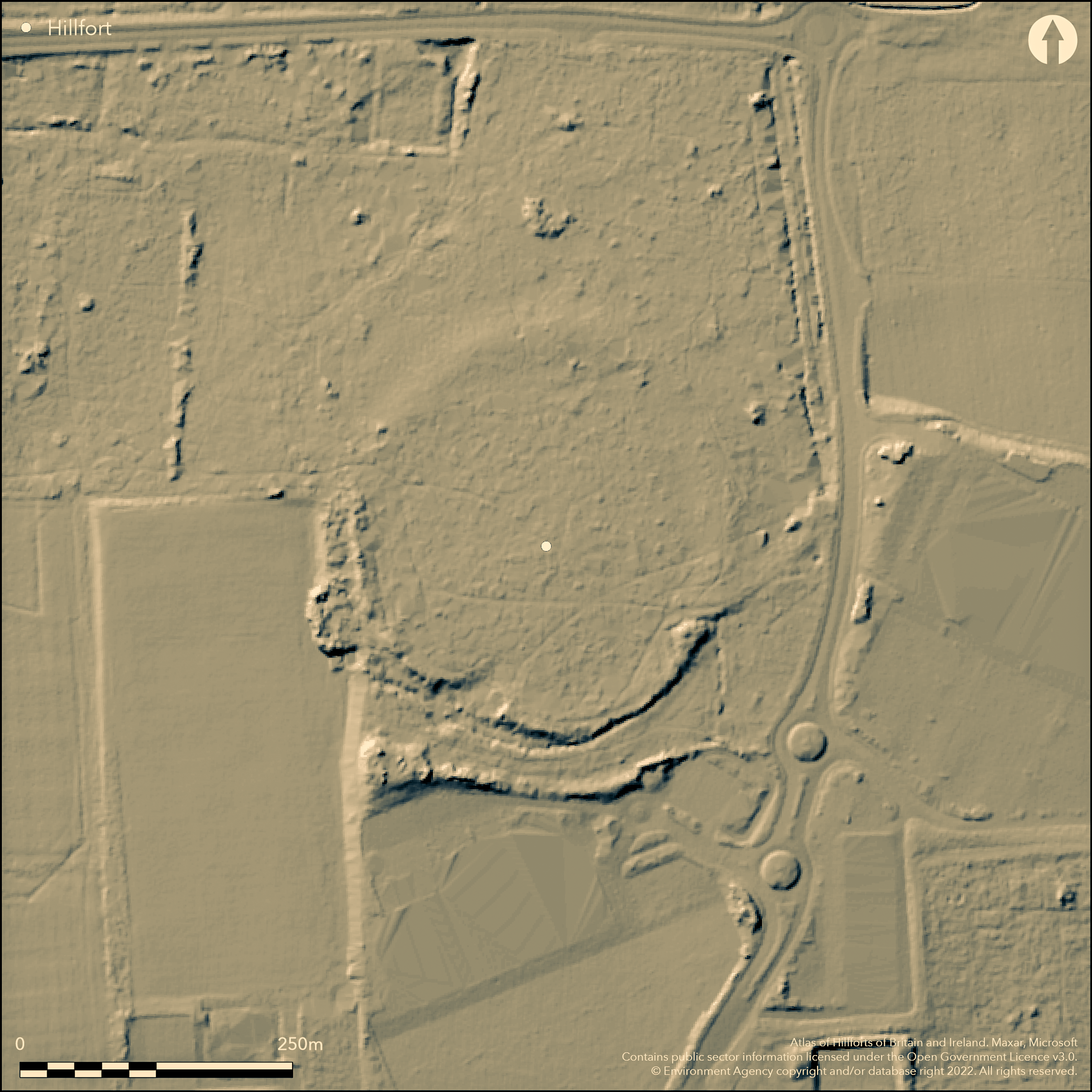
LiDAR 1m DTM Hillshade
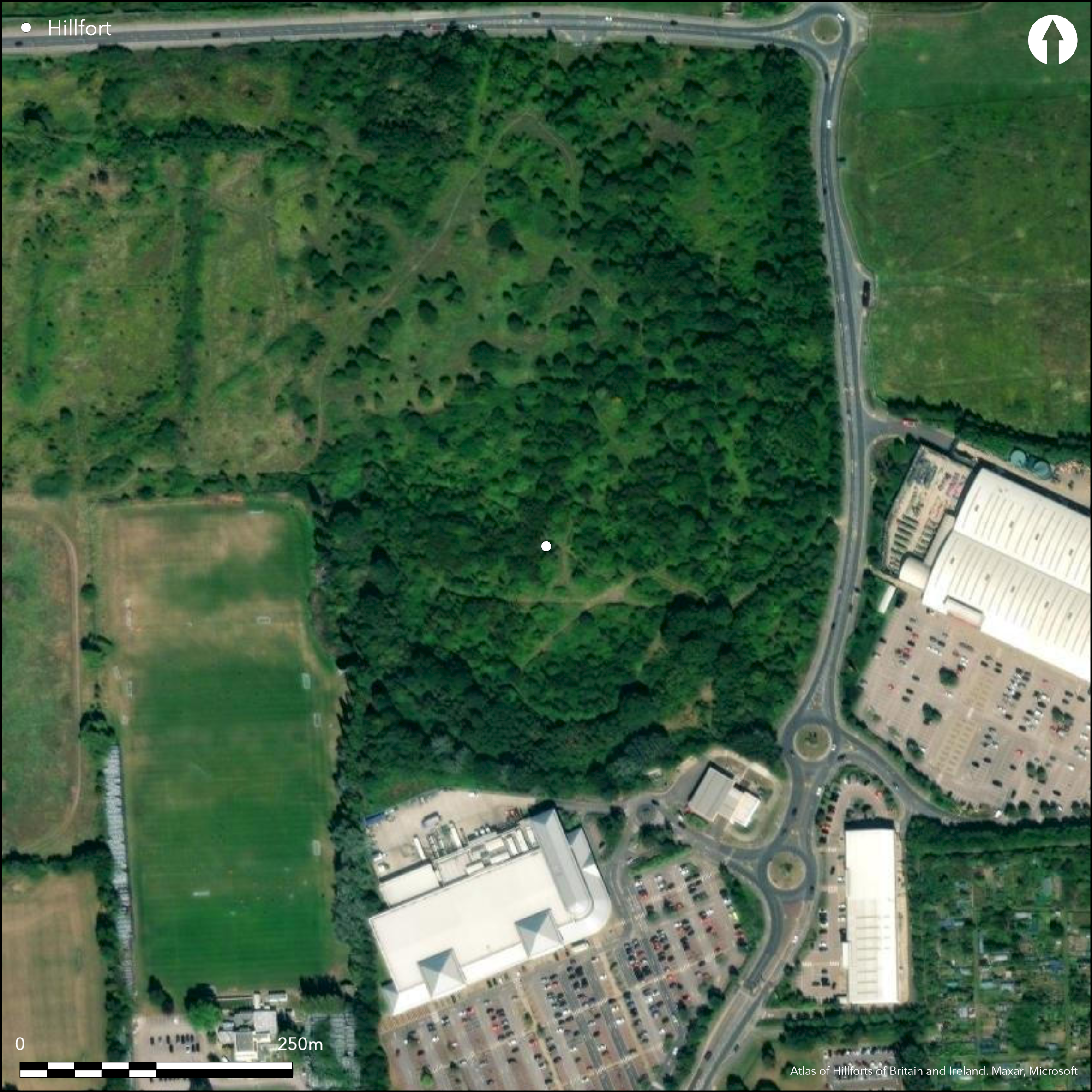
Satellite Imagery
LiDAR 1m DTM Hillshade
Satellite Imagery
Scroll left/right to view further images.
HER: Essex MEX30257 (None)
NMR: TQ 88 NE 18 (418915)
SM: 1017515
NGR: TQ 8899 8783
X: 588990 Y: 187830 (OSGB36)
On the northern outskirts of Southend-on-Sea, a slight, univallate enclosure, scheduled as a univallate hillfort. It occupies the northern edge of a broad ridge commanding views across the Roach Valley to the N. Almost circular in plan it measures 250m in diameter, enclosing 4.9ha, and once comprised an earthen bank and external ditch now reduced by ploughing in the N and E although the line of the bank has also been recorded from the air as a cropmark. The ramparts survive in a belt of woodland in the SW. The ditch is indistinct and was re-cut as an agricultural boundary and used as a corporation dump in the 1920's. A trial trench placed through the southern side of the enclosure and the southern edge of the interior in 1929 provided evidence for the composition of the bank and the original profile of the ditch but evidence for activity within the enclosure was lacking (Mepham 1931). The location of an entrance is unknown. The site was recognised as being of a prehistoric date when pottery was exhibited at a meeting of the Essex Field Club in 1893, although no secure dating has been recorded. A pipeline trench excavated in 1998 in the W of the enclosure failed to locate the ditch and it might not have continued in this area (Tripp 1998). Recorded on 1955 1:2,500 OS mapping.
Citizen Science: ✗
Reliability of Data: Confirmed
Reliability of Interpretation: Confirmed
X: 80700 Y: 6720531 (EPSG: 3857)
Longitude: 0.7249366209360751 Latitude: 51.5576310039825 (EPSG:4326)
Country: England
Current County or Unitary Authority: Southend-on-Sea
Historic County: Essex
Current Parish/Community/Council/Townland: Southend-on-Sea
None
| Extant | ✓ |
| Cropmark | ✓ |
| Likely Destroyed | ✗ |
The ramparts in the SW lie within a woodland belt and woodland appears to be encroaching in to the interior.
| Woodland | ✓ |
| Commercial Forestry Plantation | ✗ |
| Parkland | ✗ |
| Pasture (Grazing) | ✗ |
| Arable | ✗ |
| Scrub/Bracken | ✗ |
| Bare Outcrop | ✗ |
| Heather/Moorland | ✗ |
| Heath | ✗ |
| Built-up | ✗ |
| Coastal Grassland | ✗ |
| Other | ✗ |
A possible hillfort lying at 23m OD on a broad ridge.
| Contour Fort | ✗ |
| Partial Contour Fort | ✗ |
| Promontory Fort | ✗ |
| Hillslope Fort | ✗ |
| Level Terrain Fort | ✓ |
| Marsh Fort | ✗ |
| Multiple Enclosure Fort | ✗ |
| Hilltop | ✗ |
| Coastal Promontory | ✗ |
| Inland Promontory | ✗ |
| Valley Bottom | ✗ |
| Knoll/Hillock/Outcrop | ✗ |
| Ridge | ✓ |
| Cliff/Plateau-edge/Scarp | ✗ |
| Hillslope | ✗ |
| Lowland | ✓ |
| Spur | ✗ |
Dominant Topographic Feature: Broad ridge
| North | ✗ |
| Northeast | ✗ |
| East | ✗ |
| Southeast | ✗ |
| South | ✗ |
| Southwest | ✗ |
| West | ✗ |
| Northwest | ✗ |
| Level | ✓ |
Altitude: 23.0m
N/A
Recognised as being of a prehistoric date when pottery was exhibited at a meeting of the Essex Field Club in 1893, athough no secure dating has been recorded
Reliability: D - None
| Pre 1200BC | ✗ |
| 1200BC - 800BC | ✗ |
| 800BC - 400BC | ✗ |
| 400BC - AD50 | ✗ |
| AD50 - AD400 | ✗ |
| AD400 - AD 800 | ✗ |
| Post AD800 | ✗ |
| Unknown | ✓ |
| Pre Hillfort: | None |
| Post Hillfort: | The remains of a possible medieval mound is located on the line of the ramparts. Listed as a possible motte (Cathcart King 1983) |
| Artefactual: | Pottery |
Recorded on 1955 1:2,500 OS mapping. Pipeline trench excavated in 1929 (Mepham 1931). Field investigation in 1953. Surveyed by RCHME in 1998. Scheduled
| 1st Identified Written Reference (1895): | None |
| Excavation (1929): | None |
| Other (1953): | Field iinvestigation |
| 1st Identified Map Depiction (1955): | None |
| Other (1961): | Scheduled |
| Earthwork Survey (1998): | None |
No features are recorded. Pottery.
None
| None | ✓ |
| Spring | ✗ |
| Stream | ✗ |
| Pool | ✗ |
| Flush | ✗ |
| Well | ✗ |
| Other | ✗ |
None
| No Known Features | ✓ |
| Round Stone Structures | ✗ |
| Rectangular Stone Structures | ✗ |
| Curvilinear Platforms | ✗ |
| Other Roundhouse Evidence | ✗ |
| Pits | ✗ |
| Quarry Hollows | ✗ |
| Other | ✗ |
None
| No Known Excavation | ✗ |
| Pits | ✗ |
| Postholes | ✗ |
| Roundhouses | ✗ |
| Rectangular Structures | ✗ |
| Roads/Tracks | ✗ |
| Quarry Hollows | ✗ |
| Other | ✗ |
| Nothing Found | ✓ |
None
| No Known Geophysics | ✓ |
| Pits | ✗ |
| Roundhouses | ✗ |
| Rectangular Structures | ✗ |
| Roads/Tracks | ✗ |
| Quarry Hollows | ✗ |
| Other | ✗ |
| Nothing Found | ✗ |
None
| No Known Finds | ✗ |
| Pottery | ✓ |
| Metal | ✗ |
| Metalworking | ✗ |
| Human Bones | ✗ |
| Animal Bones | ✗ |
| Lithics | ✗ |
| Environmental | ✗ |
| Other | ✗ |
Partial woodland
| APs Not Checked | ✓ |
| None | ✗ |
| Roundhouses | ✗ |
| Rectangular Structures | ✗ |
| Pits | ✗ |
| Postholes | ✗ |
| Roads/Tracks | ✗ |
| Other | ✗ |
The location of an entrance is unknown
| None: | None |
| 2: | None |
Guard Chambers: ✗
Chevaux de Frise: ✗
Almost circular in plan, 250m in diameter. An earthen bank with an external ditch survives in woodland in the SW. The now indistinct ditch was recut as an agricultural boundary and used as a corporation dump. Reduced by ploughing in the N and E
| Area 1: | 4.9ha. |
| Total: | 4.9ha. |
Total Footprint Area: Noneha.
None
| ✗ | None |
| ✓ | None |
| NE Quadrant: | 1 |
| SE Quadrant: | 1 |
| SW Quadrant: | 1 |
| NW Quadrant: | 1 |
| Total: | 1 |
| Partial Univallate | ✗ |
| Univallate | ✓ |
| Partial Bivallate | ✗ |
| Bivallate | ✗ |
| Partial Multivallate | ✗ |
| Multivallate | ✗ |
| Unknown | ✗ |
| Partial Univallate | ✗ |
| Univallate | ✗ |
| Partial Bivallate | ✗ |
| Bivallate | ✗ |
| Partial Multivallate | ✗ |
| Multivallate | ✗ |
None
| None | ✗ |
| Earthen Bank | ✓ |
| Stone Wall | ✗ |
| Rubble | ✗ |
| Wall-walk | ✗ |
| Evidence of Timber | ✗ |
| Vitrification | ✗ |
| Other Burning | ✗ |
| Palisade | ✗ |
| Counter Scarp Bank | ✗ |
| Berm | ✗ |
| Unfinished | ✗ |
| Other | ✗ |
None
| None | ✗ |
| Earthen Bank | ✓ |
| Stone Wall | ✗ |
| Murus Duplex | ✗ |
| Timber-framed | ✗ |
| Timber-laced | ✗ |
| Vitrification | ✗ |
| Other Burning | ✗ |
| Palisade | ✗ |
| Counter Scarp Bank | ✗ |
| Berm | ✗ |
| Unfinished | ✗ |
| No Known Excavation | ✗ |
| Other | ✗ |
| ✗ | None |
| ✓ | None |
Number of Ditches: 1
| ✗ | None |
Buckley, J. and Samuels, J. 1996 Archaeological Assessment of Land in the South-East Corner of Southend Airport, Southend-on-Sea, Essex John Samuels Archaeological Consultants. (JSAC/132/96/01).
Cathcart King, D.J.1983. Castellarium anglicanum an index and bibliography of the castles in England, Wales and the islands. Volume I : Anglesey - Montgomery, 148
Cooper, A. and Pattison, P. 1999. Prittlewell Camp, Prittlewell, Essex. Earthwork Survey. August 1998. RCHME
Mepham, W.A. 1931. Prittlewell camp: report of excavations, 1929. Trans Southend-on-Sea & District Antiq & Hist Soc, 2, 21-47
Tripp, C.J. 1998. Rochford to Southend Pipeline, Southend-on-Sea, Essex. Archaeological Watching Brief .Essex County Council. Unpublished
Atlas of Hillforts:
Wikidata:
This work is licensed under CC BY-SA 4.0

 and should be cited as:
Lock, Gary and Ralston, Ian. 2024. Atlas of Hillforts of Britain and Ireland. Available at: https://hillforts.arch.ox.ac.uk
Document Version 1.1