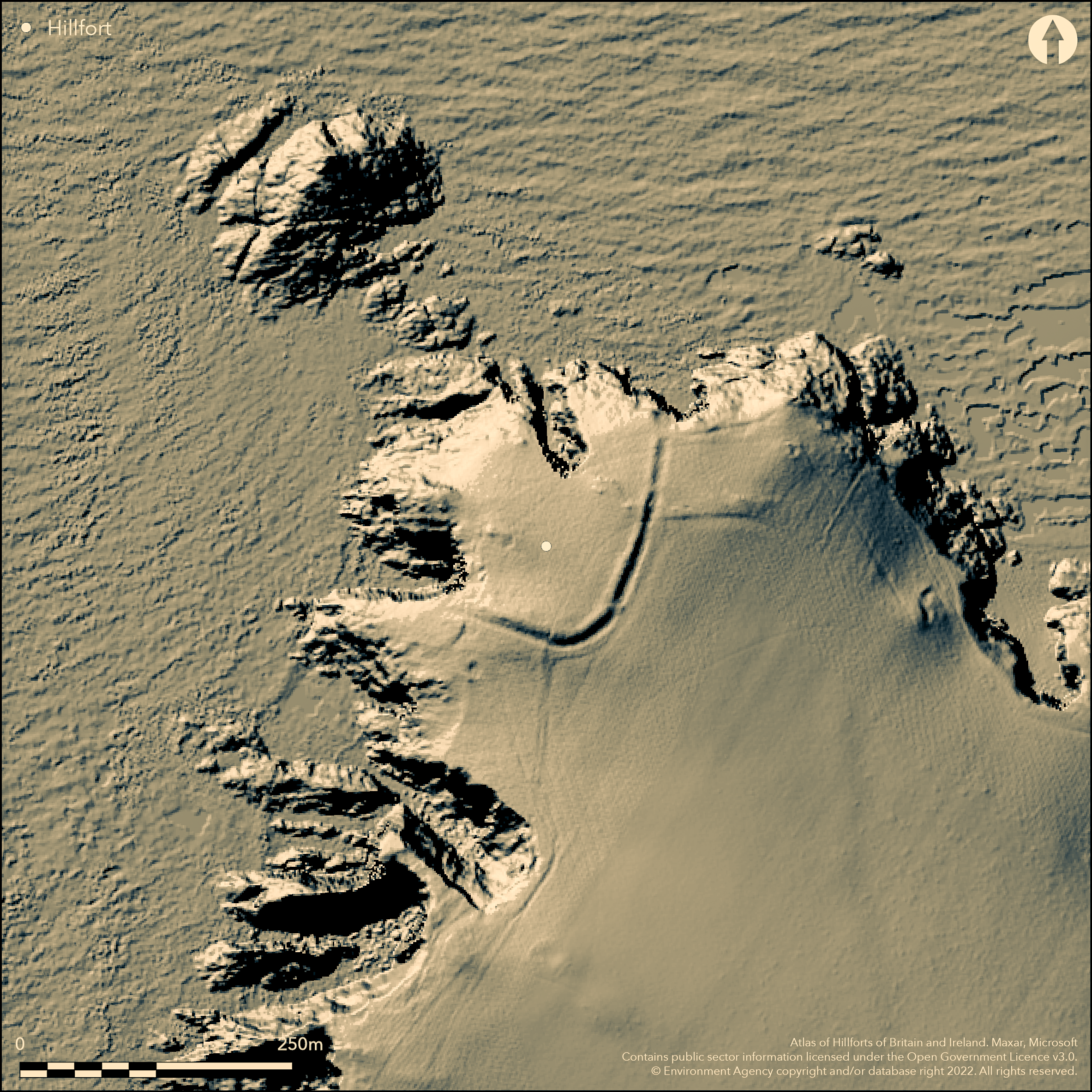
LiDAR 1m DTM Hillshade
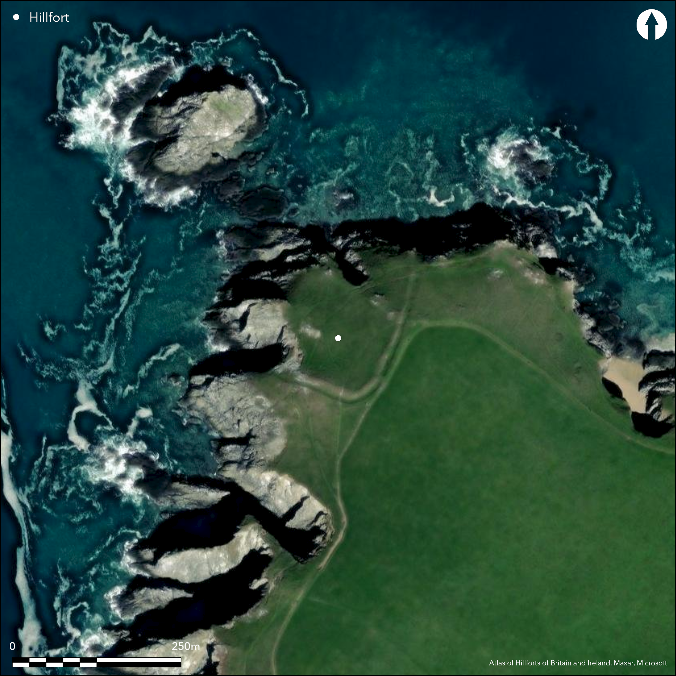
Satellite Imagery
LiDAR 1m DTM Hillshade
Satellite Imagery
Scroll left/right to view further images.
HER: Cornwall and Scilly MCO6551 (60161)
NMR: SW 76 SE 3 (428415)
SM: 1020026
NGR: SW765608
X: 176519 Y: 60801 (OSGB36)
Remains of promontory fort and annexe on N-facing coastal headland of Kelsey Head, SW of Newquay and to W of Porth Joke (Atlas No 0598 ). Precipitous sea cliffs to NE, E, SW and NW. Rocky island, The Chick, just to NW. Site irregular rectangular in plan measuring c. 170m by 160m with internal area c. 1.5ha. Eroded earth and stone rampart, incorporating natural rock outcrops, cut off the promontory in a curving L-shape from sea cliffs on NNW to same on SSW. External silted ditch partly rock-cut. Possible causewayed entrance at SE apex. An 'annexe', measuring up to 80m by 70m, adjoins site on NE, protected by an earthwork with an external ditch on SE side, although this may be remains of earlier site, later re-used as an annexe. At least four huts noted in interior. Coastal grassland and bare rock. On 1st Ed. OS map (1880). Undated.
Citizen Science: ✗
Reliability of Data: Confirmed
Reliability of Interpretation: Confirmed
X: -572897 Y: 6516611 (EPSG: 3857)
Longitude: -5.1464257707026455 Latitude: 50.40441800420566 (EPSG:4326)
Country: England
Current County or Unitary Authority: Cornwall
Historic County: Cornwall
Current Parish/Community/Council/Townland: Cubert
Eroding sea cliffs.
| Extant | ✓ |
| Cropmark | ✗ |
| Likely Destroyed | ✗ |
Coastal grassland and bare rock.
| Woodland | ✗ |
| Commercial Forestry Plantation | ✗ |
| Parkland | ✗ |
| Pasture (Grazing) | ✗ |
| Arable | ✗ |
| Scrub/Bracken | ✗ |
| Bare Outcrop | ✗ |
| Heather/Moorland | ✗ |
| Heath | ✗ |
| Built-up | ✗ |
| Coastal Grassland | ✓ |
| Other | ✗ |
Remains of promontory fort (aka cliff castle) and annexe on N-facing coastal headland of Kelsey Head, Sw of Newquay and to W of Porth Joke (Atlas No 0598). Precipitous sea cliffs to NE, E, SW and NW.
| Contour Fort | ✗ |
| Partial Contour Fort | ✗ |
| Promontory Fort | ✓ |
| Hillslope Fort | ✗ |
| Level Terrain Fort | ✗ |
| Marsh Fort | ✗ |
| Multiple Enclosure Fort | ✗ |
| Hilltop | ✗ |
| Coastal Promontory | ✓ |
| Inland Promontory | ✗ |
| Valley Bottom | ✗ |
| Knoll/Hillock/Outcrop | ✗ |
| Ridge | ✗ |
| Cliff/Plateau-edge/Scarp | ✗ |
| Hillslope | ✗ |
| Lowland | ✗ |
| Spur | ✗ |
Dominant Topographic Feature: Coastal headlland.
| North | ✗ |
| Northeast | ✗ |
| East | ✗ |
| Southeast | ✗ |
| South | ✗ |
| Southwest | ✗ |
| West | ✗ |
| Northwest | ✓ |
| Level | ✗ |
Altitude: 46.0m
N/A
None, but chance finds of Iron Age pottery on landward end of headland possibly connected with site. Considered as possibly unfinished and Roman by C.K. Croft Andrew, but no direct evidence for this.
Reliability: D - None
| Pre 1200BC | ✗ |
| 1200BC - 800BC | ✗ |
| 800BC - 400BC | ✗ |
| 400BC - AD50 | ✗ |
| AD50 - AD400 | ✗ |
| AD400 - AD 800 | ✗ |
| Post AD800 | ✗ |
| Unknown | ✓ |
| Pre Hillfort: | Flint flakes from area possibly unrelated to the earthwork, but suggest interest from the Mesolithic and Neolithic. |
| Post Hillfort: | None |
Referred to in Annual Report Royal Institution of Cornwall 1849. On 1st Ed. OS map (1880). First plan by H.M. Whitley 1881-3. Field investigations Ordnance Survey 1950, 1969.
| 1st Identified Written Reference (1849): | Referred to in Annual Report Royal Institution of Cornwall. |
| 1st Identified Map Depiction (1880): | OS map. |
| Other (None): | First plan H.M. Whitley. |
| Other (None): | Field investigation OS. |
At least four hut sites noted in interior. Chance finds of Iron Age pottery on landward end of headland possibly connected with site.
None
| None | ✓ |
| Spring | ✗ |
| Stream | ✗ |
| Pool | ✗ |
| Flush | ✗ |
| Well | ✗ |
| Other | ✗ |
At least four hut sites noted in interior - no details.
| No Known Features | ✗ |
| Round Stone Structures | ✗ |
| Rectangular Stone Structures | ✗ |
| Curvilinear Platforms | ✓ |
| Other Roundhouse Evidence | ✗ |
| Pits | ✗ |
| Quarry Hollows | ✗ |
| Other | ✗ |
None
| No Known Excavation | ✓ |
| Pits | ✗ |
| Postholes | ✗ |
| Roundhouses | ✗ |
| Rectangular Structures | ✗ |
| Roads/Tracks | ✗ |
| Quarry Hollows | ✗ |
| Other | ✗ |
| Nothing Found | ✗ |
None
| No Known Geophysics | ✓ |
| Pits | ✗ |
| Roundhouses | ✗ |
| Rectangular Structures | ✗ |
| Roads/Tracks | ✗ |
| Quarry Hollows | ✗ |
| Other | ✗ |
| Nothing Found | ✗ |
Chance finds of Iron Age pottery on landward end of headland possibly connected with site, but unclear.
| No Known Finds | ✓ |
| Pottery | ✗ |
| Metal | ✗ |
| Metalworking | ✗ |
| Human Bones | ✗ |
| Animal Bones | ✗ |
| Lithics | ✗ |
| Environmental | ✗ |
| Other | ✗ |
None
| APs Not Checked | ✓ |
| None | ✗ |
| Roundhouses | ✗ |
| Rectangular Structures | ✗ |
| Pits | ✗ |
| Postholes | ✗ |
| Roads/Tracks | ✗ |
| Other | ✗ |
Possible causewayed entrance at SE apex.
| 1: | None |
| 2: | None |
Guard Chambers: ✗
Chevaux de Frise: ✗
| 1. Simple Gap (South east): | Causewayed. |
Eroded earth and stone rampart, incorporating natural rock outcrops, cut off the promontory in a curving L shape from sea cliffs on NNW to same on SSW. External silted ditch partly rock-cut.
| Area 1: | 1.5ha. |
| Total: | 1.5ha. |
Total Footprint Area: Noneha.
None
| ✗ | None |
| ✗ | None |
| NE Quadrant: | 0 |
| SE Quadrant: | 1 |
| SW Quadrant: | 1 |
| NW Quadrant: | 0 |
| Total: | 1 |
| Partial Univallate | ✓ |
| Univallate | ✗ |
| Partial Bivallate | ✗ |
| Bivallate | ✗ |
| Partial Multivallate | ✗ |
| Multivallate | ✗ |
| Unknown | ✗ |
| Partial Univallate | ✗ |
| Univallate | ✗ |
| Partial Bivallate | ✗ |
| Bivallate | ✗ |
| Partial Multivallate | ✗ |
| Multivallate | ✗ |
Eroded earth and stone rampart incorporating rock outcrops. Considered as possibly unfinished and Roman by C.K. Croft Andrew, but no direct evidence for this.
| None | ✗ |
| Earthen Bank | ✓ |
| Stone Wall | ✗ |
| Rubble | ✓ |
| Wall-walk | ✗ |
| Evidence of Timber | ✗ |
| Vitrification | ✗ |
| Other Burning | ✗ |
| Palisade | ✗ |
| Counter Scarp Bank | ✗ |
| Berm | ✗ |
| Unfinished | ✗ |
| Other | ✗ |
None
| None | ✗ |
| Earthen Bank | ✗ |
| Stone Wall | ✗ |
| Murus Duplex | ✗ |
| Timber-framed | ✗ |
| Timber-laced | ✗ |
| Vitrification | ✗ |
| Other Burning | ✗ |
| Palisade | ✗ |
| Counter Scarp Bank | ✗ |
| Berm | ✗ |
| Unfinished | ✗ |
| No Known Excavation | ✓ |
| Other | ✗ |
| ✗ | None |
| ✓ | Silted partly rock-cut ditch. |
Number of Ditches: 1
| ✓ | An 'annexe', measuring up to 80m by 70m, adjoins site on NE, protected by an earthwork with an external ditch on SE side, although this may be remains of earlier site later reused as an annexe. |
Harding, J.R. 1950. Prehistoric Sites on the North Cornwall Coast. Antiq J, 30, 163-165.
Nankivall, F. 1962. The principal antiquities of the Newquay-Padstow District, Cornwall Archaeol Soc Field Guide 7.
Pattison, S.R. 1849. Reference in Annual Report Royal Inst Cornwall, 31, 36-7.
Warner, R. B. 1967. Some new cliff-castles, Cornish Archaeol, 6, 111.
Whitley, H.M. 1881-83. Note on paper read by H.M. Whitley on Cliff Castles in Perranzabuloe and Crantock, J Royal Inst Cornwall, 7, 288-293, plan 293.
Atlas of Hillforts:
Wikidata:
This work is licensed under CC BY-SA 4.0

 and should be cited as:
Lock, Gary and Ralston, Ian. 2024. Atlas of Hillforts of Britain and Ireland. Available at: https://hillforts.arch.ox.ac.uk
Document Version 1.1