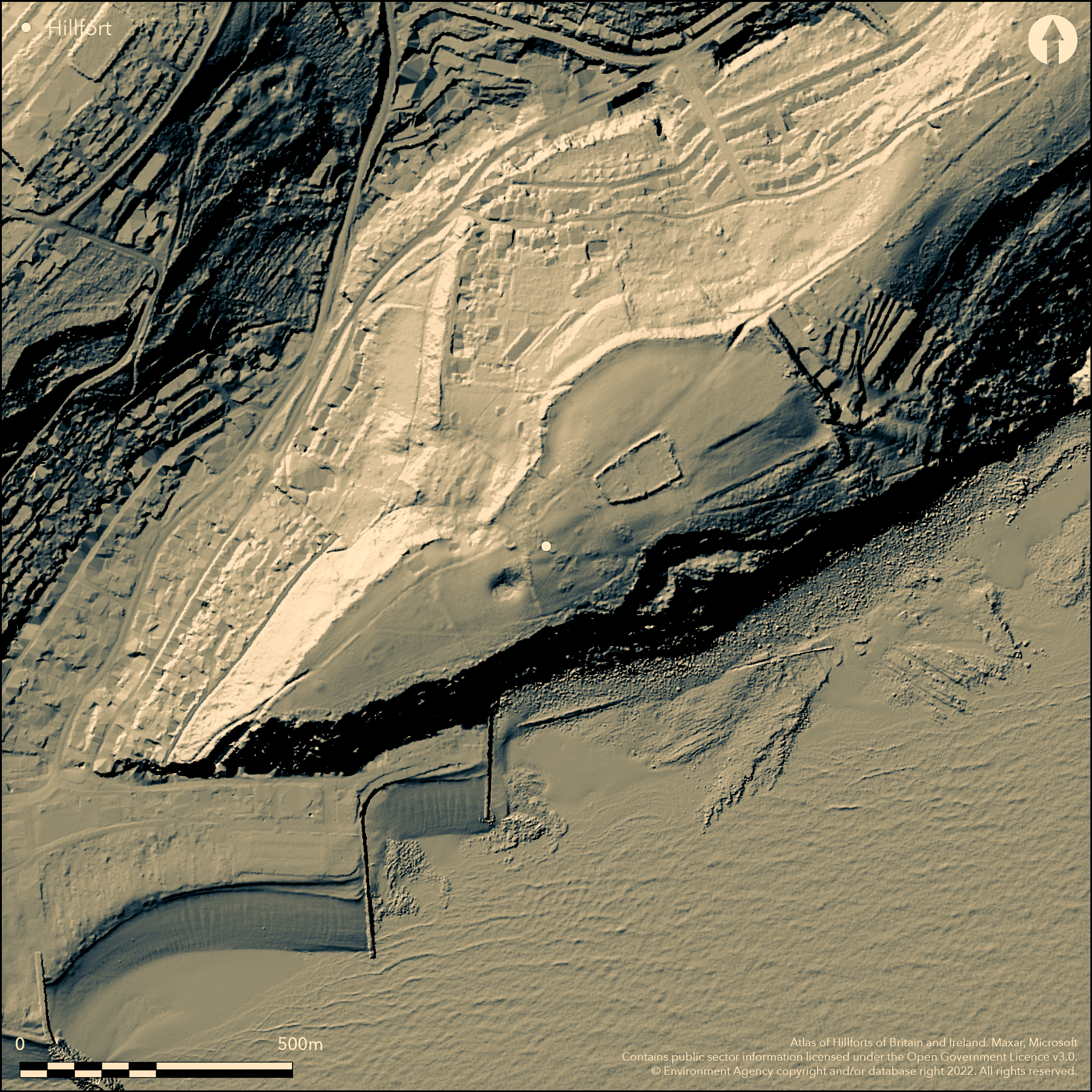
LiDAR 1m DTM Hillshade
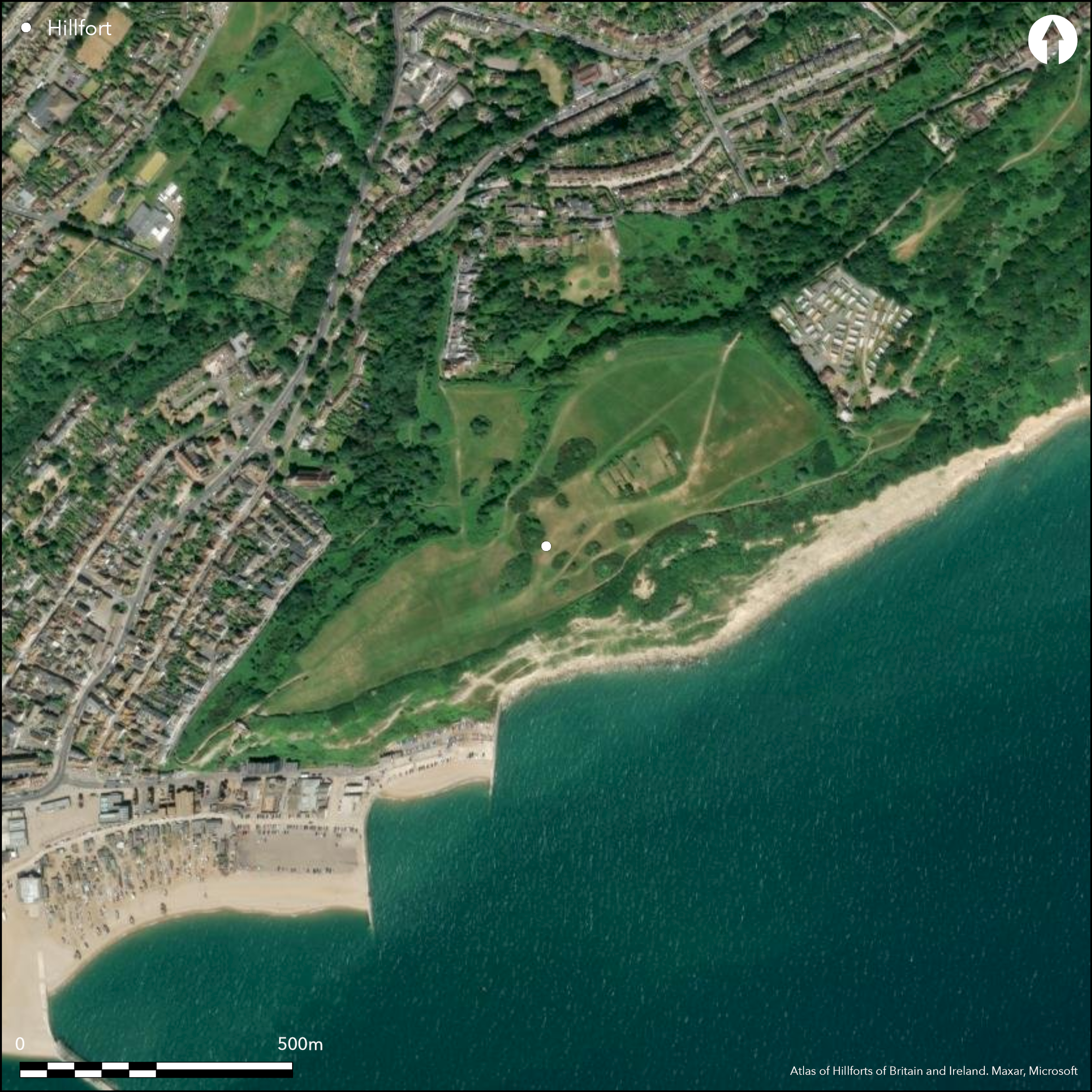
Satellite Imagery
LiDAR 1m DTM Hillshade
Satellite Imagery
Scroll left/right to view further images.
HER: East Sussex MES856 (None)
NMR: TQ 80 NW (417223)
SM: None
NGR: TQ83000980
X: 583097 Y: 109800 (OSGB36)
Coastal promontory hillfort located on East Hill above coastal chalk cliffs SE-SW. Measures c. 730m transversely NE-SW enclosing c. 14ha. Very steep natural chalk sea cliffs on S quadrants, with easiest approach on NE bounded by rampart, c. 144m long, to 3.5m high internally and on N and W by natural sandstone scarps. No ditch visible, but possibly levelled or destroyed by later quarrying and/or landscaping. Three gaps through rampart. The probably original entrance is cut through rock to c. 2.4m depth at N end of rampart, where joins natural scarp, possibly inturned and occupied by modern track. Two modern footpaths to S also cut through rampart. Bank to S of the middle gap less substantial, maybe as result of quarrying or phased construction. Substantial erosion of sea cliffs would have destroyed any detail of enclosure to S. A possible W rampart has been suggested, but no concrete evidence. Small banks within interior remains of old field boundaries as East Hill cultivated in past. On 1st Ed. OS map (1873-75) as 'supposed camp'. Minimal investigations, undated.
Citizen Science: ✗
Reliability of Data: Confirmed
Reliability of Interpretation: Confirmed
X: 66816 Y: 6596329 (EPSG: 3857)
Longitude: 0.6002219712276673 Latitude: 50.8586540668277 (EPSG:4326)
Country: England
Current County or Unitary Authority: East Sussex
Historic County: Sussex
Current Parish/Community/Council/Townland: Hastings
Rampart generally well-preserved, despite recreation ground and use for miniature golf. Substantial erosion of sea cliffs would have destroyed any detail of enclosure to S.
| Extant | ✓ |
| Cropmark | ✗ |
| Likely Destroyed | ✗ |
Interior rough grass, scrub and tree clumps of recreation ground, rampart scrub covered.
| Woodland | ✗ |
| Commercial Forestry Plantation | ✗ |
| Parkland | ✗ |
| Pasture (Grazing) | ✓ |
| Arable | ✗ |
| Scrub/Bracken | ✓ |
| Bare Outcrop | ✗ |
| Heather/Moorland | ✗ |
| Heath | ✗ |
| Built-up | ✗ |
| Coastal Grassland | ✗ |
| Other | ✓ |
Coastal promontory hillfort located on East Hill above coastal chalk cliffs SE-SW. Measures c. 730m transversely NE-SW.
| Contour Fort | ✗ |
| Partial Contour Fort | ✗ |
| Promontory Fort | ✓ |
| Hillslope Fort | ✗ |
| Level Terrain Fort | ✗ |
| Marsh Fort | ✗ |
| Multiple Enclosure Fort | ✗ |
| Hilltop | ✗ |
| Coastal Promontory | ✓ |
| Inland Promontory | ✗ |
| Valley Bottom | ✗ |
| Knoll/Hillock/Outcrop | ✗ |
| Ridge | ✗ |
| Cliff/Plateau-edge/Scarp | ✓ |
| Hillslope | ✗ |
| Lowland | ✗ |
| Spur | ✗ |
Dominant Topographic Feature: Coastal cliff edge.
| North | ✗ |
| Northeast | ✗ |
| East | ✗ |
| Southeast | ✗ |
| South | ✗ |
| Southwest | ✗ |
| West | ✗ |
| Northwest | ✗ |
| Level | ✓ |
Altitude: 90.0m
N/A
None.
Reliability: D - None
| Pre 1200BC | ✗ |
| 1200BC - 800BC | ✗ |
| 800BC - 400BC | ✗ |
| 400BC - AD50 | ✗ |
| AD50 - AD400 | ✗ |
| AD400 - AD 800 | ✗ |
| Post AD800 | ✗ |
| Unknown | ✓ |
| Pre Hillfort: | None |
| Post Hillfort: | None |
On 1st Ed. OS map (1873-75) as 'supposed camp'. English Heritage investigation and earthwork survey 2007.
| Earthwork Survey (2007): | English Heritage investigation. |
| 1st Identified Map Depiction (None): | OS map. |
None.
None
| None | ✓ |
| Spring | ✗ |
| Stream | ✗ |
| Pool | ✗ |
| Flush | ✗ |
| Well | ✗ |
| Other | ✗ |
None
| No Known Features | ✓ |
| Round Stone Structures | ✗ |
| Rectangular Stone Structures | ✗ |
| Curvilinear Platforms | ✗ |
| Other Roundhouse Evidence | ✗ |
| Pits | ✗ |
| Quarry Hollows | ✗ |
| Other | ✗ |
None
| No Known Excavation | ✓ |
| Pits | ✗ |
| Postholes | ✗ |
| Roundhouses | ✗ |
| Rectangular Structures | ✗ |
| Roads/Tracks | ✗ |
| Quarry Hollows | ✗ |
| Other | ✗ |
| Nothing Found | ✗ |
None
| No Known Geophysics | ✓ |
| Pits | ✗ |
| Roundhouses | ✗ |
| Rectangular Structures | ✗ |
| Roads/Tracks | ✗ |
| Quarry Hollows | ✗ |
| Other | ✗ |
| Nothing Found | ✗ |
None
| No Known Finds | ✓ |
| Pottery | ✗ |
| Metal | ✗ |
| Metalworking | ✗ |
| Human Bones | ✗ |
| Animal Bones | ✗ |
| Lithics | ✗ |
| Environmental | ✗ |
| Other | ✗ |
None
| APs Not Checked | ✓ |
| None | ✗ |
| Roundhouses | ✗ |
| Rectangular Structures | ✗ |
| Pits | ✗ |
| Postholes | ✗ |
| Roads/Tracks | ✗ |
| Other | ✗ |
Entrance cut through rock to c. 2.4m depth at N end of rampart where joins natural scarp, possibly inturned and occupied by modern track. Two modern footpaths also cut through rampart.
| 3: | Two modern tracks through rampart on E. |
| 2: | Towards N of rampart. |
Guard Chambers: ✗
Chevaux de Frise: ✗
| 1. In-turned (North east): | Possibly inturned entrance. Occupied by modern track. |
Very steep natural chalk sea cliffs form defence on S quadrants, with easiest approach on NE bounded by rampart to 3.5m high internally and on N and W by natural sandstone scarps. No ditch visible.
| Area 1: | 14.0ha. |
| Total: | 14.0ha. |
Total Footprint Area: Noneha.
None
| ✓ | Bank to S of the middle gap less substantial, maybe as result of quarrying or phased construction, but no direct evidence. |
| ✗ | None |
| NE Quadrant: | 1 |
| SE Quadrant: | 0 |
| SW Quadrant: | 0 |
| NW Quadrant: | 0 |
| Total: | 1 |
| Partial Univallate | ✓ |
| Univallate | ✗ |
| Partial Bivallate | ✗ |
| Bivallate | ✗ |
| Partial Multivallate | ✗ |
| Multivallate | ✗ |
| Unknown | ✗ |
| Partial Univallate | ✗ |
| Univallate | ✗ |
| Partial Bivallate | ✗ |
| Bivallate | ✗ |
| Partial Multivallate | ✗ |
| Multivallate | ✗ |
Chalk bank.
| None | ✗ |
| Earthen Bank | ✓ |
| Stone Wall | ✗ |
| Rubble | ✗ |
| Wall-walk | ✗ |
| Evidence of Timber | ✗ |
| Vitrification | ✗ |
| Other Burning | ✗ |
| Palisade | ✗ |
| Counter Scarp Bank | ✗ |
| Berm | ✗ |
| Unfinished | ✗ |
| Other | ✗ |
None
| None | ✗ |
| Earthen Bank | ✗ |
| Stone Wall | ✗ |
| Murus Duplex | ✗ |
| Timber-framed | ✗ |
| Timber-laced | ✗ |
| Vitrification | ✗ |
| Other Burning | ✗ |
| Palisade | ✗ |
| Counter Scarp Bank | ✗ |
| Berm | ✗ |
| Unfinished | ✗ |
| No Known Excavation | ✓ |
| Other | ✗ |
| ✗ | None |
| ✗ | No ditch visible, but possibly now remnant buried feature. |
Number of Ditches: 0
| ✗ | None |
Allcroft, A.H. 1908. Earthworks of England : prehistoric, Roman, Saxon, Danish, Norman, and mediaeval, London: Macmillann, 674.
Fradley, M.and Newsome, S. 2008. East Hill, Hastings, East Sussex: A Landscape Survey and Investigation: survey report, Centre for Archaeology Report Series, Report No 35-2008.
Page, W. (ed) 1905. The Victoria history of the county of Sussex: volume one, 468.
Atlas of Hillforts:
Wikidata:
This work is licensed under CC BY-SA 4.0

 and should be cited as:
Lock, Gary and Ralston, Ian. 2024. Atlas of Hillforts of Britain and Ireland. Available at: https://hillforts.arch.ox.ac.uk
Document Version 1.1