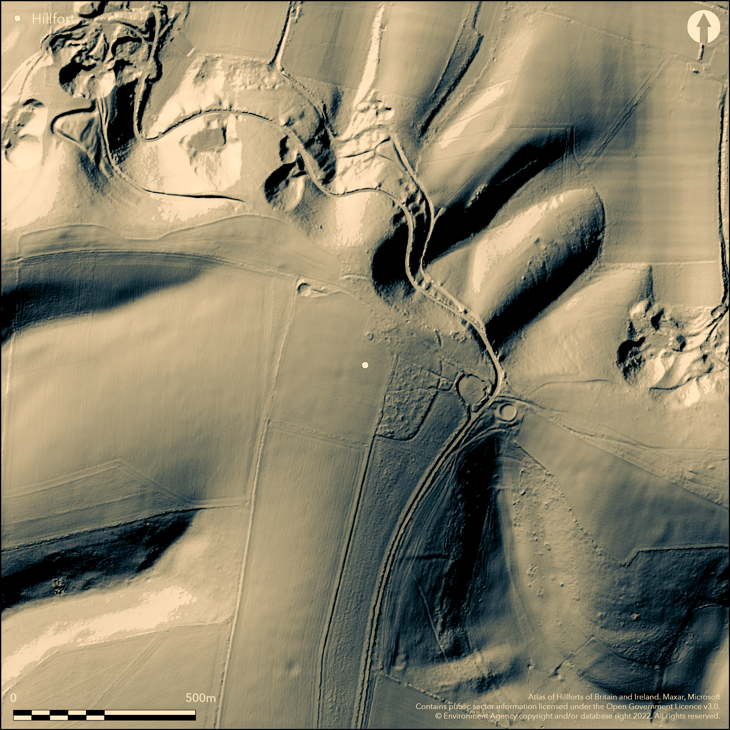
LiDAR 1m DTM Hillshade
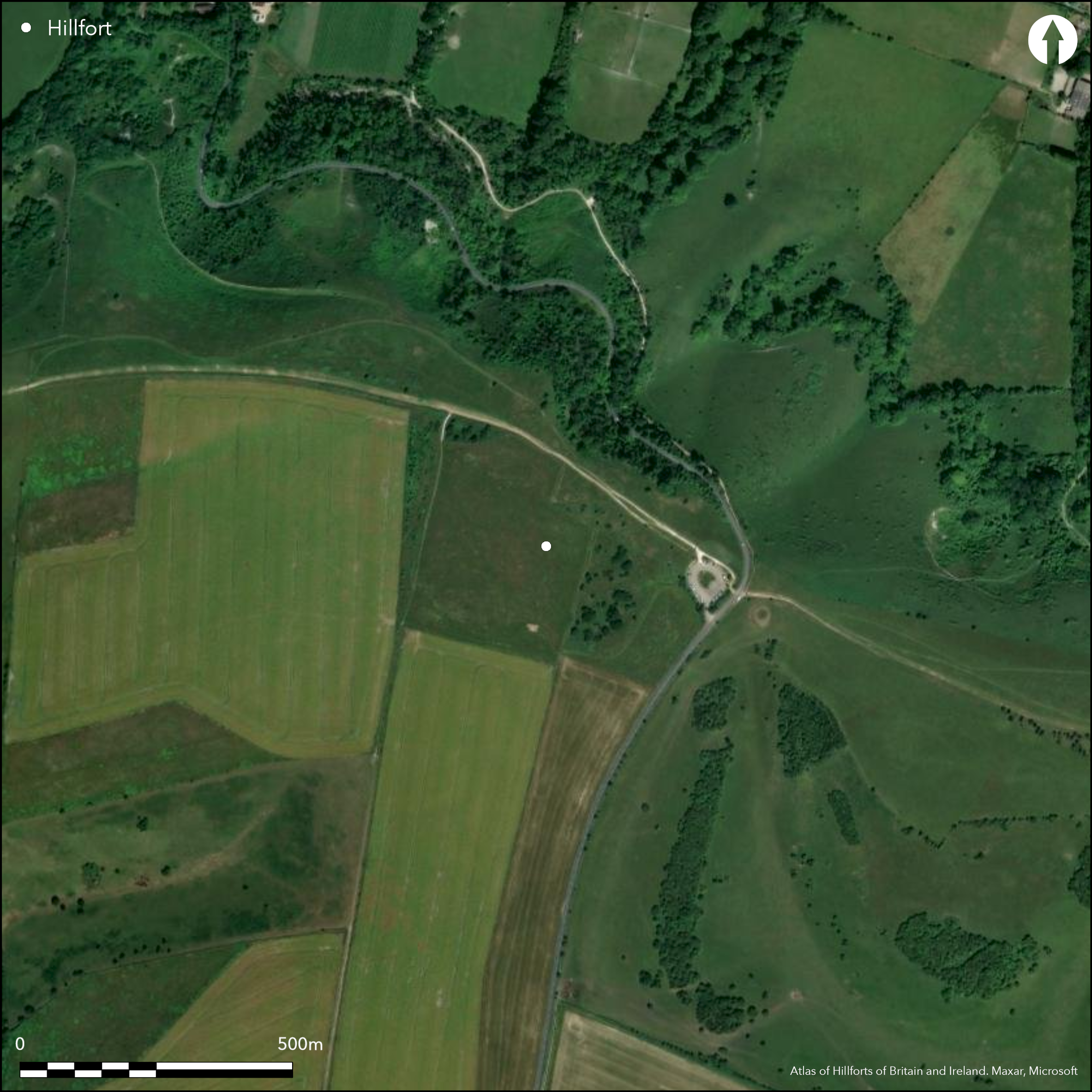
Satellite Imagery
LiDAR 1m DTM Hillshade
Satellite Imagery
Scroll left/right to view further images.
HER: East Sussex MES1289 (None)
NMR: TQ 31 SW 13 (403045)
SM: 1015340
NGR: TQ33151300
X: 533155 Y: 113020 (OSGB36)
Univallate contour hillfort located on summit of prominent Ditchling Beacon on ridge of South Downs. Far-reaching views from site. Steep slopes, becoming very steep on N and NE, moderate along ridge to S. Roughly rectangular area encloses c. 7ha. Simple rampart, to c. 1m high, above generally infilled ditch, c. 3m wide and to 0.5m deep, follow contours on E and NW sides. Most of S part reduced or lost to ploughing. On N steep natural slopes make ramparts unnecessary. Several gaps of later downland tracks and paths cross the monument; original entrance nor determined. Excavations by Crow, D.A. and Williamson (Crow 1930) proved inconclusive, other than Iron Age and Roman pottery. Some evidence of early Iron Age sherds from rampart dump. Resistivity survey and trial trenching 2000 found two prehistoric features, but suggested enclosure formed by natural fissures in the chalk (Butler 2001). Later beacon hearth mound, one of a chain of beacons stretching along South Downs during medieval and post-medieval periods, 18th/19th century dewpond and 19th century boundary stone. On 1st Ed. OS map (1874).
Citizen Science: ✗
Reliability of Data: Confirmed
Reliability of Interpretation: Confirmed
X: -11993 Y: 6603844 (EPSG: 3857)
Longitude: -0.10773734423805807 Latitude: 50.90124468172535 (EPSG:4326)
Country: England; None
Current County or Unitary Authority: East Sussex
Historic County: Sussex
Current Parish/Community/Council/Townland: Ditchling; Westmeston
Most of S half reduced or destroyed by ploughing. Elsewhere ramparts weak to 1.0m high, but generally well-preserved. Modern tracks mutilated entrances. Beacon mound disturbed by OS trig point. Viewpoint panel. Popular with visitors. National Trust site.
| Extant | ✓ |
| Cropmark | ✗ |
| Likely Destroyed | ✗ |
Rough grazing. SSSI.
| Woodland | ✗ |
| Commercial Forestry Plantation | ✗ |
| Parkland | ✗ |
| Pasture (Grazing) | ✓ |
| Arable | ✗ |
| Scrub/Bracken | ✗ |
| Bare Outcrop | ✗ |
| Heather/Moorland | ✗ |
| Heath | ✗ |
| Built-up | ✗ |
| Coastal Grassland | ✗ |
| Other | ✗ |
Univallate contour hillfort located on summit of prominent Ditchling Beacon on ridge of South Downs. Far-reaching views from site. Steep slopes, becoming very steep on N and NE, moderate along ridge to S.
| Contour Fort | ✓ |
| Partial Contour Fort | ✗ |
| Promontory Fort | ✗ |
| Hillslope Fort | ✗ |
| Level Terrain Fort | ✗ |
| Marsh Fort | ✗ |
| Multiple Enclosure Fort | ✗ |
| Hilltop | ✗ |
| Coastal Promontory | ✗ |
| Inland Promontory | ✗ |
| Valley Bottom | ✗ |
| Knoll/Hillock/Outcrop | ✗ |
| Ridge | ✓ |
| Cliff/Plateau-edge/Scarp | ✗ |
| Hillslope | ✗ |
| Lowland | ✗ |
| Spur | ✗ |
Dominant Topographic Feature: Ridge summit.
| North | ✗ |
| Northeast | ✗ |
| East | ✗ |
| Southeast | ✗ |
| South | ✗ |
| Southwest | ✗ |
| West | ✗ |
| Northwest | ✗ |
| Level | ✓ |
Altitude: 248.0m
Boundary Type: Parish/Townland
Iron Age and Romano-British pottery; some evidence of early Iron Age sherds from rampart dump.
Reliability: C - Low
| Pre 1200BC | ✗ |
| 1200BC - 800BC | ✗ |
| 800BC - 400BC | ✓ |
| 400BC - AD50 | ✓ |
| AD50 - AD400 | ✗ |
| AD400 - AD 800 | ✗ |
| Post AD800 | ✗ |
| Unknown | ✗ |
| Pre Hillfort: | None |
| Post Hillfort: | None |
| Artefactual: | Iron Age and Romano-British pottery. |
On 1st Ed. OS map (1874). Excavation D.A. Crow and Ross-Williamson 1929. Geophysical survey and trial trenching C. Butler, Mid Sussex Field Archaeological Team 2000. Measured survey N. Bannister, National Trust historic landscape survey 2000.
| 1st Identified Map Depiction (1874): | OS map. |
| Geophysical Survey (2000): | Resistivilty survey and trial trenching. |
| Earthwork Survey (2000): | Measured survey. |
Resistivity survey and trial trenching 2000 found two prehistoric features, but suggested enclosure formed by natural fissures in the chalk. Few sherds of Iron Age pottery and Romano-British, charcoal, flint flakes from 1929 excavations.
Later dew ponds in NW corner suggest possible source.
| None | ✗ |
| Spring | ✗ |
| Stream | ✗ |
| Pool | ✗ |
| Flush | ✗ |
| Well | ✗ |
| Other | ✓ |
None
| No Known Features | ✓ |
| Round Stone Structures | ✗ |
| Rectangular Stone Structures | ✗ |
| Curvilinear Platforms | ✗ |
| Other Roundhouse Evidence | ✗ |
| Pits | ✗ |
| Quarry Hollows | ✗ |
| Other | ✗ |
Possible hut sites proved negative in 1929 excavations.
| No Known Excavation | ✗ |
| Pits | ✗ |
| Postholes | ✗ |
| Roundhouses | ✗ |
| Rectangular Structures | ✗ |
| Roads/Tracks | ✗ |
| Quarry Hollows | ✗ |
| Other | ✗ |
| Nothing Found | ✓ |
Resistivity survey and trial trenching 2000 found two prehistoric features, but suggested enclosure formed by natural fissures in the chalk.
| No Known Geophysics | ✗ |
| Pits | ✗ |
| Roundhouses | ✗ |
| Rectangular Structures | ✗ |
| Roads/Tracks | ✗ |
| Quarry Hollows | ✗ |
| Other | ✓ |
| Nothing Found | ✗ |
Few sherds of Iron Age pottery and Romano-British, charcoal, flint flakes from 1929 excavations.
| No Known Finds | ✗ |
| Pottery | ✓ |
| Metal | ✗ |
| Metalworking | ✗ |
| Human Bones | ✗ |
| Animal Bones | ✗ |
| Lithics | ✓ |
| Environmental | ✓ |
| Other | ✗ |
None
| APs Not Checked | ✓ |
| None | ✗ |
| Roundhouses | ✗ |
| Rectangular Structures | ✗ |
| Pits | ✗ |
| Postholes | ✗ |
| Roads/Tracks | ✗ |
| Other | ✗ |
Several gaps of later downland tracks and paths cross the monument; original entrance not determined.
| None: | Several gaps of later downland tracks and paths cross the monument - number not defined. |
| 2: | Original entrance not determined. |
Guard Chambers: ✗
Chevaux de Frise: ✗
Simple rampart, to c. 1m high, above generally infilled ditch, c. 3m wide and to 0.5m deep, follow contours on E and NW sides. Most of S part reduced or lost to ploughing. On N steep natural slopes make artificial defences unnecessary.
| Area 1: | 7.0ha. |
| Total: | 7.0ha. |
Total Footprint Area: Noneha.
None
| ✗ | None |
| ✓ | To S rampart largely reduced or destroyed by ploughing. |
| NE Quadrant: | 1 |
| SE Quadrant: | 1 |
| SW Quadrant: | 1 |
| NW Quadrant: | 1 |
| Total: | 1 |
| Partial Univallate | ✗ |
| Univallate | ✓ |
| Partial Bivallate | ✗ |
| Bivallate | ✗ |
| Partial Multivallate | ✗ |
| Multivallate | ✗ |
| Unknown | ✗ |
| Partial Univallate | ✗ |
| Univallate | ✗ |
| Partial Bivallate | ✗ |
| Bivallate | ✗ |
| Partial Multivallate | ✗ |
| Multivallate | ✗ |
Probably chalk rubble.
| None | ✗ |
| Earthen Bank | ✓ |
| Stone Wall | ✗ |
| Rubble | ✗ |
| Wall-walk | ✗ |
| Evidence of Timber | ✗ |
| Vitrification | ✗ |
| Other Burning | ✗ |
| Palisade | ✗ |
| Counter Scarp Bank | ✗ |
| Berm | ✗ |
| Unfinished | ✗ |
| Other | ✗ |
None
| None | ✓ |
| Earthen Bank | ✗ |
| Stone Wall | ✗ |
| Murus Duplex | ✗ |
| Timber-framed | ✗ |
| Timber-laced | ✗ |
| Vitrification | ✗ |
| Other Burning | ✗ |
| Palisade | ✗ |
| Counter Scarp Bank | ✗ |
| Berm | ✗ |
| Unfinished | ✗ |
| No Known Excavation | ✗ |
| Other | ✗ |
| ✗ | None |
| ✓ | None |
Number of Ditches: 1
| ✗ | None |
Allcroft, A.H. 1908. Earthwork of England : prehistoric, Roman, Saxon, Danish, Norman, and mediaeval, London: Macmillann, 667-69.
Bannister, N. The National Trust Annual Archaeological Review, 9, 2000-2001.
Butler, C. 2001. Ditchling Beacon Enclosure: survey and trial trenching, Mid Sussex Field Archaeological Team assessment and evaluation report.
Crow, D.A. 1930. Excavations at Ditchling Beacon, Sussex Archaeol Collect. 71, 259-61.
Hamilton, S. and Manley, J.1997. Points of view. Prominent enclosures in 1st millennium Sussex, Sussex Archaeol Coll, 135, 93-112.
Hamilton, S. and Manley, J. 2001. Hillforts, monumentality and place: a chronological and topographic review of first millennium BC hillforts of southeast England, European J Archaeol, 4.1, 7-42.
Atlas of Hillforts:
Wikidata:
This work is licensed under CC BY-SA 4.0

 and should be cited as:
Lock, Gary and Ralston, Ian. 2024. Atlas of Hillforts of Britain and Ireland. Available at: https://hillforts.arch.ox.ac.uk
Document Version 1.1