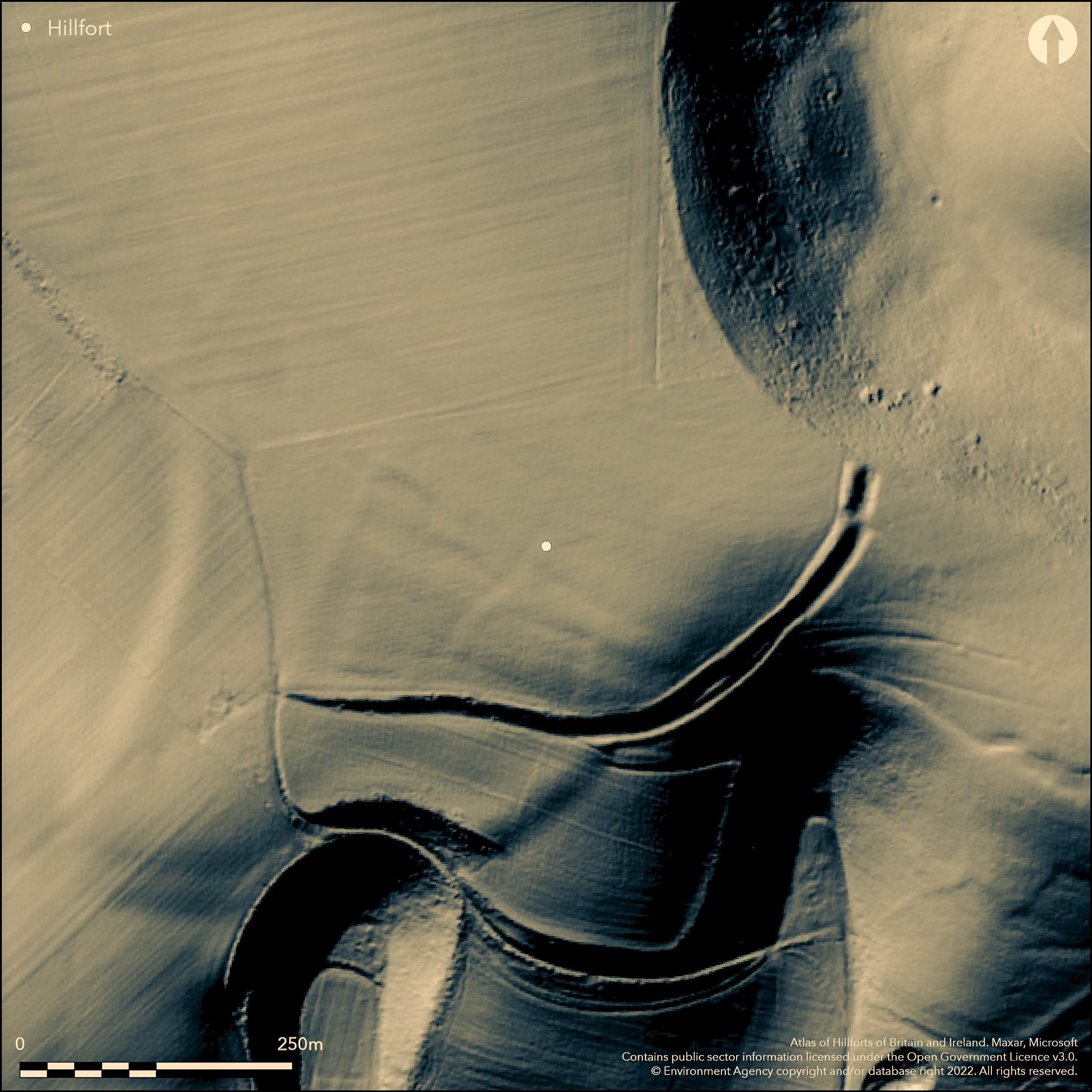
LiDAR 1m DTM Hillshade
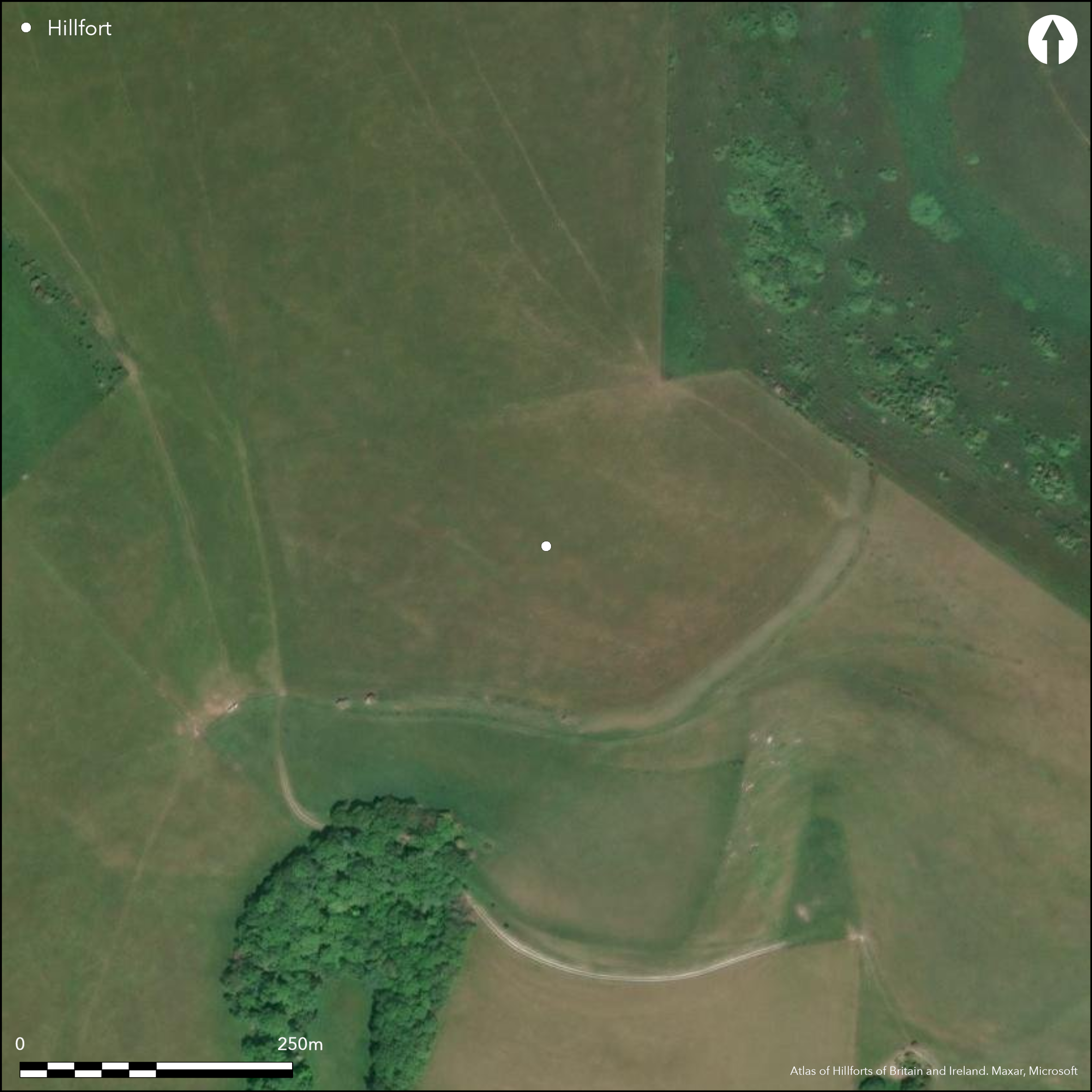
Satellite Imagery
LiDAR 1m DTM Hillshade
Satellite Imagery
Scroll left/right to view further images.
HER: East Sussex MES1448 (None)
NMR: TQ 40 NW 8 (405859)
SM: 1014528
NGR: TQ437091
X: 543793 Y: 109162 (OSGB36)
Unfinished, univallate, partial contour hillfort located on NW-SE ridge of Sussex Downs 500m to NW of Mount Caburn hillfort (Atlas No. 3730) with which it is broadly contemporary. Very steep slopes to Caburn Bottom on N and NE, to SE and S, steep elsewhere. Extensive views of Ouse valley to S. Defined by NE-SW curving bank c. 400m long and c.1 0m wide to 2m high at NE end, but to SW reduced by ploughing. Bank flanked by ditch, infilled in places, on SE side, on NE end visible as depression c. 7m wide and c.1 m deep, flanked by slight counterscarp bank c. 2m wide. Gap of c. 6m wide in bank, c. 30m from NE end,seemingly site of intended entrance, but not constructed. Part excavations by Pitt-Rivers 1878 (Lane Fox 1881)and Brighton and Hove Archaeological Society 1959-60 (Burstow and Holleyman 1960; 1961; 1964). Latter revealed bank originally constructed as box rampart, or earth and chalk rubble wall reinforced with double row of timbers and revetted with turves. This separated from ditch by berm c. 4.5m wide, but natural slippage obscured this. Pitt-Rivers claimed continuation of bank around W to NE, but no trace of this as yet. Both excavations found Iron Age and early second century AD pottery. Series of test pits dug under auspices of Sussex Archaeological Society 1997 between The Caburn (Atlas No 3740) and Ranscombe Camp 1997 suggested prehistoric activity concentrated at either end of the ridge. Rough pasture. Disused, grassy track which runs along infilled ditch at SW end of site and modern fence which runs across fort. On 1st Ed. OS map (1873-75) as 'supposed site'.
Citizen Science: ✗
Reliability of Data: Confirmed
Reliability of Interpretation: Confirmed
X: 4668 Y: 6597276 (EPSG: 3857)
Longitude: 0.04193454862875042 Latitude: 50.864024012139524 (EPSG:4326)
Country: England; None
Current County or Unitary Authority: East Sussex
Historic County: Sussex
Current Parish/Community/Council/Townland: South Malling; Glynde
To SW bank reduced by ploughing. In South Downs National Park.
| Extant | ✓ |
| Cropmark | ✗ |
| Likely Destroyed | ✗ |
Improved downland pasture.
| Woodland | ✗ |
| Commercial Forestry Plantation | ✗ |
| Parkland | ✗ |
| Pasture (Grazing) | ✓ |
| Arable | ✗ |
| Scrub/Bracken | ✗ |
| Bare Outcrop | ✗ |
| Heather/Moorland | ✗ |
| Heath | ✗ |
| Built-up | ✗ |
| Coastal Grassland | ✗ |
| Other | ✗ |
Unfinished, univallate, possible partial contour hillfort located on NW-SE ridge of Sussex Downs 500m to NW of Mount Caburn hillfort (Atlas No. 3730). Very steep slopes to Caburn Bottom on N and NE, to SE and S, steep elsewhere.
| Contour Fort | ✗ |
| Partial Contour Fort | ✓ |
| Promontory Fort | ✗ |
| Hillslope Fort | ✗ |
| Level Terrain Fort | ✗ |
| Marsh Fort | ✗ |
| Multiple Enclosure Fort | ✗ |
| Hilltop | ✗ |
| Coastal Promontory | ✗ |
| Inland Promontory | ✗ |
| Valley Bottom | ✗ |
| Knoll/Hillock/Outcrop | ✗ |
| Ridge | ✓ |
| Cliff/Plateau-edge/Scarp | ✗ |
| Hillslope | ✗ |
| Lowland | ✗ |
| Spur | ✗ |
Dominant Topographic Feature: Ridge
| North | ✗ |
| Northeast | ✗ |
| East | ✗ |
| Southeast | ✓ |
| South | ✗ |
| Southwest | ✗ |
| West | ✗ |
| Northwest | ✗ |
| Level | ✗ |
Altitude: 128.0m
Boundary Type: Parish/Townland
Excavations 1878 and 1959-60 found Iron Age and early second century AD pottery.
Reliability: B - Medium
| Pre 1200BC | ✗ |
| 1200BC - 800BC | ✗ |
| 800BC - 400BC | ✗ |
| 400BC - AD50 | ✓ |
| AD50 - AD400 | ✓ |
| AD400 - AD 800 | ✗ |
| Post AD800 | ✗ |
| Unknown | ✗ |
| Pre Hillfort: | None |
| Post Hillfort: | None |
| Artefactual: | Pottery sherds of Iron Age and early second century AD. |
Excavations by Augustus Henry Lane Fox Pitt-Rivers (one cutting) 1878 and G.P Burstow and G.A. Holleyman Brighton and Hove Archaeological Society 1959-60. Excavation O. Bedwin 1976. Measured survey English Heritage South Downs Project 2005-2011.
| Excavation (1878): | Augustus Henry Lane Fox Pitt-Rivers. |
| Other (1975): | Visit by Hillfort Study Group |
| Excavation (1976): | O. Bedwin. |
| Excavation (None): | G.P Burstow and G.A. Holleyman Brighton and Hove Archaeological Society. |
| Earthwork Survey (None): | Measured survey English Heritage South Downs Project. |
Excavations found Iron Age and early second century AD pottery.
None
| None | ✓ |
| Spring | ✗ |
| Stream | ✗ |
| Pool | ✗ |
| Flush | ✗ |
| Well | ✗ |
| Other | ✗ |
None
| No Known Features | ✓ |
| Round Stone Structures | ✗ |
| Rectangular Stone Structures | ✗ |
| Curvilinear Platforms | ✗ |
| Other Roundhouse Evidence | ✗ |
| Pits | ✗ |
| Quarry Hollows | ✗ |
| Other | ✗ |
None
| No Known Excavation | ✗ |
| Pits | ✗ |
| Postholes | ✗ |
| Roundhouses | ✗ |
| Rectangular Structures | ✗ |
| Roads/Tracks | ✗ |
| Quarry Hollows | ✗ |
| Other | ✗ |
| Nothing Found | ✓ |
None
| No Known Geophysics | ✓ |
| Pits | ✗ |
| Roundhouses | ✗ |
| Rectangular Structures | ✗ |
| Roads/Tracks | ✗ |
| Quarry Hollows | ✗ |
| Other | ✗ |
| Nothing Found | ✗ |
Excavations found Iron Age and early second century AD pottery.
| No Known Finds | ✗ |
| Pottery | ✓ |
| Metal | ✗ |
| Metalworking | ✗ |
| Human Bones | ✗ |
| Animal Bones | ✗ |
| Lithics | ✗ |
| Environmental | ✗ |
| Other | ✗ |
None
| APs Not Checked | ✓ |
| None | ✗ |
| Roundhouses | ✗ |
| Rectangular Structures | ✗ |
| Pits | ✗ |
| Postholes | ✗ |
| Roads/Tracks | ✗ |
| Other | ✗ |
Gap of c. 6m wide in bank, c. 30m from NE end, seemingly site of intended entrance, but not constructed.
| 1: | None |
| 2: | Gap of c. 6m wide in bank, c. 30m from NE end. |
Guard Chambers: ✗
Chevaux de Frise: ✗
| 1. Simple Gap (North east): | Possible intended entrance. |
Defined by NE-SW curving bank c. 400m long and c.1 0m wide to 2m high at NE end, but to SW reduced by ploughing. Bank flanked by ditch, infilled in places, on SE side, on NE end visible as depression c. 7m wide and c.1 m deep, flanked by slight counterscarp bank c. 2m wide.
| Area 1: | Noneha. |
| Total: | Noneha. |
Total Footprint Area: Noneha.
None
| ✗ | Area cannot be defined. |
| ✗ | None |
| NE Quadrant: | 0 |
| SE Quadrant: | 1 |
| SW Quadrant: | 1 |
| NW Quadrant: | 0 |
| Total: | 1 |
| Partial Univallate | ✓ |
| Univallate | ✗ |
| Partial Bivallate | ✗ |
| Bivallate | ✗ |
| Partial Multivallate | ✗ |
| Multivallate | ✗ |
| Unknown | ✗ |
| Partial Univallate | ✗ |
| Univallate | ✗ |
| Partial Bivallate | ✗ |
| Bivallate | ✗ |
| Partial Multivallate | ✗ |
| Multivallate | ✗ |
Entrance seemingly not constructed.
| None | ✗ |
| Earthen Bank | ✓ |
| Stone Wall | ✗ |
| Rubble | ✗ |
| Wall-walk | ✗ |
| Evidence of Timber | ✗ |
| Vitrification | ✗ |
| Other Burning | ✗ |
| Palisade | ✗ |
| Counter Scarp Bank | ✓ |
| Berm | ✗ |
| Unfinished | ✓ |
| Other | ✗ |
Excavation 1959-60 revealed that bank originally constructed as box rampart, or earth and chalk rubble wall reinforced by double row of timbers and revetted with turves. This separated from ditch by berm c. 4.5m wide, but natural slippage obscured this.
| None | ✗ |
| Earthen Bank | ✓ |
| Stone Wall | ✗ |
| Murus Duplex | ✗ |
| Timber-framed | ✗ |
| Timber-laced | ✓ |
| Vitrification | ✗ |
| Other Burning | ✗ |
| Palisade | ✗ |
| Counter Scarp Bank | ✗ |
| Berm | ✓ |
| Unfinished | ✗ |
| No Known Excavation | ✗ |
| Other | ✓ |
| ✗ | None |
| ✓ | Bank flanked by ditch, infilled in places, on SE side, on NE end visible as depression c. 7m wide and c.1 m deep, |
Number of Ditches: 1
| ✗ | None |
Bedwin, O.1978. The excavation of a Romano-British site at Ranscombe Hill, South Malling, East Sussex, 1976, Sussex Archaeol Collect., 116 241-55.
Burstow, G.P. and Holleyman, G.A. 1960. Ranscombe Camp, nr Glynde. First season's excavations, Sussex N & Q, 15(5), 156-57.
Burstow, G.P. and Holleyman, G.A. 1961. Ranscombe Camp, near Glynde. Sussex N & Q, 15(7), 233-35.
Burstow, G.P. and Holleyman, G.A. 1964. Excavations at Ranscombe Camp 1959-60, Sussex Archaeol Collect., 102, 55-67.
Lane Fox, A. 1881. Excavations at Mount Caburn Camp, near Lewes, conducted in September and October, 1877, and July 1878, Arch, 46, 2, 471-76.
Atlas of Hillforts:
Wikidata:
This work is licensed under CC BY-SA 4.0

 and should be cited as:
Lock, Gary and Ralston, Ian. 2024. Atlas of Hillforts of Britain and Ireland. Available at: https://hillforts.arch.ox.ac.uk
Document Version 1.1