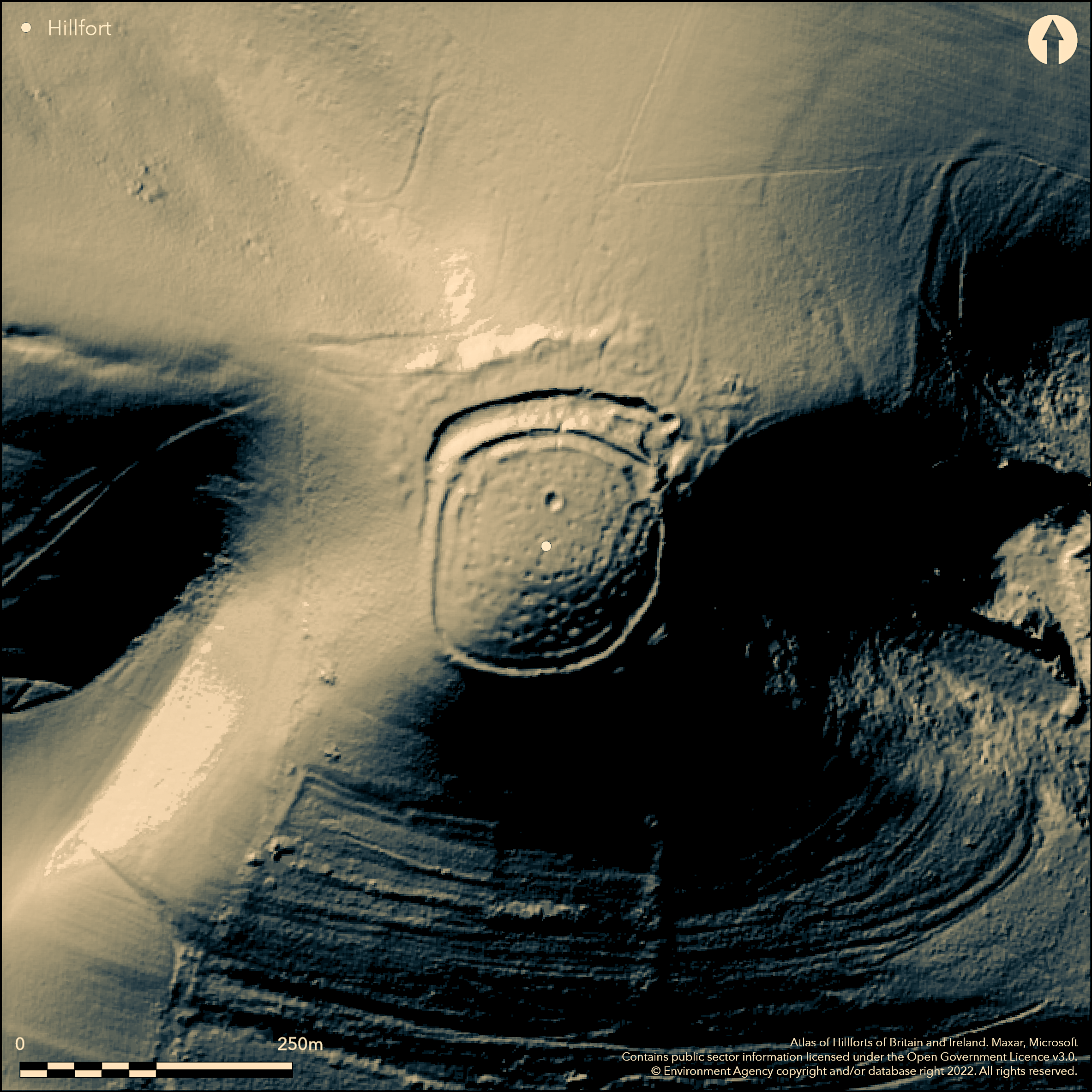
LiDAR 1m DTM Hillshade
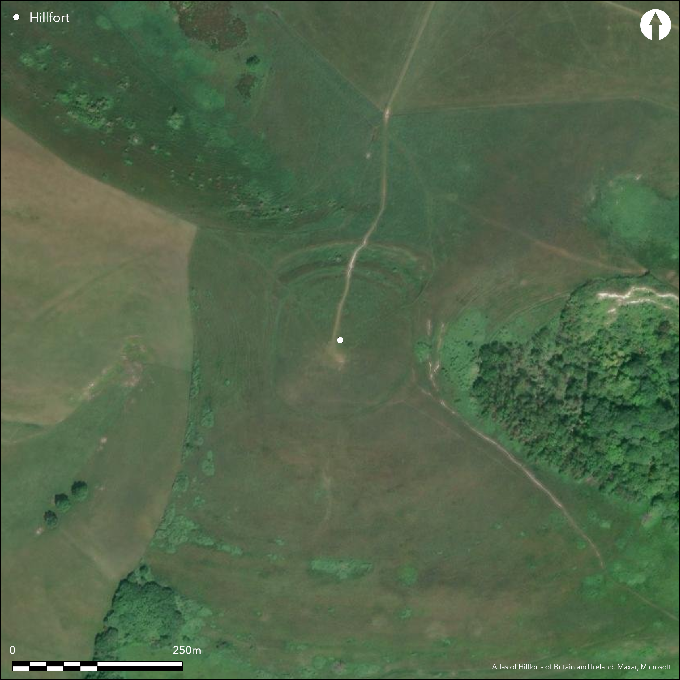
Satellite Imagery
LiDAR 1m DTM Hillshade
Satellite Imagery
Scroll left/right to view further images.
HER: East Sussex MES1456 (None)
NMR: TQ 40 NW 29 (405932)
SM: 1014527
NGR: TQ 4441 0891
X: 544436 Y: 108924 (OSGB36)
Multivallate, contour hillfort situated on prominent spur of Caburn hill in South Downs above coastal plain and overlooking Ouse valley to SW, and 500m SE of the unfinished Ranscombe Camp (Atlas No 3729). Generally very steep surrounding slopes on S to NW and moderate along ridge to NNE. Steep wooded valley to E. Sub-circular shape, c.130m diameter, encloses c. 3ha. First excavated by Pitt-Rivers in 1877-8, cutting sections through rampart and investigating 40 of the small depressions and large pit, with early Iron Age material. Excavation by E. Curwen 1925-6 when remaining 99 untouched depressions excavated. These pits probably for storage and refuse, and finds included British and Roman coins, iron slag and crucibles, spindle-whorls, beads, slingstones and Iron Age pottery. Pits Hallstatt to Romano-British with densest period of occupation 250-50 BC. In 1937-8 the Brighton and Hove Arch Soc (Wilson 1939) excavated ramparts and gateway and through S defences. Two hut sites and a 'Norman hearth' investigated near gate. This work showed complex phased history of development from Iron Age to medieval period, when very unusual late phase of redevelopment and reuse. First phase of two circular wooden buildings before hillfort of unenclosed settlement c. 300BC, with spindle whorls, loom weights and fragments of quernstone found. Second phase had dump earth and chalk rubble bank constructed around settlement; now present inner rampart to 6m wide and 0.3m high with part filled ditch 6m wide and to 1.3m deep, with slight counterscarp on S side. Slightly inturned, causewayed entrance on NE. Urned cremation found below second phase counterscarp bank on S. Around AD 43 in third phase defences strengthened by second rampart and ditch on N side of fort; a timber reinforced earth wall with retaining timbers. This bank now c.10m wide to 2m high, with, partly infilled, outer ditch c. 4m wide and 0.5m deep. NE entrance elaborated with extended passage and another simple gate added on NW, but this has been questioned. Hillfort then abandoned with traces of fire at NE gate. Excavation evidence of late Roman/early medieval repair and reuse, and mid 12th century use as an Adulterine castle with construction of third rampart around N side, now slight bank c. 0.5m high with outer ditch c. 6m wide and c. 2m deep and flanked by slight bank to c. 0.5m high. A low outwork bank for 100m runs parallel to N ramparts c. 20m from their NW edge. Geophysical survey and excavation 1996-8 with section across ramparts and in interior found round house and first in situ collection of Caburn I located associated with the roundhouse (Drewett and Hamilton 1999). This new work suggests site served to define, rather defend, the interior. Also series of test pits between The Caburn and Ranscombe Camp 1997 suggested prehistoric activity concentrated at either end of the ridge. Under downland pasture. Well-preserved despite 19th century flint digging. On 1st Ed. OS map (1873).
Citizen Science: ✗
Reliability of Data: Confirmed
Reliability of Interpretation: Confirmed
X: 5674 Y: 6596871 (EPSG: 3857)
Longitude: 0.05097157703080163 Latitude: 50.86172497580829 (EPSG:4326)
Country: England; None
Current County or Unitary Authority: East Sussex
Historic County: Sussex
Current Parish/Community/Council/Townland: Glynde; South Malling
Well-preserved despite 19th century flint digging. In South Downs National Park.
| Extant | ✓ |
| Cropmark | ✗ |
| Likely Destroyed | ✗ |
Downland pasture. WWII slit trench. SSSI.
| Woodland | ✗ |
| Commercial Forestry Plantation | ✗ |
| Parkland | ✗ |
| Pasture (Grazing) | ✓ |
| Arable | ✗ |
| Scrub/Bracken | ✗ |
| Bare Outcrop | ✗ |
| Heather/Moorland | ✗ |
| Heath | ✗ |
| Built-up | ✗ |
| Coastal Grassland | ✗ |
| Other | ✓ |
Multivallate, contour hillfort situated on prominent spur of Caburn hill in South Downs above coastal plain and overlooking Ouse valley to SW, and 500m SE of the unfinished Ranscombe Camp (Atlas No 3729). Generally very steep surrounding slopes on S to NW and moderate along ridge to NNE. Steep wooded valley to E.
| Contour Fort | ✓ |
| Partial Contour Fort | ✗ |
| Promontory Fort | ✗ |
| Hillslope Fort | ✗ |
| Level Terrain Fort | ✗ |
| Marsh Fort | ✗ |
| Multiple Enclosure Fort | ✗ |
| Hilltop | ✓ |
| Coastal Promontory | ✗ |
| Inland Promontory | ✗ |
| Valley Bottom | ✗ |
| Knoll/Hillock/Outcrop | ✗ |
| Ridge | ✗ |
| Cliff/Plateau-edge/Scarp | ✗ |
| Hillslope | ✗ |
| Lowland | ✗ |
| Spur | ✗ |
Dominant Topographic Feature: Hill top
| North | ✗ |
| Northeast | ✗ |
| East | ✗ |
| Southeast | ✗ |
| South | ✗ |
| Southwest | ✗ |
| West | ✗ |
| Northwest | ✗ |
| Level | ✓ |
Altitude: 137.0m
Boundary Type: Parish/Townland
Part excavation 1937-8 showed complex history of development from early Iron Age through to 12th century AD when third rampart on N side constructed.
Reliability: B - Medium
| Pre 1200BC | ✗ |
| 1200BC - 800BC | ✗ |
| 800BC - 400BC | ✓ |
| 400BC - AD50 | ✓ |
| AD50 - AD400 | ✓ |
| AD400 - AD 800 | ✓ |
| Post AD800 | ✓ |
| Unknown | ✗ |
| Pre Hillfort: | None |
| Post Hillfort: | None |
| Artefactual: | Many dateable finds including middle Iron Age pottery. |
| Morphology/Earthwork/Typology: | Excavation showed complex morphology from Iron Age to 12th century AD. |
In Aubrey's Monumenta Britannica (1665-1693). On 1st Ed. OS map (1873). Excavations by Augustus Henry Lane Fox Pitt-Rivers 1877-8. Surveyed by R.P.R. Williamson and excavation by E. Curwen 1925-6. Excavation Brighton and Hove Archaeological Society 1937-8. Geophysical survey D. Combes and P. Combes 1996-8. Excavation P. Drewett and S. Hamilton 1996-8. Measured survey D. McOmish English Heritage 2005-2011.
| 1st Identified Map Depiction (1873): | OS map. |
| Other (1975): | Visit by Hillfort Study Group |
| 1st Identified Written Reference (None): | None |
| Excavation (None): | Augustus Henry Lane Fox Pitt-Rivers. |
| Excavation (None): | Surveyed by R.P.R. Williamson and three trial trenches dug by E. Curwen. |
| Excavation (None): | A.E. Wilson, E. Curwen and C.P. Burstow, Brighton and Hove Archaeological Society. |
| Geophysical Survey (None): | D. Combes and P. Combes. |
| Excavation (None): | P. Drewett and S. Hamilton. |
| Earthwork Survey (None): | Measured survey D. Mcomish. |
Circular huts and many pits. Iron Age pottery. Deposit of calcined boned was found with two pottery vessels beneath primary rampart. Iron Age coins from Pitt-Rivers excavations. Spindle whorls, loom weights and fragments of quernstone. Roman coins, iron slag and crucibles, spindle-whorls, beads, slingstones. Urned cremation below S counterscarp bank.
None
| None | ✓ |
| Spring | ✗ |
| Stream | ✗ |
| Pool | ✗ |
| Flush | ✗ |
| Well | ✗ |
| Other | ✗ |
At least 139 pits found on site showed as depressions on surface.
| No Known Features | ✗ |
| Round Stone Structures | ✗ |
| Rectangular Stone Structures | ✗ |
| Curvilinear Platforms | ✗ |
| Other Roundhouse Evidence | ✗ |
| Pits | ✓ |
| Quarry Hollows | ✗ |
| Other | ✗ |
Circular huts and at least 139 pits. Urned cremation below S counterscarp bank.
| No Known Excavation | ✗ |
| Pits | ✓ |
| Postholes | ✓ |
| Roundhouses | ✓ |
| Rectangular Structures | ✗ |
| Roads/Tracks | ✗ |
| Quarry Hollows | ✗ |
| Other | ✓ |
| Nothing Found | ✗ |
None
| No Known Geophysics | ✗ |
| Pits | ✓ |
| Roundhouses | ✗ |
| Rectangular Structures | ✗ |
| Roads/Tracks | ✗ |
| Quarry Hollows | ✗ |
| Other | ✗ |
| Nothing Found | ✗ |
Iron Age pottery. Deposit of calcined boned was found with two pottery vessels beneath primary rampart. Iron Age coins from Pitt-Rivers excavations. Spindle whorls, loom weights and fragments of quernstone. Roman coins, iron slag and crucibles, spindle-whorls, beads, slingstones.
| No Known Finds | ✗ |
| Pottery | ✓ |
| Metal | ✗ |
| Metalworking | ✓ |
| Human Bones | ✓ |
| Animal Bones | ✗ |
| Lithics | ✓ |
| Environmental | ✗ |
| Other | ✓ |
None
| APs Not Checked | ✓ |
| None | ✗ |
| Roundhouses | ✗ |
| Rectangular Structures | ✗ |
| Pits | ✗ |
| Postholes | ✗ |
| Roads/Tracks | ✗ |
| Other | ✗ |
Inner bank has slightly inturned, causewayed entrance on NE, in third phase elaborated with extended passage and another simple gate added on NW, but this has been questioned. Evidence of burning at NE gate.
| 2: | None |
| 2: | None |
Guard Chambers: ✗
Chevaux de Frise: ✗
| 1. In-turned (North east): | Entrance through inner rampart. Slightly inturned and causewayed. |
| 1. Passage-way/Corridor (North east): | Extended passage. |
| 2. Simple Gap (North west): | None |
Second phase had dump earth and chalk rubble bank constructed around settlement; now present inner rampart to 6m wide and 0.3m high with part filled ditch 6m wide and to 1.3m deep, with slight counterscarp on S side. Around AD 43 in third phase defences strengthened by second rampart and ditch on N side of fort; a timber reinforced earth wall with retaining timbers. This bank now c. 10m wide to 2m high, with, partly infilled, outer ditch c. 4m wide and 0.5m deep. Excavation evidence of late Roman/early medieval repair and reuse, and mid 12th century use as an Adulterine castle with construction of third rampart around N side, now slight bank c. 0.5m high with outer ditch c. 6m wide and c. 2m deep and flanked by slight bank to c. 0.5m high. A low outwork bank for 100m runs parallel to N ramparts c. 20m from their NW edge. Evidence of burning at NE gate.
| Area 1: | 3.0ha. |
| Total: | 3.0ha. |
Total Footprint Area: Noneha.
None
| ✓ | Five phases from Iron Age to 12th century AD; first unenclosed settlement within later hillfort enclosure. |
| ✓ | Third rampart on N flanked by slight bank not included in quadrants. |
| NE Quadrant: | 3 |
| SE Quadrant: | 1 |
| SW Quadrant: | 1 |
| NW Quadrant: | 3 |
| Total: | 3 |
| Partial Univallate | ✓ |
| Univallate | ✗ |
| Partial Bivallate | ✗ |
| Bivallate | ✗ |
| Partial Multivallate | ✓ |
| Multivallate | ✗ |
| Unknown | ✗ |
| Partial Univallate | ✗ |
| Univallate | ✓ |
| Partial Bivallate | ✗ |
| Bivallate | ✗ |
| Partial Multivallate | ✗ |
| Multivallate | ✗ |
None
| None | ✗ |
| Earthen Bank | ✓ |
| Stone Wall | ✗ |
| Rubble | ✗ |
| Wall-walk | ✗ |
| Evidence of Timber | ✗ |
| Vitrification | ✗ |
| Other Burning | ✗ |
| Palisade | ✗ |
| Counter Scarp Bank | ✓ |
| Berm | ✗ |
| Unfinished | ✓ |
| Other | ✗ |
Second phase had dump earth and chalk Dump earth and rubble bank and ditch constructed around first phase unenclosed settlement. Around AD 43 in third phase defences strengthened by second rampart and ditch on N side of fort; a timber reinforced earth wall with retaining timbers. Late Roman/early medieval repair and reuse, and mid 12th century construction of third rampart around N side. Evidence of burning at NE gate.
| None | ✗ |
| Earthen Bank | ✓ |
| Stone Wall | ✗ |
| Murus Duplex | ✗ |
| Timber-framed | ✓ |
| Timber-laced | ✓ |
| Vitrification | ✗ |
| Other Burning | ✓ |
| Palisade | ✗ |
| Counter Scarp Bank | ✗ |
| Berm | ✗ |
| Unfinished | ✗ |
| No Known Excavation | ✗ |
| Other | ✗ |
| ✗ | None |
| ✓ | Ditch to each rampart. |
Number of Ditches: 3
| ✗ | None |
Carpenter, E. 2008. The South Downs NMP Pilot Area 1; Worthing to The Weald: National Mapping Programme, Centre for Archaeology Report No 11-2008.
Curwen, E. and Curwen, E.C. 1927. Excavation in The Caburn, near Lewes, Sussex Archaeol Collect. 68, 1-56.
Curwen, E.C. 1931. The Caburn: its date and a fresh find, Sussex Archaeol Collect. 72, 152-6
Drewett, P.L. and Hamilton, S. 1999. Marking time and making space: excavations and landscape studies at the Caburn Hillfort, East Sussex, 1996-98,Sussex Archaeol Collect. 137, 7-38. With specialist reports.
Hamilton, S. 1998. Using elderly data bases. Iron Age pit deposits at The Caburn, East Sussex, and related sites, Sussex Archaeol Coll, 136, 23-39.
Hamilton, S. and Manley, J.1997. Points of view. Prominent enclosures in 1st millennium Sussex, Sussex Archaeol Coll, 135, 93-112.
Hamilton, S. and Manley, J. 2001. Hillforts, monumentality and place: a chronological and topographic review of first millennium BC hillforts of southeast England, European J Archaeol, 4.1, 7-42.
Holmes, J. 1984. Excavations at Hollingbury Camp, Sussex, 1967-9, Sussex Archaeol Collect. 122, 51.
Lane Fox, A. 1881. Excavations at Mount Caburn Camp, near Lewes, conducted in September and October, 1877, and July 1878, Arch, 46, 2, 423-95.
Wilson, A. E. 1939. Excavations at The Caburn 1938, Sussex Archaeol Collect. 80, 193-216.
Atlas of Hillforts:
Wikidata:
This work is licensed under CC BY-SA 4.0

 and should be cited as:
Lock, Gary and Ralston, Ian. 2024. Atlas of Hillforts of Britain and Ireland. Available at: https://hillforts.arch.ox.ac.uk
Document Version 1.1