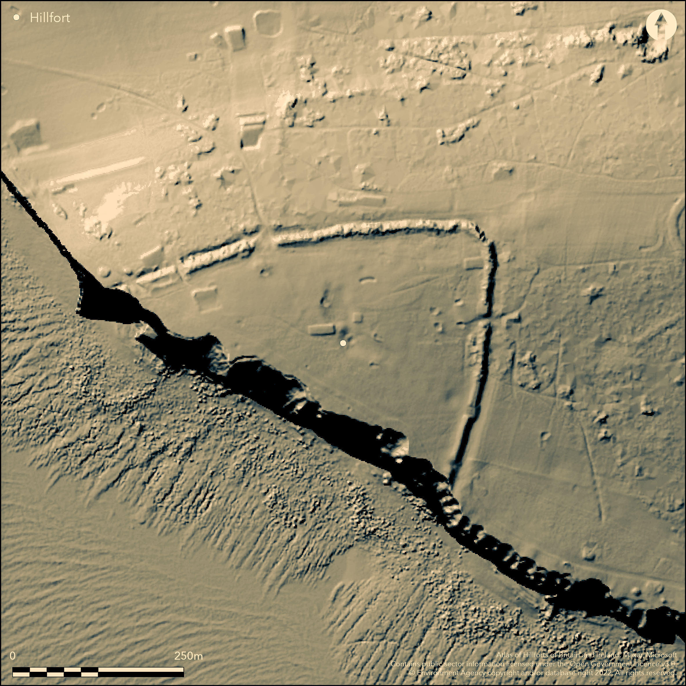
LiDAR 1m DTM Hillshade
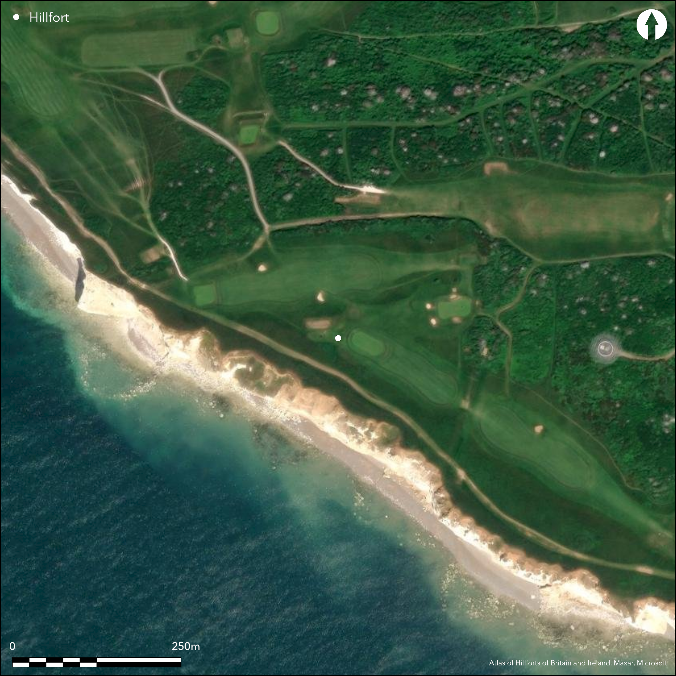
Satellite Imagery
LiDAR 1m DTM Hillshade
Satellite Imagery
Scroll left/right to view further images.
HER: East Sussex MES1699 (626636)
NMR: TV 49 NE (1523052)
SM: 1014523
NGR: TV 4947 9786
X: 549499 Y: 97835 (OSGB36)
Univallate level terrain fort located on high, clay-topped, chalk, SW-facing sea cliff-edge, located to W of, and across Cuckmere Haven and bay from, the Belle Tout enclosure (Atlas No 3750). Precipitous sea cliffs S-SW, moderate to level slopes elsewhere. Extensive coastal erosion has resulted in perhaps half of the original site lost to sea on SW, and now a relatively level D-shaped enclosure of internal area c. 4ha remains, much affected by WWII acitivity and active golf course. Excavation by General Pitt-Rivers (Col. A. Lane Fox) and Park Harrison in 1876 when the site considered as a promontory fort. Map of 1587 marks the site, and, considering the rapid coastal erosion on this coast (see Brown 2009 187, Fig 82), probably originally conventional univallate enclosure somewhat inland. Now survives to NE of the present cliff edge as large bank and outer ditch enclosing this D-shaped area. Partly-infilled ditch best near NW cliff edge, where depression c. 8m wide and c. 1m deep. Inner bank c. 10m wide and to 3.5m high from ditch bottom. Ramparts disturbed by the World War II activities and landscaping associated with the golf course and coastal footpath erosion and construction of bunkers, fairways and greens of golf course also partly disturbed interior of hillfort. Two simple gaps in the ramparts on NW side and one to E interpreted as original entrances, but mutilated and which original uncertain. Excavations 1876 and the later 1983 (Bedwin 1986) excavations of Sussex Archaeological Society showed ditch wide, flat bottom and originally c. 1m deeper than present level. Closely-spaced postholes found running along outer face of the earth-dumped bank suggested a supporting wooden revetment. Early Iron Age (600-400 BC) pottery sherds found at the bottom of ditch and Roman occupation debris found in upper ditch fills, indicated later reuse after fort had fallen into period of disuse. Analysis of layer of buried soil found beneath bank showed hilltop of Burdyck Hill had been under cultivation immediately before fort's construction. RAF 1946 aerial photographs suggested interior hut circles, but now considered by 2005-2011 English Heritage survey as fungus rings. Coastal grassland and managed grassland. On 1st Ed. OS map (1874) as 'Roman Camp'.
Citizen Science: ✗
Reliability of Data: Confirmed
Reliability of Interpretation: Confirmed
X: 13174 Y: 6579088 (EPSG: 3857)
Longitude: 0.1183484698512093 Latitude: 50.760787154762475 (EPSG:4326)
Country: England
Current County or Unitary Authority: East Sussex
Historic County: Sussex
Current Parish/Community/Council/Townland: Seaford
Half of site lost to sea. Mutilated by tees and links of Seaford Head golf course and World War II military camp situated over E parts of fort. WWII activity includes NNE-SSW aligned, rectangular flat-roofed concrete structure, interpreted as a World War II shelter and/or magazine, measuring 7m by 3m. Structure lies within E ditch of hillfort and partly disturbed outer face of rampart.
| Extant | ✓ |
| Cropmark | ✗ |
| Likely Destroyed | ✗ |
Coastal grassland, managed grassland of golf course and scrub.
| Woodland | ✗ |
| Commercial Forestry Plantation | ✗ |
| Parkland | ✗ |
| Pasture (Grazing) | ✗ |
| Arable | ✗ |
| Scrub/Bracken | ✓ |
| Bare Outcrop | ✗ |
| Heather/Moorland | ✗ |
| Heath | ✗ |
| Built-up | ✗ |
| Coastal Grassland | ✓ |
| Other | ✓ |
Univallate level terrain fort located on high, clay-topped, chalk, SW-facing sea cliff-edge, located to W of, and across Cuckmere Haven and bay from, the Belle Tout enclosure (Atlas No 3750). Precipitous sea cliffs S-SW, moderate to level slopes elsewhere. Extensive coastal erosion has resulted in perhaps half of the original site lost to sea on SW,
| Contour Fort | ✗ |
| Partial Contour Fort | ✗ |
| Promontory Fort | ✗ |
| Hillslope Fort | ✗ |
| Level Terrain Fort | ✓ |
| Marsh Fort | ✗ |
| Multiple Enclosure Fort | ✗ |
| Hilltop | ✗ |
| Coastal Promontory | ✗ |
| Inland Promontory | ✗ |
| Valley Bottom | ✗ |
| Knoll/Hillock/Outcrop | ✗ |
| Ridge | ✗ |
| Cliff/Plateau-edge/Scarp | ✓ |
| Hillslope | ✗ |
| Lowland | ✗ |
| Spur | ✗ |
Dominant Topographic Feature: Coastal headland.
| North | ✗ |
| Northeast | ✗ |
| East | ✗ |
| Southeast | ✗ |
| South | ✗ |
| Southwest | ✗ |
| West | ✗ |
| Northwest | ✗ |
| Level | ✓ |
Altitude: 86.0m
N/A
Early Iron Age (600-400 BC) pottery sherds found at the bottom of ditch and Roman occupation debris found in upper ditch fills, indicated later reuse after fort had fallen into period of disuse. Analysis of layer of buried soil found beneath bank showed hilltop of Burdyck Hill had been under cultivation immediately before fort's construction.
Reliability: B - Medium
| Pre 1200BC | ✗ |
| 1200BC - 800BC | ✗ |
| 800BC - 400BC | ✓ |
| 400BC - AD50 | ✓ |
| AD50 - AD400 | ✗ |
| AD400 - AD 800 | ✗ |
| Post AD800 | ✗ |
| Unknown | ✗ |
| Pre Hillfort: | None |
| Post Hillfort: | None |
In Aubrey's Monumenta Britannica (1665-1693). Survey of the Coast of Sussex (1587) by Sir Thomas Palmere and Mr Walter Coverte (ed. M.A. Lower). On 1st Ed. OS map (1874) as 'Roman Camp'. Excavated by General Pitt-Rivers and Park Harrison 1876. Measured survey D. Excavation O. Bedwin Sussex Archaeological Society 1983. Mcomish English Heritage South Downs Project 2005-2011.
| 1st Identified Map Depiction (1587): | Map identification. Survey of the Coast of Sussex (1587) by Sir Thomas Palmere and Mr Walter Coverte. |
| Other (1874): | OS map. |
| Excavation (1876): | General Pitt-Rivers and Park Harrison. |
| Excavation (1983): | O. Bedwin, Sussex Archaeological Society. |
| 1st Identified Written Reference (None): | None |
| Earthwork Survey (None): | Measured survey English Heritage South Downs Project. |
Early Iron Age (600-400 BC) pottery sherds found at the bottom of ditch and Roman occupation debris found in upper ditch fills, indicated later reuse after fort had fallen into period of disuse. Analysis of layer of buried soil found beneath bank showed hilltop of Burdyck Hill had been under cultivation immediately before fort's construction.
Natural spring at bottom of slope to N.
| None | ✓ |
| Spring | ✗ |
| Stream | ✗ |
| Pool | ✗ |
| Flush | ✗ |
| Well | ✗ |
| Other | ✗ |
None
| No Known Features | ✓ |
| Round Stone Structures | ✗ |
| Rectangular Stone Structures | ✗ |
| Curvilinear Platforms | ✗ |
| Other Roundhouse Evidence | ✗ |
| Pits | ✗ |
| Quarry Hollows | ✗ |
| Other | ✗ |
None
| No Known Excavation | ✗ |
| Pits | ✗ |
| Postholes | ✗ |
| Roundhouses | ✗ |
| Rectangular Structures | ✗ |
| Roads/Tracks | ✗ |
| Quarry Hollows | ✗ |
| Other | ✗ |
| Nothing Found | ✓ |
None
| No Known Geophysics | ✓ |
| Pits | ✗ |
| Roundhouses | ✗ |
| Rectangular Structures | ✗ |
| Roads/Tracks | ✗ |
| Quarry Hollows | ✗ |
| Other | ✗ |
| Nothing Found | ✗ |
Early Iron Age (600-400 BC) pottery sherds found at the bottom of ditch and Roman occupation debris found in upper ditch fills, indicated later reuse after fort had fallen into period of disuse. Analysis of layer of buried soil found beneath bank showed hilltop of Burdyck Hill had been under cultivation immediately before fort's construction.
| No Known Finds | ✗ |
| Pottery | ✓ |
| Metal | ✗ |
| Metalworking | ✗ |
| Human Bones | ✗ |
| Animal Bones | ✗ |
| Lithics | ✗ |
| Environmental | ✓ |
| Other | ✓ |
RAF 1946 aerial photographs suggested interior hut circles, but now considered by 2005-2011 English Heritage survey as fungus rings.
| APs Not Checked | ✗ |
| None | ✗ |
| Roundhouses | ✓ |
| Rectangular Structures | ✗ |
| Pits | ✗ |
| Postholes | ✗ |
| Roads/Tracks | ✗ |
| Other | ✗ |
Two simple gaps in the ramparts on NW side and one to E interpreted as original entrances, but mutilated and uncertain which original.
| 3: | None |
| 2: | Which gap original uncertain. |
Guard Chambers: ✗
Chevaux de Frise: ✗
| 1. Simple Gap (North west): | Uncertain. |
| 2. Simple Gap (North west): | Uncertain. |
| 3. Simple Gap (East): | Uncertain. |
Now survives to NE of the present cliff edge as large bank and outer ditch enclosing this D-shaped area. Partly-infilled ditch best near NW cliff edge, where depression c. 8m wide and c. 1m deep. Inner bank c. 10m wide and to 3.5m high from ditch bottom.
| Area 1: | 4.0ha. |
| Total: | 4.0ha. |
Total Footprint Area: Noneha.
None
| ✗ | None |
| ✗ | None |
| NE Quadrant: | 1 |
| SE Quadrant: | 1 |
| SW Quadrant: | 0 |
| NW Quadrant: | 1 |
| Total: | 1 |
| Partial Univallate | ✓ |
| Univallate | ✗ |
| Partial Bivallate | ✗ |
| Bivallate | ✗ |
| Partial Multivallate | ✗ |
| Multivallate | ✗ |
| Unknown | ✗ |
| Partial Univallate | ✗ |
| Univallate | ✗ |
| Partial Bivallate | ✗ |
| Bivallate | ✗ |
| Partial Multivallate | ✗ |
| Multivallate | ✗ |
None
| None | ✗ |
| Earthen Bank | ✓ |
| Stone Wall | ✗ |
| Rubble | ✗ |
| Wall-walk | ✗ |
| Evidence of Timber | ✗ |
| Vitrification | ✗ |
| Other Burning | ✗ |
| Palisade | ✗ |
| Counter Scarp Bank | ✗ |
| Berm | ✗ |
| Unfinished | ✗ |
| Other | ✗ |
Excavations 1876 and the later 1983 excavations of Sussex Archaeological Society showed spaced postholes found running along outer face of the earth-dumped bank suggested a supporting wooden revetment.
| None | ✗ |
| Earthen Bank | ✓ |
| Stone Wall | ✗ |
| Murus Duplex | ✗ |
| Timber-framed | ✓ |
| Timber-laced | ✗ |
| Vitrification | ✗ |
| Other Burning | ✗ |
| Palisade | ✗ |
| Counter Scarp Bank | ✗ |
| Berm | ✗ |
| Unfinished | ✗ |
| No Known Excavation | ✗ |
| Other | ✗ |
| ✗ | None |
| ✓ | Excavations 1876 and the later 1983 excavations of Sussex Archaeological Society showed ditch wide, flat bottom and originally c. 1m deeper than present level. |
Number of Ditches: 1
| ✗ | None |
Bedwin, O. 1986. Excavations at Seaford Head Camp, East Sussex, 1983, Sussex Archaeol Collect. 124, 25-33.
Brown, I. 2009. Beacons in the landscape. The hillforts of England and Wales.. Windgather Press.
Carpenter, E. 2008. The South Downs NMP Pilot Area 1; Worthing to The Weald: National Mapping Programme, Centre for Archaeology Report No 11-2008.
Fox, Col. A. Lane 1877. Excavations in the camp and tumulus of Seaford, Sussex, J Anthrop Inst, 6, 287-99.
Hamilton, S. and Manley, J.1997. Points of view. Prominent enclosures in 1st millennium Sussex, Sussex Archaeol Coll, 135, 93-112.
Hamilton, S. and Manley, J. 2001. Hillforts, monumentality and place: a chronological and topographic review of first millennium BC hillforts of southeast England, European J Archaeol, 4.1, 7-42.
Price, J.E. 1882. On Excavations In the camp, the tumulus, and Romano-British cemetery, Seaford, Sussex, Sussex Archaeol Collect. 32, 167-178.
Atlas of Hillforts:
Wikidata:
This work is licensed under CC BY-SA 4.0

 and should be cited as:
Lock, Gary and Ralston, Ian. 2024. Atlas of Hillforts of Britain and Ireland. Available at: https://hillforts.arch.ox.ac.uk
Document Version 1.1