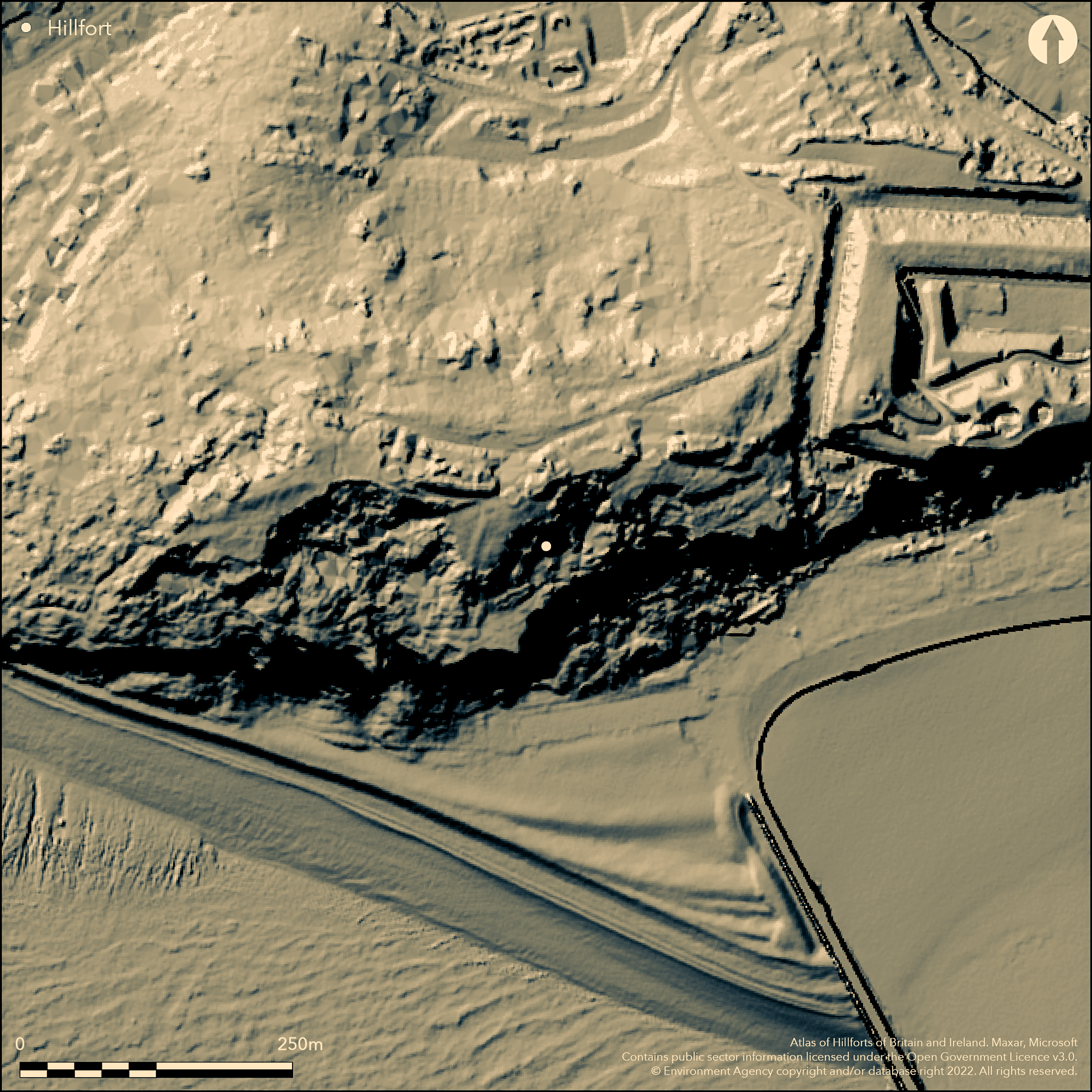
LiDAR 1m DTM Hillshade
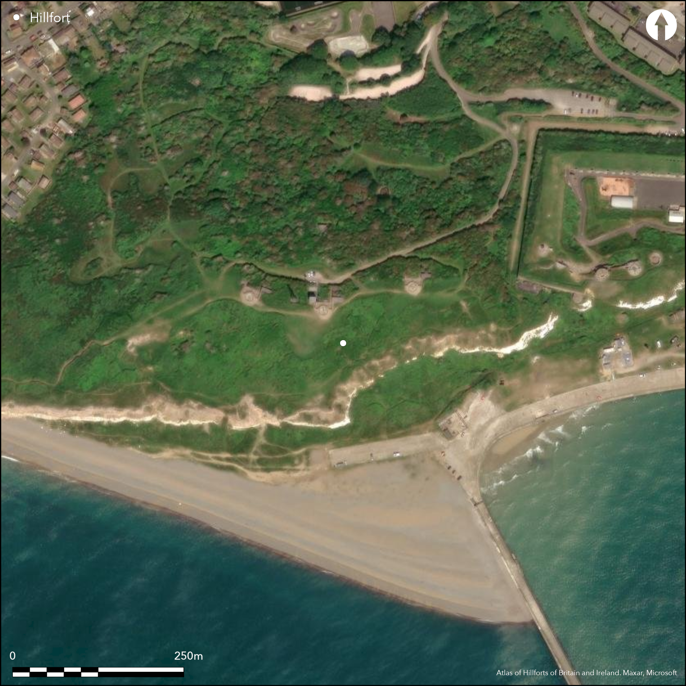
Satellite Imagery
LiDAR 1m DTM Hillshade
Satellite Imagery
Scroll left/right to view further images.
HER: East Sussex MES1794 (None)
NMR: TQ 40 SW 33 (406342)
SM: None
NGR: TQ446000
X: 544649 Y: 100056 (OSGB36)
Thought destroyed, possible contour hillfort located on Castle Hill or Burrow Cliff or Burrow Head facing the sea to S. In an area of severe slumping, further mutilated by old military works. However, landscape assessment by Archaeology South East has revealed earthworks spanning later prehistoric to modern periods (Johnson 2000). Mentioned as 'Miching Camp' in 17th century and later in 18th and 19th centuries when N side seems to have extended for c. 365m - 457m from hill summit down to site of modern fort. Finds, including those from an excavation 1935-8 (Field 1939) include a sherd of Neolithic ware, Bronze Age hoard of woodworking tools and some Bronze Age sherds, together with very numerous Iron Age sherds including Belgic, and numerous Romano-British sherds and Roman coins. Small Iron Age bowl in Lewes Museum. Grassy scrub and bare rock.
Citizen Science: ✗
Reliability of Data: Confirmed
Reliability of Interpretation: Confirmed
X: 5622 Y: 6582818 (EPSG: 3857)
Longitude: 0.05050124160593616 Latitude: 50.78197572076056 (EPSG:4326)
Country: England
Current County or Unitary Authority: East Sussex
Historic County: Sussex
Current Parish/Community/Council/Townland: Newhaven
Thought destroyed.
| Extant | ✓ |
| Cropmark | ✗ |
| Likely Destroyed | ✓ |
Grassy scrub and bare rock.
| Woodland | ✗ |
| Commercial Forestry Plantation | ✗ |
| Parkland | ✗ |
| Pasture (Grazing) | ✗ |
| Arable | ✗ |
| Scrub/Bracken | ✓ |
| Bare Outcrop | ✗ |
| Heather/Moorland | ✗ |
| Heath | ✗ |
| Built-up | ✗ |
| Coastal Grassland | ✗ |
| Other | ✗ |
Thought destroyed, possible contour hillfort located on Castle Hill or Burrow Cliff or Burrow Head facing the sea to S. In
| Contour Fort | ✓ |
| Partial Contour Fort | ✗ |
| Promontory Fort | ✗ |
| Hillslope Fort | ✗ |
| Level Terrain Fort | ✗ |
| Marsh Fort | ✗ |
| Multiple Enclosure Fort | ✗ |
| Hilltop | ✓ |
| Coastal Promontory | ✗ |
| Inland Promontory | ✗ |
| Valley Bottom | ✗ |
| Knoll/Hillock/Outcrop | ✗ |
| Ridge | ✗ |
| Cliff/Plateau-edge/Scarp | ✗ |
| Hillslope | ✗ |
| Lowland | ✗ |
| Spur | ✗ |
Dominant Topographic Feature: Hill top
| North | ✗ |
| Northeast | ✗ |
| East | ✗ |
| Southeast | ✗ |
| South | ✗ |
| Southwest | ✗ |
| West | ✗ |
| Northwest | ✗ |
| Level | ✓ |
Altitude: 50.0m
N/A
Iron Age pottery including Belgic from excavation plus Neolithic, lower Bronze Age and Roman material.
Reliability: B - Medium
| Pre 1200BC | ✗ |
| 1200BC - 800BC | ✗ |
| 800BC - 400BC | ✓ |
| 400BC - AD50 | ✓ |
| AD50 - AD400 | ✗ |
| AD400 - AD 800 | ✗ |
| Post AD800 | ✗ |
| Unknown | ✗ |
| Pre Hillfort: | None |
| Post Hillfort: | None |
| Artefactual: | Pottery evidence. |
Mentioned as 'Miching Camp' in 17th century and later in 18th and 19th centuries. In Stukeley's Itinerarium Curiosum 1724. On Yeakell and Gardner's Map of Sussex 1783 and Greenwood's map of 1825. Excavation L.F. Field 1935-38. Landscape assessment Archaeology South-East 2000. Measured Survey English Heritage: South Downs Project 2005-2011.
| Other (1724): | Mention in Stukeley's Itinerarium Curiosum. |
| 1st Identified Map Depiction (1783): | On Yeakell and Gardner's Map of Sussex. |
| Other (1825): | On Greenwood's map. |
| Other (2000): | Landscape assessment Archaeology South-East. |
| 1st Identified Written Reference (None): | No details. |
| Excavation (None): | L.F. Field. |
| Earthwork Survey (None): | Measured Survey English Heritage: South Downs Project. |
Finds, including those from an excavation 1935-8 include a sherd Neolithic ware, Bronze Age hoard of woodworking tools and some Bronze Age sherds, together with very numerous Iron Age sherds including Belgic, and numerous Romano-Brithish sherds and Roman coins. Small Iron Age bowl in Lewes Museum.
None
| None | ✓ |
| Spring | ✗ |
| Stream | ✗ |
| Pool | ✗ |
| Flush | ✗ |
| Well | ✗ |
| Other | ✗ |
None
| No Known Features | ✓ |
| Round Stone Structures | ✗ |
| Rectangular Stone Structures | ✗ |
| Curvilinear Platforms | ✗ |
| Other Roundhouse Evidence | ✗ |
| Pits | ✗ |
| Quarry Hollows | ✗ |
| Other | ✗ |
None
| No Known Excavation | ✗ |
| Pits | ✗ |
| Postholes | ✗ |
| Roundhouses | ✗ |
| Rectangular Structures | ✗ |
| Roads/Tracks | ✗ |
| Quarry Hollows | ✗ |
| Other | ✗ |
| Nothing Found | ✓ |
None
| No Known Geophysics | ✓ |
| Pits | ✗ |
| Roundhouses | ✗ |
| Rectangular Structures | ✗ |
| Roads/Tracks | ✗ |
| Quarry Hollows | ✗ |
| Other | ✗ |
| Nothing Found | ✗ |
Finds, including those from an excavation 1935-8 include a sherd Neolithic ware, Bronze Age hoard of woodworking tools and some Bronze Age sherds, together with very numerous Iron Age sherds including Belgic, and numerous Romano-Brithish sherds and Roman coins. Small Iron Age bowl in Lewes Museum.
| No Known Finds | ✗ |
| Pottery | ✓ |
| Metal | ✓ |
| Metalworking | ✗ |
| Human Bones | ✗ |
| Animal Bones | ✗ |
| Lithics | ✗ |
| Environmental | ✗ |
| Other | ✓ |
None
| APs Not Checked | ✓ |
| None | ✗ |
| Roundhouses | ✗ |
| Rectangular Structures | ✗ |
| Pits | ✗ |
| Postholes | ✗ |
| Roads/Tracks | ✗ |
| Other | ✗ |
Not defined.
| 0: | None |
| 2: | None |
Guard Chambers: ✗
Chevaux de Frise: ✗
In an area of severe slumping, further mutilated by old military works. However, landscape assessment by Archaeology South East has revealed earthworks spanning later prehistoric to modern periods.
| Area 1: | Noneha. |
| Total: | Noneha. |
Total Footprint Area: Noneha.
None
| ✗ | Area not defined. |
| ✗ | Site thought destroyed. |
| NE Quadrant: | None |
| SE Quadrant: | None |
| SW Quadrant: | None |
| NW Quadrant: | None |
| Total: | None |
| Partial Univallate | ✗ |
| Univallate | ✗ |
| Partial Bivallate | ✗ |
| Bivallate | ✗ |
| Partial Multivallate | ✗ |
| Multivallate | ✗ |
| Unknown | ✓ |
| Partial Univallate | ✗ |
| Univallate | ✗ |
| Partial Bivallate | ✗ |
| Bivallate | ✗ |
| Partial Multivallate | ✗ |
| Multivallate | ✗ |
Site thought destroyed.
| None | ✗ |
| Earthen Bank | ✓ |
| Stone Wall | ✗ |
| Rubble | ✗ |
| Wall-walk | ✗ |
| Evidence of Timber | ✗ |
| Vitrification | ✗ |
| Other Burning | ✗ |
| Palisade | ✗ |
| Counter Scarp Bank | ✗ |
| Berm | ✗ |
| Unfinished | ✗ |
| Other | ✗ |
None
| None | ✓ |
| Earthen Bank | ✗ |
| Stone Wall | ✗ |
| Murus Duplex | ✗ |
| Timber-framed | ✗ |
| Timber-laced | ✗ |
| Vitrification | ✗ |
| Other Burning | ✗ |
| Palisade | ✗ |
| Counter Scarp Bank | ✗ |
| Berm | ✗ |
| Unfinished | ✗ |
| No Known Excavation | ✗ |
| Other | ✗ |
| ✗ | None |
| ✗ | None |
Number of Ditches: 0
| ✗ | None |
Carpenter, E. 2008. The South Downs NMP Pilot Area 1; Worthing to The Weald: National Mapping Programme, Centre for Archaeology Report No 11-2008.
Carpenter, E. 2010. English Heritage: South Downs Project Beachy head - Peacehaven NMP.
Field, L.F. 1939, Castle Hill, Newhaven, Sussex Archaeol Collect. 80, 263-292.
Hamilton, S. and Manley, J.1997. Points of view. Prominent enclosures in 1st millennium Sussex, Sussex Archaeol Coll, 135, 93-112.
Hamilton, S. and Manley, J. 2001. Hillforts, monumentality and place: a chronological and topographic review of first millennium BC hillforts of southeast England, European J Archaeol, 4.1, 7-42.
Johnson, C. 2000. Archaeological and historic landscape survey: Castle Hill, Newhaven, East Sussex, Archaeology South-East Report No 1247.
Lane-Fox, Col. A. H. 1869. An examination into the character and probable origin of the hill forts of Sussex. Arch, 42, 34-5.
Atlas of Hillforts:
Wikidata:
This work is licensed under CC BY-SA 4.0

 and should be cited as:
Lock, Gary and Ralston, Ian. 2024. Atlas of Hillforts of Britain and Ireland. Available at: https://hillforts.arch.ox.ac.uk
Document Version 1.1