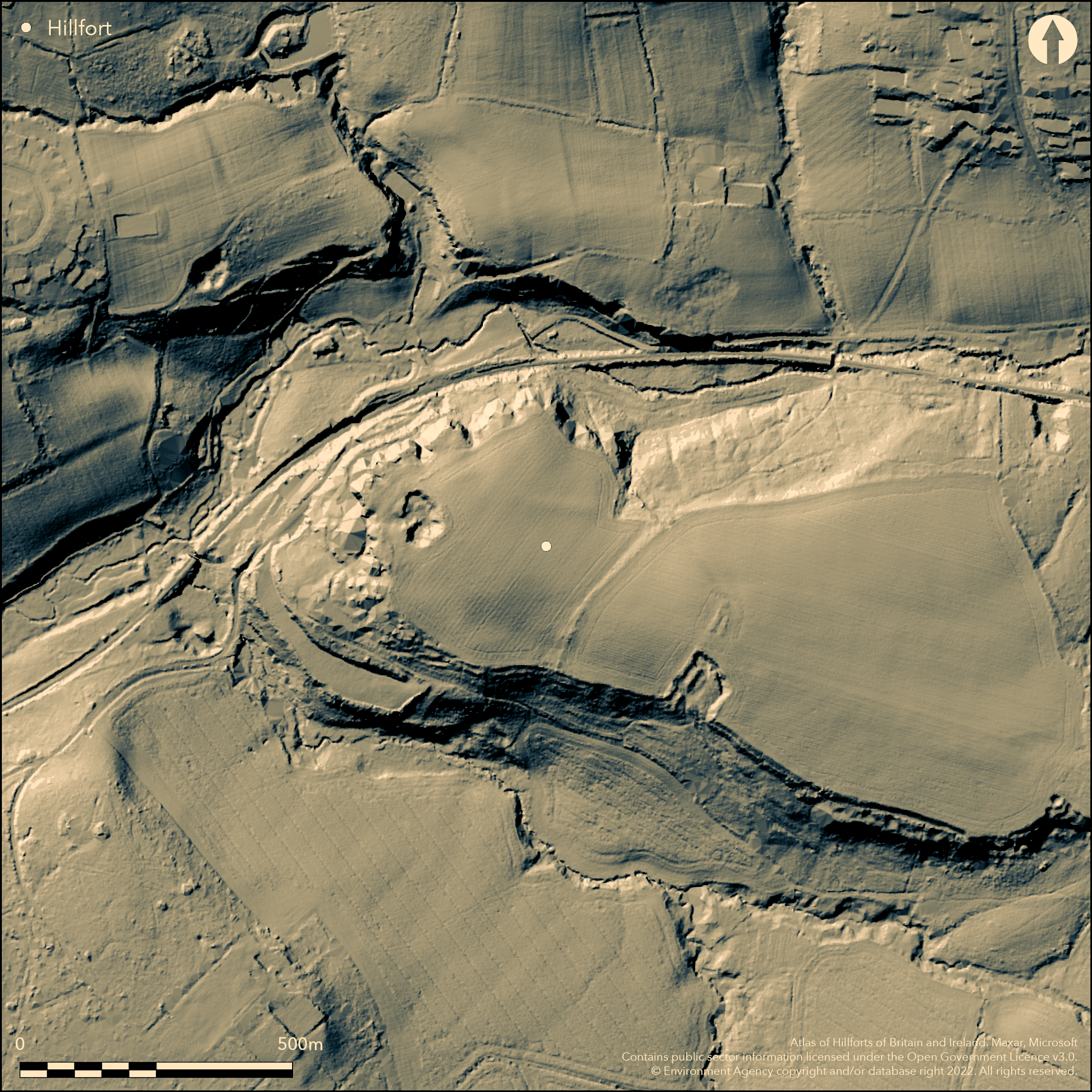
LiDAR 1m DTM Hillshade
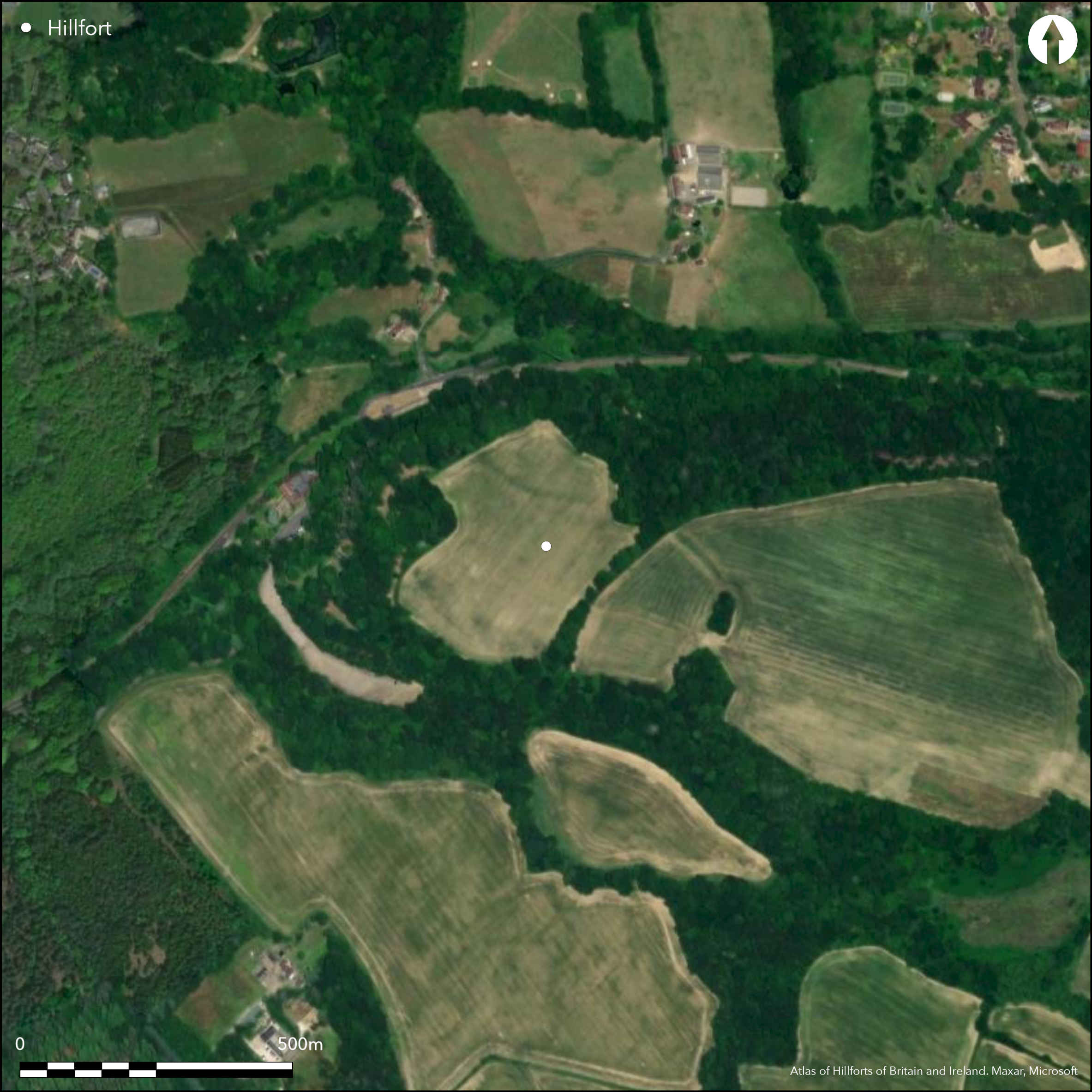
Satellite Imagery
LiDAR 1m DTM Hillshade
Satellite Imagery
Scroll left/right to view further images.
HER: Kent MKE120 (MES3276); East Sussex None
NMR: TQ 53 NE 8 (409149)
SM: 1003816
NGR: TQ 5612 3825
X: 556129 Y: 138250 (OSGB36)
A bivallate hillfort at High Rocks, Tunbridge Wells straddling the East Sussex and Kent border. Located on the summit of a rocky promontory at 95m OD overlooking the valley of the River Grom in the NW, the river forming part of the county boundary. It measures approximately 470m NW-SE by 350m transversely, enclosing 8ha with a double bank and ditch in the NE, SE and SW, which carries around to the steep natural slope of the High Rocks escarpment in the N and NW. The earthworks were first discovered by J.H. Money in 1939 who undertook a brief excavation in 1940 and more detailed investigations between 1958-60. He showed that the site underwent two construction phases. In Phase I a single bank revetted with stone on the outer face, and an outer ditch were constructed, with a simple entrance in the E on the easiest line of approach, with some evidence for a gate and palisade. In the second phase an inner bank, similarly stone revetted, was created. It also had an entrance in the E strengthened with a guard house or turret, an outer wall and a paved approach. Pottery provided a possible date of 150-100 BC for the first phase and around AD 25-40 for the second phase. The excavations also produced some flint implements and debitage from earlier occupation in the Mesolithic and Neolithic periods focused on the nearby rock shelters. Some evidence for late Roman occupation in the E of the camp in the form of a Samian bowl of Claudio-Neronian date and fragments of pottery was also recorded. It was concluded that the site was probably not continuously occupied during the phase I period. Within the interior a magnetometer survey carried out during the later excavations recorded two hearths. The site is recorded as a 'fort' on 1961-2 1:10,560 OS mapping. Scheduled.
Citizen Science: ✗
Reliability of Data: Confirmed
Reliability of Interpretation: Confirmed
X: 25558 Y: 6642938 (EPSG: 3857)
Longitude: 0.22959076813837453 Latitude: 51.12220163803218 (EPSG:4326)
Country: England; None
Current County or Unitary Authority: Kent; East Sussex
Historic County: Kent; Sussex
Current Parish/Community/Council/Townland: Tunbridge Wells; Frant
On Heritage at Risk Register (2015).
| Extant | ✓ |
| Cropmark | ✗ |
| Likely Destroyed | ✗ |
None
| Woodland | ✓ |
| Commercial Forestry Plantation | ✗ |
| Parkland | ✗ |
| Pasture (Grazing) | ✗ |
| Arable | ✓ |
| Scrub/Bracken | ✗ |
| Bare Outcrop | ✗ |
| Heather/Moorland | ✗ |
| Heath | ✗ |
| Built-up | ✗ |
| Coastal Grassland | ✗ |
| Other | ✗ |
A contour fort located on the summit of a rocky promontory at 95m OD overlooking the valley of the River Grom in the NW
| Contour Fort | ✓ |
| Partial Contour Fort | ✗ |
| Promontory Fort | ✗ |
| Hillslope Fort | ✗ |
| Level Terrain Fort | ✗ |
| Marsh Fort | ✗ |
| Multiple Enclosure Fort | ✗ |
| Hilltop | ✗ |
| Coastal Promontory | ✗ |
| Inland Promontory | ✓ |
| Valley Bottom | ✗ |
| Knoll/Hillock/Outcrop | ✗ |
| Ridge | ✗ |
| Cliff/Plateau-edge/Scarp | ✗ |
| Hillslope | ✗ |
| Lowland | ✗ |
| Spur | ✗ |
Dominant Topographic Feature: Rocky promontory
| North | ✓ |
| Northeast | ✓ |
| East | ✗ |
| Southeast | ✗ |
| South | ✗ |
| Southwest | ✗ |
| West | ✗ |
| Northwest | ✓ |
| Level | ✗ |
Altitude: 95.0m
The county boundary between E Sussex and Kent runs NW-SE through the hillfort
Boundary Type: County
Pottery provided a possible date of 150-100 BC for the first phase and around AD 25-40 for the second phase.
Reliability: B - Medium
| Pre 1200BC | ✗ |
| 1200BC - 800BC | ✗ |
| 800BC - 400BC | ✗ |
| 400BC - AD50 | ✓ |
| AD50 - AD400 | ✓ |
| AD400 - AD 800 | ✗ |
| Post AD800 | ✗ |
| Unknown | ✗ |
| Pre Hillfort: | None |
| Post Hillfort: | None |
| Artefactual: | None |
Discovered in 1939 by J.H. Money and excavated in 1940 and 1958-60. Recorded on 1961-2 1:10,560 OS mapping. Field investigations in 1965 and 1970. Proton magnetometer survey of part of the interior during 1958-60 excavations. Scheduled
| Excavation (1940): | None |
| 1st Identified Written Reference (1942): | None |
| Geophysical Survey (None): | None |
| Excavation (None): | None |
| 1st Identified Map Depiction (None): | None |
Two hearths recorded by a magnetometer survey, lithics and pottery.
River Grom to the NW, other streams and springs in the vicinity
| None | ✓ |
| Spring | ✗ |
| Stream | ✗ |
| Pool | ✗ |
| Flush | ✗ |
| Well | ✗ |
| Other | ✗ |
None
| No Known Features | ✓ |
| Round Stone Structures | ✗ |
| Rectangular Stone Structures | ✗ |
| Curvilinear Platforms | ✗ |
| Other Roundhouse Evidence | ✗ |
| Pits | ✗ |
| Quarry Hollows | ✗ |
| Other | ✗ |
None
| No Known Excavation | ✗ |
| Pits | ✗ |
| Postholes | ✗ |
| Roundhouses | ✗ |
| Rectangular Structures | ✗ |
| Roads/Tracks | ✗ |
| Quarry Hollows | ✗ |
| Other | ✗ |
| Nothing Found | ✓ |
Hearths
| No Known Geophysics | ✗ |
| Pits | ✗ |
| Roundhouses | ✗ |
| Rectangular Structures | ✗ |
| Roads/Tracks | ✗ |
| Quarry Hollows | ✗ |
| Other | ✓ |
| Nothing Found | ✗ |
An assemblage of Mesolithic and Neolithic objects found in association with the rock shelters which also occupy the site. Finds included micro-cores, micro-blades, microliths, blade cores, blades and blade tools and waste material, sandstone hearths, charcoal, Neolithic pottery sherds and arrowheads. IronAge, Roman and Romano-British pottery also recovered.
| No Known Finds | ✗ |
| Pottery | ✓ |
| Metal | ✗ |
| Metalworking | ✗ |
| Human Bones | ✗ |
| Animal Bones | ✗ |
| Lithics | ✓ |
| Environmental | ✗ |
| Other | ✗ |
None
| APs Not Checked | ✓ |
| None | ✗ |
| Roundhouses | ✗ |
| Rectangular Structures | ✗ |
| Pits | ✗ |
| Postholes | ✗ |
| Roads/Tracks | ✗ |
| Other | ✗ |
In Phase I a simple entrance in the E on the easiest line of approach, with some evidence for a gate and palisade. In the second phase an entrance on E strengthened with a guard house or turret, an outer wall and a paved approach.
| 2: | None |
| 2: | None |
Guard Chambers: ✓
Chevaux de Frise: ✗
| 1. Simple Gap (East): | Evidence for a gate and palisade. |
| 2. Recesses/Guard Chambers (East): | In the second phase an entrance on E strengthened with a guard house or turret, an outer wall and a paved approach. |
Measuring approximately 470m NW-SE by 350m transversely, enclosing 8ha with a double bank and ditch in the NE, SE and SW which carries around to the steep natural slope of the High Rocks escarpment in the N and NW. Two construction phases. In Phase I a single bank revetted with stone on the outer face, and an outer ditch were constructed. In the second phase an inner bank, similarly stone revetted.
| Area 1: | 8.0ha. |
| Total: | 8.0ha. |
Total Footprint Area: Noneha.
None
| ✓ | Two phases of construction. |
| ✗ | None |
| NE Quadrant: | 2 |
| SE Quadrant: | 2 |
| SW Quadrant: | 2 |
| NW Quadrant: | 0 |
| Total: | 2 |
| Partial Univallate | ✗ |
| Univallate | ✗ |
| Partial Bivallate | ✓ |
| Bivallate | ✗ |
| Partial Multivallate | ✗ |
| Multivallate | ✗ |
| Unknown | ✗ |
| Partial Univallate | ✗ |
| Univallate | ✓ |
| Partial Bivallate | ✗ |
| Bivallate | ✗ |
| Partial Multivallate | ✗ |
| Multivallate | ✗ |
None
| None | ✗ |
| Earthen Bank | ✓ |
| Stone Wall | ✗ |
| Rubble | ✗ |
| Wall-walk | ✗ |
| Evidence of Timber | ✗ |
| Vitrification | ✗ |
| Other Burning | ✗ |
| Palisade | ✗ |
| Counter Scarp Bank | ✗ |
| Berm | ✗ |
| Unfinished | ✗ |
| Other | ✗ |
None
| None | ✗ |
| Earthen Bank | ✓ |
| Stone Wall | ✓ |
| Murus Duplex | ✗ |
| Timber-framed | ✗ |
| Timber-laced | ✗ |
| Vitrification | ✗ |
| Other Burning | ✗ |
| Palisade | ✓ |
| Counter Scarp Bank | ✗ |
| Berm | ✗ |
| Unfinished | ✗ |
| No Known Excavation | ✗ |
| Other | ✗ |
| ✗ | None |
| ✓ | None |
Number of Ditches: 1
| ✗ | None |
Money, J.H. 1941. An Interim Report on Excavations at High Rocks, Tunbridge Wells, 1940. Sussex Archaeol Collect 82,104-9
Money, J.H. 1960. Excavations at High Rocks, Tunbridge Wells, 1954-1956. Sussex Archaeol Collect 98, 173-197
Money, J. H. 1968. Excavations in the Iron Age hillfort at High Rocks, near Tunbridge Wells, 1957-61. Sussex Archaeol Collect 106,158-205
Atlas of Hillforts:
Wikidata:
This work is licensed under CC BY-SA 4.0

 and should be cited as:
Lock, Gary and Ralston, Ian. 2024. Atlas of Hillforts of Britain and Ireland. Available at: https://hillforts.arch.ox.ac.uk
Document Version 1.1