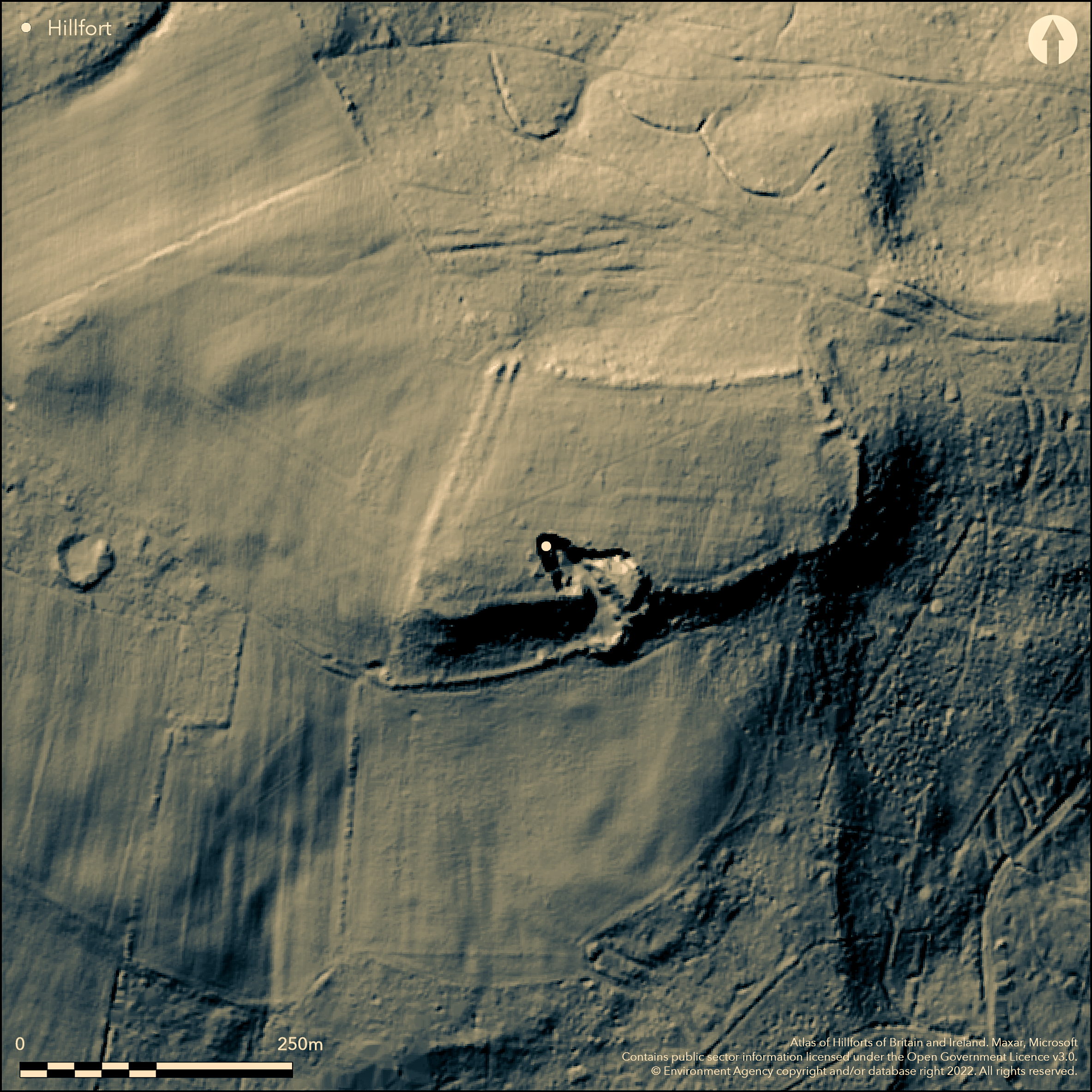
LiDAR 1m DTM Hillshade
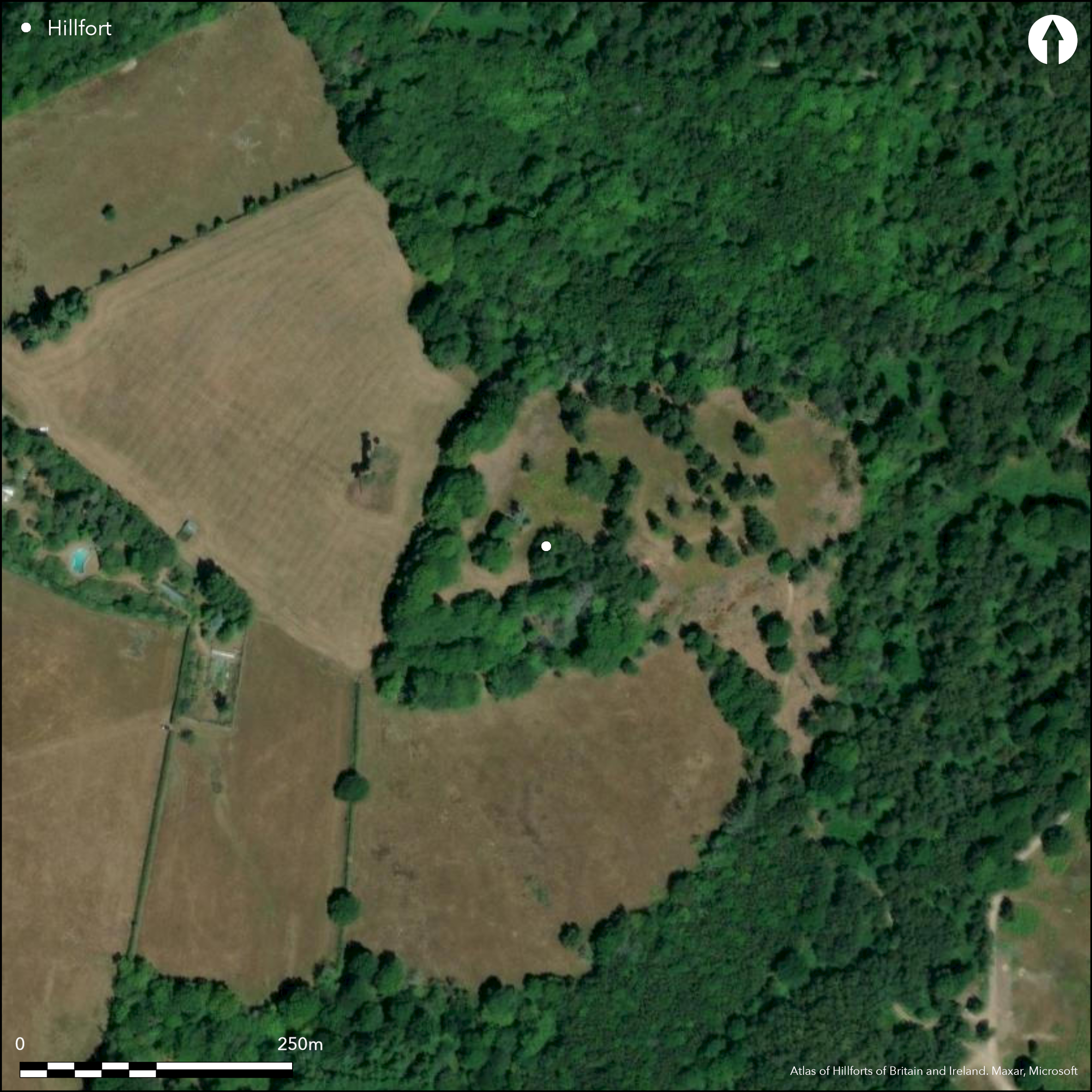
Satellite Imagery
LiDAR 1m DTM Hillshade
Satellite Imagery
Scroll left/right to view further images.
HER: East Sussex ME4555 (None)
NMR: TQ 43 SE (407127)
SM: 1014524
NGR: TQ 4446 3196
X: 544412 Y: 131921 (OSGB36)
Slight, univallate, contour hillfort located within the Ashdown Forest on a spur of Ashdown Sand of High Weald of East Sussex, which caps steep natural escarpment to N, E and S with extensive views towards the North and South Downs. Roughly rectangular shape enclosing relatively level interior of c. 3ha. Defined by slight rampart, c. 2.5m wide and to 0.75m high, constructed on top of N, E and S slopes of the natural spur. Best on E. Part excavation 1969-82 (Money 1977; Money and Streeton 1979; Tebbutt 1970) showed inner face of bank originally revetted by drystone wall and vertically set timbers, and enhanced by larger drystone wall set against outer face. Generally ruined but some stonework still visible. Also showed Infilled outer ditch near bottom of steep slopes of the spur, originally flat-bottomed to 3.5m wide on E. Ditch fronted here by shallow, now infilled, gully c.0.6 m wide. On W side, where approach level, rampart is low bank fronted by a, now infilled, ditch, visible during dry summers as darker area of vegetation. Inturned entrance towards N end of E ramparts, measuring c. 5m wide. Part excavation revealed two sets of stone-packed gateposts within entrance passage, suggesting double gateway or gate tower, and metalled roadway leading into interior. Towards NW corner two parallel banks indicate possible further entrance passage with access from N. Excavations by J.R. Money 1957-61 found five periods, from pre-hillfort activity Period I to Roman iron works Period 5; Period 2 being hillfort phase, when two adjacent timber-built roundhouses from SE corner, each c. 11m diameter with central posts. S most with two porches E and W. Associated forging hearth and baking oven dated to mid 1st century BC. Evidence provided by dating of pottery sherds buried beneath ramparts suggests that hillfort defences built around this time. Ditch fills indicate that ramparts collapsed, or deliberately slighted, soon after construction. Buried foundations and lower walls of small domestic range of later Roman villa sited immediately to NE of roundhouses. Earliest phase of villa dates to late 1st-early 2nd century AD., with later associated buildings and bath suite. In late 2nd and 3rd centuries AD, villa buildings levelled and site cleared in advance of reuse as small iron works. Iron slag and Roman local and imported pottery, including amphora, found. Possible animal pound. Post-medieval cart track disturbed NE corner. On S side c. 40m length of defences and part of interior destroyed by deep, disused post-medieval stone quarry. On 1:25,000 OS map (1948) as short length of earthwork.
Citizen Science: ✗
Reliability of Data: Confirmed
Reliability of Interpretation: Confirmed
X: 6652 Y: 6633401 (EPSG: 3857)
Longitude: 0.05975330602575099 Latitude: 51.06839778884776 (EPSG:4326)
Country: England
Current County or Unitary Authority: East Sussex
Historic County: Sussex
Current Parish/Community/Council/Townland: Hartfield
Post-medieval cart track disturbed NE corner. On S side c. 40m length of defences and part of interior of destroyed by deep, disused post-medieval stone quarry.
| Extant | ✓ |
| Cropmark | ✗ |
| Likely Destroyed | ✗ |
Rough grass and woodland. Quarry.
| Woodland | ✓ |
| Commercial Forestry Plantation | ✗ |
| Parkland | ✗ |
| Pasture (Grazing) | ✓ |
| Arable | ✗ |
| Scrub/Bracken | ✗ |
| Bare Outcrop | ✗ |
| Heather/Moorland | ✗ |
| Heath | ✗ |
| Built-up | ✗ |
| Coastal Grassland | ✗ |
| Other | ✓ |
Slight, univallate, contour hillfort located within the Ashdown Forest on a spur of Ashdown Sand of High Weald of East Sussex, which caps steep natural escarpment to N, E and S with extensive views towards the North and South Downs.
| Contour Fort | ✓ |
| Partial Contour Fort | ✗ |
| Promontory Fort | ✗ |
| Hillslope Fort | ✗ |
| Level Terrain Fort | ✗ |
| Marsh Fort | ✗ |
| Multiple Enclosure Fort | ✗ |
| Hilltop | ✗ |
| Coastal Promontory | ✗ |
| Inland Promontory | ✗ |
| Valley Bottom | ✗ |
| Knoll/Hillock/Outcrop | ✗ |
| Ridge | ✗ |
| Cliff/Plateau-edge/Scarp | ✗ |
| Hillslope | ✗ |
| Lowland | ✗ |
| Spur | ✓ |
Dominant Topographic Feature: Spur
| North | ✗ |
| Northeast | ✗ |
| East | ✗ |
| Southeast | ✗ |
| South | ✗ |
| Southwest | ✗ |
| West | ✗ |
| Northwest | ✗ |
| Level | ✓ |
Altitude: 160.0m
N/A
Forging hearth and baking oven, both constructed within clay make-up of rampart, dated by archaeomagnetic techniques to mid 1st century BC. Evidence provided by dating of pottery sherds buried beneath ramparts suggests that hillfort defences built around this time. Ditch fills indicate that ramparts collapsed, or deliberately slighted, soon after construction.
Reliability: B - Medium
| Pre 1200BC | ✗ |
| 1200BC - 800BC | ✗ |
| 800BC - 400BC | ✗ |
| 400BC - AD50 | ✓ |
| AD50 - AD400 | ✗ |
| AD400 - AD 800 | ✗ |
| Post AD800 | ✗ |
| Unknown | ✗ |
| Pre Hillfort: | None |
| Post Hillfort: | None |
| Artefactual: | Dating of pottery sherds buried beneath ramparts. |
| Other: | Forging hearth and baking oven, both constructed within clay make-up of rampart, dated by archaeomagnetic techniques to mid 1st century BC. |
Excavations by J.R. Money 1957-61, 1969. Excavation C.F. Tebbutt 1968. On 1:25,000 OS map (1948) as short length of earthwork.
| 1st Identified Map Depiction (1948): | None |
| Excavation (1968): | C.F. Tebbutt. |
| Excavation (None): | J.H. Money. |
Two adjacent timber-built roundhouses from SE corner, each c. 11m diameter with central posts. S most with two porches E and W. Associated forging hearth and baking oven dated to mid first century BC. Roman villa and associated buildings, and later Roman iron working site with buildings, hearths and pits. Iron Age sherds. Glass and lead piping from Roman villa. Evidence of Roman iron working, with slag and Roman and imported pottery.
None
| None | ✓ |
| Spring | ✗ |
| Stream | ✗ |
| Pool | ✗ |
| Flush | ✗ |
| Well | ✗ |
| Other | ✗ |
None
| No Known Features | ✓ |
| Round Stone Structures | ✗ |
| Rectangular Stone Structures | ✗ |
| Curvilinear Platforms | ✗ |
| Other Roundhouse Evidence | ✗ |
| Pits | ✗ |
| Quarry Hollows | ✗ |
| Other | ✗ |
Two adjacent timber-built roundhouses from SE corner, each c. 11m diameter with central posts. S most with two porches E and W. Associated forging hearth and baking oven dated to mid 1st century BC. Roman villa and associated buildings, and later Roman iron working site, with buildings and associated hearths and pits.
| No Known Excavation | ✗ |
| Pits | ✓ |
| Postholes | ✓ |
| Roundhouses | ✓ |
| Rectangular Structures | ✓ |
| Roads/Tracks | ✓ |
| Quarry Hollows | ✗ |
| Other | ✓ |
| Nothing Found | ✗ |
None
| No Known Geophysics | ✓ |
| Pits | ✗ |
| Roundhouses | ✗ |
| Rectangular Structures | ✗ |
| Roads/Tracks | ✗ |
| Quarry Hollows | ✗ |
| Other | ✗ |
| Nothing Found | ✗ |
Iron Age sherds from hillfort period. Bronze strap-union, nails and coin of 1st century AD. Intaglio, glass and lead piping from Roman villa. Evidence of Roman iron working, with slag and Roman local and imported pottery, including amphora and other metal and lithic finds.
| No Known Finds | ✗ |
| Pottery | ✓ |
| Metal | ✓ |
| Metalworking | ✓ |
| Human Bones | ✗ |
| Animal Bones | ✗ |
| Lithics | ✓ |
| Environmental | ✗ |
| Other | ✓ |
None
| APs Not Checked | ✓ |
| None | ✗ |
| Roundhouses | ✗ |
| Rectangular Structures | ✗ |
| Pits | ✗ |
| Postholes | ✗ |
| Roads/Tracks | ✗ |
| Other | ✗ |
Inturned entrance towards N end of E ramparts, measuring c. 5m wide. Part excavation revealed two sets of stone-packed gateposts within entrance passage, suggesting double gateway or gate tower, and metalled roadway leading into interior. Towards NW corner two parallel banks indicate possible further entrance passage with access from N
| 2: | None |
| 2: | Possible entrance also on NW. |
Guard Chambers: ✗
Chevaux de Frise: ✗
| 1. In-turned (East): | Part excavation revealed two sets of stone-packed gateposts within entrance passage, suggesting double gateway or gate tower, and metalled roadway leading into interior. |
| 1. Passage-way/Corridor (East): | None |
| 2. Passage-way/Corridor (North west): | Possible entrance passage - two parallel banks. |
Defined by slight rampart, c. 2.5m wide and to 0.75m high, constructed on top of N, E and S slopes of the natural spur. Best on E. Part excavation 1969-82 showed inner face of bank originally revetted by drystone wall and vertically set timbers, and enhanced by larger drystone wall set against outer face. Generally ruined but some stonework still visible. Also showed Infilled outer ditch near bottom of steep slopes of the spur, originally flat-bottomed to 3.5m wide on E. Ditch fronted here by shallow, now infilled, gully c.0.6 m wide. On W side, where approach level, hillfort defences low bank fronted by a, now infilled, ditch, visible during dry summers as darker area of vegetation.
| Area 1: | 3.0ha. |
| Total: | 3.0ha. |
Total Footprint Area: Noneha.
None
| ✓ | Excavations by J.R. Money 1957-61 found five periods from pre-hillfort activity Period I to Roman iron works Period 5; Period 2 being hillfort phase. |
| ✗ | None |
| NE Quadrant: | 1 |
| SE Quadrant: | 1 |
| SW Quadrant: | 1 |
| NW Quadrant: | 1 |
| Total: | 1 |
| Partial Univallate | ✗ |
| Univallate | ✓ |
| Partial Bivallate | ✗ |
| Bivallate | ✗ |
| Partial Multivallate | ✗ |
| Multivallate | ✗ |
| Unknown | ✗ |
| Partial Univallate | ✗ |
| Univallate | ✗ |
| Partial Bivallate | ✗ |
| Bivallate | ✗ |
| Partial Multivallate | ✗ |
| Multivallate | ✗ |
Generally ruined walls, but some stonework still visible.
| None | ✗ |
| Earthen Bank | ✓ |
| Stone Wall | ✓ |
| Rubble | ✗ |
| Wall-walk | ✗ |
| Evidence of Timber | ✗ |
| Vitrification | ✗ |
| Other Burning | ✗ |
| Palisade | ✗ |
| Counter Scarp Bank | ✗ |
| Berm | ✗ |
| Unfinished | ✗ |
| Other | ✗ |
Defined by slight rampart, c. 2.5m wide and to 0.75m high, constructed on top of N, E and S slopes of the natural spur. Best on E. Part excavation 1969-82 showed inner face of bank originally revetted by drystone wall and vertically set timbers, and enhanced by larger drystone wall set against outer face. Generally ruined but some stonework still visible. Also showed Infilled outer ditch near bottom of steep slopes of the spur, originally flat-bottomed to 3.5m wide on E. Ditch fronted here by shallow, now infilled, gully c.0.6 m wide.
| None | ✗ |
| Earthen Bank | ✓ |
| Stone Wall | ✓ |
| Murus Duplex | ✗ |
| Timber-framed | ✓ |
| Timber-laced | ✗ |
| Vitrification | ✗ |
| Other Burning | ✗ |
| Palisade | ✗ |
| Counter Scarp Bank | ✗ |
| Berm | ✗ |
| Unfinished | ✗ |
| No Known Excavation | ✗ |
| Other | ✗ |
| ✗ | None |
| ✓ | Excavation showed Infilled outer ditch near bottom of steep slopes of the spur, originally flat-bottomed to 3.5m wide on E. Ditch fronted here by shallow, now infilled, gully c.0.6 m wide. |
Number of Ditches: 1
| ✗ | None |
Hamilton, S. and Manley, J.1997. Points of view. Prominent enclosures in 1st millennium Sussex, Sussex Archaeol Coll, 135, 93-112.
Hamilton, S. and Manley, J. 2001. Hillforts, monumentality and place: a chronological and topographic review of first millennium BC hillforts of southeast England, European J Archaeol, 4.1, 7-42.
Money, J. H. 1977. The Iron Age hill-fort and Romano-British iron-working settlement at Garden Hill, Sussex. Britannia, 8, 339-50.
Money, J. H. and Streeten, A. 1979. Excavations in the Iron Age Hill Fort and Romano-British Ironworking settlement at Garden Hill, Hartfield, East Sussex (1968- 1978). Wealden Iron , Bull Wealden Iron Res Grp. 1st ser, 15, 16-26.
Tebbutt, C.F. 1970. Garden Hill Camp, Hartfield, Sussex Archaeol Collect. 108, 39-49
Atlas of Hillforts:
Wikidata:
This work is licensed under CC BY-SA 4.0

 and should be cited as:
Lock, Gary and Ralston, Ian. 2024. Atlas of Hillforts of Britain and Ireland. Available at: https://hillforts.arch.ox.ac.uk
Document Version 1.1