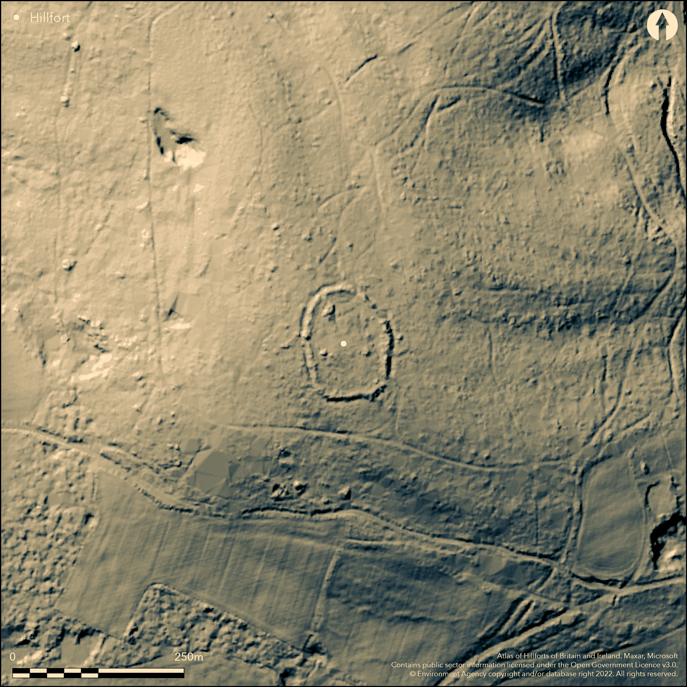
LiDAR 1m DTM Hillshade
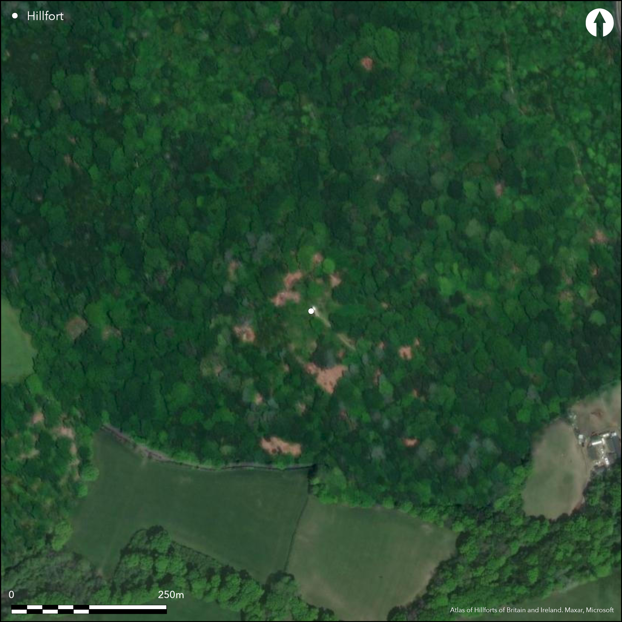
Satellite Imagery
LiDAR 1m DTM Hillshade
Satellite Imagery
Scroll left/right to view further images.
HER: East Sussex MES4757 (None)
NMR: TQ 53 SE 1 (409224)
SM: 1014525
NGR: TQ57783294
X: 557774 Y: 132963 (OSGB36)
Commanding, univallate, contour hillfort located on summit of Saxonbury Hill, a sandstone hill which forms part of High Weald of East Sussex. Steep surrounding slopes. Ovoid in plan measuring c. 113m by 88m enclosing c. 1ha. Defined by bank and outer ditch surrounding circuit; excavations by S.E. Winbolt 1929-30 showed large stones and earth-flint flakes construction, c. 5m wide and to 1.5m high. Partly filled ditch c. 6m wide and c.1 m deep, encircled by slight counterscarp bank c. 3m wide and 0.2m high. Slightly inturned entrance through SE ramparts c. 10m wide. Also buried foundations of an earlier, prehistoric enclosure found underlying the NW sector of the later hillfort although this is unclear (Lea and English 2015). This has NW-SE aligned, oval-shaped drystone wall c. 5m wide enclosing area c. 0.2ha, with possible entrances to N and S ends, a hollow way leading from former. This inner area produced many flint artefacts, sherds of Iron Age pottery, a first century AD Roman coin, about 200 pieces of Iron-Age slag, hearth and masonry foundations of stone building underlying the SW wall. A watching brief (Shand 1996) across the line of the inner enclosure failed to confirm it. Survey has shown earlier lynchets (Lea and English 2015). Derelict 19th century folly on site. Part cleared woodland and scrub with wooded surrounds. On 1st Ed. OS map (1873).
Citizen Science: ✗
Reliability of Data: Confirmed
Reliability of Interpretation: Confirmed
X: 27915 Y: 6634437 (EPSG: 3857)
Longitude: 0.25076861384355575 Latitude: 51.0742459029128 (EPSG:4326)
Country: England
Current County or Unitary Authority: East Sussex
Historic County: Sussex
Current Parish/Community/Council/Townland: Rotherfield
Some tree damage.
| Extant | ✓ |
| Cropmark | ✗ |
| Likely Destroyed | ✗ |
Part cleared woodland and rhododendron scrub and wooded surrounding slopes. Folly.
| Woodland | ✓ |
| Commercial Forestry Plantation | ✗ |
| Parkland | ✗ |
| Pasture (Grazing) | ✗ |
| Arable | ✗ |
| Scrub/Bracken | ✓ |
| Bare Outcrop | ✗ |
| Heather/Moorland | ✗ |
| Heath | ✗ |
| Built-up | ✓ |
| Coastal Grassland | ✗ |
| Other | ✗ |
Commanding, univallate, contour hillfort located on summit of Saxonbury Hill, a sandstone hill which forms part of High Weald of East Sussex. Steep surrounding slopes.
| Contour Fort | ✓ |
| Partial Contour Fort | ✗ |
| Promontory Fort | ✗ |
| Hillslope Fort | ✗ |
| Level Terrain Fort | ✗ |
| Marsh Fort | ✗ |
| Multiple Enclosure Fort | ✗ |
| Hilltop | ✓ |
| Coastal Promontory | ✗ |
| Inland Promontory | ✗ |
| Valley Bottom | ✗ |
| Knoll/Hillock/Outcrop | ✗ |
| Ridge | ✗ |
| Cliff/Plateau-edge/Scarp | ✗ |
| Hillslope | ✗ |
| Lowland | ✗ |
| Spur | ✗ |
Dominant Topographic Feature: Hill top.
| North | ✗ |
| Northeast | ✗ |
| East | ✗ |
| Southeast | ✗ |
| South | ✗ |
| Southwest | ✗ |
| West | ✗ |
| Northwest | ✗ |
| Level | ✓ |
Altitude: 202.0m
N/A
Many Iron Age sherds.
Reliability: B - Medium
| Pre 1200BC | ✗ |
| 1200BC - 800BC | ✗ |
| 800BC - 400BC | ✗ |
| 400BC - AD50 | ✓ |
| AD50 - AD400 | ✗ |
| AD400 - AD 800 | ✗ |
| Post AD800 | ✗ |
| Unknown | ✗ |
| Pre Hillfort: | None |
| Post Hillfort: | None |
| Artefactual: | None |
On map by Richard Budgen (1724) and 1st Ed. OS map (1873). In Horsfield 1835. Excavations by S.E. Winbolt 1929-30. Watching brief (Shand 1996).
| 1st Identified Map Depiction (1724): | None |
| 1st Identified Written Reference (1835): | None |
| Other (1873): | OS map. |
| Other (1996): | None |
| Excavation (None): | None |
Iron Age pottery sherds excavated confirm date of site, whilst c. 200 pieces of iron slag suggest iron working on site. Wood ash, charcoal and burnt stones found in association bank. Earlier enclosure found by excavation.
None
| None | ✓ |
| Spring | ✗ |
| Stream | ✗ |
| Pool | ✗ |
| Flush | ✗ |
| Well | ✗ |
| Other | ✗ |
None
| No Known Features | ✓ |
| Round Stone Structures | ✗ |
| Rectangular Stone Structures | ✗ |
| Curvilinear Platforms | ✗ |
| Other Roundhouse Evidence | ✗ |
| Pits | ✗ |
| Quarry Hollows | ✗ |
| Other | ✗ |
None
| No Known Excavation | ✗ |
| Pits | ✗ |
| Postholes | ✗ |
| Roundhouses | ✗ |
| Rectangular Structures | ✗ |
| Roads/Tracks | ✗ |
| Quarry Hollows | ✗ |
| Other | ✓ |
| Nothing Found | ✗ |
None
| No Known Geophysics | ✓ |
| Pits | ✗ |
| Roundhouses | ✗ |
| Rectangular Structures | ✗ |
| Roads/Tracks | ✗ |
| Quarry Hollows | ✗ |
| Other | ✗ |
| Nothing Found | ✗ |
Inner area produced many flint artefacts, sherds of Iron Age pottery , a first century AD Roman coin, about 200 pieces of Iron-Age slag. Wood ash, charcoal and burnt stones found in association bank.
| No Known Finds | ✗ |
| Pottery | ✓ |
| Metal | ✗ |
| Metalworking | ✓ |
| Human Bones | ✗ |
| Animal Bones | ✗ |
| Lithics | ✓ |
| Environmental | ✓ |
| Other | ✗ |
NO APPARENT FEATURES
| APs Not Checked | ✓ |
| None | ✗ |
| Roundhouses | ✗ |
| Rectangular Structures | ✗ |
| Pits | ✗ |
| Postholes | ✗ |
| Roads/Tracks | ✗ |
| Other | ✗ |
Slightly inturned entrance through SE ramparts c. 10m wide.
| 1: | None |
| 2: | None |
Guard Chambers: ✗
Chevaux de Frise: ✗
| 1. In-turned (South east): | Slightly inturned. |
Defined by bank and outer ditch surrounding circuit; excavations 1929-30 showed large stones and earth-flint flakes construction, c. 5m wide and to 1.5m high. Partly filled ditch c. 6m wide and c.1 m deep, encircled by slight counterscarp bank c. 3m wide and 0.2m high.
| Area 1: | 1.0ha. |
| Total: | 1.0ha. |
Total Footprint Area: Noneha.
None
| ✗ | None |
| ✓ | None |
| NE Quadrant: | 1 |
| SE Quadrant: | 1 |
| SW Quadrant: | 1 |
| NW Quadrant: | 1 |
| Total: | 1 |
| Partial Univallate | ✗ |
| Univallate | ✓ |
| Partial Bivallate | ✗ |
| Bivallate | ✗ |
| Partial Multivallate | ✗ |
| Multivallate | ✗ |
| Unknown | ✗ |
| Partial Univallate | ✗ |
| Univallate | ✗ |
| Partial Bivallate | ✗ |
| Bivallate | ✗ |
| Partial Multivallate | ✗ |
| Multivallate | ✗ |
Slight counterscarp bank c. 3m wide and 0.2m high.
| None | ✗ |
| Earthen Bank | ✓ |
| Stone Wall | ✗ |
| Rubble | ✓ |
| Wall-walk | ✗ |
| Evidence of Timber | ✗ |
| Vitrification | ✗ |
| Other Burning | ✗ |
| Palisade | ✗ |
| Counter Scarp Bank | ✓ |
| Berm | ✗ |
| Unfinished | ✗ |
| Other | ✗ |
Excavations 1929-30 showed bank of large stones and earth-flint flakes construction.
| None | ✗ |
| Earthen Bank | ✓ |
| Stone Wall | ✗ |
| Murus Duplex | ✗ |
| Timber-framed | ✗ |
| Timber-laced | ✗ |
| Vitrification | ✗ |
| Other Burning | ✗ |
| Palisade | ✗ |
| Counter Scarp Bank | ✗ |
| Berm | ✗ |
| Unfinished | ✗ |
| No Known Excavation | ✗ |
| Other | ✓ |
| ✗ | None |
| ✓ | None |
Number of Ditches: 1
| ✗ | None |
Hamilton, S. and Manley, J.1997. Points of view. Prominent enclosures in 1st millennium Sussex, Sussex Archaeol Coll, 135, 93-112.
Hamilton, S. and Manley, J. 2001. Hillforts, monumentality and place: a chronological and topographic review of first millennium BC hillforts of southeast England, European J Archaeol, 4.1, 7-42.
Hors-eld, T. W. 1835. The History, Antiquities and Topography of the County of Sussex, as reprinted in 1974, Dorking: Kohler and Coombes.
Lea, D. and English, J. 2015. Analytical survey and landscape context of Saxonbury Hillfort, Rotherbridge, East Sussex. Sussex Archaeol Collect. 135, 29-40.
Shand, G. 1996. Archaeological watching brief at Saxonbury Hillfort, East Sussex, private client report by Canterbury Archaeological Trus
Winbolt, S.E. 1930. Excavations at Saxonbury Camp, Sussex Archaeol Collect. 71, 222-36.
Atlas of Hillforts:
Wikidata:
This work is licensed under CC BY-SA 4.0

 and should be cited as:
Lock, Gary and Ralston, Ian. 2024. Atlas of Hillforts of Britain and Ireland. Available at: https://hillforts.arch.ox.ac.uk
Document Version 1.1