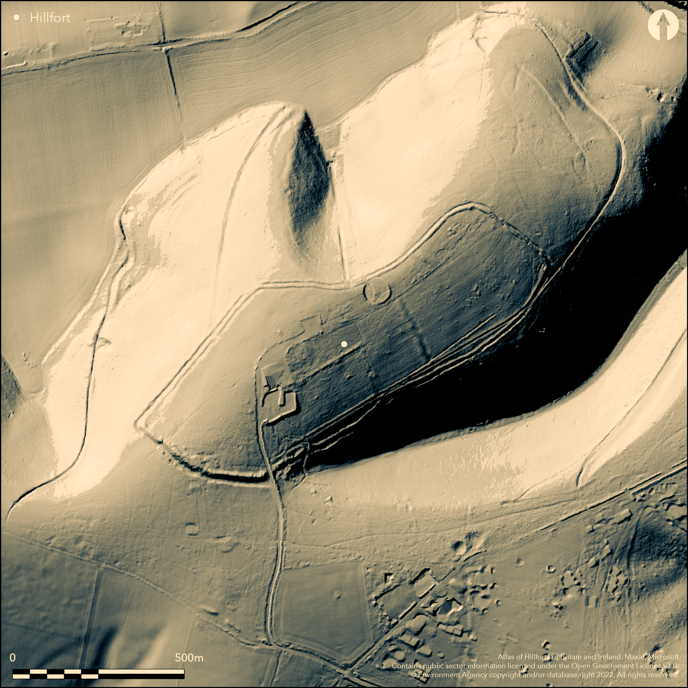
LiDAR 1m DTM Hillshade
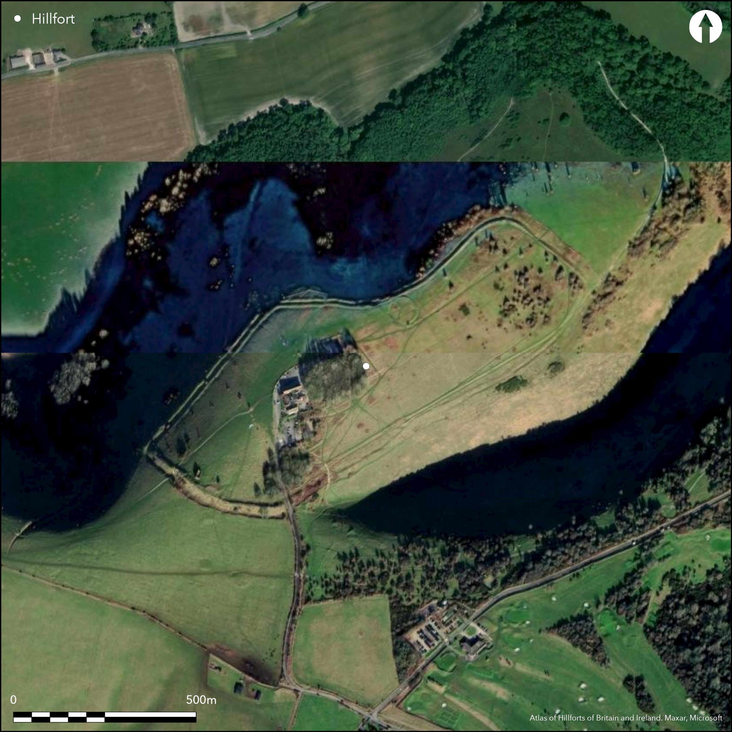
Satellite Imagery
LiDAR 1m DTM Hillshade
Satellite Imagery
Scroll left/right to view further images.
HER: West Sussex MWS5074 (None)
NMR: TQ 21 SE 3 (399072)
SM: 1014953
NGR: TQ26041109
X: 525971 Y: 111090 (OSGB36)
Univallate, partial contour hillfort located on NE-SW chalk spur of Sussex Downs. Slopes mostly very steep, with deep combe to E, penetrating into escarpment from N, with moderate slopes to SW along ridge. Extensive views of Weald to N and downland and Channel coast to S. Roughly rectangular area, measuring 800m SW-NE by 330m, encloses c. 14ha. Defined by strong bank to c.14m wide and rising to c. 3m high where crosses the level neck of spur on SW side, with ditch to 12m wide and to 2m deep, with slight counterscarp on NW. Elsewhere, ramparts are slighter above the very steep slopes, with bank on SE surviving as low scarp. Site possibly began as smaller enclosure sited at highest point, whose NE end is now ploughed-down rampart, and later expanded over whole circuit. However, this bank could be a cross-ridge dyke, with no relation to any subsequent enclosure. Similarly, main cross-ridge rampart forms SW end of hillfort could also be earlier cross-ridge dyke eventually incorporated into circuit. Inconclusive excavations when pottery sherds of c. 50 BC-AD 50 found, possible round house and pits. Oyster shells and coins indicate use into Roman period, and extended medieval human burial from inside SW ramparts (Curwen 1932). Minor public Dyke Road from Brighton through possible original entrance at SE corner. Possible blocked entrance on SW. Use of site during 19th and early 20th centuries for tavern, first constructed 1817, and visitor attractions. Steep grade railway and aerial cableway, which survive in ruined form. Modern hotel and car park and facilities. WWI and WWII activity disturbed ramparts. On 1st Ed. OS map (1873).
Citizen Science: ✗
Reliability of Data: Confirmed
Reliability of Interpretation: Confirmed
X: -23434 Y: 6601066 (EPSG: 3857)
Longitude: -0.21051432173292728 Latitude: 50.88550830902693 (EPSG:4326)
Country: England; None
Current County or Unitary Authority: West Sussex
Historic County: Sussex
Current Parish/Community/Council/Townland: Poynings; Fulking; Newtimber
Use of site during 19th and early 20th centuries for tavern, first constructed 1817, and visitor attractions. Steep grade railway and aerial cableway, which survive in ruined form. Modern hotel and car park, with access via minor public Dyke Road from Brighton through possible original entrance at SE corner. WWI and WWII activity disturbed ramparts. National Trust site.
| Extant | ✓ |
| Cropmark | ✗ |
| Likely Destroyed | ✓ |
Pasture and scattered trees and scrub, public buildings, car park, facilities and road.
| Woodland | ✗ |
| Commercial Forestry Plantation | ✗ |
| Parkland | ✗ |
| Pasture (Grazing) | ✓ |
| Arable | ✗ |
| Scrub/Bracken | ✓ |
| Bare Outcrop | ✗ |
| Heather/Moorland | ✗ |
| Heath | ✗ |
| Built-up | ✓ |
| Coastal Grassland | ✗ |
| Other | ✓ |
Univallate partial contour hillfort located on NE-SW chalk spur of Sussex Downs. Slopes mostly very steep, with deep coombe to E, penetrating into escarpment from N, with moderate slopes to SW along ridge. Extensive views of Weald to N and downland and Channel coast to S.
| Contour Fort | ✗ |
| Partial Contour Fort | ✓ |
| Promontory Fort | ✗ |
| Hillslope Fort | ✗ |
| Level Terrain Fort | ✗ |
| Marsh Fort | ✗ |
| Multiple Enclosure Fort | ✗ |
| Hilltop | ✗ |
| Coastal Promontory | ✗ |
| Inland Promontory | ✗ |
| Valley Bottom | ✗ |
| Knoll/Hillock/Outcrop | ✗ |
| Ridge | ✗ |
| Cliff/Plateau-edge/Scarp | ✗ |
| Hillslope | ✗ |
| Lowland | ✗ |
| Spur | ✓ |
Dominant Topographic Feature: Spur
| North | ✗ |
| Northeast | ✗ |
| East | ✗ |
| Southeast | ✗ |
| South | ✗ |
| Southwest | ✗ |
| West | ✗ |
| Northwest | ✗ |
| Level | ✓ |
Altitude: 212.0m
Boundary Type: Parish/Townland
Pottery sherds of c. 50 BC-AD 50 found. Oyster shells and coins indicate use into Roman period.
Reliability: B - Medium
| Pre 1200BC | ✗ |
| 1200BC - 800BC | ✗ |
| 800BC - 400BC | ✗ |
| 400BC - AD50 | ✓ |
| AD50 - AD400 | ✗ |
| AD400 - AD 800 | ✗ |
| Post AD800 | ✗ |
| Unknown | ✗ |
| Pre Hillfort: | None |
| Post Hillfort: | None |
| Artefactual: | None |
On Yeakell and Gardner's map of 1778-83. On 1st Ed. OS map (1873). Excavation 1931 E. Curwen. Evaluation Archaeology South-East 1999. Watching Brief Archaeology South-East 2001, 2008-2009.
| Other (1873): | OS map. |
| Excavation (1931): | E. Curwen. |
| Evaluation (1999): | South-East Archaeology. |
| 1st Identified Map Depiction (None): | On Yeakell and Gardner's map. |
| Other (None): | Watching Briefs South-East Archaeology. |
Pottery sherds of c. 50 BC-AD 50. Oyster shells and coins indicate use into Roman period, and extended medieval human burial from inside SW ramparts by workmen in 1931. Neolithic flints. Inconclusive excavations 1931, when traces of roundhouse circular gully 8.55m diameter surrounding levelled floor, with four associated refuse pits.
None
| None | ✓ |
| Spring | ✗ |
| Stream | ✗ |
| Pool | ✗ |
| Flush | ✗ |
| Well | ✗ |
| Other | ✗ |
None
| No Known Features | ✓ |
| Round Stone Structures | ✗ |
| Rectangular Stone Structures | ✗ |
| Curvilinear Platforms | ✗ |
| Other Roundhouse Evidence | ✗ |
| Pits | ✗ |
| Quarry Hollows | ✗ |
| Other | ✗ |
Inconclusive excavations 1931, when traces of roundhouse circular gully 8.55m diameter surrounding levelled floor, with four associated refuse pits.
| No Known Excavation | ✗ |
| Pits | ✓ |
| Postholes | ✗ |
| Roundhouses | ✓ |
| Rectangular Structures | ✗ |
| Roads/Tracks | ✗ |
| Quarry Hollows | ✗ |
| Other | ✗ |
| Nothing Found | ✗ |
None
| No Known Geophysics | ✓ |
| Pits | ✗ |
| Roundhouses | ✗ |
| Rectangular Structures | ✗ |
| Roads/Tracks | ✗ |
| Quarry Hollows | ✗ |
| Other | ✗ |
| Nothing Found | ✗ |
Pottery sherds of c. 50 BC-AD 50. Oyster shells and coins indicate use into Roman period, and extended medieval human burial from inside SW ramparts by workmen in 1931. Neolithic flints.
| No Known Finds | ✗ |
| Pottery | ✓ |
| Metal | ✗ |
| Metalworking | ✗ |
| Human Bones | ✓ |
| Animal Bones | ✗ |
| Lithics | ✓ |
| Environmental | ✓ |
| Other | ✓ |
None
| APs Not Checked | ✓ |
| None | ✗ |
| Roundhouses | ✗ |
| Rectangular Structures | ✗ |
| Pits | ✗ |
| Postholes | ✗ |
| Roads/Tracks | ✗ |
| Other | ✗ |
Minor public Dyke Road from Brighton through possible original entrance at SE corner. Possible blocked entrance on SW.
| 2: | None |
| 2: | None |
Guard Chambers: ✗
Chevaux de Frise: ✗
| 1. Simple Gap (South east): | Dyke Road passes through. |
| 2. Blocked (South west): | Possible entrance only. |
Defended by strong bank to c.14m wide and rising to c. 3m high where crosses the level neck of spur on SW side, with ditch to 12m wide and to 2m deep, with slight counterscarp on NW. Elsewhere, defences slighter above the very steep slopes, with bank on SE surviving as low scarp. Site possibly began as smaller enclosure sited at highest point, whose NE end is now ploughed-down rampart, and later expanded over whole circuit. However, this bank could be a cross-ridge dyke, with no relation to any subsequent enclosure. Similarly, main cross-ridge rampart forms SW end of hillfort could also be earlier cross-ridge dyke eventually incorporated into circuit.
| Area 1: | 14.0ha. |
| Total: | 14.0ha. |
Total Footprint Area: Noneha.
None
| ✓ | Possibly started as smaller enclosure at highest point, whose NE end ploughed down rampart - however, later expanded over whole circuit. However, this could be a cross-ridge dyke with no relation to any subsequent enclosure. |
| ✓ | Quadrants estimated. |
| NE Quadrant: | 1 |
| SE Quadrant: | 1 |
| SW Quadrant: | 1 |
| NW Quadrant: | 1 |
| Total: | 1 |
| Partial Univallate | ✗ |
| Univallate | ✓ |
| Partial Bivallate | ✗ |
| Bivallate | ✗ |
| Partial Multivallate | ✗ |
| Multivallate | ✗ |
| Unknown | ✗ |
| Partial Univallate | ✗ |
| Univallate | ✓ |
| Partial Bivallate | ✗ |
| Bivallate | ✗ |
| Partial Multivallate | ✗ |
| Multivallate | ✗ |
Slight counterscarp on NW.
| None | ✗ |
| Earthen Bank | ✓ |
| Stone Wall | ✗ |
| Rubble | ✗ |
| Wall-walk | ✗ |
| Evidence of Timber | ✗ |
| Vitrification | ✗ |
| Other Burning | ✗ |
| Palisade | ✗ |
| Counter Scarp Bank | ✓ |
| Berm | ✗ |
| Unfinished | ✗ |
| Other | ✗ |
None
| None | ✓ |
| Earthen Bank | ✗ |
| Stone Wall | ✗ |
| Murus Duplex | ✗ |
| Timber-framed | ✗ |
| Timber-laced | ✗ |
| Vitrification | ✗ |
| Other Burning | ✗ |
| Palisade | ✗ |
| Counter Scarp Bank | ✗ |
| Berm | ✗ |
| Unfinished | ✗ |
| No Known Excavation | ✗ |
| Other | ✗ |
| ✗ | None |
| ✓ | None |
Number of Ditches: 1
| ✗ | None |
Curwen, E. 1932-3. Human Remains at the Dyke, Sussex N & S, 4, 7-8.
Curwen, E.C. 1954. Archaeology of Sussex, 237-9.
Dunkin, D. 2001. An Archaeological Watching Brief on Drainage Repairs at Devil's Dyke, Near Brighton, West Sussex, Archaeology South-East Rep. No. 1452.
Hart D. 2009. An archaeological watching brief at Devils Dyke Hillfort, Poynings, West Sussex, Archaeology South-East Report No 09/79.
Sibun L. 1999. An archaeological evaluation at The Devil's Dyke (Car Park Enhancement), West Sussex, Archaeology South-East Report.
Atlas of Hillforts:
Wikidata:
This work is licensed under CC BY-SA 4.0

 and should be cited as:
Lock, Gary and Ralston, Ian. 2024. Atlas of Hillforts of Britain and Ireland. Available at: https://hillforts.arch.ox.ac.uk
Document Version 1.1