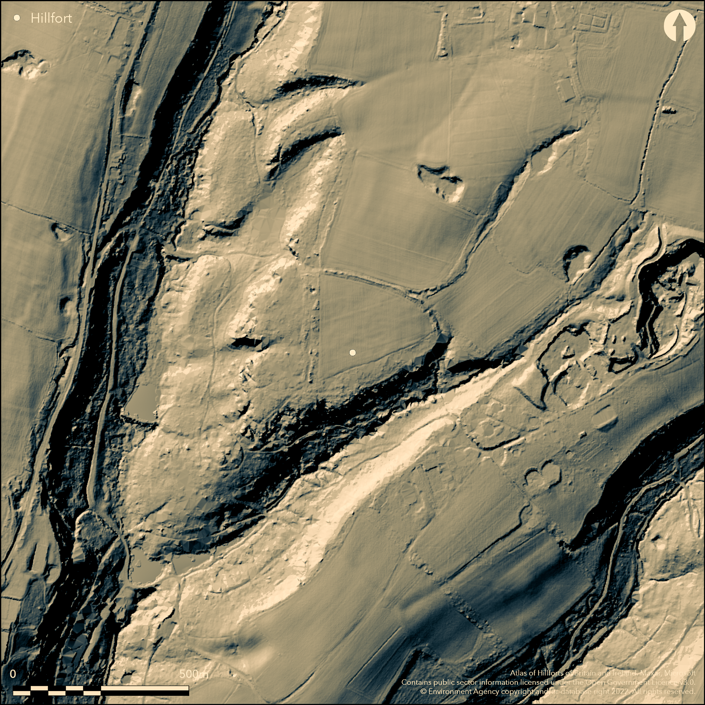
LiDAR 1m DTM Hillshade
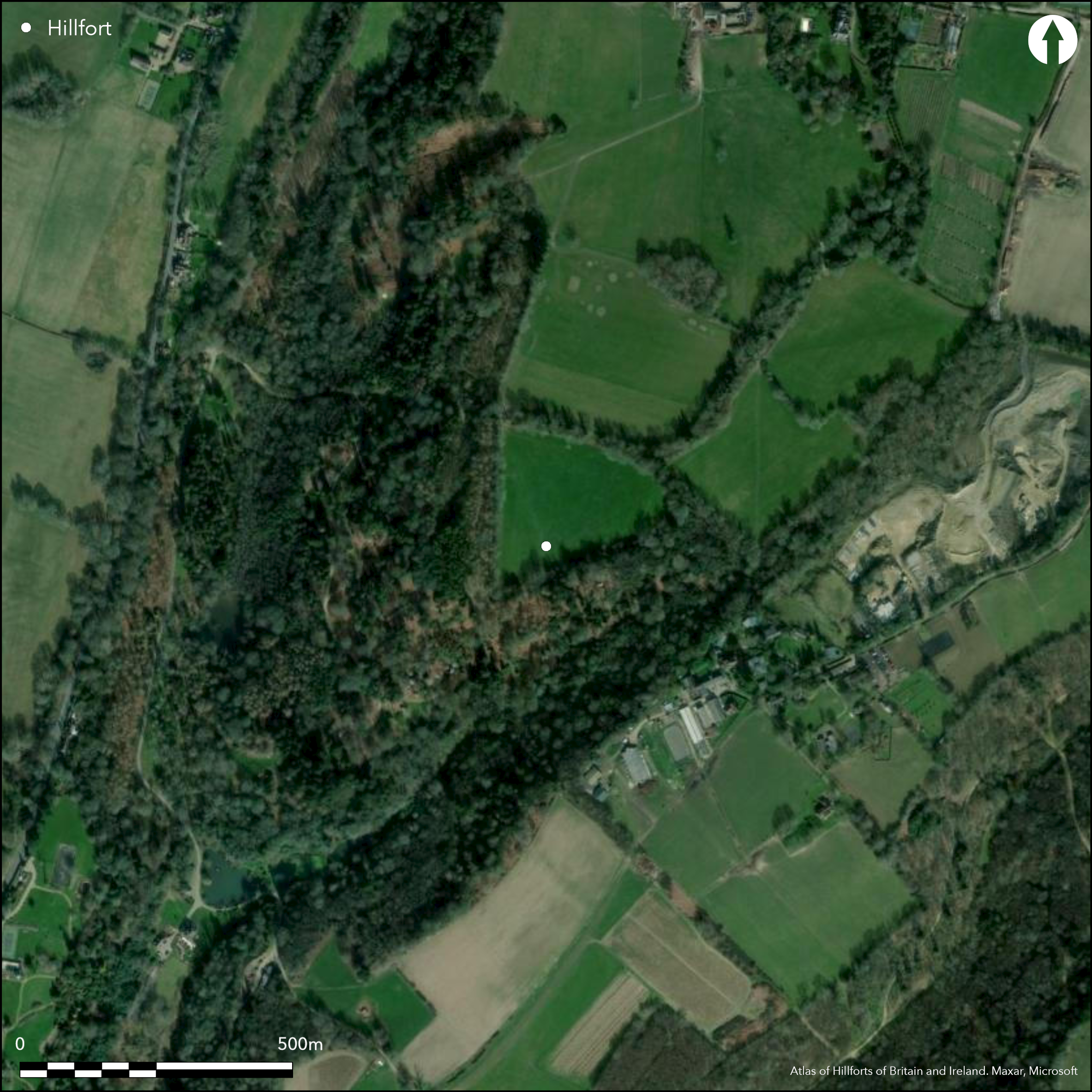
Satellite Imagery
LiDAR 1m DTM Hillshade
Satellite Imagery
Scroll left/right to view further images.
HER: West Sussex MWS5086 (None)
NMR: TQ 33 SE 7 (403485)
SM: 1014955
NGR: TQ 3495 3224
X: 534977 Y: 132219 (OSGB36)
Inland promontory fort sited on NE-SW aligned sandstone spur promontory of High Weald of Sussex, roughly triangular being defined by junction of two rivers. E and W sides defined by low cliffs, c. 5m-10m high, of Lower Tonbridge Wells Sand which form the edge of the spur, with single, curving, bank and external ditch across the neck of the spur on NE and enclosing c. 6.2ha. Rampart where best preserved 8m wide and 1.5m in height above the ditch to 6m wide and 0.7m deep. Ramparts trenched (Hannah 1932), showing bank of dumped soil and ditch originally flat-bottomed to 2m deep. Also suggested position of entrance gaps, that on E being damaged, and finding only some charcoal fragments and a few flints from one of ditch bottoms. Fragments of charcoal indicated that bank possibly topped by timber palisade subsequently destroyed by burning. Possible Mesolithic arrowhead and some flakes from interior. Two gaps in rampart possible original entrances, one near NW end, other towards the SE end. Vague overgrown bank at SE end of rampart possible boundary bank of uncertain date. Undated.
Citizen Science: ✗
Reliability of Data: Confirmed
Reliability of Interpretation: Confirmed
X: -8317 Y: 6634282 (EPSG: 3857)
Longitude: -0.07471422426325085 Latitude: 51.073370654048894 (EPSG:4326)
Country: England
Current County or Unitary Authority: West Sussex
Historic County: Sussex
Current Parish/Community/Council/Townland: West Hoathly
Fair condition.
| Extant | ✓ |
| Cropmark | ✗ |
| Likely Destroyed | ✗ |
Pasture and woodland.
| Woodland | ✓ |
| Commercial Forestry Plantation | ✗ |
| Parkland | ✗ |
| Pasture (Grazing) | ✓ |
| Arable | ✗ |
| Scrub/Bracken | ✗ |
| Bare Outcrop | ✗ |
| Heather/Moorland | ✗ |
| Heath | ✗ |
| Built-up | ✗ |
| Coastal Grassland | ✗ |
| Other | ✗ |
Inland promontory fort
| Contour Fort | ✗ |
| Partial Contour Fort | ✗ |
| Promontory Fort | ✓ |
| Hillslope Fort | ✗ |
| Level Terrain Fort | ✗ |
| Marsh Fort | ✗ |
| Multiple Enclosure Fort | ✗ |
| Hilltop | ✗ |
| Coastal Promontory | ✗ |
| Inland Promontory | ✓ |
| Valley Bottom | ✗ |
| Knoll/Hillock/Outcrop | ✗ |
| Ridge | ✗ |
| Cliff/Plateau-edge/Scarp | ✗ |
| Hillslope | ✗ |
| Lowland | ✗ |
| Spur | ✓ |
Dominant Topographic Feature: Spur
| North | ✗ |
| Northeast | ✗ |
| East | ✗ |
| Southeast | ✗ |
| South | ✗ |
| Southwest | ✓ |
| West | ✗ |
| Northwest | ✗ |
| Level | ✗ |
Altitude: 137.0m
N/A
None
Reliability: D - None
| Pre 1200BC | ✗ |
| 1200BC - 800BC | ✗ |
| 800BC - 400BC | ✗ |
| 400BC - AD50 | ✗ |
| AD50 - AD400 | ✗ |
| AD400 - AD 800 | ✗ |
| Post AD800 | ✗ |
| Unknown | ✓ |
| Pre Hillfort: | Adjacent cliffs have several shelters, caves and fissures to SE and SW, possibly Mesolithic, and later flints. |
| Post Hillfort: | None |
Ramparts trenched by I.C. Hannah 1931. Evaluation M.J. Allen 2007.
| Excavation (1931): | Small scale trenching of ramparts. |
| Other (2007): | Augering and Palaeoenvironmental Assessment M.J. Allen. |
Charcoal fragments and a few flints from one of ditch bottoms.
None
| None | ✓ |
| Spring | ✗ |
| Stream | ✗ |
| Pool | ✗ |
| Flush | ✗ |
| Well | ✗ |
| Other | ✗ |
None
| No Known Features | ✓ |
| Round Stone Structures | ✗ |
| Rectangular Stone Structures | ✗ |
| Curvilinear Platforms | ✗ |
| Other Roundhouse Evidence | ✗ |
| Pits | ✗ |
| Quarry Hollows | ✗ |
| Other | ✗ |
None
| No Known Excavation | ✓ |
| Pits | ✗ |
| Postholes | ✗ |
| Roundhouses | ✗ |
| Rectangular Structures | ✗ |
| Roads/Tracks | ✗ |
| Quarry Hollows | ✗ |
| Other | ✗ |
| Nothing Found | ✗ |
None
| No Known Geophysics | ✓ |
| Pits | ✗ |
| Roundhouses | ✗ |
| Rectangular Structures | ✗ |
| Roads/Tracks | ✗ |
| Quarry Hollows | ✗ |
| Other | ✗ |
| Nothing Found | ✗ |
Charcoal fragments and a few flints from one of ditch bottoms.
| No Known Finds | ✗ |
| Pottery | ✗ |
| Metal | ✗ |
| Metalworking | ✗ |
| Human Bones | ✗ |
| Animal Bones | ✗ |
| Lithics | ✓ |
| Environmental | ✓ |
| Other | ✗ |
None
| APs Not Checked | ✓ |
| None | ✗ |
| Roundhouses | ✗ |
| Rectangular Structures | ✗ |
| Pits | ✗ |
| Postholes | ✗ |
| Roads/Tracks | ✗ |
| Other | ✗ |
Two gaps in rampart possible original entrances, one near NW end, other towards the SE end.
| 2: | None |
| 2: | None |
Guard Chambers: ✗
Chevaux de Frise: ✗
| 1. Simple Gap (North east): | Located at NW end. |
| 2. Simple Gap (North east): | Located at SE end. |
E and W sides defined by low cliffs, c. 5m-10m high, of Lower Tonbridge Wells Sand which form the edge of the spur, with single, curing, bank and external ditch across the neck of the spur on NE and enclosing c. 2.4ha. Rampart where best preserved, 8m wide and 1.5m in height above the ditch to 6m wide and 0.7m deep. Ramparts trenched 1931, showing bank of dumped soil and ditch originally flat-bottomed to 2m deep. Fragments of charcoal indicated that bank possibly topped by timber palisade subsequently destroyed by burning.
| Area 1: | 6.2ha. |
| Total: | 6.2ha. |
Total Footprint Area: Noneha.
None
| ✗ | None |
| ✗ | None |
| NE Quadrant: | 1 |
| SE Quadrant: | 0 |
| SW Quadrant: | 0 |
| NW Quadrant: | 0 |
| Total: | 1 |
| Partial Univallate | ✓ |
| Univallate | ✗ |
| Partial Bivallate | ✗ |
| Bivallate | ✗ |
| Partial Multivallate | ✗ |
| Multivallate | ✗ |
| Unknown | ✗ |
| Partial Univallate | ✗ |
| Univallate | ✗ |
| Partial Bivallate | ✗ |
| Bivallate | ✗ |
| Partial Multivallate | ✗ |
| Multivallate | ✗ |
None
| None | ✗ |
| Earthen Bank | ✓ |
| Stone Wall | ✗ |
| Rubble | ✗ |
| Wall-walk | ✗ |
| Evidence of Timber | ✗ |
| Vitrification | ✗ |
| Other Burning | ✗ |
| Palisade | ✗ |
| Counter Scarp Bank | ✗ |
| Berm | ✗ |
| Unfinished | ✗ |
| Other | ✗ |
Ramparts trenched 1931, showing bank of dumped soil and ditch originally flat-bottomed to 2m deep. Fragments of charcoal indicated that bank possibly topped by timber palisade subsequently destroyed by burning.
| None | ✗ |
| Earthen Bank | ✓ |
| Stone Wall | ✗ |
| Murus Duplex | ✗ |
| Timber-framed | ✗ |
| Timber-laced | ✗ |
| Vitrification | ✗ |
| Other Burning | ✓ |
| Palisade | ✓ |
| Counter Scarp Bank | ✗ |
| Berm | ✗ |
| Unfinished | ✗ |
| No Known Excavation | ✗ |
| Other | ✗ |
| ✗ | None |
| ✓ | External ditch. Ramparts trenched 1931, showing bank of dumped soil and ditch originally flat-bottomed to 2m deep. |
Number of Ditches: 1
| ✗ | None |
Allen, M.J. 2007. Philpots Camp Geoarchaeological Report. Augering and Palaeoenvironmental Assessment, No details.
Hannah, I.C. 1932. Philpots Camp, West Hoathly, Sussex Archaeol Collect. 73, 157-67.
Atlas of Hillforts:
Wikidata:
This work is licensed under CC BY-SA 4.0

 and should be cited as:
Lock, Gary and Ralston, Ian. 2024. Atlas of Hillforts of Britain and Ireland. Available at: https://hillforts.arch.ox.ac.uk
Document Version 1.1