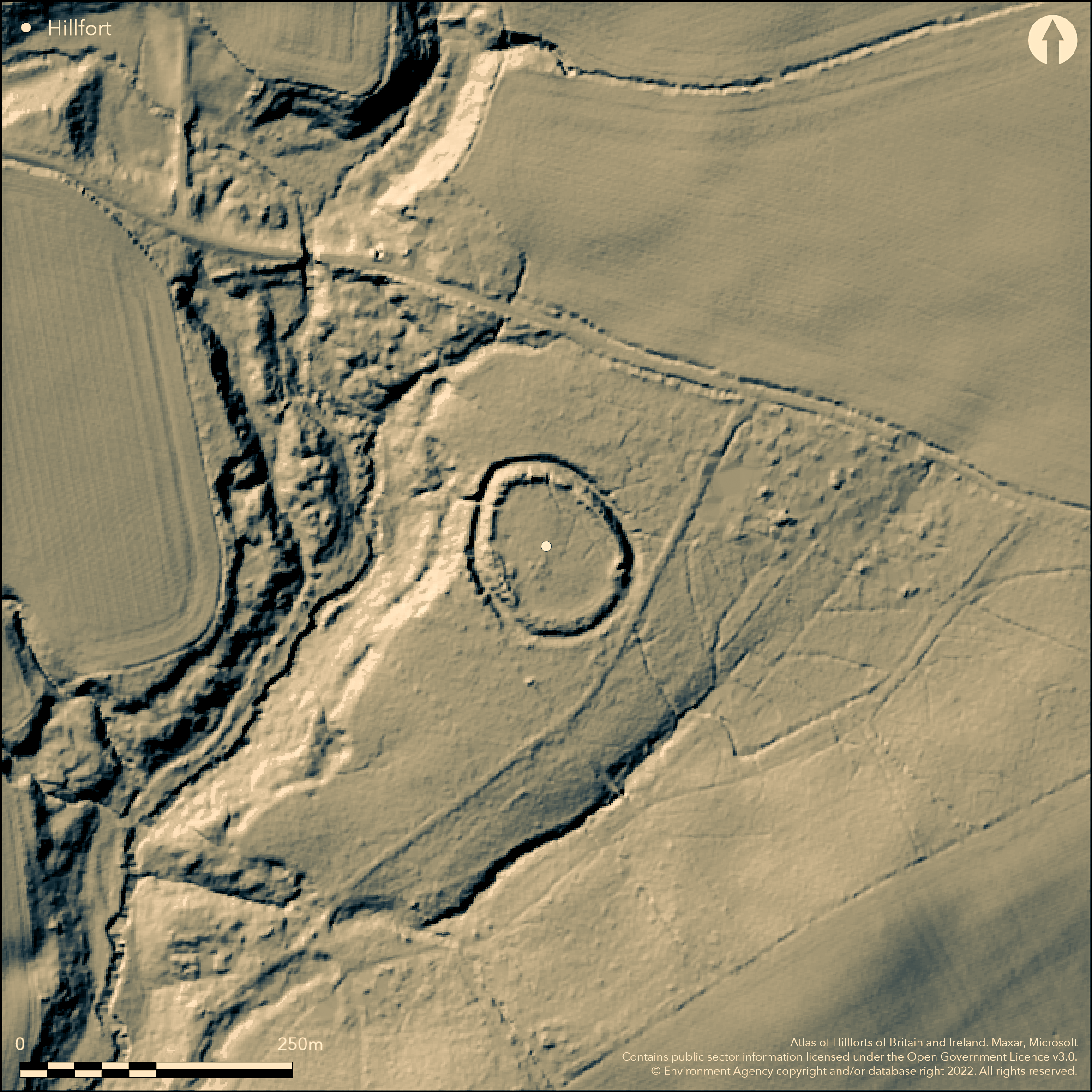
LiDAR 1m DTM Hillshade
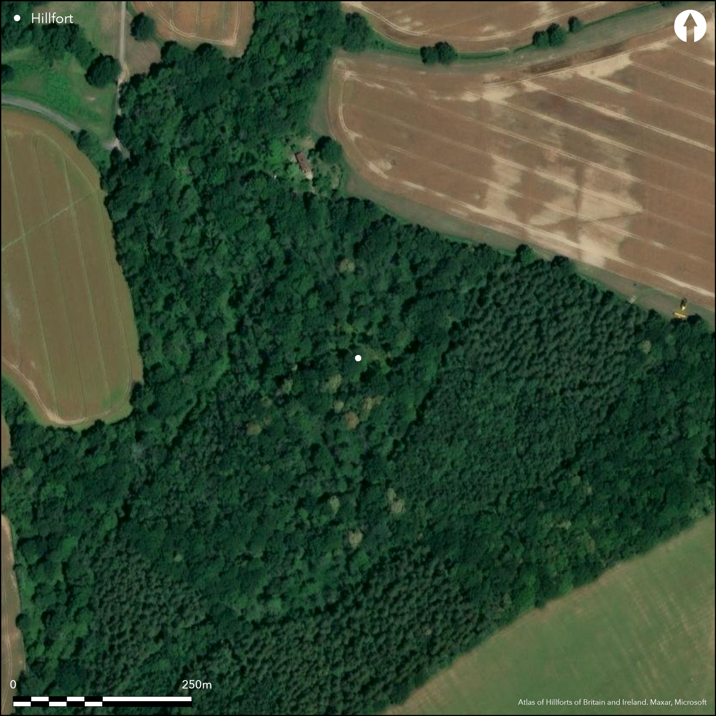
Satellite Imagery
LiDAR 1m DTM Hillshade
Satellite Imagery
Scroll left/right to view further images.
HER: West Sussex MWS2626 (None)
NMR: SU 92 NE 1 (249767)
SM: None
NGR: SU9784029550
X: 497827 Y: 129540 (OSGB36)
Level terrain fort located on plateau immediately overlooking steep slopes to a stream on the NW side. Sub-circular in plan, with an average diameter of 100m overall and internal area c. 0.6ha. Defined by strong earthen rampart with outer ditch, contained on steep NW side by short stretch of outer bank. Original entrance on SE side where traces of causeway across the ditch and rampart inturned on the N side. Modern breaches through the rampart to the N and W. Site much reduced on SE side, probably during reafforestation of the area. Excavated by Winbolt and Kenyon 1934 who discovered burnt clay, charcoal, pieces of iron ore and a hearth probably of the last century BC, with fragments of Early Iron Age pottery, now in Lewes Museum. Also fragments of Romano-British and medieval pottery found. Lumps of bloomery slag on surface reported inside W and N sides of rampart. Entrance probably SE where bank and ditch nearly levelled. On OS 1:25,000 map (1958).
Citizen Science: ✗
Reliability of Data: Confirmed
Reliability of Interpretation: Confirmed
X: -67406 Y: 6631350 (EPSG: 3857)
Longitude: -0.6055225443420152 Latitude: 51.05681737293946 (EPSG:4326)
Country: England
Current County or Unitary Authority: West Sussex
Historic County: Sussex
Current Parish/Community/Council/Townland: Northchapel
Site much reduced on SE side, probably during reafforestation of the area.
| Extant | ✓ |
| Cropmark | ✗ |
| Likely Destroyed | ✗ |
Reafforested.
| Woodland | ✗ |
| Commercial Forestry Plantation | ✓ |
| Parkland | ✗ |
| Pasture (Grazing) | ✗ |
| Arable | ✗ |
| Scrub/Bracken | ✗ |
| Bare Outcrop | ✗ |
| Heather/Moorland | ✗ |
| Heath | ✗ |
| Built-up | ✗ |
| Coastal Grassland | ✗ |
| Other | ✗ |
Level terrain fort located on plateau immediately overlooking steep slopes to a stream on the NW side.
| Contour Fort | ✗ |
| Partial Contour Fort | ✗ |
| Promontory Fort | ✗ |
| Hillslope Fort | ✗ |
| Level Terrain Fort | ✓ |
| Marsh Fort | ✗ |
| Multiple Enclosure Fort | ✗ |
| Hilltop | ✗ |
| Coastal Promontory | ✗ |
| Inland Promontory | ✗ |
| Valley Bottom | ✗ |
| Knoll/Hillock/Outcrop | ✗ |
| Ridge | ✗ |
| Cliff/Plateau-edge/Scarp | ✓ |
| Hillslope | ✗ |
| Lowland | ✗ |
| Spur | ✗ |
Dominant Topographic Feature: Plateau
| North | ✗ |
| Northeast | ✗ |
| East | ✗ |
| Southeast | ✗ |
| South | ✗ |
| Southwest | ✗ |
| West | ✗ |
| Northwest | ✗ |
| Level | ✓ |
Altitude: 38.0m
N/A
Excavations found burnt clay, charcoal, pieces of iron ore and a hearth probably of the last century BC, with fragments of early Iron Age pottery, now in Lewes Museum. Also fragments of Romano-British and medieval pottery also found.
Reliability: B - Medium
| Pre 1200BC | ✗ |
| 1200BC - 800BC | ✗ |
| 800BC - 400BC | ✓ |
| 400BC - AD50 | ✓ |
| AD50 - AD400 | ✗ |
| AD400 - AD 800 | ✗ |
| Post AD800 | ✗ |
| Unknown | ✗ |
| Pre Hillfort: | None |
| Post Hillfort: | None |
| Artefactual: | Excavations found burnt clay, charcoal, pieces of iron ore and a hearth probably of the last century BC, with fragments of early Iron Age pottery. Fragments of Romano-British and medieval pottery also found. |
On OS 1:25,000 map (1958). Excavation G.H. Kenyon and S.E. Winbolt 1934.
| Excavation (1934): | G.H. Kenyon and S.E. Winbolt. |
| 1st Identified Map Depiction (1958): | None |
Excavations found burnt clay, charcoal, pieces of iron ore and a hearth probably of the last century B.C, with fragments of early Iron Age pottery, now in Lewes Museum. Lumps of bloomery slag on surface reported inside W and N sides of rampart.
None
| None | ✓ |
| Spring | ✗ |
| Stream | ✗ |
| Pool | ✗ |
| Flush | ✗ |
| Well | ✗ |
| Other | ✗ |
None
| No Known Features | ✓ |
| Round Stone Structures | ✗ |
| Rectangular Stone Structures | ✗ |
| Curvilinear Platforms | ✗ |
| Other Roundhouse Evidence | ✗ |
| Pits | ✗ |
| Quarry Hollows | ✗ |
| Other | ✗ |
Hearth found.
| No Known Excavation | ✗ |
| Pits | ✗ |
| Postholes | ✗ |
| Roundhouses | ✗ |
| Rectangular Structures | ✗ |
| Roads/Tracks | ✗ |
| Quarry Hollows | ✗ |
| Other | ✓ |
| Nothing Found | ✗ |
None
| No Known Geophysics | ✓ |
| Pits | ✗ |
| Roundhouses | ✗ |
| Rectangular Structures | ✗ |
| Roads/Tracks | ✗ |
| Quarry Hollows | ✗ |
| Other | ✗ |
| Nothing Found | ✗ |
Burnt clay, charcoal, pieces of iron ore and a hearth probably of the last century B.C, with fragments of early Iron Age pottery, now in Lewes Museum. Lumps of bloomery slag on surface reported inside W and N sides of rampart. Also fragments of Romano-British and medieval pottery also found
| No Known Finds | ✗ |
| Pottery | ✓ |
| Metal | ✗ |
| Metalworking | ✓ |
| Human Bones | ✗ |
| Animal Bones | ✗ |
| Lithics | ✗ |
| Environmental | ✓ |
| Other | ✗ |
None
| APs Not Checked | ✓ |
| None | ✗ |
| Roundhouses | ✗ |
| Rectangular Structures | ✗ |
| Pits | ✗ |
| Postholes | ✗ |
| Roads/Tracks | ✗ |
| Other | ✗ |
Entrance probably SE where bank and ditch nearly levelled, with where traces of causeway across the ditch and rampart inturned on the N side. Modern breaches through the rampart to the N and W.
| None: | Modern breaches through the rampart to the N and W. Total breaks not specified. |
| 2: | None |
Guard Chambers: ✗
Chevaux de Frise: ✗
| 1. In-turned (South east): | Traces of causeway across the ditch and rampart inturned on the N side. |
Defined by strong earthen rampart with outer ditch, contained on steep NW side by short stretch of outer bank.
| Area 1: | 0.6ha. |
| Total: | 0.6ha. |
Total Footprint Area: Noneha.
None
| ✗ | None |
| ✓ | Much reduced on SE. |
| NE Quadrant: | 1 |
| SE Quadrant: | 1 |
| SW Quadrant: | 1 |
| NW Quadrant: | 2 |
| Total: | 2 |
| Partial Univallate | ✓ |
| Univallate | ✗ |
| Partial Bivallate | ✓ |
| Bivallate | ✗ |
| Partial Multivallate | ✗ |
| Multivallate | ✗ |
| Unknown | ✗ |
| Partial Univallate | ✗ |
| Univallate | ✗ |
| Partial Bivallate | ✗ |
| Bivallate | ✗ |
| Partial Multivallate | ✗ |
| Multivallate | ✗ |
None
| None | ✗ |
| Earthen Bank | ✓ |
| Stone Wall | ✗ |
| Rubble | ✗ |
| Wall-walk | ✗ |
| Evidence of Timber | ✗ |
| Vitrification | ✗ |
| Other Burning | ✗ |
| Palisade | ✗ |
| Counter Scarp Bank | ✗ |
| Berm | ✗ |
| Unfinished | ✗ |
| Other | ✗ |
None
| None | ✗ |
| Earthen Bank | ✓ |
| Stone Wall | ✗ |
| Murus Duplex | ✗ |
| Timber-framed | ✗ |
| Timber-laced | ✗ |
| Vitrification | ✗ |
| Other Burning | ✗ |
| Palisade | ✗ |
| Counter Scarp Bank | ✗ |
| Berm | ✗ |
| Unfinished | ✗ |
| No Known Excavation | ✗ |
| Other | ✗ |
| ✗ | None |
| ✓ | None |
Number of Ditches: 1
| ✗ | None |
Winbolt, S.E. 1936. An Early Iron Age Camp in Piper's Copse, Kirdford, Sussex Archaeol Collect. 77, 245- 52.
Atlas of Hillforts:
Wikidata:
This work is licensed under CC BY-SA 4.0

 and should be cited as:
Lock, Gary and Ralston, Ian. 2024. Atlas of Hillforts of Britain and Ireland. Available at: https://hillforts.arch.ox.ac.uk
Document Version 1.1