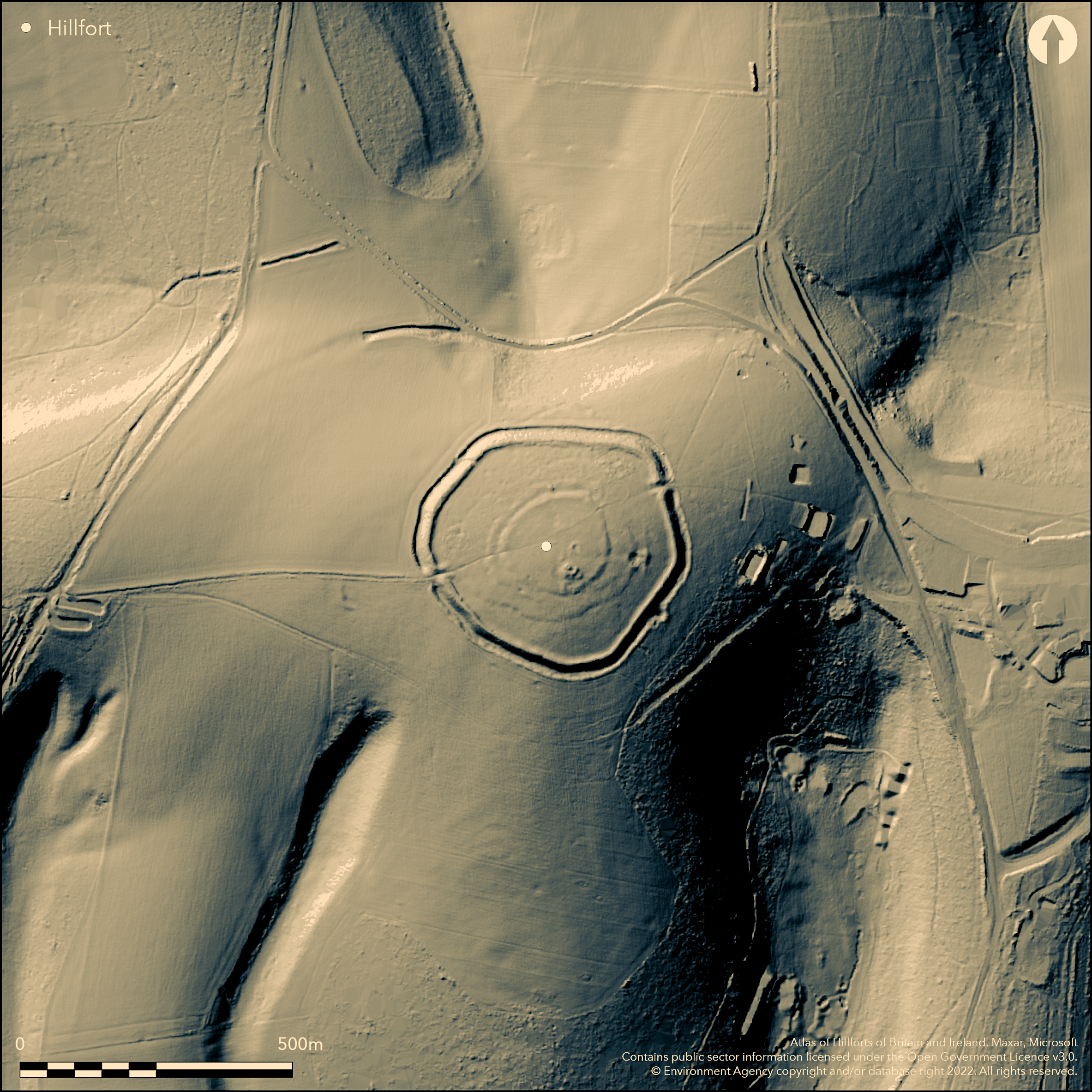
LiDAR 1m DTM Hillshade
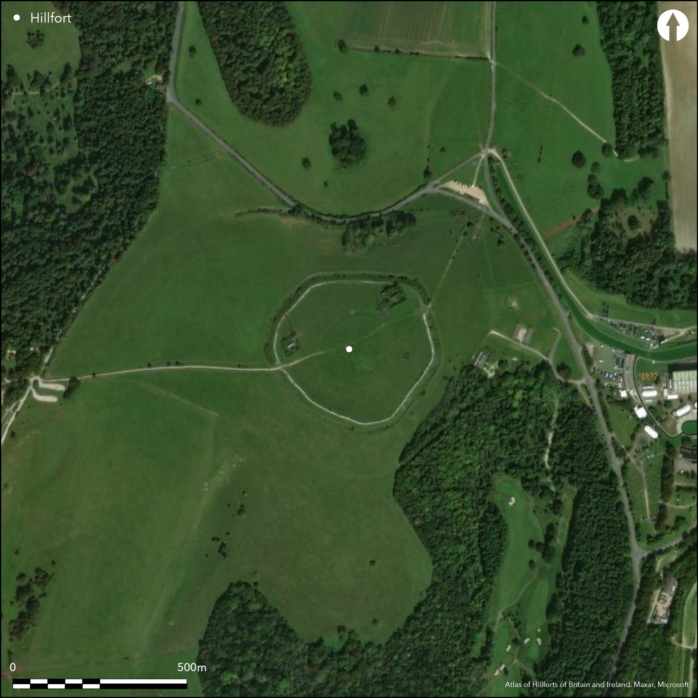
Satellite Imagery
LiDAR 1m DTM Hillshade
Satellite Imagery
Scroll left/right to view further images.
HER: West Sussex MWS4154 (None)
NMR: SU 81 SE 21 (246354)
SM: 1018034
NGR: SU87741107
X: 487727 Y: 111075 (OSGB36)
Large, contour hillfort located on prominent St Roche's Hill, one of the most dominant hills along S edge of Sussex Downs. Hillfort polygonal in shape with internal area 5.6ha. Defined by bank, c. 9m wide and to 1.8m high, surrounded by ditch and counterscarp. Slight quarry ditch follows inner edge of the bank. Two opposing gates, to NE and SW, which survive as causewayed gaps in ramparts flanked by inward turning banks. Part excavation of these entrances by E. Curwen 1928 and 1930 revealed several phases of reconstruction of timber gateways during the Iron Age. Excavations 1928-1930, and in 1980 in advance of alterations to radio station within enclosure. A RCHME survey of 1995 confirmed the polygonal shape for the hillfort, comprising nine straight sections of rampart essentially following the contours and earthworks representing later additions to the original entrances. Fifteen possible house platforms, 5.5m and 8.5m in diameter, identified in interior, while three sub-rectangular building platforms possibly part of a Roman phase. Outside W entrance, RCHME air photograph analysis and transcription identified a funnel-like inturned post-hole arrangement apparently directed towards the gateway. Artefact assemblage recovered from excavations and chance finds mostly Iron Age with some Roman material, but some of pottery, possibly late Bronze Age origin, as may be a linear earthwork which extends at right angles away from SW ramparts for c. 15m, with ditch 3m wide and 0.3m deep, flanked on either side by low bank. Hillfort partly overlies an elaborate Neolithic causewayed enclosure first identified 1925. C14 indicates dates to c. 3300 BC, and environmental evidence suggests constructed in area already extensively cleared of trees. Defined by pair of concentric banks with outer ditches surrounded by at least four less regular bank and ditch circuits. Central circuit enclosing c. 0.95ha with simple entrance to NE. Ditch series of unequal`U'-shaped segments, to 7m wide and 1.4m deep, partly infilled, separated by frequent causeways, flanked by internal bank to 1.6m, separated by 1m berm. Angled section of outer ditch underlies and extends beyond N side of hillfort ramparts. Part excavation of this ditch section 1928 showed it to be `V'-shaped and almost 2.7m deep. Group of contemporary, associated earthworks revealed by aerial photography c. 265m to W of Neolithic enclosure. Much later reuse of the hilltop with remains of a small chapel dedicated to the 14th century French saint, St Roche and later beacons and 18th and 19th century use. Ramparts disturbed in places by later tracks, marl pits, and trenches and other features associated with major reuse of the hillfort during World War II. Well-preserved under rough grass, but disturbed in places by later tracks, marl pits, and trenches associated with reuse of the hillfort during World War II Radio-station stands in enclosure. Overlooks modern Goodwood racecourse. On 1st Ed. OS map (1874-77).
Citizen Science: ✗
Reliability of Data: Confirmed
Reliability of Interpretation: Confirmed
X: -83940 Y: 6602290 (EPSG: 3857)
Longitude: -0.7540492487149765 Latitude: 50.892441303808205 (EPSG:4326)
Country: England; None
Current County or Unitary Authority: West Sussex
Historic County: Sussex
Current Parish/Community/Council/Townland: Singleton; Lavant
Well-preserved, but disturbed in places by later tracks, marl pits, and trenches associated with reuse of the hillfort during World War II Radio-station stands in enclosure. Overlooks modern Goodwood racecourse. Close association of hillfort and enclosure with other prehistoric monuments in area, including cross dykes, burial mounds and nearby Neolithic causewayed enclosure on Court Hill,
| Extant | ✓ |
| Cropmark | ✗ |
| Likely Destroyed | ✓ |
Rough pasture and radio-station. WWII features.
| Woodland | ✗ |
| Commercial Forestry Plantation | ✗ |
| Parkland | ✗ |
| Pasture (Grazing) | ✓ |
| Arable | ✗ |
| Scrub/Bracken | ✗ |
| Bare Outcrop | ✗ |
| Heather/Moorland | ✗ |
| Heath | ✗ |
| Built-up | ✓ |
| Coastal Grassland | ✗ |
| Other | ✓ |
Fine, large, contour hillfort located on prominent St Roche's Hill, one of the most dominant hills along S edge of Sussex Downs.
| Contour Fort | ✓ |
| Partial Contour Fort | ✗ |
| Promontory Fort | ✗ |
| Hillslope Fort | ✗ |
| Level Terrain Fort | ✗ |
| Marsh Fort | ✗ |
| Multiple Enclosure Fort | ✗ |
| Hilltop | ✓ |
| Coastal Promontory | ✗ |
| Inland Promontory | ✗ |
| Valley Bottom | ✗ |
| Knoll/Hillock/Outcrop | ✗ |
| Ridge | ✗ |
| Cliff/Plateau-edge/Scarp | ✗ |
| Hillslope | ✗ |
| Lowland | ✗ |
| Spur | ✗ |
Dominant Topographic Feature: Hill top
| North | ✗ |
| Northeast | ✗ |
| East | ✗ |
| Southeast | ✗ |
| South | ✗ |
| Southwest | ✗ |
| West | ✗ |
| Northwest | ✗ |
| Level | ✓ |
Altitude: 206.0m
Boundary Type: Parish/Townland
Artefact assemblage recovered from excavations and chance finds mostly Iron Age with some Romano-British material. Saucepan pottery from gate posthole. Some of pottery, possibly late Bronze Age origin,
Reliability: B - Medium
| Pre 1200BC | ✗ |
| 1200BC - 800BC | ✗ |
| 800BC - 400BC | ✓ |
| 400BC - AD50 | ✗ |
| AD50 - AD400 | ✗ |
| AD400 - AD 800 | ✗ |
| Post AD800 | ✗ |
| Unknown | ✗ |
| Pre Hillfort: | None |
| Post Hillfort: | None |
| Artefactual: | Pottery assemblages. |
In Aubrey's Monumenta Britannica (1665-1693). On 1st Ed. OS map (1874-77).Excavation E. Curwen 1928-1930. Excavation F.G. Aldsworth 1975. Excavation O. Bedwin, F.G. Aldsworth 1980. Evaluation J.A. Kenny Chichester District Archaeological Unit 1994. Measured survey RCHME Industry and Enclosure in the Neolithic Project 1995, ref. no. 1050744. Geophysical survey Institute of Archaeology Sussex Archaeological Field Unit 1987. Geophysical survey Geophysical Surveys of Bradford 1989. Watching Brief Southern Archaeology (Chichester) Ltd 1997. Watching Briefs Development Archaeological Services 2000, 2002. Watching Brief Headland Archaeology 2013.
| Excavation (1975): | F.G. Aldsworth. |
| Other (1975): | Visit by Hillfort Study Group |
| Excavation (1980): | O.Bedwin, F.G. Aldsworth. |
| Geophysical Survey (1987): | Institute of Archaeology Sussex Archaeological Field Unit. |
| Geophysical Survey (1989): | Geophysical Surveys of Bradford. |
| Other (1994): | Evaluation J.A. Kenny Chichester District Archaeological Unit |
| Earthwork Survey (1995): | Surveyed by RCHME Industry and Enclosure in the Neolithic Project. |
| Other (1997): | Watching Brief Southern Archaeology (Chichester) Ltd. |
| Other (2013): | Watching Brief Headland Archaeology. |
| 1st Identified Written Reference (None): | None |
| 1st Identified Map Depiction (None): | OS map. |
| Excavation (None): | E.. Curwen. |
| Other (None): | Watching Briefs Development Archaeological Services. |
Fifteen possible house platforms identified in interior, while three sub-rectangular building platforms possibly part of a Roman phase. Rubbish pits and postholes of buildings identified. Slight quarry ditch follows inner edge of the bank. Artefact assemblage recovered from excavations and chance finds mostly Iron Age with some Roman material, but some of pottery, possibly late Bronze Age origin. Foundation burial. Bone phallus. Outside W entrance, RCHME air photograph analysis and transcription identified a funnel-like inturned post-hole arrangement apparently directed towards the gateway.
None
| None | ✓ |
| Spring | ✗ |
| Stream | ✗ |
| Pool | ✗ |
| Flush | ✗ |
| Well | ✗ |
| Other | ✗ |
Slight quarry ditch follows inner edge of the bank.
| No Known Features | ✗ |
| Round Stone Structures | ✗ |
| Rectangular Stone Structures | ✗ |
| Curvilinear Platforms | ✗ |
| Other Roundhouse Evidence | ✗ |
| Pits | ✗ |
| Quarry Hollows | ✓ |
| Other | ✗ |
Rubbish pits and postholes of buildings identified.
| No Known Excavation | ✗ |
| Pits | ✓ |
| Postholes | ✓ |
| Roundhouses | ✗ |
| Rectangular Structures | ✗ |
| Roads/Tracks | ✗ |
| Quarry Hollows | ✗ |
| Other | ✗ |
| Nothing Found | ✗ |
None
| No Known Geophysics | ✗ |
| Pits | ✗ |
| Roundhouses | ✗ |
| Rectangular Structures | ✗ |
| Roads/Tracks | ✗ |
| Quarry Hollows | ✗ |
| Other | ✗ |
| Nothing Found | ✓ |
Artefact assemblage recovered from excavations and chance finds mostly Iron Age, with pottery, quern fragments and animal bones and some Romano-British pottery. However, some of pottery possibly late Bronze Age origin. Foundation burial. Bone phallus.
| No Known Finds | ✗ |
| Pottery | ✓ |
| Metal | ✗ |
| Metalworking | ✗ |
| Human Bones | ✓ |
| Animal Bones | ✓ |
| Lithics | ✓ |
| Environmental | ✗ |
| Other | ✗ |
Fifteen possible house platforms identified in interior, while three sub-rectangular building platforms possibly part of a Roman phase. Outside W entrance, RCHME air photograph analysis and transcription identified a funnel-like inturned post-hole arrangement apparently directed towards the gateway. Neolithic causewayed enclosure first identified by aerial photography 1925.
| APs Not Checked | ✗ |
| None | ✗ |
| Roundhouses | ✓ |
| Rectangular Structures | ✗ |
| Pits | ✗ |
| Postholes | ✓ |
| Roads/Tracks | ✗ |
| Other | ✗ |
Two opposing gates, to NE and SW, which survive as causewayed gaps in ramparts flanked by inward turning banks. Part excavation of these entrances 1928 and 1930 revealed several phases of reconstruction of timber gateways during the Iron Age.
| None: | Much public access. Total gaps not identified. |
| 2: | None |
Guard Chambers: ✗
Chevaux de Frise: ✗
| 1. In-turned (North east): | Causewayed gaps. |
| 2. In-turned (South west): | Causewayed gaps. |
Hillfort defined by bank, c. 9m wide and to 1.8m high, around circuit and surrounded by ditch and counterscarp.
| Area 1: | 5.6ha. |
| Total: | 5.6ha. |
Total Footprint Area: Noneha.
None
| ✓ | Multiple phases. |
| ✓ | None |
| NE Quadrant: | 1 |
| SE Quadrant: | 1 |
| SW Quadrant: | 1 |
| NW Quadrant: | 1 |
| Total: | 1 |
| Partial Univallate | ✗ |
| Univallate | ✓ |
| Partial Bivallate | ✗ |
| Bivallate | ✗ |
| Partial Multivallate | ✗ |
| Multivallate | ✗ |
| Unknown | ✗ |
| Partial Univallate | ✗ |
| Univallate | ✗ |
| Partial Bivallate | ✗ |
| Bivallate | ✗ |
| Partial Multivallate | ✗ |
| Multivallate | ✗ |
None
| None | ✗ |
| Earthen Bank | ✓ |
| Stone Wall | ✗ |
| Rubble | ✗ |
| Wall-walk | ✗ |
| Evidence of Timber | ✗ |
| Vitrification | ✗ |
| Other Burning | ✗ |
| Palisade | ✗ |
| Counter Scarp Bank | ✓ |
| Berm | ✗ |
| Unfinished | ✗ |
| Other | ✗ |
None
| None | ✗ |
| Earthen Bank | ✓ |
| Stone Wall | ✗ |
| Murus Duplex | ✗ |
| Timber-framed | ✗ |
| Timber-laced | ✗ |
| Vitrification | ✗ |
| Other Burning | ✗ |
| Palisade | ✗ |
| Counter Scarp Bank | ✗ |
| Berm | ✗ |
| Unfinished | ✗ |
| No Known Excavation | ✗ |
| Other | ✗ |
| ✓ | Possibly. Ramparts constructed in nine straight sections may suggest gang working. |
| ✓ | None |
Number of Ditches: 1
| ✗ | None |
Aldsworth, F.G. 1976. Reports from the Archaeology Officer, West Sussex County Council, Sussex Archaeol Collect. 114, 327-32.
Bedwin, O. and Aldridge, F.G. 1981. Excavations at The Trundle 1980, Sussex Archaeol Collect.119, 208-214.
Curwen, E.C. 1929. Excavations in the Trundle, Goodwood 1928, Sussex Archaeol Collect. 70, 33-85.
Curwen, E.C. 1931. Excavations in The Trundle, Second Season 1930, Sussex Archaeol Collect. 72, 100-150.
Down C. 1997. The archaeological monitoring of groundworks at The Trundle, Singleton, West Sussex, Southern Archaeology (Chichester) Report.
Field Archaeology Unit. 1987 THE TRUNDLE, WEST SUSSEX. A GEOPHYSICAL SURVEY OF THE PROPOSED BRITISH TELECOM GOODWOOD RADIO STATION SITE. Institute of Archaeology, UCL.
Gater J and Gaffney C. 1989 REPORT ON GEOPHYSICAL SURVEY. THE TRUNDLE, WEST SUSSEX JULY 1989 GEOPHYSICAL SURVEYS OF BRADFORD 89/38
Hunter P. and Pine C. 2000. Archaeological monitoring at the site of a new cabinand mast on St Roches' Hill, Singleton, nr Chichester, West Sussex, Development Archaeological Services Report.
Kenny J. 1994. Archaeological investigation: Trundle Triangle Car Park, Chichester District Archaeological Unit Report.
Newman J. 2013. The Trundle Mast Replacement, Trundle Radio Station, The Trundle, Goodwood, Chichester, West Sussex: archaeological watching brief, Headland Archaeology Report.
Oswald A. and McOmish D. 1995. A Causewayed Enclosure and The Trundle Hillfort on St Roche's Hill, Singleton, West Sussex - An Earthwork Survey by the RCHME, Full report Virtual Catalogue Entry to support E.I. Migration.
Pine C. and Hunder P. 2002. Summary report on the archaeological monitoring at the site of proposed mast installations on St Roche's Hill (The Trundle), Singleton, Chichester, West Sussex, Development Archaeological Services Report.
RCHME 1995. Causewayed enclosure and The Trundle hillfort on St Roche's Hill, RCHME.
Atlas of Hillforts:
Wikidata:
This work is licensed under CC BY-SA 4.0

 and should be cited as:
Lock, Gary and Ralston, Ian. 2024. Atlas of Hillforts of Britain and Ireland. Available at: https://hillforts.arch.ox.ac.uk
Document Version 1.1