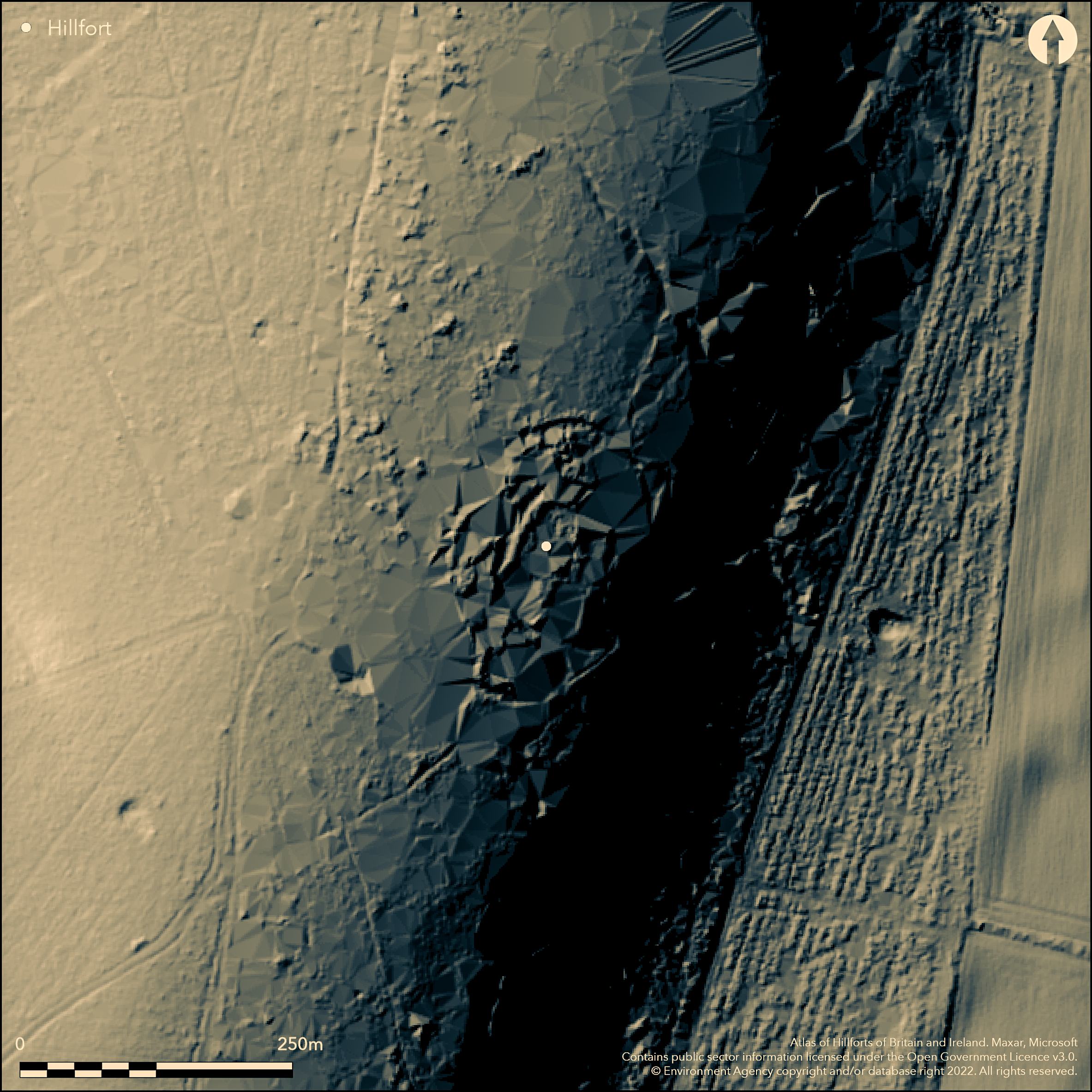
LiDAR 1m DTM Hillshade
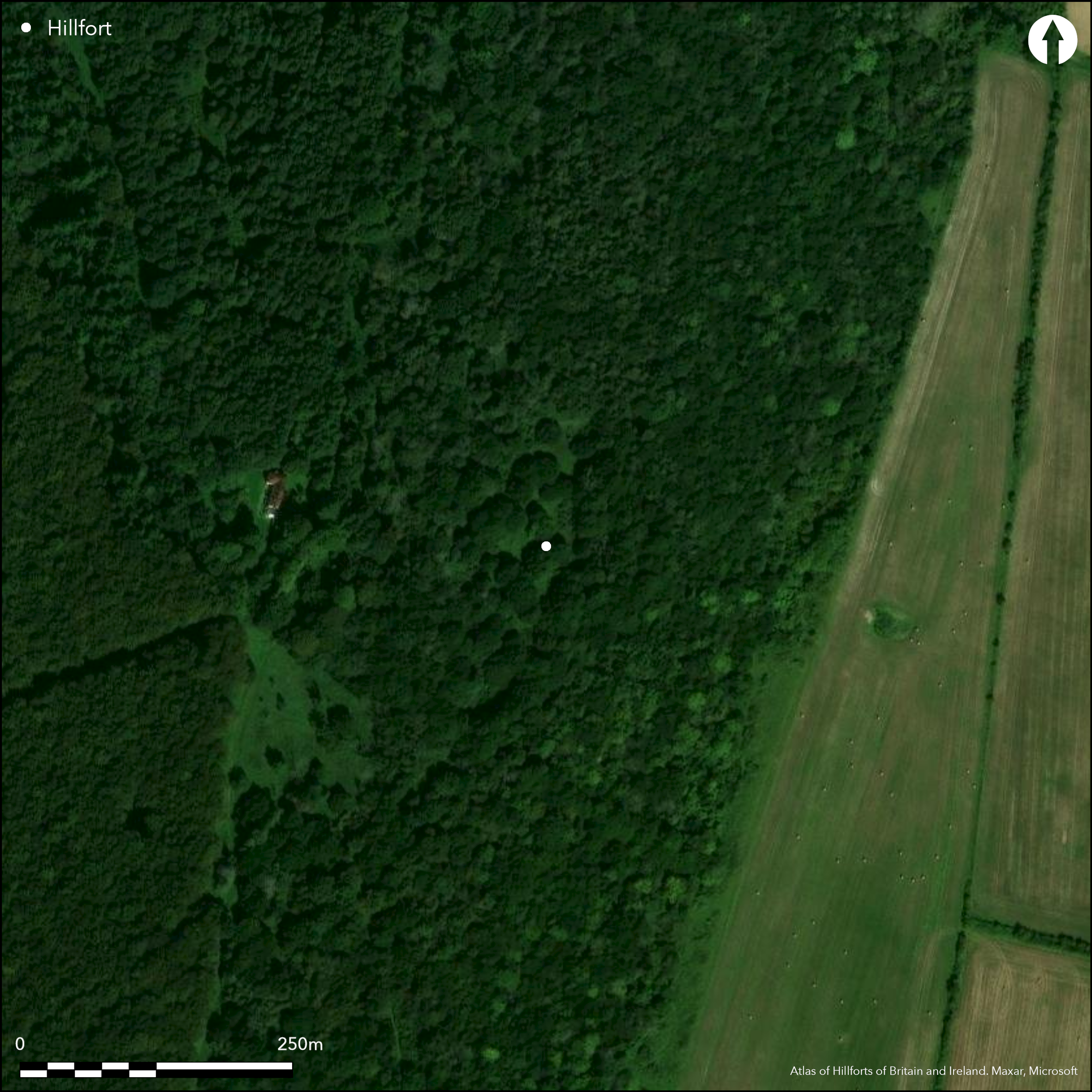
Satellite Imagery
LiDAR 1m DTM Hillshade
Satellite Imagery
Scroll left/right to view further images.
HER: West Sussex MWS3729 (None)
NMR: SU 81 SW 18 (246477)
SM: 1008375
NGR: SU82971265
X: 482966 Y: 112659 (OSGB36)
Multiple enclosure hillfort, sited on ESE-facing sloping ground just below summit of ridge of Sussex Downs. Very steep slopes on E sides, steep elsewhere. Two concentric rings of oval-shaped ramparts 29m apart, each with substantial ditch. Inner ring greater with bank 8.7m wide and 2m high, surrounded by ditch 9.3m wide and 1.7m deep, enclosing c.0.3ha. Outer circuit bank 0.5m high and 2.4m wide with ditch 6.8m wide and 1m deep enclosing c1.4ha. Slight counterscarps to ditches, infilled over time. To SE, where very steep, rampart fades into hillside. Entrance to inner enclosure on SE, downslope side of ring formed by a 7.5m break in the ramparts. Just to the S, a slight outer bank, which follows the alignment of the E side of the inner ring, further defines the entrance. Part excavated 1953-55 (Boyden 1956), showing rampart ditches of V-section and originally 1.4m deeper than present level. Finds from the ramparts included Iron Age and Romano-British pottery and AD bronze brooch. Partial excavation of circular depressions in inner enclosure showed them to be sites of at least three small Iron Age structures with post holes. Some modern chalk digging disturbance to ditch and tree root damage. C. 19th century SSW-NNE orientated low boundary bank crosses fort. On 1st Ed. OS map (1874).
Citizen Science: ✗
Reliability of Data: Confirmed
Reliability of Interpretation: Confirmed
X: -91434 Y: 6604928 (EPSG: 3857)
Longitude: -0.8213680052651282 Latitude: 50.90738529707021 (EPSG:4326)
Country: England; None
Current County or Unitary Authority: West Sussex
Historic County: Sussex
Current Parish/Community/Council/Townland: West Dean; Marden Forest
Some modern chalk digging disturbance to ditch and tree root damage.
| Extant | ✓ |
| Cropmark | ✗ |
| Likely Destroyed | ✗ |
Overgrown with trees and scrub.
| Woodland | ✓ |
| Commercial Forestry Plantation | ✗ |
| Parkland | ✗ |
| Pasture (Grazing) | ✓ |
| Arable | ✗ |
| Scrub/Bracken | ✓ |
| Bare Outcrop | ✗ |
| Heather/Moorland | ✗ |
| Heath | ✗ |
| Built-up | ✗ |
| Coastal Grassland | ✗ |
| Other | ✗ |
Multiple enclosure hillfort, sited on ESE-facing sloping ground just below summit of ridge of Sussex Downs. Very steep slopes on E sides, steep elsewhere.
| Contour Fort | ✗ |
| Partial Contour Fort | ✗ |
| Promontory Fort | ✗ |
| Hillslope Fort | ✗ |
| Level Terrain Fort | ✗ |
| Marsh Fort | ✗ |
| Multiple Enclosure Fort | ✓ |
| Hilltop | ✗ |
| Coastal Promontory | ✗ |
| Inland Promontory | ✗ |
| Valley Bottom | ✗ |
| Knoll/Hillock/Outcrop | ✗ |
| Ridge | ✗ |
| Cliff/Plateau-edge/Scarp | ✗ |
| Hillslope | ✓ |
| Lowland | ✗ |
| Spur | ✗ |
Dominant Topographic Feature: Hillslope.
| North | ✗ |
| Northeast | ✗ |
| East | ✗ |
| Southeast | ✓ |
| South | ✗ |
| Southwest | ✗ |
| West | ✗ |
| Northwest | ✗ |
| Level | ✗ |
Altitude: 152.0m
Boundary Type: Parish/Townland
Early to middle Iron Age pottery found during excavations1953-5, together with Roman finds and a flint knife.
Reliability: B - Medium
| Pre 1200BC | ✗ |
| 1200BC - 800BC | ✗ |
| 800BC - 400BC | ✓ |
| 400BC - AD50 | ✓ |
| AD50 - AD400 | ✗ |
| AD400 - AD 800 | ✗ |
| Post AD800 | ✗ |
| Unknown | ✗ |
| Pre Hillfort: | None |
| Post Hillfort: | None |
| Artefactual: | Early to middle Iron Age pottery found during excavations 1953-5, together with Roman finds and a flint knife. |
In Aubrey's Monumenta Britannica (1665-1693). On 1st Ed. OS map (1874). Excavation J.R. Boyden 1953-5.
| 1st Identified Map Depiction (1874): | OS map. |
| 1st Identified Written Reference (None): | In Aubrey's Monumenta Britannica |
| Excavation (None): | J.R. Boyden. |
Partial excavation of circular depressions in inner enclosure showed them to be sites of at least three small Iron Age structures with postholes, fragments of daub. Early to middle Iron Age and Romano-British pottery found during excavations 1953-5, together with First century AD bronze brooch and a flint axe or knife. Fragments of daub and charcoal. Other finds included a 1st c. A.D. bronze brooch. Coin of Constans AD 337-50.
None
| None | ✓ |
| Spring | ✗ |
| Stream | ✗ |
| Pool | ✗ |
| Flush | ✗ |
| Well | ✗ |
| Other | ✗ |
On SW side of inner enclosure, just inside ramparts and sheltered by them, two roughly circular depressions to 1m deep. However, whether these were roundhouse sites or another type of structure uncertain.
| No Known Features | ✗ |
| Round Stone Structures | ✗ |
| Rectangular Stone Structures | ✗ |
| Curvilinear Platforms | ✗ |
| Other Roundhouse Evidence | ✗ |
| Pits | ✗ |
| Quarry Hollows | ✗ |
| Other | ✓ |
Partial excavation of roughly circular depressions in inner enclosure showed them to be sites of at least three small Iron Age structures with postholes and fragments of daub and charcoal. However, whether these were roundhouses or another type of structure uncertain.
| No Known Excavation | ✗ |
| Pits | ✗ |
| Postholes | ✓ |
| Roundhouses | ✗ |
| Rectangular Structures | ✗ |
| Roads/Tracks | ✗ |
| Quarry Hollows | ✗ |
| Other | ✓ |
| Nothing Found | ✗ |
None
| No Known Geophysics | ✓ |
| Pits | ✗ |
| Roundhouses | ✗ |
| Rectangular Structures | ✗ |
| Roads/Tracks | ✗ |
| Quarry Hollows | ✗ |
| Other | ✗ |
| Nothing Found | ✗ |
Early to middle Iron Age and Romano-British pottery found during excavations 1953-5, together with First century AD bronze brooch and a flint axe or knife. Fragments of daub and charcoal.Other finds included a 1st c. A.D. bronze brooch. Coin of Constans AD 337-50.
| No Known Finds | ✗ |
| Pottery | ✓ |
| Metal | ✗ |
| Metalworking | ✗ |
| Human Bones | ✗ |
| Animal Bones | ✗ |
| Lithics | ✓ |
| Environmental | ✓ |
| Other | ✓ |
None
| APs Not Checked | ✓ |
| None | ✗ |
| Roundhouses | ✗ |
| Rectangular Structures | ✗ |
| Pits | ✗ |
| Postholes | ✗ |
| Roads/Tracks | ✗ |
| Other | ✗ |
Entrance to inner enclosure on SE, downslope side of ring formed by a 7.5m break in the ramparts. Just to the S, a slight outer bank, which follows the alignment of the E side of the inner ring, further defines the entrance.
| None: | Total gaps not defined. |
| 2: | None |
Guard Chambers: ✗
Chevaux de Frise: ✗
| 1. Passage-way/Corridor (South east): | Entrance to inner enclosure. |
Two concentric rings of oval-shaped ramparts 29m apart, each with substantial ditch. Inner ring greater with bank 8.7m wide and 2m high, surrounded by ditch 9.3m wide and 1.7m deep. Outer circuit bank 0.5m high and 2.4m wide with ditch 6.8m wide and 1m deep. Slight counterscarps to ditches, infilled over time. To SE, where very steep, rampart fades into hillside. Part excavated 1953-55, showing rampart ditches of V-section and originally 1.4m deeper than present level.
| Area 1: | 1.4ha. |
| Area 2: | 0.3ha. |
| Total: | 1.4ha. |
Total Footprint Area: Noneha.
None
| ✗ | None |
| ✓ | None |
| NE Quadrant: | 2 |
| SE Quadrant: | 2 |
| SW Quadrant: | 2 |
| NW Quadrant: | 2 |
| Total: | 2 |
| Partial Univallate | ✗ |
| Univallate | ✗ |
| Partial Bivallate | ✗ |
| Bivallate | ✓ |
| Partial Multivallate | ✗ |
| Multivallate | ✗ |
| Unknown | ✗ |
| Partial Univallate | ✗ |
| Univallate | ✗ |
| Partial Bivallate | ✗ |
| Bivallate | ✗ |
| Partial Multivallate | ✗ |
| Multivallate | ✗ |
Slight counterscarps to ditches.
| None | ✗ |
| Earthen Bank | ✓ |
| Stone Wall | ✗ |
| Rubble | ✗ |
| Wall-walk | ✗ |
| Evidence of Timber | ✗ |
| Vitrification | ✗ |
| Other Burning | ✗ |
| Palisade | ✗ |
| Counter Scarp Bank | ✓ |
| Berm | ✗ |
| Unfinished | ✗ |
| Other | ✗ |
Part excavated 1953-55, showing rampart ditches of V-section and originally 1.4m deeper than present level.
| None | ✗ |
| Earthen Bank | ✓ |
| Stone Wall | ✗ |
| Murus Duplex | ✗ |
| Timber-framed | ✗ |
| Timber-laced | ✗ |
| Vitrification | ✗ |
| Other Burning | ✗ |
| Palisade | ✗ |
| Counter Scarp Bank | ✗ |
| Berm | ✗ |
| Unfinished | ✗ |
| No Known Excavation | ✗ |
| Other | ✓ |
| ✗ | None |
| ✓ | Part excavated 1953-55, showing rampart ditches of V-section and originally 1.4m deeper than present level. |
Number of Ditches: 2
| ✗ | None |
Boyden, J .R. 1956. Excavations at Goosehill Camp 1953-1955, 94, Sussex Archaeol Collect. 70-99.
Atlas of Hillforts:
Wikidata:
This work is licensed under CC BY-SA 4.0

 and should be cited as:
Lock, Gary and Ralston, Ian. 2024. Atlas of Hillforts of Britain and Ireland. Available at: https://hillforts.arch.ox.ac.uk
Document Version 1.1