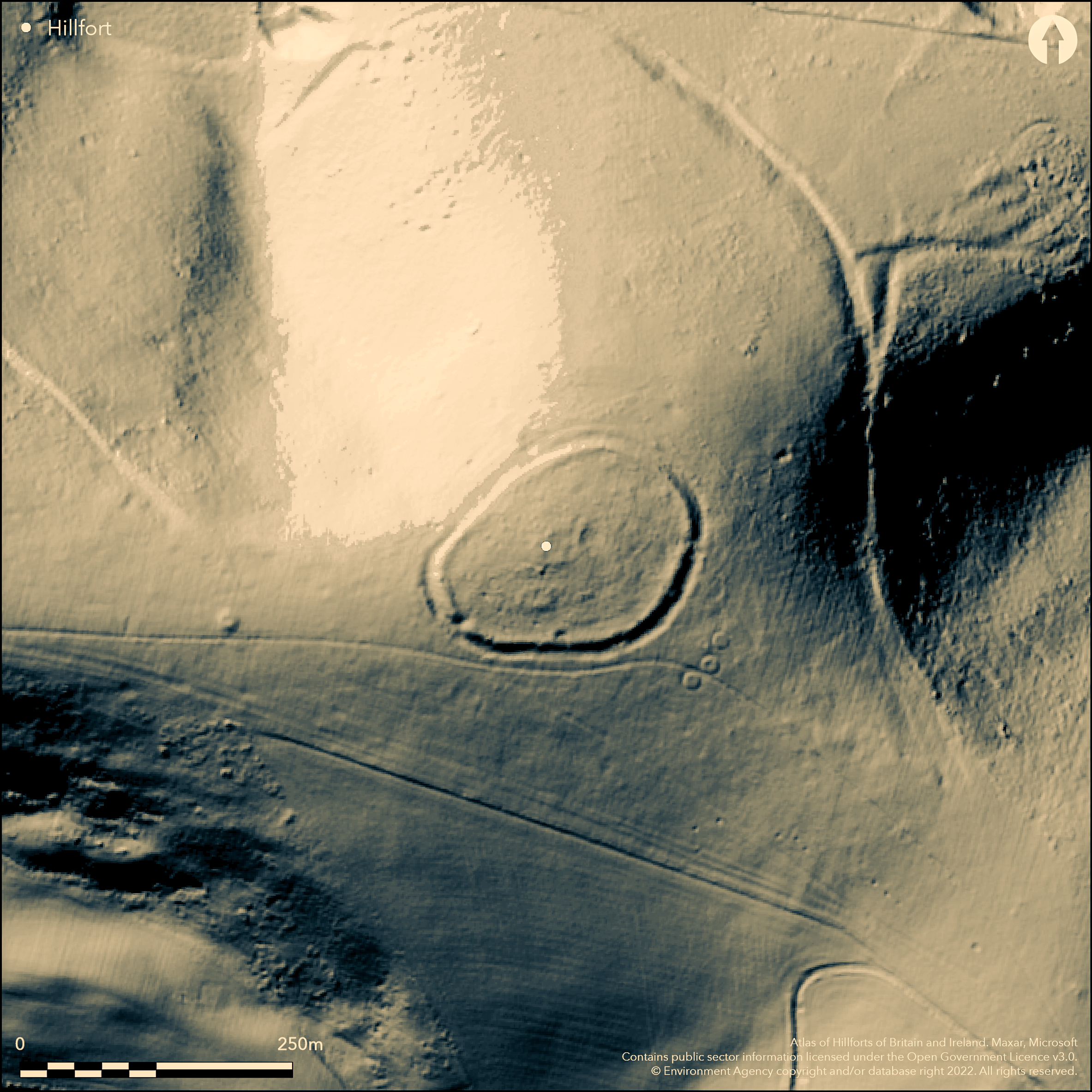
LiDAR 1m DTM Hillshade
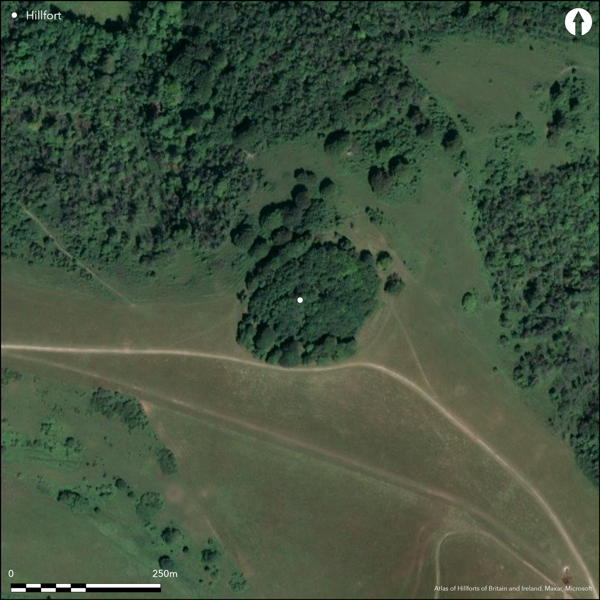
Satellite Imagery
LiDAR 1m DTM Hillshade
Satellite Imagery
Scroll left/right to view further images.
HER: West Sussex MWS5184 (None)
NMR: TQ 11 SW 1 (396437)
SM: 1015114
NGR: TQ13931206
X: 513921 Y: 112073 (OSGB36)
Univallate, contour hillfort located towards middle of roughly E-W aligned chalk ridge of Chanctonbury Hill, forming part of Sussex Downs. Extensive views towards Channel coast c. 8km to S and the Weald to N. Very steep surrounding slopes to NE, SE and NW, steep to S and moderate along ridge to SSE and WSW. Roughly circular enclosing c. 1.5ha. Defined by bank to 0.8m high and 8m wide, with ditch c. 8m wide and c. 0.7m deep. Excavations and investigations from late nineteenth century, the first possibly associated with two barrows to W of site and W section of rampart by A.H. Lane Fox (Pitt Rivers) 1899. Investigations 1909 (Mitchell 1910) showed bank of dumped chalk rubble and flinty-clay excavated from the surrounding ditch. Simple original entrance 6m wide gap in ramparts on E side. Lower Bronze Age pottery evidence and C14. Analysis of pottery sherds from ditch and contemporary refuse pits in 1909 excavations and further investigations 1977, 1990-91 (Bedwin 1980; Rudling 1989) suggest that hillfort in use from 6th to 4th centuries BC. After period of abandonment between mid 4th century BC and the mid 1st century AD, hillfort ramparts revamped and a revetment of regular chalk blocks built along inner side of bank. Fort then reused as a temenos, or sacred precinct, within which, at least, two Romano-Celtic temples constructed, with cella and ambulatory and entrance to building was on its E side, in line with original gateway through hillfort ramparts. Many associated finds, especially large amount of pig head and jaw bone, suggesting a form of porcine cult. Subsequent quarrying and siting of four WWII anti-aircraft gun emplacements caused disturbance to S and SW ramparts. Monument well known local landscape feature, visible on skyline as the site of a stand of beech trees first planted 1760 by then owner, Charles Goring. Trees continually replanted by Goring family to present. On 1st Ed. OS map (1875).
Citizen Science: ✗
Reliability of Data: Confirmed
Reliability of Interpretation: Confirmed
X: -42462 Y: 6603067 (EPSG: 3857)
Longitude: -0.38144086626171586 Latitude: 50.89684441101697 (EPSG:4326)
Country: England; None
Current County or Unitary Authority: West Sussex
Historic County: Sussex
Current Parish/Community/Council/Townland: Washington; Steyning
Subsequent quarrying and siting of four WWII anti-aircraft gun emplacements caused disturbance to S and SW ramparts. Monument well known local landscape feature, visible on skyline as the site of a stand of beech trees first planted 1760 by then owner, Charles Goring. Trees continually replanted by Goring family to present.
| Extant | ✓ |
| Cropmark | ✗ |
| Likely Destroyed | ✓ |
Woodland copse and rough grass. WWII anti-aircraft gun emplacements. Quarrying. SSSI.
| Woodland | ✓ |
| Commercial Forestry Plantation | ✗ |
| Parkland | ✗ |
| Pasture (Grazing) | ✓ |
| Arable | ✗ |
| Scrub/Bracken | ✗ |
| Bare Outcrop | ✗ |
| Heather/Moorland | ✗ |
| Heath | ✗ |
| Built-up | ✗ |
| Coastal Grassland | ✗ |
| Other | ✓ |
Univallate, contour hillfort located towards middle of roughly E-W aligned chalk ridge forming part of Sussex Downs. Extensive views towards Channel coast c. 8km to S and the Weald to N. Very sreep surrounding slopes to NE, SE and NW, steep to S and moderate along ridge to SSE and WSW.
| Contour Fort | ✓ |
| Partial Contour Fort | ✗ |
| Promontory Fort | ✗ |
| Hillslope Fort | ✗ |
| Level Terrain Fort | ✗ |
| Marsh Fort | ✗ |
| Multiple Enclosure Fort | ✗ |
| Hilltop | ✗ |
| Coastal Promontory | ✗ |
| Inland Promontory | ✗ |
| Valley Bottom | ✗ |
| Knoll/Hillock/Outcrop | ✗ |
| Ridge | ✓ |
| Cliff/Plateau-edge/Scarp | ✗ |
| Hillslope | ✗ |
| Lowland | ✗ |
| Spur | ✗ |
Dominant Topographic Feature: Ridge
| North | ✗ |
| Northeast | ✗ |
| East | ✗ |
| Southeast | ✗ |
| South | ✗ |
| Southwest | ✗ |
| West | ✗ |
| Northwest | ✗ |
| Level | ✓ |
Altitude: 229.0m
Boundary Type: Parish/Townland
Lower Bronze Age decorated wares from pit context. C14 date of 760+/-190 cal BC. Analysis of pottery sherds from ditch and contemporary refuse pits in 1909 excavations and further investigations 1977, 1990-91, suggests that hillfort in use from 6th to 4th centuries BC. After period of abandonment between mid 4th century BC and the mid 1st century AD, hillfort ramparts revamped and a revetment of regular chalk blocks built along inner side of bank. Fort then reused as a temenos, or sacred precinct, within which, at least, two Romano-Celtic temples constructed.
Reliability: B - Medium
| Pre 1200BC | ✗ |
| 1200BC - 800BC | ✗ |
| 800BC - 400BC | ✓ |
| 400BC - AD50 | ✗ |
| AD50 - AD400 | ✓ |
| AD400 - AD 800 | ✗ |
| Post AD800 | ✗ |
| Unknown | ✗ |
| Pre Hillfort: | None |
| Post Hillfort: | None |
| Artefactual: | Analysis of pottery sherds and refuse pits. |
| C14: | Date of 760+/-190 cal BC. |
On 1st Ed. OS map (1875). Excavation A.H. Lane Fox (Pitt Rivers) 1899. Excvavation G.S. Mitchell 1909. Excavation O.Bedwin 1977. Excavation D. Rudling 1990-91.
| 1st Identified Map Depiction (1875): | OS map. |
| Excavation (1899): | A.H. Lane Fox (Pitt Rivers). |
| Excavation (1909): | G.S. Mitchell. |
| Excavation (1977): | O. Bedwin. |
| Excavation (None): | D. Rudling. |
Lower Bronze Age decorated wares from pit context. Iron Age pottery sherds from ditch. Finds associated with temple include fragments of clay roof tile, window glass, oyster shells, pottery sherds and coins. Much pig bone. Medieval human bone.
None
| None | ✓ |
| Spring | ✗ |
| Stream | ✗ |
| Pool | ✗ |
| Flush | ✗ |
| Well | ✗ |
| Other | ✗ |
None
| No Known Features | ✓ |
| Round Stone Structures | ✗ |
| Rectangular Stone Structures | ✗ |
| Curvilinear Platforms | ✗ |
| Other Roundhouse Evidence | ✗ |
| Pits | ✗ |
| Quarry Hollows | ✗ |
| Other | ✗ |
Detail of Romano-Celtic temples. Refuse pits.
| No Known Excavation | ✗ |
| Pits | ✓ |
| Postholes | ✗ |
| Roundhouses | ✗ |
| Rectangular Structures | ✗ |
| Roads/Tracks | ✗ |
| Quarry Hollows | ✗ |
| Other | ✓ |
| Nothing Found | ✗ |
None
| No Known Geophysics | ✓ |
| Pits | ✗ |
| Roundhouses | ✗ |
| Rectangular Structures | ✗ |
| Roads/Tracks | ✗ |
| Quarry Hollows | ✗ |
| Other | ✗ |
| Nothing Found | ✗ |
Lower Bronze Age decorated wares from pit context. Iron Age pottery sherds from ditch. Finds associated with temple include fragments of clay roof tile, window glass, oyster shells, pottery sherds and coins. Much pig bone. Medieval human bone.
| No Known Finds | ✗ |
| Pottery | ✓ |
| Metal | ✓ |
| Metalworking | ✗ |
| Human Bones | ✓ |
| Animal Bones | ✓ |
| Lithics | ✗ |
| Environmental | ✓ |
| Other | ✓ |
None
| APs Not Checked | ✓ |
| None | ✗ |
| Roundhouses | ✗ |
| Rectangular Structures | ✗ |
| Pits | ✗ |
| Postholes | ✗ |
| Roads/Tracks | ✗ |
| Other | ✗ |
Simple original entrance 6m wide gap in ramparts on E side.
| None: | Total gaps not defined. |
| 2: | None |
Guard Chambers: ✗
Chevaux de Frise: ✗
| 1. Simple Gap (East): | None |
Defined by bank to 0.8m high and 8m wide, with ditch c. 8m wide and c. 0.7m deep. Investigations 1909 showed bank of dumped chalk rubble and flinty-clay excavated from the surrounding ditch. Revetment of regular chalk blocks built along inner side of bank.
| Area 1: | 1.5ha. |
| Total: | 1.5ha. |
Total Footprint Area: Noneha.
None
| ✗ | None |
| ✓ | None |
| NE Quadrant: | 1 |
| SE Quadrant: | 1 |
| SW Quadrant: | 1 |
| NW Quadrant: | 1 |
| Total: | 1 |
| Partial Univallate | ✗ |
| Univallate | ✓ |
| Partial Bivallate | ✗ |
| Bivallate | ✗ |
| Partial Multivallate | ✗ |
| Multivallate | ✗ |
| Unknown | ✗ |
| Partial Univallate | ✗ |
| Univallate | ✗ |
| Partial Bivallate | ✗ |
| Bivallate | ✗ |
| Partial Multivallate | ✗ |
| Multivallate | ✗ |
None
| None | ✗ |
| Earthen Bank | ✓ |
| Stone Wall | ✗ |
| Rubble | ✗ |
| Wall-walk | ✗ |
| Evidence of Timber | ✗ |
| Vitrification | ✗ |
| Other Burning | ✗ |
| Palisade | ✗ |
| Counter Scarp Bank | ✗ |
| Berm | ✗ |
| Unfinished | ✗ |
| Other | ✗ |
Investigations 1909 showed bank of dumped chalk rubble and flinty-clay excavated from the surrounding ditch. Revetment of regular chalk blocks built along inner side of bank.
| None | ✗ |
| Earthen Bank | ✓ |
| Stone Wall | ✓ |
| Murus Duplex | ✗ |
| Timber-framed | ✗ |
| Timber-laced | ✗ |
| Vitrification | ✗ |
| Other Burning | ✗ |
| Palisade | ✗ |
| Counter Scarp Bank | ✗ |
| Berm | ✗ |
| Unfinished | ✗ |
| No Known Excavation | ✗ |
| Other | ✗ |
| ✗ | None |
| ✓ | None |
Number of Ditches: 1
| ✗ | None |
Bedwin, O. 1980. Excavations at Chanctonbury Ring, Wiston, West Sussex, 1977, Britannia, 173-231.
Lane Fox, A.H. 1869. An examination into the character and probable origin of the hill forts of Sussex, Arch, 42, 43.
Mitchell, G.S. 1910. Excavations at Chanctonbury Ring, 1909, Sussex Archaeol Collect. 53, 131-137
Rudling, D. 1989. Chanctonbury Ring, Wiston, West Sussex. Assess Excavs, Dec 1989, unpublished report.
Atlas of Hillforts:
Wikidata:
This work is licensed under CC BY-SA 4.0

 and should be cited as:
Lock, Gary and Ralston, Ian. 2024. Atlas of Hillforts of Britain and Ireland. Available at: https://hillforts.arch.ox.ac.uk
Document Version 1.1