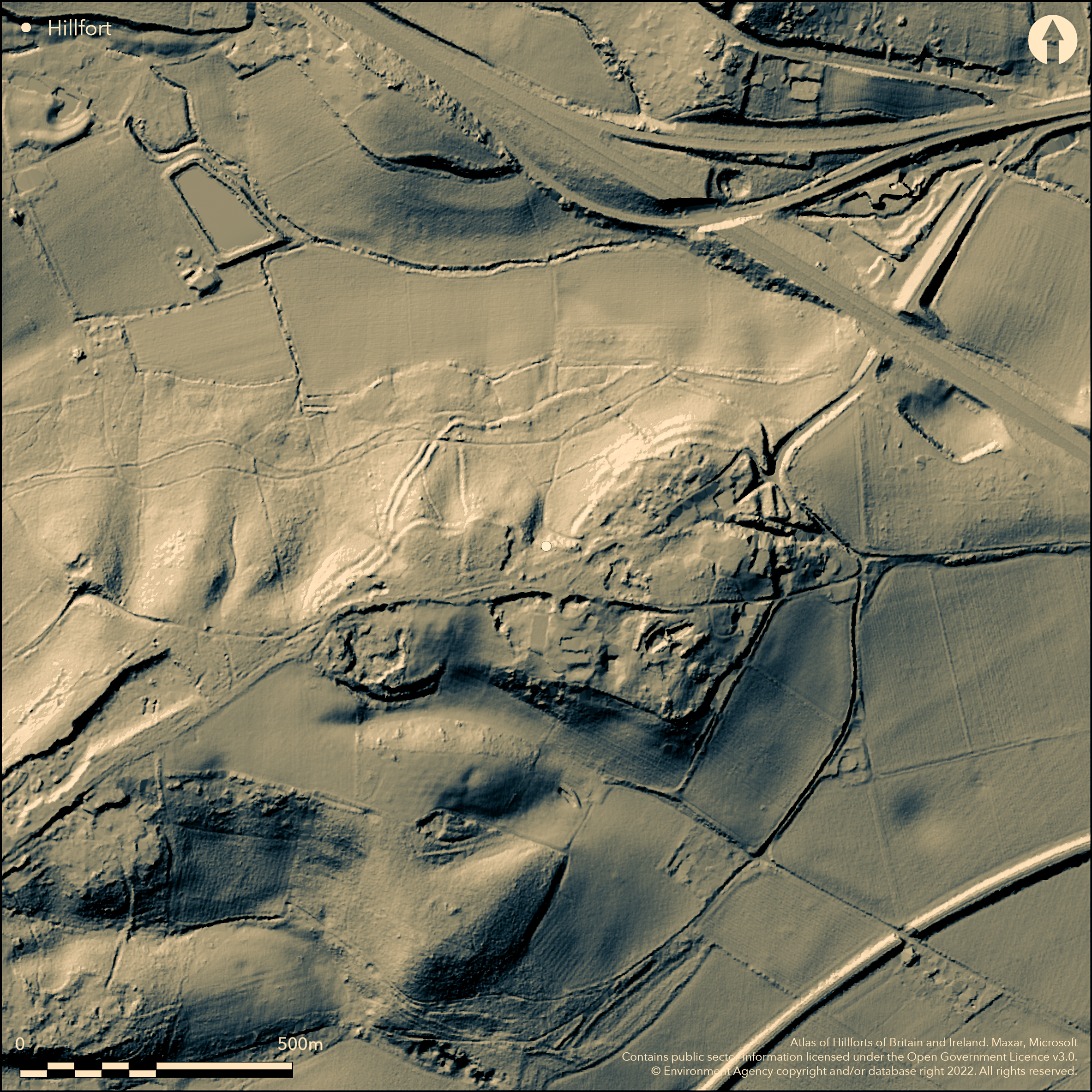
LiDAR 1m DTM Hillshade
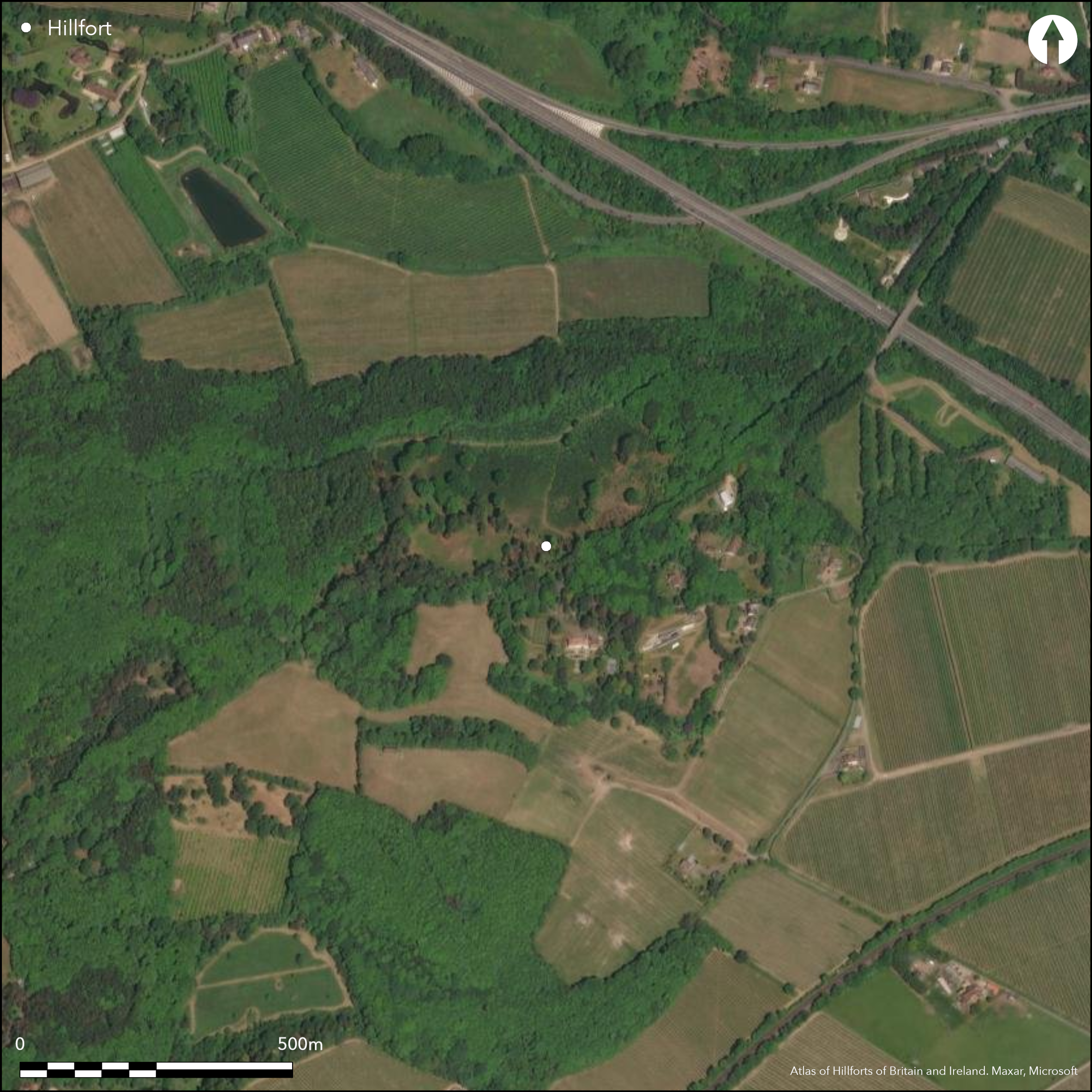
Satellite Imagery
LiDAR 1m DTM Hillshade
Satellite Imagery
Scroll left/right to view further images.
HER: Kent MKE4844 (None)
NMR: TR 15 NW 33 (464710)
SM: 1005169
NGR: TR 1167 5758
X: 611676 Y: 157589 (OSGB36)
A large univallate hillfort aligned on the Pilgrim's Way and lying to the N of Bigbury Wood. A bivallate, crescent-shaped annex or possible cattle compound is appended to the northern side. It occupies the eastern end of a gravel-capped spur to the NW of the River Great Stour at Hambledown. Curvilinear and amorphous in plan, the ramparts follow the 60m contour enclosing 10.7ha and comprise a single bank and external 4.8m wide ditch with a rounded V-shaped profile, beyond which is a counterscarp. The 3.2ha annex runs northwards across the contours. Work, inclusing survey, in 2015/16 has suggested that this is not an annex but a refortification as a response to Caesar's invasion (Haselgrove and Fitzpatrick). The naturally steep slopes around much of the site make further ramparts unnecessary. Possible entrances which now carry a modern road lie in the E and W. The site has produced an extensive range of metalwork including horse and vehicle fittings, weapons, a slave chain, tools and hearth fittings and is suggested by Cunliffe (2005, 166) to have the characteristics of an enclosed oppidum. The first finds of late Iron Age ironwork were recovered during gravel working and reported to the Royal Archaeological Institute (Brent 1861) but it was not until 1873 that was recognised as the site of an enclosure (Hussey 1874) and recorded on OS mapping. The site has undergone a number of small excavations; in 1933 and 1934 (Jessup and Cook 1936), and again in 1962-3 when two large postholes, probably from a palisade were revealed in the ditch to the N of the proposed eastern entrance. Further finds including early Iron Age pottery and a slingbolt were recovered (unpublished report in Kent HER). The remains of a hut circle and evidence for the ramparts on the eastern side of the hillfort were identified during excavations in 1978-80 (unpublished report in Kent HER). A watching brief in 2009-11 by Canterbury Archaeological Trust (unpublished), during fencing works, located a dark soil layer within the inner rampart which was found to contain burnt flint, prehistoric pottery and a copper alloy harness ring. Charcoal from this layer was radiocarbon dated to the late 4th or early 3rd century BC (Burleigh et al. 1982). This deposit was thought to be similar to that identified during the 1933-34 excavation. The ramparts are now partially destroyed in the S by gravel quarrying. In the E it has been disturbed by the modern road and a small mineral railway. It is possibly one of earliest forts to have been attacked by Caesar (Dyer 2001). The site is recorded on 1873 1:2,500 OS mapping.
Citizen Science: ✗
Reliability of Data: Confirmed
Reliability of Interpretation: Confirmed
X: 115070 Y: 6670625 (EPSG: 3857)
Longitude: 1.0336871115741146 Latitude: 51.27804415287851 (EPSG:4326)
Country: England; None
Current County or Unitary Authority: Kent
Historic County: Kent
Current Parish/Community/Council/Townland: Harbledown and Rough Common; Chartham; Thanington Without
Destroyed in the S
| Extant | ✓ |
| Cropmark | ✗ |
| Likely Destroyed | ✓ |
Grassland, small number of buildings and former gravel quarries. 2014 Google Earth imagery shows the woodland mostly felled and replanted.
| Woodland | ✗ |
| Commercial Forestry Plantation | ✓ |
| Parkland | ✗ |
| Pasture (Grazing) | ✗ |
| Arable | ✓ |
| Scrub/Bracken | ✗ |
| Bare Outcrop | ✗ |
| Heather/Moorland | ✗ |
| Heath | ✗ |
| Built-up | ✗ |
| Coastal Grassland | ✗ |
| Other | ✓ |
Contour fort occupying the summit of a spur at 71m OD
| Contour Fort | ✓ |
| Partial Contour Fort | ✗ |
| Promontory Fort | ✗ |
| Hillslope Fort | ✗ |
| Level Terrain Fort | ✗ |
| Marsh Fort | ✗ |
| Multiple Enclosure Fort | ✗ |
| Hilltop | ✓ |
| Coastal Promontory | ✗ |
| Inland Promontory | ✗ |
| Valley Bottom | ✗ |
| Knoll/Hillock/Outcrop | ✗ |
| Ridge | ✓ |
| Cliff/Plateau-edge/Scarp | ✗ |
| Hillslope | ✗ |
| Lowland | ✗ |
| Spur | ✓ |
Dominant Topographic Feature: Gravel-capped spur
| North | ✗ |
| Northeast | ✗ |
| East | ✗ |
| Southeast | ✗ |
| South | ✗ |
| Southwest | ✗ |
| West | ✗ |
| Northwest | ✗ |
| Level | ✓ |
Altitude: 71.0m
The parish boundary between Harbledown & Rough Common and Chartham lies to the SW. The parish boundary between Harbledown & Rough Common and Thanington Without lies to the SE
Boundary Type: Parish/Townland
Two charcoal samples taken by Jessup and Cook in 1936 submitted for analysis by F.H. Thompson gave dates of 2080±45 and 1920±35 (Burleigh et al. 1982). Late Iron Age metalwork recovered during gravel workings and excavation
Reliability: B - Medium
| Pre 1200BC | ✗ |
| 1200BC - 800BC | ✗ |
| 800BC - 400BC | ✗ |
| 400BC - AD50 | ✓ |
| AD50 - AD400 | ✓ |
| AD400 - AD 800 | ✗ |
| Post AD800 | ✗ |
| Unknown | ✗ |
| Pre Hillfort: | None |
| Post Hillfort: | None |
| Artefactual: | None |
| C14: | None |
General reference in Brent (1861). Recorded on 1873, 1:2,500 OS mapping. Field investigation 1963. Partially excavated in 1933-4, 1962-3 and 1978-80. Earthworks re-surveyed in 2008 by Canterbury Archaeological Trust carried following coppice clearance. Watching brief 2009-11. Scheduled
| 1st Identified Written Reference (1861): | None |
| 1st Identified Map Depiction (1873): | None |
| Other (1954): | Scheduled |
| Other (1963): | Field investigation |
| Earthwork Survey (2008): | Canterbury Archaeological Trust |
| Earthwork Survey (2015): | Al Oswald. |
| Excavation (None): | None |
| Excavation (None): | None |
| Excavation (None): | None |
| Other (None): | Watching brief |
The remains of a hut circle was identified during excavations in 1978-80. A range of finds from excavation.
River Great Stour to the S, stream to the N
| None | ✓ |
| Spring | ✗ |
| Stream | ✗ |
| Pool | ✗ |
| Flush | ✗ |
| Well | ✗ |
| Other | ✗ |
None
| No Known Features | ✓ |
| Round Stone Structures | ✗ |
| Rectangular Stone Structures | ✗ |
| Curvilinear Platforms | ✗ |
| Other Roundhouse Evidence | ✗ |
| Pits | ✗ |
| Quarry Hollows | ✗ |
| Other | ✗ |
Hut circle
| No Known Excavation | ✗ |
| Pits | ✗ |
| Postholes | ✗ |
| Roundhouses | ✓ |
| Rectangular Structures | ✗ |
| Roads/Tracks | ✗ |
| Quarry Hollows | ✗ |
| Other | ✗ |
| Nothing Found | ✗ |
None
| No Known Geophysics | ✓ |
| Pits | ✗ |
| Roundhouses | ✗ |
| Rectangular Structures | ✗ |
| Roads/Tracks | ✗ |
| Quarry Hollows | ✗ |
| Other | ✗ |
| Nothing Found | ✗ |
Late Iron Age Aylesford-Swaling pottery sherds; metalwork including a plough share, coulter, cattle goad and horse gear and vehicle fittings. Burnt clay slingbolt,slave chain with collars, fire dogs, agricultural implements, kitchenware and weapons. A description of the finds recovered between 1861 and 1895 is given in Jessup (1932)
| No Known Finds | ✗ |
| Pottery | ✓ |
| Metal | ✓ |
| Metalworking | ✓ |
| Human Bones | ✗ |
| Animal Bones | ✗ |
| Lithics | ✓ |
| Environmental | ✗ |
| Other | ✓ |
Woodland
| APs Not Checked | ✓ |
| None | ✗ |
| Roundhouses | ✗ |
| Rectangular Structures | ✗ |
| Pits | ✗ |
| Postholes | ✗ |
| Roads/Tracks | ✗ |
| Other | ✗ |
Possible entrances, although unconfirmed, lie in the E and W which now carry a modern road.
| 3: | None |
| 2: | None |
Guard Chambers: ✗
Chevaux de Frise: ✗
| 1. Simple Gap (East): | None |
| 2. Simple Gap (West): | None |
Large univallate enclosure, with bivallate, crescent-shaped annex or possible cattle compound appended to the northern side. Curvilinear and amorphous in plan, it comprises a single bank and external 4.8m wide rounded V-shaped ditch enclosing 10.7ha, beyond which is a counterscarp. The 3.2ha annex runs northwards across the contours. The naturally steep slopes around much of the site make further defences unnecessary.
| Area 1: | 10.7ha. |
| Total: | 10.7ha. |
Total Footprint Area: 15.9ha.
None
| ✓ | Whole site footprint estimated from 1937-61 OS mapping. Evidence for a possible palisade within the ditch suggests an earlier phase of enclosure |
| ✓ | Three rampart in N including those of the annex. Single rampart elsewhere, now lost in the S |
| NE Quadrant: | 3 |
| SE Quadrant: | 1 |
| SW Quadrant: | 1 |
| NW Quadrant: | 3 |
| Total: | 3 |
| Partial Univallate | ✓ |
| Univallate | ✗ |
| Partial Bivallate | ✗ |
| Bivallate | ✗ |
| Partial Multivallate | ✓ |
| Multivallate | ✗ |
| Unknown | ✗ |
| Partial Univallate | ✗ |
| Univallate | ✓ |
| Partial Bivallate | ✗ |
| Bivallate | ✗ |
| Partial Multivallate | ✗ |
| Multivallate | ✗ |
None
| None | ✗ |
| Earthen Bank | ✓ |
| Stone Wall | ✗ |
| Rubble | ✗ |
| Wall-walk | ✗ |
| Evidence of Timber | ✗ |
| Vitrification | ✗ |
| Other Burning | ✗ |
| Palisade | ✗ |
| Counter Scarp Bank | ✓ |
| Berm | ✗ |
| Unfinished | ✗ |
| Other | ✗ |
None
| None | ✗ |
| Earthen Bank | ✓ |
| Stone Wall | ✗ |
| Murus Duplex | ✗ |
| Timber-framed | ✗ |
| Timber-laced | ✗ |
| Vitrification | ✗ |
| Other Burning | ✗ |
| Palisade | ✓ |
| Counter Scarp Bank | ✗ |
| Berm | ✗ |
| Unfinished | ✗ |
| No Known Excavation | ✗ |
| Other | ✗ |
| ✗ | None |
| ✓ | None |
Number of Ditches: 1
| ✓ | Possible annex or cattle compound. Bvallate enclosing 3.2ha lying on a hillslope to the N of the main enclosure |
Brent, J. 1861. Roman cemeteries in Canterbury, with some conjectures concerning its earliest inhabitants. Archaeol Cantiana 4: 27-42
Burleigh, R., Mathews, K. and Ambers, J. 1982. Radiocarbon 1982 British Museum Natural Radiocarbon Measurements XIV. Radiocarbon, 24, No.3, 229-261
Canterbury Archaeological Trust, 2012, Archaeological watching brief on fencing work at Bigbury Camp, Kent. Unpublished
Cunliffe, B. 2005. Iron Age Communities in Britain. 4th Ed. Routledge
Dyer, J. 2001. Discovering Prehistoric England: A gazetteer of prehistoric sites. Shire Publications.
Haselgrove, C. and Fitzpatrick, A. In the footsteps of Caesar: the archaeology of the first Roman invasions of Britain, see: https://www2.le.ac.uk/departments/archaeology/research/projects/footsteps-of-caesar [accessed November 2016].
Hussey, R.C. 1874. The British Settllement at Bigbury Wood, Harbledown. Archaeol Cantiana 9, 13-15
Jessup, R.F. 1932. Bigberry Camp, Harbledown, Kent. Arch J. 89:1, 87-115
Jessup, R.F. and Cook, N.C. 1936. Excavations at Bigberry Camp, Harbledown. Kent Archaeological Society Archaeol Cantiana. 48 Page(s)151-68
Sparey-Green, C. 2011. Archaeological Watching Brief on fencing work at Bugbury Camp, Kent. 2011/82. Canterbury Archaeological Trust. BC-WB-09BCF-WB-10. Unpublished
Atlas of Hillforts:
Wikidata:
This work is licensed under CC BY-SA 4.0

 and should be cited as:
Lock, Gary and Ralston, Ian. 2024. Atlas of Hillforts of Britain and Ireland. Available at: https://hillforts.arch.ox.ac.uk
Document Version 1.1