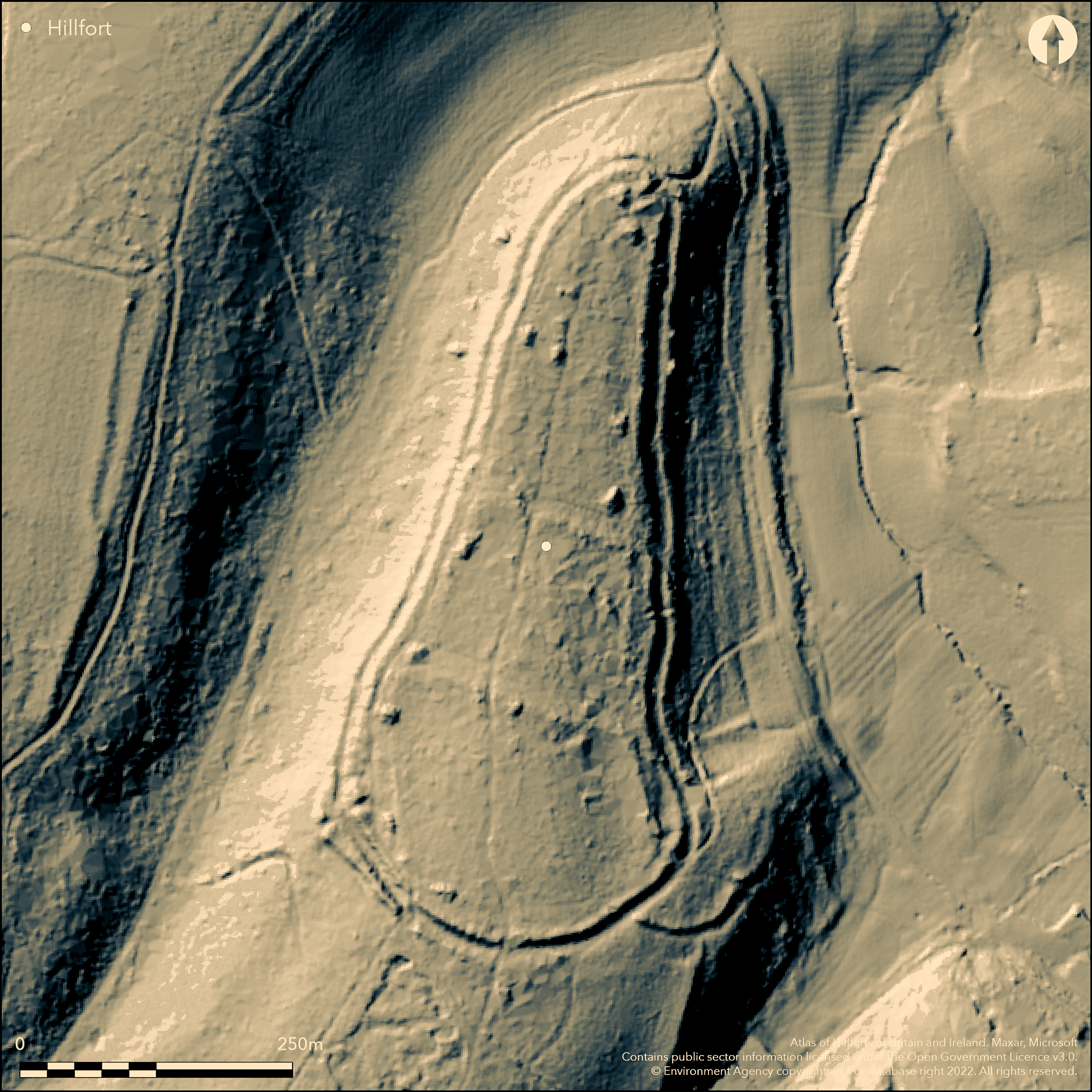
LiDAR 1m DTM Hillshade
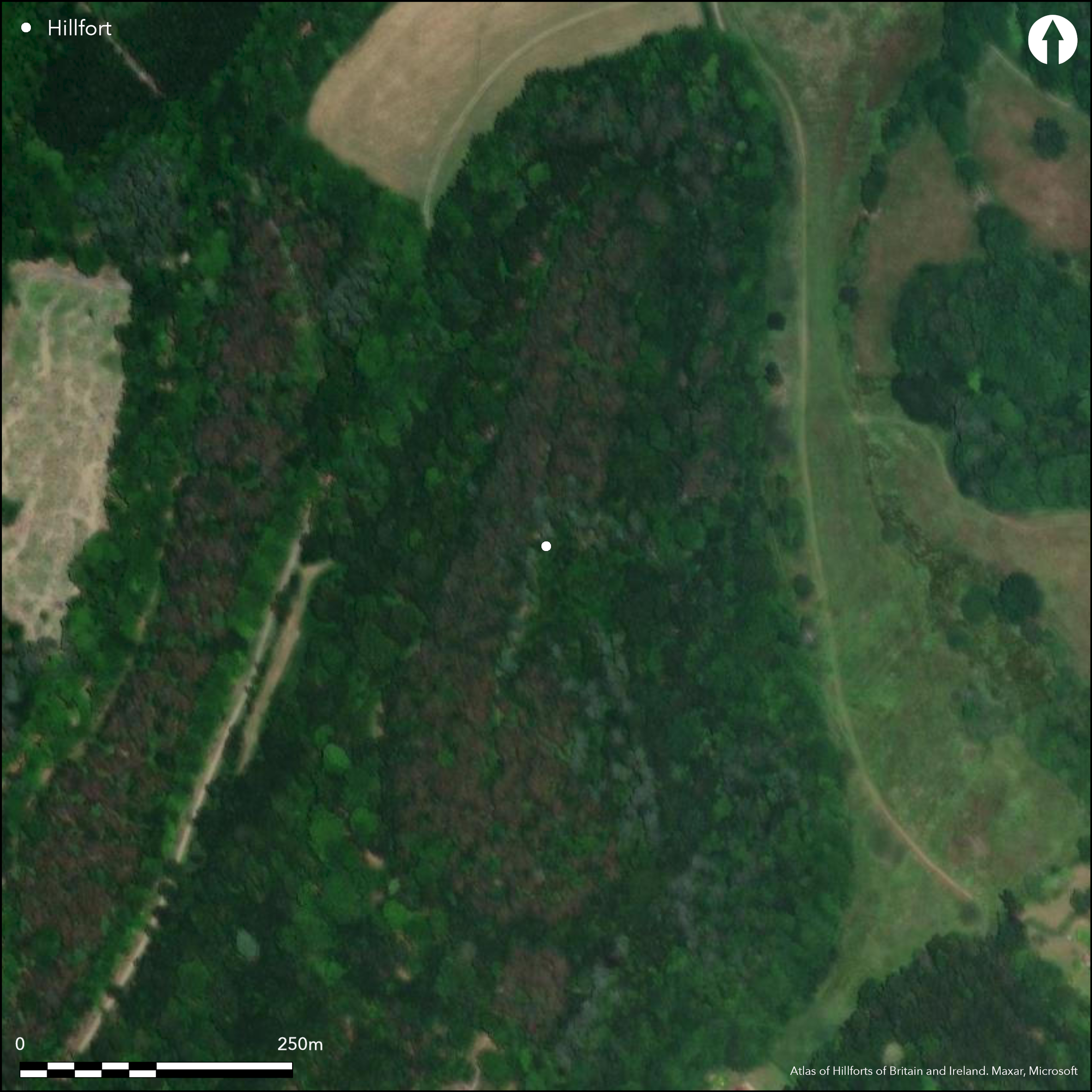
Satellite Imagery
LiDAR 1m DTM Hillshade
Satellite Imagery
Scroll left/right to view further images.
HER: Kent MKE90 (None)
NMR: TQ 45 SW 30 (407515)
SM: 1005180
NGR: TQ 4427 5227
X: 544278 Y: 152276 (OSGB36)
A large, mostly univallate hillfort occupying a thickly wooded hilltop overlooking Westerham. It lies on a steep-sided, N-sloping promontory of the Chart Hills at between 160-190m OD. The site is an elongated oval in plan enclosing 4.45ha, comprising a bank, ditch and counterscarp. A second bank is shown on a plan by Robertson (1886) in the SW. Excavated by Piercy Fox in 1961 during a programme of tree-felling and in 1970 (Philps 1970) following bulldozer damage. The 1961 excavation showed two distinctly different construction methods for the double ramparts, which had used turf for bonding in addition to the stone revetment. The distance between the crest of the banks was measured at 13.4m. In 1970, two trenches across sections of the rampart determined it was constructed of yellow sandy loam with sandstone rubble. Quarry ditches found behind the rampart had been used to supply core bank material, with the bank enhanced further by soil from the ditch and by scarping the natural slopes. Large sandstone blocks were used for revetting. The defences were considered by Philps (1970) to have once stood over 1.8-3m high. Beyond the rampart is a V-shaped, 8.5m wide and 2.7m deep ditch and a counterscarp 0.6m high. Trenches placed in the SW and E during the 1961 excavation showed the ditch was V-shaped, 8.5m wide and 2.7m deep. Four gaps lie around the circuit, two of which have in-turning terminals in the SW and NE and are considered possibly original. This contradicts Robertson (1886) who placed the probable entrance in the SE. Mechanical stripping of a large area of the interior in 1961 revealed nothing, although pits were discovered during the 1970's excavation beneath and behind the rampart which produced finds of a domestic nature including pottery and a paste bead (Philps 1970). Banks, visible across the interior of the hillfort are possibly later field boundaries. The rampart is most prominent in the S but destroyed along the western side and the ditch has the appearance of a terrace-way. Robertson (1886) showed the outer earthwork and ditch in the S as levelled at that time. Preserved ancient soils from the 1961 excavation indicated a forest intermixed with cultivation and areas of scrub woodland at the time of the construction of the hillfort (Dimbleby 1970). Recorded on 1909 1:2,500 OS mapping. Scheduled.
Citizen Science: ✗
Reliability of Data: Confirmed
Reliability of Interpretation: Confirmed
X: 7347 Y: 6665875 (EPSG: 3857)
Longitude: 0.06599945119802689 Latitude: 51.251348554179636 (EPSG:4326)
Country: England
Current County or Unitary Authority: Kent
Historic County: Kent
Current Parish/Community/Council/Townland: Westerham
The ramparts have been part mutilated or cut through in places. In the W the bank has been levelled with the ditch forming a terrace way
| Extant | ✓ |
| Cropmark | ✗ |
| Likely Destroyed | ✗ |
None
| Woodland | ✓ |
| Commercial Forestry Plantation | ✗ |
| Parkland | ✗ |
| Pasture (Grazing) | ✗ |
| Arable | ✗ |
| Scrub/Bracken | ✗ |
| Bare Outcrop | ✗ |
| Heather/Moorland | ✗ |
| Heath | ✗ |
| Built-up | ✗ |
| Coastal Grassland | ✗ |
| Other | ✗ |
A hillslope fort lying on a steep-sided, N-S sloping promontory of the Chart Hills at between 160-190m OD
| Contour Fort | ✗ |
| Partial Contour Fort | ✗ |
| Promontory Fort | ✗ |
| Hillslope Fort | ✓ |
| Level Terrain Fort | ✗ |
| Marsh Fort | ✗ |
| Multiple Enclosure Fort | ✗ |
| Hilltop | ✗ |
| Coastal Promontory | ✗ |
| Inland Promontory | ✓ |
| Valley Bottom | ✗ |
| Knoll/Hillock/Outcrop | ✗ |
| Ridge | ✗ |
| Cliff/Plateau-edge/Scarp | ✗ |
| Hillslope | ✓ |
| Lowland | ✗ |
| Spur | ✗ |
Dominant Topographic Feature: Promontory
| North | ✓ |
| Northeast | ✗ |
| East | ✗ |
| Southeast | ✗ |
| South | ✗ |
| Southwest | ✗ |
| West | ✗ |
| Northwest | ✗ |
| Level | ✗ |
Altitude: 173.0m
N/A
Second or first century BC pottery, glass bead, fragment of clay crucible
Reliability: B - Medium
| Pre 1200BC | ✗ |
| 1200BC - 800BC | ✗ |
| 800BC - 400BC | ✗ |
| 400BC - AD50 | ✓ |
| AD50 - AD400 | ✗ |
| AD400 - AD 800 | ✗ |
| Post AD800 | ✗ |
| Unknown | ✗ |
| Pre Hillfort: | None |
| Post Hillfort: | None |
| Artefactual: | None |
Brief mention and detailed plan by Robertson (1886, 135-137). Recorded on 1909 1:2,500 OS mapping. Field investigation 1963. Excavated in 1961 and 1970. Scheduled
| 1st Identified Written Reference (1886): | None |
| Earthwork Survey (1886): | None |
| 1st Identified Map Depiction (1909): | None |
| Other (1946): | Scheduled |
| Excavation (1961): | None |
| Other (1963): | Field investigation |
| Excavation (1970): | None |
Pits, a hearth and quarry hollows were recorded during excavation. Pottery was also recovered
Spring below the camp reported by Piercy Fox (1970)
| None | ✓ |
| Spring | ✗ |
| Stream | ✗ |
| Pool | ✗ |
| Flush | ✗ |
| Well | ✗ |
| Other | ✗ |
None
| No Known Features | ✓ |
| Round Stone Structures | ✗ |
| Rectangular Stone Structures | ✗ |
| Curvilinear Platforms | ✗ |
| Other Roundhouse Evidence | ✗ |
| Pits | ✗ |
| Quarry Hollows | ✗ |
| Other | ✗ |
Hearth
| No Known Excavation | ✗ |
| Pits | ✓ |
| Postholes | ✗ |
| Roundhouses | ✗ |
| Rectangular Structures | ✗ |
| Roads/Tracks | ✗ |
| Quarry Hollows | ✓ |
| Other | ✓ |
| Nothing Found | ✗ |
None
| No Known Geophysics | ✓ |
| Pits | ✗ |
| Roundhouses | ✗ |
| Rectangular Structures | ✗ |
| Roads/Tracks | ✗ |
| Quarry Hollows | ✗ |
| Other | ✗ |
| Nothing Found | ✗ |
Paste bead and pottery
| No Known Finds | ✗ |
| Pottery | ✓ |
| Metal | ✗ |
| Metalworking | ✗ |
| Human Bones | ✗ |
| Animal Bones | ✗ |
| Lithics | ✗ |
| Environmental | ✓ |
| Other | ✓ |
Woodland
| APs Not Checked | ✓ |
| None | ✗ |
| Roundhouses | ✗ |
| Rectangular Structures | ✗ |
| Pits | ✗ |
| Postholes | ✗ |
| Roads/Tracks | ✗ |
| Other | ✗ |
Four gaps lie around the circuit, two of which have in-turning terminals in the SW and NE and are possibly original.
| 4: | None |
| 2: | None |
Guard Chambers: ✗
Chevaux de Frise: ✗
| 1. In-turned (South west): | None |
| 2. In-turned (North east): | None |
Elongated oval in plan enclosing 4.45ha, comprising a bank, ditch and counterscarp. A second bank is recorded in the SW. The 1961 excavation showed two distinctly different construction methods for the double ramparts in the SW which had used turf for bonding, in addition to the stone revetment. The distance between the crest of the banks was measured at 13.4m. The main rampart was constructed of yellow sandy loam with sandstone rubble. Quarry ditches behind the rampart had been used to supply core bank material, with the bank enhanced further by soil from the ditch and by scarping the natural slopes. Large sandstone blocks were used for revetting. The defences were considered by Philp (1970) to have once stood over 1.8-3m high. Beyond the rampart is a V-shaped, 8.5m wide and 2.7m deep ditch and a counterscarp 0.6m high.
| Area 1: | 4.45ha. |
| Total: | 4.45ha. |
Total Footprint Area: 7.9ha.
None
| ✗ | Area estimated from OS mapping |
| ✓ | Now destroyed in places |
| NE Quadrant: | 1 |
| SE Quadrant: | 1 |
| SW Quadrant: | 2 |
| NW Quadrant: | 1 |
| Total: | 2 |
| Partial Univallate | ✓ |
| Univallate | ✗ |
| Partial Bivallate | ✓ |
| Bivallate | ✗ |
| Partial Multivallate | ✗ |
| Multivallate | ✗ |
| Unknown | ✗ |
| Partial Univallate | ✗ |
| Univallate | ✗ |
| Partial Bivallate | ✗ |
| Bivallate | ✗ |
| Partial Multivallate | ✗ |
| Multivallate | ✗ |
None
| None | ✗ |
| Earthen Bank | ✓ |
| Stone Wall | ✗ |
| Rubble | ✗ |
| Wall-walk | ✗ |
| Evidence of Timber | ✗ |
| Vitrification | ✗ |
| Other Burning | ✗ |
| Palisade | ✗ |
| Counter Scarp Bank | ✗ |
| Berm | ✗ |
| Unfinished | ✗ |
| Other | ✗ |
Yellow sandy loam with sandstone rubble.
| None | ✗ |
| Earthen Bank | ✓ |
| Stone Wall | ✗ |
| Murus Duplex | ✗ |
| Timber-framed | ✗ |
| Timber-laced | ✗ |
| Vitrification | ✗ |
| Other Burning | ✗ |
| Palisade | ✗ |
| Counter Scarp Bank | ✓ |
| Berm | ✗ |
| Unfinished | ✗ |
| No Known Excavation | ✗ |
| Other | ✓ |
| ✗ | None |
| ✓ | None |
Number of Ditches: 1
| ✗ | None |
Dimbleby, G.W. 1970. Pollen Analysis. In N. Piercy-Fox, The Iron Age Camp at Squerryes, Westerham. Archaeol Cantiana 32-33
Philps, B. 1970. The Iron Age Hillfort at Squerryes Park, Westerham. Kent Archaeol Rev 22.
Piercy Fox, N. 1970 Excavations of the Iron Age Camp at Squerryes, Westerham. Archaeol Cantiana 85, 29-33 illus figs 1-3
Robertson, S. 1886. Squerryes Court, the Camp and the Pictures. Archaeol Cantiana 16. 134-141
Atlas of Hillforts:
Wikidata:
This work is licensed under CC BY-SA 4.0

 and should be cited as:
Lock, Gary and Ralston, Ian. 2024. Atlas of Hillforts of Britain and Ireland. Available at: https://hillforts.arch.ox.ac.uk
Document Version 1.1