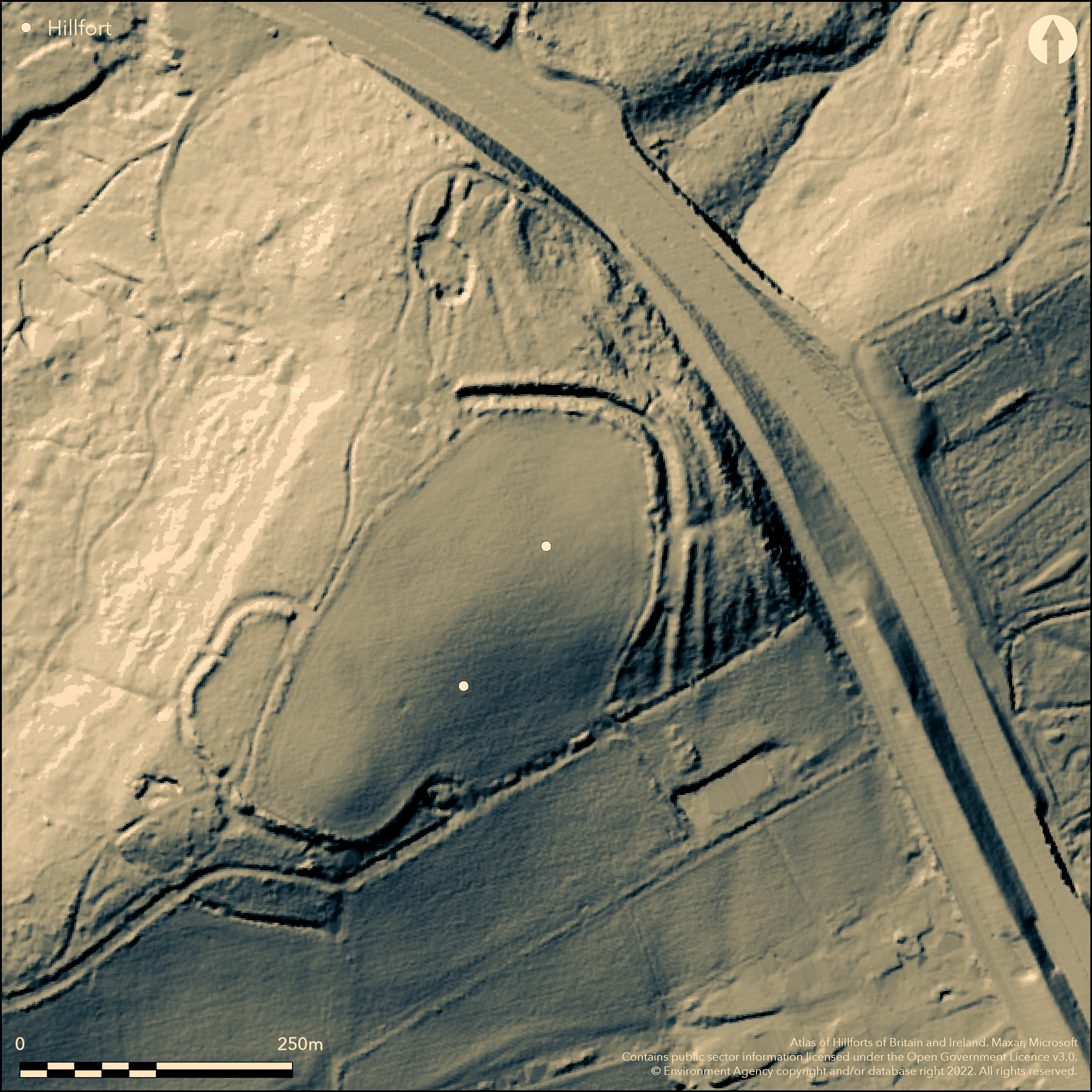
LiDAR 1m DTM Hillshade
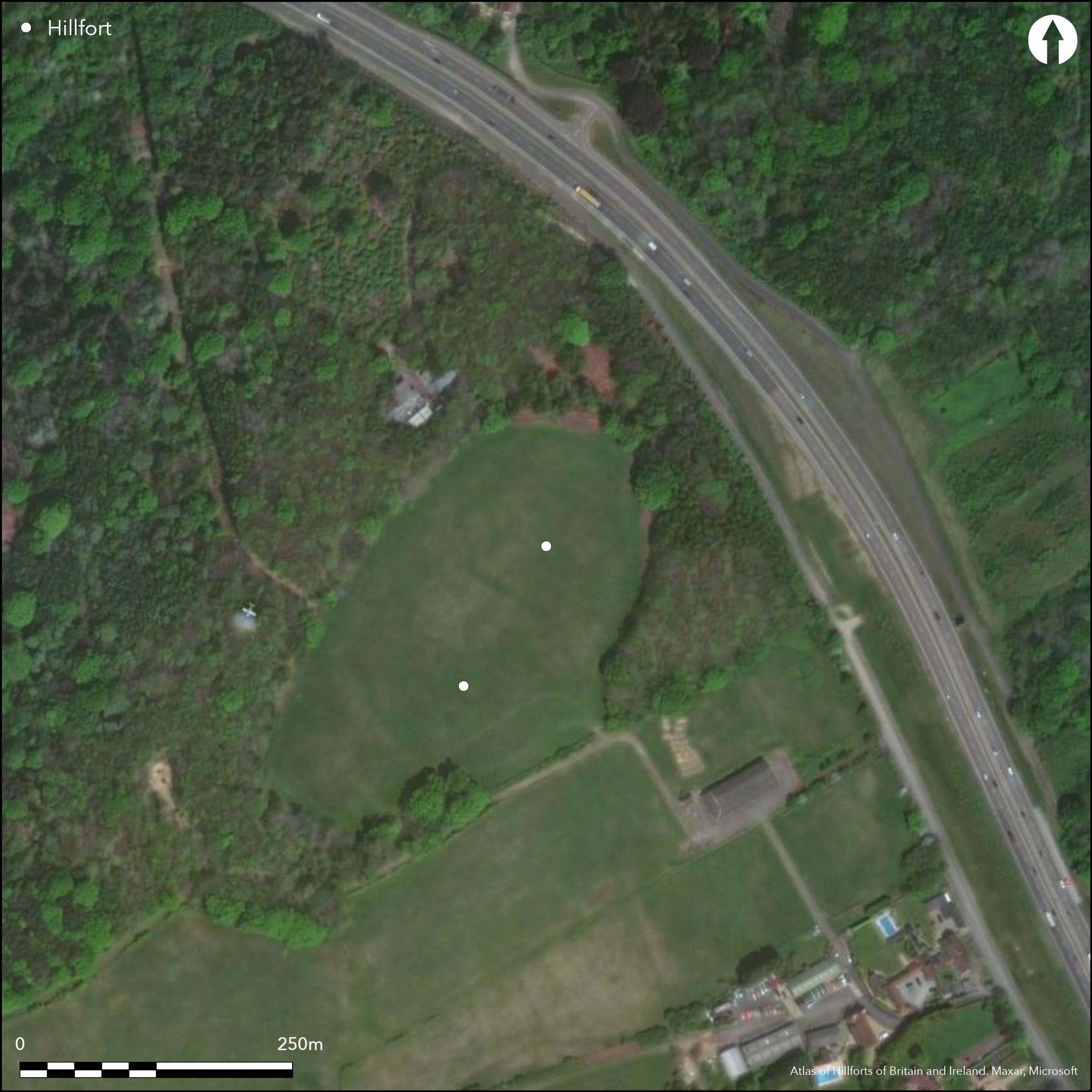
Satellite Imagery
LiDAR 1m DTM Hillshade
Satellite Imagery
Scroll left/right to view further images.
HER: Kent MKE1116 (None)
NMR: TQ 64 SW 1 (412408)
SM: 1005191
NGR: TQ 60825 43922
X: 560825 Y: 143922 (OSGB36)
Within a clearing on the south-eastern edge of Castle Hill Wood and to the W of Castle Hill Road, two Iron Age contour forts. They are located at 125m OD on a spur of high ground overlooking the Weald. The site was excavated by Winbolt in 1929 who considered it to be a single enclosure with damage occurring to ramparts the NW and SE. Later investigated in 1959 by E. Geary of the Archaeology Division of the Ordnance Survey who concluded the remains were of two distinctly separate contour forts. This was investigated further between 1969-71 (Money 1975) where the sites are described as Fort I and II. Fort II is recorded under Atlas No. 3857. Fort I is oval in form but now damaged or incomplete and in the region of 1.2ha in size lying on the brow of the spur. Extant in the N and E but destroyed elsewhere with the ditch now filled in. Probing showed that the ramparts continued in areas where no surface remains existed. A trench placed across the defences in the N showed it comprised two banks with a medial ditch. The inner bank, which stood at 0.84m high, was originally between 4.57-5.48m wide, and composed of clay and small sandstones. The V-shaped ditch was 8.23m wide and 3.65m deep but silted-up with material from the eroding bank. Two bands of humic soils across the ditch showed where a hiatus had occurred in the silting processes. The outer bank was 9.14m wide and 1.82m high. Charcoal scattered across the old land surface suggested burning of the undergrowth prior to the rampart construction. This gave a radiocarbon date of c.315 BC. A single posthole and a number of depressions, interpreted as being for a palisade, were discovered in section descending from the crest of the rampart. Magnetic susceptibility measurements from the ditch silts and lack of archaeological material suggest the site was occupied only for a short time. An entrance lies in the E approached by a trackway approximately 36.5m long and 10m wide paved with ironstone. The northern terminal of the entrance was wider than that in the S by 4.5m (Winbolt 1929, 193) as shown on a later plan by Money (1975, 68). Forestry activities have damaged the earthworks to the S of the entrance. At the inner part of the entrance, large postholes, 0.2m and 0.25m in diameter set 3m apart on either side of the entrance, sunk to a depth of 0.45m and packed with earth and stone were interpreted as gate posts (Money 1975, 70-1). From further postholes in this location it was suggested they were possibly the uprights for a bridge. Further excavation in the ditch to the S of the entrance produced large numbers of revetting stones and burnt timbers, including planks beams stakes and a strut, tumbled from the inner rampart. The outer entrance also produced evidence for post and stake holes. Smaller excavations within the interior of both sites recorded little in the way of occupation material. It was concluded that both forts had a brief occupation with Fort II replacing Fort I after its destruction. There was possibly a hiatus following the destruction of Fort I when farming might have taken place on the hilltop. The site is recorded on 1909 1:10,560 OS mapping. Scheduled
Citizen Science: ✗
Reliability of Data: Confirmed
Reliability of Interpretation: Confirmed
X: 33303 Y: 6651751 (EPSG: 3857)
Longitude: 0.2991687166611829 Latitude: 51.171866208113904 (EPSG:4326)
Country: England
Current County or Unitary Authority: Kent
Historic County: Kent
Current Parish/Community/Council/Townland: Capel
None
| Extant | ✓ |
| Cropmark | ✗ |
| Likely Destroyed | ✓ |
None
| Woodland | ✓ |
| Commercial Forestry Plantation | ✗ |
| Parkland | ✗ |
| Pasture (Grazing) | ✗ |
| Arable | ✓ |
| Scrub/Bracken | ✗ |
| Bare Outcrop | ✗ |
| Heather/Moorland | ✗ |
| Heath | ✗ |
| Built-up | ✗ |
| Coastal Grassland | ✗ |
| Other | ✗ |
A contour fort lying on a level sandstone spur at 125m OD
| Contour Fort | ✓ |
| Partial Contour Fort | ✗ |
| Promontory Fort | ✗ |
| Hillslope Fort | ✗ |
| Level Terrain Fort | ✗ |
| Marsh Fort | ✗ |
| Multiple Enclosure Fort | ✗ |
| Hilltop | ✓ |
| Coastal Promontory | ✗ |
| Inland Promontory | ✗ |
| Valley Bottom | ✗ |
| Knoll/Hillock/Outcrop | ✗ |
| Ridge | ✗ |
| Cliff/Plateau-edge/Scarp | ✗ |
| Hillslope | ✗ |
| Lowland | ✗ |
| Spur | ✓ |
Dominant Topographic Feature: Sandstone spur
| North | ✗ |
| Northeast | ✗ |
| East | ✗ |
| Southeast | ✗ |
| South | ✗ |
| Southwest | ✗ |
| West | ✗ |
| Northwest | ✗ |
| Level | ✓ |
Altitude: 125.0m
N/A
Radiocarbon dates were obtained from charcoal from clearance of the old land surface. Dated c. 315 BC. Small amounts of pottery dated to the pre-Roman Iron Age.
Reliability: B - Medium
| Pre 1200BC | ✗ |
| 1200BC - 800BC | ✗ |
| 800BC - 400BC | ✗ |
| 400BC - AD50 | ✓ |
| AD50 - AD400 | ✗ |
| AD400 - AD 800 | ✗ |
| Post AD800 | ✗ |
| Unknown | ✗ |
| Pre Hillfort: | None |
| Post Hillfort: | None |
| Artefactual: | None |
| C14: | None |
Possibly in Aubrey's Monumenta Britannica (1665-1693). Recorded on 1909 1:10,560 OS mapping. OS field survey 1959. Excavated in 1929 (Winbolt 1929) and 1969-71 (Money 1975). Watching brief in 1965. Scheduled
| 1st Identified Map Depiction (1900): | None |
| Excavation (1929): | None |
| Other (1959): | Field survey |
| Other (1965): | Watching Brief |
| 1st Identified Written Reference (None): | None |
| Excavation (None): | None |
| Other (None): | Magnetic Susceptibility |
| Other (None): | Scheduled |
Burning across the interior prior to construction. Little evidence for occupation
None
| None | ✓ |
| Spring | ✗ |
| Stream | ✗ |
| Pool | ✗ |
| Flush | ✗ |
| Well | ✗ |
| Other | ✗ |
None
| No Known Features | ✓ |
| Round Stone Structures | ✗ |
| Rectangular Stone Structures | ✗ |
| Curvilinear Platforms | ✗ |
| Other Roundhouse Evidence | ✗ |
| Pits | ✗ |
| Quarry Hollows | ✗ |
| Other | ✗ |
Burning prior to construction
| No Known Excavation | ✗ |
| Pits | ✗ |
| Postholes | ✗ |
| Roundhouses | ✗ |
| Rectangular Structures | ✗ |
| Roads/Tracks | ✗ |
| Quarry Hollows | ✗ |
| Other | ✓ |
| Nothing Found | ✗ |
Magnetic susceptibility
| No Known Geophysics | ✗ |
| Pits | ✗ |
| Roundhouses | ✗ |
| Rectangular Structures | ✗ |
| Roads/Tracks | ✗ |
| Quarry Hollows | ✗ |
| Other | ✗ |
| Nothing Found | ✓ |
Mesolithic flints, Neolithic sherds
| No Known Finds | ✗ |
| Pottery | ✓ |
| Metal | ✗ |
| Metalworking | ✗ |
| Human Bones | ✗ |
| Animal Bones | ✗ |
| Lithics | ✓ |
| Environmental | ✗ |
| Other | ✗ |
None
| APs Not Checked | ✓ |
| None | ✗ |
| Roundhouses | ✗ |
| Rectangular Structures | ✗ |
| Pits | ✗ |
| Postholes | ✗ |
| Roads/Tracks | ✗ |
| Other | ✗ |
An entrance lies in the E approached by a trackway approximately 36.5m long and 10m wide paved with ironstone. The northern terminal of the entrance was wider than that in the S by 4.5m (Winbolt 1929, 193) as shown on a later plan by Money (1975, 68). At the inner part of the entrance, large postholes,0.2m and 0.25m in diameter set 3m apart on either side of the entrance, were interpreted as gate posts sunk to a depth of 0.45m and packed with earth and stone (Money 1975, 70-1). From further postholes in this location it was suggested they were possibly the uprights for a bridge.
| 4: | Breaks through inner and outer rampart |
| 2: | None |
Guard Chambers: ✗
Chevaux de Frise: ✗
| 1. Simple Gap (East): | None |
| 2. Simple Gap (East): | None |
Oval in form but now damaged or incomplete, in the region of 1.2ha. Extant in the N and E but destroyed elsewhere with the ditch now filled in. Probing showed that the ramparts continued in areas where no surface remains existed. It comprised two banks with a medial ditch. The inner bank which stood at 0.84m high, was originally between 4.57-5.48m wide, and composed of clay and small sandstones. The V-shaped ditch was 8.23m wide and 3.65m deep but silted-up with material from the eroding bank. Two bands of humic soils across the ditch showed where a hiatus had occurred in the silting processes. The outer bank was 9.14m wide and 1.82m high. This gave a radiocarbon date of c.315 BC. A single posthole and a number of depressions, interpreted as being for a palisade, discovered in the crest of the rampart. Further excavation in the ditch to the S of the entrance produced large numbers of revetting stones and burnt timbers, including planks, beams, stakes and a strut, tumbled from the inner rampart. The outer bank is possibly a counterscarp
| Area 1: | 1.2ha. |
| Total: | 1.2ha. |
Total Footprint Area: Noneha.
None
| ✗ | None |
| ✓ | None |
| NE Quadrant: | 2 |
| SE Quadrant: | 2 |
| SW Quadrant: | 2 |
| NW Quadrant: | 2 |
| Total: | 2 |
| Partial Univallate | ✗ |
| Univallate | ✗ |
| Partial Bivallate | ✗ |
| Bivallate | ✓ |
| Partial Multivallate | ✗ |
| Multivallate | ✗ |
| Unknown | ✗ |
| Partial Univallate | ✗ |
| Univallate | ✗ |
| Partial Bivallate | ✗ |
| Bivallate | ✗ |
| Partial Multivallate | ✗ |
| Multivallate | ✗ |
None
| None | ✗ |
| Earthen Bank | ✓ |
| Stone Wall | ✗ |
| Rubble | ✗ |
| Wall-walk | ✗ |
| Evidence of Timber | ✗ |
| Vitrification | ✗ |
| Other Burning | ✗ |
| Palisade | ✗ |
| Counter Scarp Bank | ✓ |
| Berm | ✗ |
| Unfinished | ✗ |
| Other | ✗ |
Stone fragments and sand. The outer bank is possibly a counterscarp
| None | ✗ |
| Earthen Bank | ✓ |
| Stone Wall | ✓ |
| Murus Duplex | ✗ |
| Timber-framed | ✗ |
| Timber-laced | ✗ |
| Vitrification | ✗ |
| Other Burning | ✓ |
| Palisade | ✓ |
| Counter Scarp Bank | ✓ |
| Berm | ✗ |
| Unfinished | ✗ |
| No Known Excavation | ✗ |
| Other | ✓ |
| ✗ | None |
| ✓ | None |
Number of Ditches: 1
| ✗ | None |
Money, J.H. 1975. Excavations in the two Iron-Age Hill-Forts Castle Hill, Capel, Near Tonbridge 1965 and 1969-71. Archaeol Cantiana, 91, 61-85
Winbolt, S.E. 1929. Castle Hill Camp Tonbridge. Archaeol Cantiana, 41, 193-5
Atlas of Hillforts:
Wikidata:
This work is licensed under CC BY-SA 4.0

 and should be cited as:
Lock, Gary and Ralston, Ian. 2024. Atlas of Hillforts of Britain and Ireland. Available at: https://hillforts.arch.ox.ac.uk
Document Version 1.1