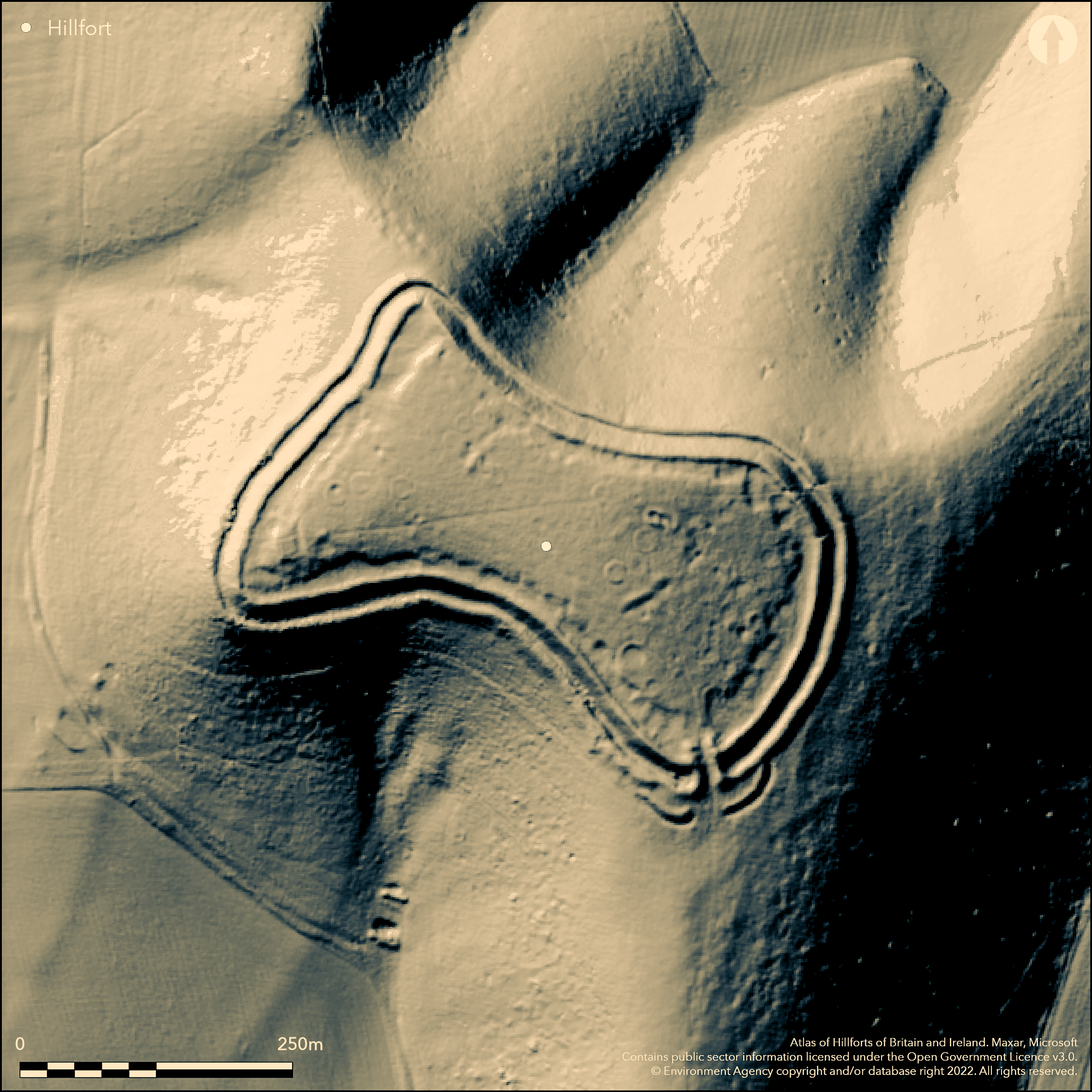
LiDAR 1m DTM Hillshade
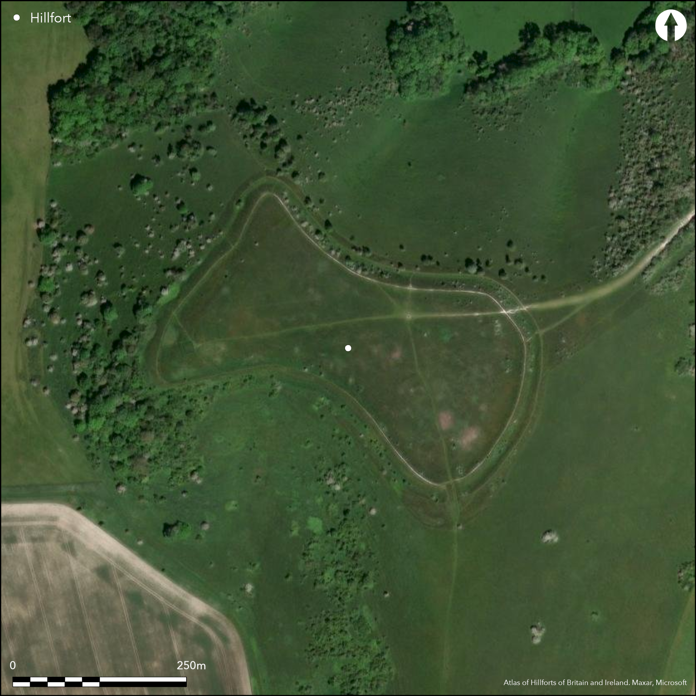
Satellite Imagery
LiDAR 1m DTM Hillshade
Satellite Imagery
Scroll left/right to view further images.
HER: Hampshire 21430 (None)
NMR: SU 45 NE 38 (232559)
SM: 1008037
NGR: SU457572
X: 445778 Y: 157259 (OSGB36)
Commanding, univallate, contour hillfort located on summit of prominent Beacon Hill, Burghclere, a ridge of Upper Chalk S of Kennet valley. Very steep surrounding slopes to N, steep elsewhere. Measures 300m internally SE-NW, with maximum internal width 190m at W end, narrowing to 95m at centre and broadening again to 160m, with area 3.84ha. For most of circuit the ramparts follow shoulder of hill comprising single rampart and ditch with counterscxarp. Bank rises to 2.5m above interior and ditch, to 12m wide and 6m below rampart apex. Counterscarp to 2.5m high. Single entrance exists on SE, flanked by parallel banks on each side, and accompanied by outer hornworks. A second entrance, now blocked, may have existed on W side. Two short, irregular stretches of bank and ditch on highest part of hill seem to predate hillfort, possibly enclosing less than 1.2 ha if linked. Date unknown, and could be traces of Neolithic causewayed enclosure. Depressions in interior possible structures. Traces generally slight of c. 30 hut circles, similar number of platforms (not necessarily for buildings), and c. 60 pits. Other features include few low mounds of uncertain provenance, plus various unclassifiable banks and ditches. Excavations by Leonard Woolley (1913) in 1912 of one hut circle and three pits, confirmed possible hut circles and potsherds recovered generally described as Bronze Age. Iron Age and, possibly, Bronze Age potsherds and Neolithic finds from surface or excavation. Tomb of the 5th Earl of Carnarvon stands on platform in SW corner of hillfort. Depression in interior excavated by Wooley and containing medieval and later pottery and bottles, probably associated with later beacon on site (SU 45 NE 35). In excellent condition under rough pasture. Survey and geophysics as part of English Heritage Wessex Hillforts Project (Payne. et. al. 2006). On 1st Ed. OS map (1873).
Citizen Science: ✗
Reliability of Data: Confirmed
Reliability of Interpretation: Confirmed
X: -149679 Y: 6676768 (EPSG: 3857)
Longitude: -1.3445923731178726 Latitude: 51.31255482306379 (EPSG:4326)
Country: England; None
Current County or Unitary Authority: Hampshire
Historic County: Hampshire and Isle of Wight
Current Parish/Community/Council/Townland: Burghclere; Highclere
Excellent condition with no plough damage. Tomb of the 5th Earl of Carnarvon stands on platform in SW corner of hillfort. Later beacon site on highest part of hill. Setting affected by A34 immediately below fort on E.
| Extant | ✓ |
| Cropmark | ✗ |
| Likely Destroyed | ✗ |
Rough upland pasture. SSSI. Fenced off tomb.
| Woodland | ✗ |
| Commercial Forestry Plantation | ✗ |
| Parkland | ✗ |
| Pasture (Grazing) | ✓ |
| Arable | ✗ |
| Scrub/Bracken | ✗ |
| Bare Outcrop | ✗ |
| Heather/Moorland | ✗ |
| Heath | ✗ |
| Built-up | ✗ |
| Coastal Grassland | ✗ |
| Other | ✓ |
Commanding, univallate, contour hillfort located on summit of prominent Beacon Hill, Burghclere, a ridge of Upper Chalk S of Kennet valley. Very steep surrounding slopes to N, steep elsewhere.
| Contour Fort | ✓ |
| Partial Contour Fort | ✗ |
| Promontory Fort | ✗ |
| Hillslope Fort | ✗ |
| Level Terrain Fort | ✗ |
| Marsh Fort | ✗ |
| Multiple Enclosure Fort | ✗ |
| Hilltop | ✓ |
| Coastal Promontory | ✗ |
| Inland Promontory | ✗ |
| Valley Bottom | ✗ |
| Knoll/Hillock/Outcrop | ✗ |
| Ridge | ✗ |
| Cliff/Plateau-edge/Scarp | ✗ |
| Hillslope | ✗ |
| Lowland | ✗ |
| Spur | ✗ |
Dominant Topographic Feature: Hill top
| North | ✗ |
| Northeast | ✗ |
| East | ✗ |
| Southeast | ✗ |
| South | ✗ |
| Southwest | ✗ |
| West | ✗ |
| Northwest | ✗ |
| Level | ✓ |
Altitude: 262.0m
Boundary Type: Parish/Townland
Probably early? Iron Age, as Iron Age pottery found, although Wooley from his excavations ascribed pottery to Bronze Age.
Reliability: B - Medium
| Pre 1200BC | ✗ |
| 1200BC - 800BC | ✗ |
| 800BC - 400BC | ✓ |
| 400BC - AD50 | ✗ |
| AD50 - AD400 | ✗ |
| AD400 - AD 800 | ✗ |
| Post AD800 | ✗ |
| Unknown | ✗ |
| Pre Hillfort: | None |
| Post Hillfort: | None |
| Artefactual: | Iron Age and possibly Bronze Age pottery and Neolithic material. |
In Aubrey's Monumenta Britannica (1665-1693). On 1st Ed. OS map (1873). Excavations L. Woolley 1912. Survey by RCHME 1978-9, ref. no. 88841. Survey B.N. Eagles 1991. Geophysical survey part of Wessex Hillforts Project 1997. Survey part of English Heritage Wessex Hillforts Project 1997.
| 1st Identified Map Depiction (1873): | OS map. |
| Excavation (1912): | L. Woolley. |
| Other (1971): | Visited by Hillfort Study Group |
| Other (1991): | Survey B.N. Eagles. |
| Geophysical Survey (1997): | Wessex Hillforts Project magnetometer survey. |
| Other (1997): | English Heritage Wessex Hillforts Project. |
| 1st Identified Written Reference (None): | None |
| Other (None): | Survey RCHME. |
Depressions in interior possible structures. Traces generally slight of c. 30 hut circles, similar number of platforms (not necessarily for buildings), and c. 60 pits. Other features include few low mounds of uncertain provenance, plus various unclassifiable banks and ditches. Magnetometer survey 1997 picked up larger ditches surrounding hut sites and larger pits. Excavations by Leonard Woolley 1912 confirrmed possible hut circles and potsherds recovered generally described as Bronze Age. Iron Age and, possibly, Bronze Age potsherds and Neolithic finds from surface or excavation.
None
| None | ✓ |
| Spring | ✗ |
| Stream | ✗ |
| Pool | ✗ |
| Flush | ✗ |
| Well | ✗ |
| Other | ✗ |
Depressions in interior possible structures. Traces generally slight of c. 30 hut circles, similar number of platforms (not necessarily for buildings), and c. 60 pits. Hut sites take form of circular or sub-circular banks or platforms with banks, all with external ditches. Other features include few low mounds of uncertain provenance, plus various unclassifiable banks and ditches.
| No Known Features | ✗ |
| Round Stone Structures | ✗ |
| Rectangular Stone Structures | ✗ |
| Curvilinear Platforms | ✓ |
| Other Roundhouse Evidence | ✓ |
| Pits | ✓ |
| Quarry Hollows | ✗ |
| Other | ✗ |
Possible hut circles confirmed from 1912 excavations.
| No Known Excavation | ✗ |
| Pits | ✗ |
| Postholes | ✗ |
| Roundhouses | ✓ |
| Rectangular Structures | ✗ |
| Roads/Tracks | ✗ |
| Quarry Hollows | ✗ |
| Other | ✗ |
| Nothing Found | ✗ |
Magnetometer survey 1997 picked up larger ditches surrounding hut sites and larger pits.
| No Known Geophysics | ✗ |
| Pits | ✓ |
| Roundhouses | ✗ |
| Rectangular Structures | ✗ |
| Roads/Tracks | ✗ |
| Quarry Hollows | ✗ |
| Other | ✓ |
| Nothing Found | ✗ |
Iron Age and, possibly, Bronze Age potsherds and Neolithic finds from surface or excavation.
| No Known Finds | ✗ |
| Pottery | ✓ |
| Metal | ✗ |
| Metalworking | ✗ |
| Human Bones | ✗ |
| Animal Bones | ✗ |
| Lithics | ✗ |
| Environmental | ✗ |
| Other | ✗ |
None
| APs Not Checked | ✓ |
| None | ✗ |
| Roundhouses | ✗ |
| Rectangular Structures | ✗ |
| Pits | ✗ |
| Postholes | ✗ |
| Roads/Tracks | ✗ |
| Other | ✗ |
Single entrance exists on SE, flanked by parallel banks on each side, and accompanied by outer hornworks. A second entrance, now blocked, may have existed on N corner.
| 2: | None |
| 2: | Possible second, blocked, entrance on NW corner. |
Guard Chambers: ✗
Chevaux de Frise: ✗
| 1. Hornwork (South east): | Also with inturned corridor. |
| 1. In-turned (South east): | Inturned corridor. |
| 1. Passage-way/Corridor (South east): | Inturned corridor. |
| 2. Blocked (North west): | Possibly existed. |
For most of circuit defences follow shoulder of hill comprising single ditch between two banks. Two short, irregular stretches of bank and ditch on highest part of hill seem to predate hillfort and possibly enclosing less than 1.2 ha if linked. Date unknown, and could be traces of Neolithic causewayed enclosure.
| Area 1: | 3.84ha. |
| Total: | 3.84ha. |
Total Footprint Area: Noneha.
None
| ✗ | None |
| ✓ | None |
| NE Quadrant: | 1 |
| SE Quadrant: | 1 |
| SW Quadrant: | 1 |
| NW Quadrant: | 1 |
| Total: | 1 |
| Partial Univallate | ✗ |
| Univallate | ✓ |
| Partial Bivallate | ✗ |
| Bivallate | ✗ |
| Partial Multivallate | ✗ |
| Multivallate | ✗ |
| Unknown | ✗ |
| Partial Univallate | ✗ |
| Univallate | ✗ |
| Partial Bivallate | ✗ |
| Bivallate | ✗ |
| Partial Multivallate | ✗ |
| Multivallate | ✗ |
Good counterscarp bank.
| None | ✗ |
| Earthen Bank | ✓ |
| Stone Wall | ✗ |
| Rubble | ✗ |
| Wall-walk | ✗ |
| Evidence of Timber | ✗ |
| Vitrification | ✗ |
| Other Burning | ✗ |
| Palisade | ✗ |
| Counter Scarp Bank | ✓ |
| Berm | ✗ |
| Unfinished | ✗ |
| Other | ✗ |
Excavation 1912 confined to interior.
| None | ✗ |
| Earthen Bank | ✗ |
| Stone Wall | ✗ |
| Murus Duplex | ✗ |
| Timber-framed | ✗ |
| Timber-laced | ✗ |
| Vitrification | ✗ |
| Other Burning | ✗ |
| Palisade | ✗ |
| Counter Scarp Bank | ✗ |
| Berm | ✗ |
| Unfinished | ✗ |
| No Known Excavation | ✓ |
| Other | ✗ |
| ✗ | None |
| ✓ | None |
Number of Ditches: 1
| ✗ | None |
Eagles, B.N, 1991. A New Survey of the Hillfort on Beacon Hill, Arch J, 148, 98-103.
Payne, A., Corney, M. and Cunliffe, B.W. 2006, Wessex Hillforts Project - extensive survey of hillfort interiors in central southern England. London: English Heritage, 47-54.
Woolley, L. 1913. Excavations on Beacon Hill, Hampshire, Man,13, 8-10.
Atlas of Hillforts:
Wikidata:
This work is licensed under CC BY-SA 4.0

 and should be cited as:
Lock, Gary and Ralston, Ian. 2024. Atlas of Hillforts of Britain and Ireland. Available at: https://hillforts.arch.ox.ac.uk
Document Version 1.1