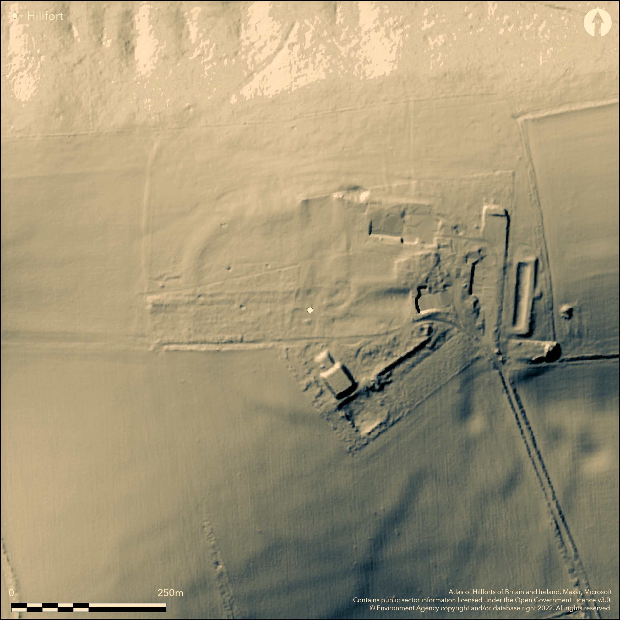
LiDAR 1m DTM Hillshade
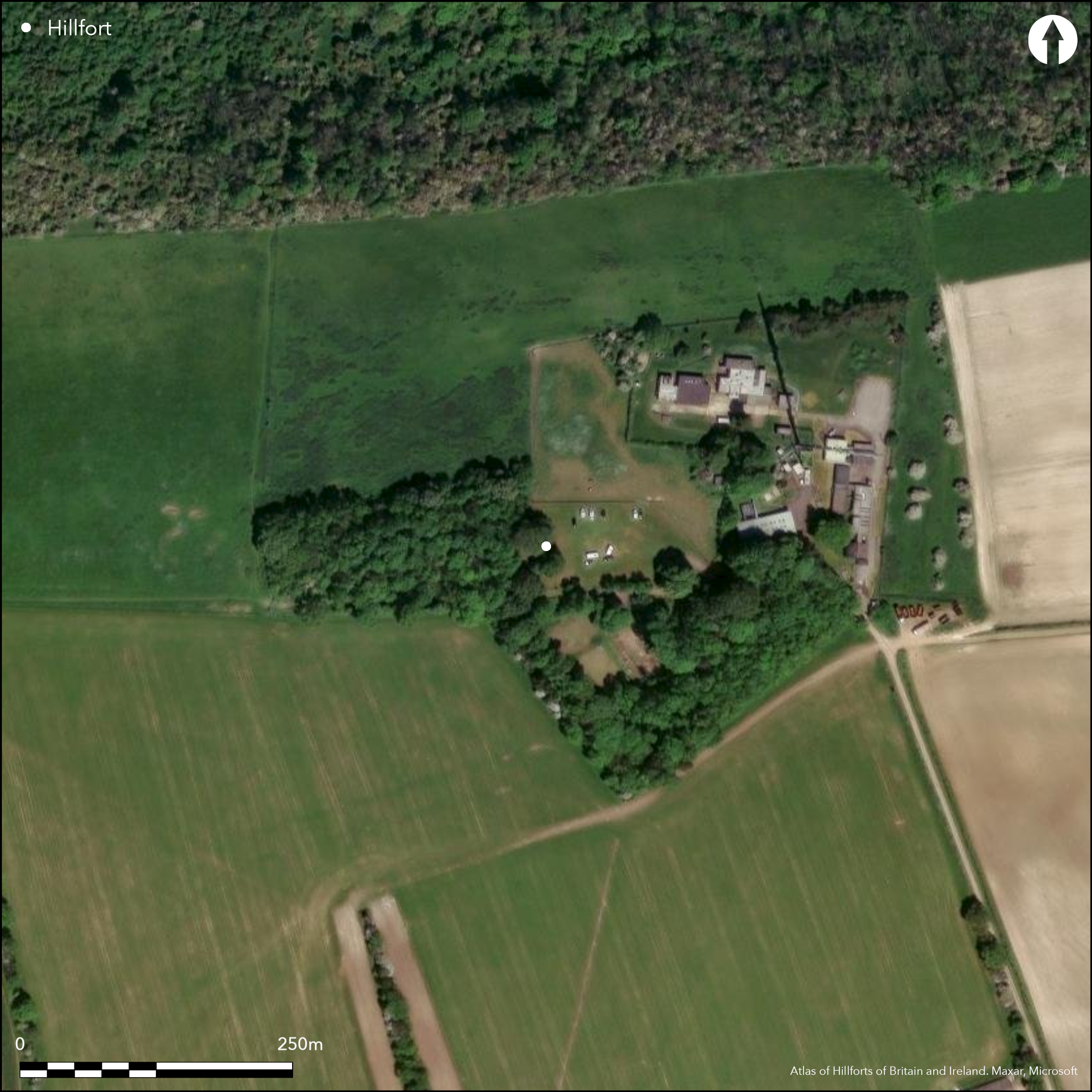
Satellite Imagery
LiDAR 1m DTM Hillshade
Satellite Imagery
Scroll left/right to view further images.
HER: Hampshire No record found (None)
NMR: SU 55 NW 22 (236604)
SM: None
NGR: SU52605676
X: 452600 Y: 156760 (OSGB36)
Contour hillfort located on chalk downland summit of Cottington's Hill in Freemantle Park above Kingsclere. Steep surrounding slopes to N, less steep to S along the ridge, to E and W, level. Defined by single ditch and bank enclosing c. 3.6ha, of which 0.8ha now covered by buildings. Best on N, where originally bank and outer ditch with counterscarp, but bank deliberately levelled, possibly to improve view from a Royal Hunting Lodge, with much material deposited in ditch. Near middle of this stretch surviving scarp of bank inturned for c. 30 m and probably mutilation connected with the hunting lodge. No trace of entrance: possible locations would have been at E and W along the line of the ridge. Extensive mutilation, result of construction of Royal Hunting Lodge and part of earthwork destroyed by construction of reservoir and part by wireless station. Chalk digging and part ploughed-out. Few investigations. Undated.
Citizen Science: ✗
Reliability of Data: Confirmed
Reliability of Interpretation: Confirmed
X: -138792 Y: 6675865 (EPSG: 3857)
Longitude: -1.2467940287091719 Latitude: 51.30747962819447 (EPSG:4326)
Country: England
Current County or Unitary Authority: Hampshire
Historic County: Hampshire and Isle of Wight
Current Parish/Community/Council/Townland: Kingsclere
Extensive mutilation, result of construction of Royal Hunting Lodge (SU55NW 26) and part of earthwork destroyed by construction of reservoir and part by wireless station. Chalk digging and part ploughed-out.
| Extant | ✓ |
| Cropmark | ✗ |
| Likely Destroyed | ✓ |
In Freemantle Park, parkland with buildings. Wooded to S.
| Woodland | ✓ |
| Commercial Forestry Plantation | ✗ |
| Parkland | ✓ |
| Pasture (Grazing) | ✗ |
| Arable | ✗ |
| Scrub/Bracken | ✗ |
| Bare Outcrop | ✗ |
| Heather/Moorland | ✗ |
| Heath | ✗ |
| Built-up | ✓ |
| Coastal Grassland | ✗ |
| Other | ✗ |
Contour hillfort located on chalk downland summit of Cottington's Hill in Freemantle Park above Kingsclere. Steep surrounding slopes to N, less steep to S along the ridge, to E and W, level.
| Contour Fort | ✓ |
| Partial Contour Fort | ✗ |
| Promontory Fort | ✗ |
| Hillslope Fort | ✗ |
| Level Terrain Fort | ✗ |
| Marsh Fort | ✗ |
| Multiple Enclosure Fort | ✗ |
| Hilltop | ✓ |
| Coastal Promontory | ✗ |
| Inland Promontory | ✗ |
| Valley Bottom | ✗ |
| Knoll/Hillock/Outcrop | ✗ |
| Ridge | ✗ |
| Cliff/Plateau-edge/Scarp | ✗ |
| Hillslope | ✗ |
| Lowland | ✗ |
| Spur | ✗ |
Dominant Topographic Feature: Hill top
| North | ✗ |
| Northeast | ✗ |
| East | ✗ |
| Southeast | ✗ |
| South | ✗ |
| Southwest | ✗ |
| West | ✗ |
| Northwest | ✗ |
| Level | ✓ |
Altitude: 230.0m
N/A
None.
Reliability: D - None
| Pre 1200BC | ✗ |
| 1200BC - 800BC | ✗ |
| 800BC - 400BC | ✗ |
| 400BC - AD50 | ✗ |
| AD50 - AD400 | ✗ |
| AD400 - AD 800 | ✗ |
| Post AD800 | ✗ |
| Unknown | ✓ |
| Pre Hillfort: | None |
| Post Hillfort: | None |
On M.S.S. of S. Lethicullier (1701-60,) p.240, copied by Colt Hoare (Book of MS. Collections preserved at Devizes, pp. 42-3). Possible mention in Gough's Camden 1806. Field investigator comments 1956, 1967, 1982.
| Other (1806): | Possible mention in Gough's Camden. |
| 1st Identified Written Reference (None): | On M.S.S. of S. Lethicullier, copied by Colt Hoare (Book of MS. Collections preserved at Devizes, pp. 42-3). |
| Other (None): | Field investigator comments - no details. |
None.
None
| None | ✓ |
| Spring | ✗ |
| Stream | ✗ |
| Pool | ✗ |
| Flush | ✗ |
| Well | ✗ |
| Other | ✗ |
None
| No Known Features | ✓ |
| Round Stone Structures | ✗ |
| Rectangular Stone Structures | ✗ |
| Curvilinear Platforms | ✗ |
| Other Roundhouse Evidence | ✗ |
| Pits | ✗ |
| Quarry Hollows | ✗ |
| Other | ✗ |
None
| No Known Excavation | ✓ |
| Pits | ✗ |
| Postholes | ✗ |
| Roundhouses | ✗ |
| Rectangular Structures | ✗ |
| Roads/Tracks | ✗ |
| Quarry Hollows | ✗ |
| Other | ✗ |
| Nothing Found | ✗ |
None
| No Known Geophysics | ✓ |
| Pits | ✗ |
| Roundhouses | ✗ |
| Rectangular Structures | ✗ |
| Roads/Tracks | ✗ |
| Quarry Hollows | ✗ |
| Other | ✗ |
| Nothing Found | ✗ |
None
| No Known Finds | ✓ |
| Pottery | ✗ |
| Metal | ✗ |
| Metalworking | ✗ |
| Human Bones | ✗ |
| Animal Bones | ✗ |
| Lithics | ✗ |
| Environmental | ✗ |
| Other | ✗ |
None
| APs Not Checked | ✓ |
| None | ✗ |
| Roundhouses | ✗ |
| Rectangular Structures | ✗ |
| Pits | ✗ |
| Postholes | ✗ |
| Roads/Tracks | ✗ |
| Other | ✗ |
No trace of entrance: possible locations would have been at E and W along the line of the ridge.
| 0: | None |
| 2: | None |
Guard Chambers: ✗
Chevaux de Frise: ✗
Defined by single ditch and bank enclosing c. 3.6ha, of which 0.8ha now covered by buildings. Best on N, where originally bank and outer ditch with counterscarp, but bank deliberately levelled, possibly to improve view from a Royal Hunting Lodge, with much material deposited in ditch. Near middle of this stretch surviving scarp of bank inturned for c. 30 m and probably mutilation connected with the hunting lodge.
| Area 1: | 3.6ha. |
| Total: | 3.6ha. |
Total Footprint Area: Noneha.
None
| ✗ | None |
| ✗ | Bank mutilated and present difficult to interpret. However, very probably univallate with counterscarp in prehistory and quadrants defined as such. |
| NE Quadrant: | 1 |
| SE Quadrant: | 1 |
| SW Quadrant: | 1 |
| NW Quadrant: | 1 |
| Total: | 1 |
| Partial Univallate | ✗ |
| Univallate | ✓ |
| Partial Bivallate | ✗ |
| Bivallate | ✗ |
| Partial Multivallate | ✗ |
| Multivallate | ✗ |
| Unknown | ✗ |
| Partial Univallate | ✗ |
| Univallate | ✗ |
| Partial Bivallate | ✗ |
| Bivallate | ✗ |
| Partial Multivallate | ✗ |
| Multivallate | ✗ |
None
| None | ✗ |
| Earthen Bank | ✓ |
| Stone Wall | ✗ |
| Rubble | ✗ |
| Wall-walk | ✗ |
| Evidence of Timber | ✗ |
| Vitrification | ✗ |
| Other Burning | ✗ |
| Palisade | ✗ |
| Counter Scarp Bank | ✓ |
| Berm | ✗ |
| Unfinished | ✗ |
| Other | ✗ |
None
| None | ✗ |
| Earthen Bank | ✗ |
| Stone Wall | ✗ |
| Murus Duplex | ✗ |
| Timber-framed | ✗ |
| Timber-laced | ✗ |
| Vitrification | ✗ |
| Other Burning | ✗ |
| Palisade | ✗ |
| Counter Scarp Bank | ✗ |
| Berm | ✗ |
| Unfinished | ✗ |
| No Known Excavation | ✓ |
| Other | ✗ |
| ✗ | None |
| ✓ | None |
Number of Ditches: 1
| ✗ | None |
Gough's edn 1806. Camden's Britannia, I, p. 206.
M.S.S. of S.Lethicullier (1701-60,) p.240, copied by Colt Hoare (Book of MS. Collections preserved at Devizes, pp. 42-3).
Atlas of Hillforts:
Wikidata:
This work is licensed under CC BY-SA 4.0

 and should be cited as:
Lock, Gary and Ralston, Ian. 2024. Atlas of Hillforts of Britain and Ireland. Available at: https://hillforts.arch.ox.ac.uk
Document Version 1.1