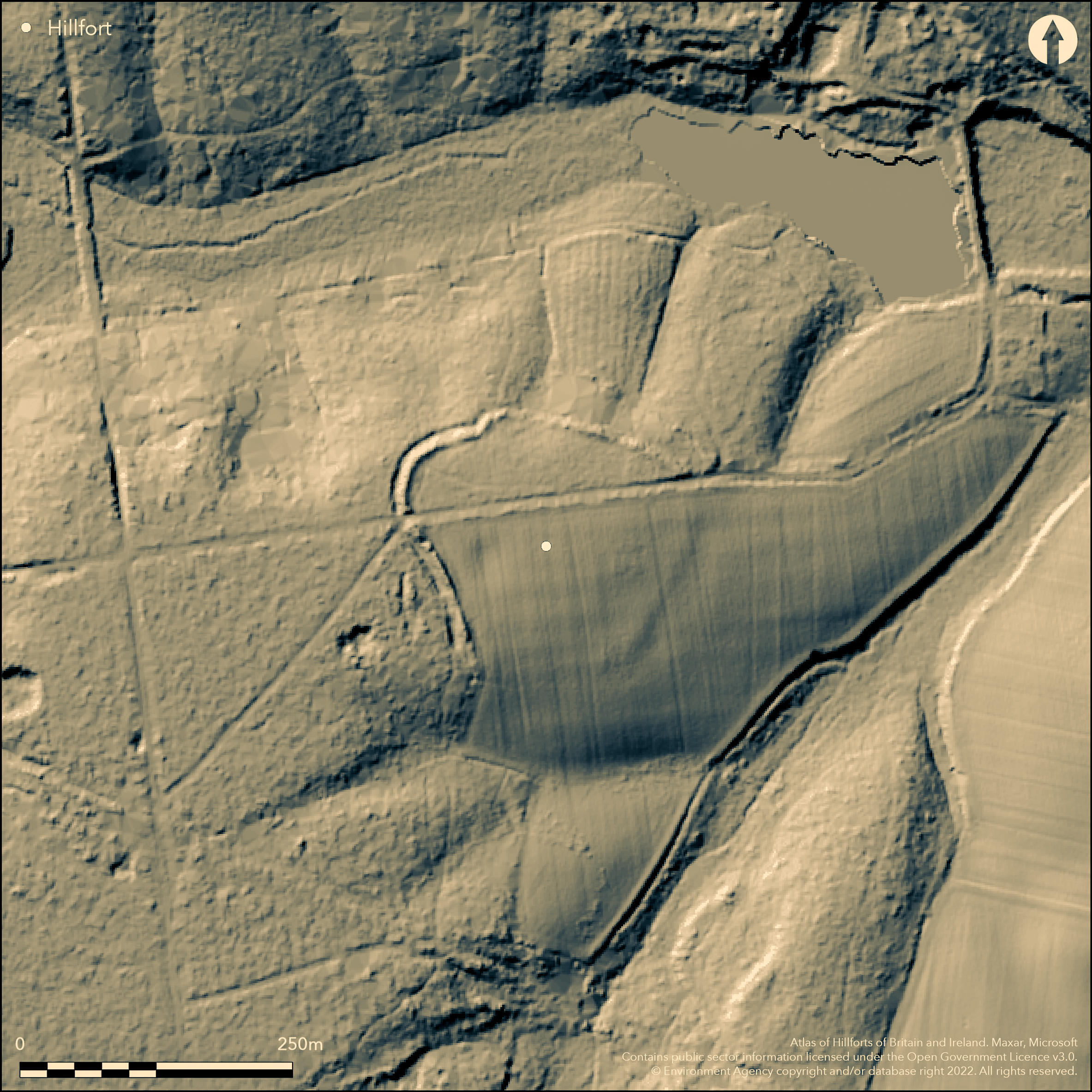
LiDAR 1m DTM Hillshade
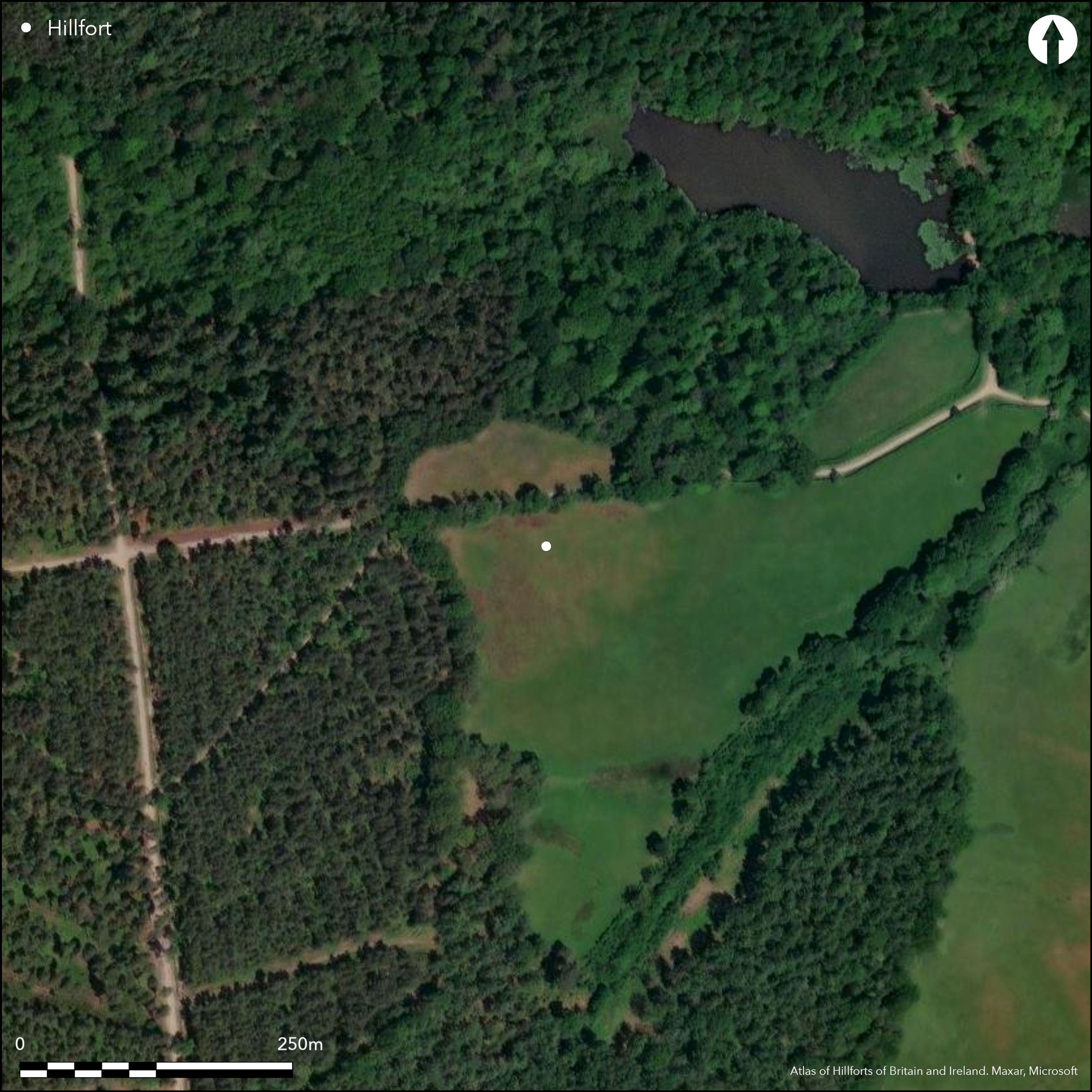
Satellite Imagery
LiDAR 1m DTM Hillshade
Satellite Imagery
Scroll left/right to view further images.
HER: Hampshire 20196 (None)
NMR: SU 66 SW 9 (241076)
SM: 1008726
NGR: SU62686308
X: 462680 Y: 163080 (OSGB36)
Univallate, contour hillfort sited on E point of spur of gravel jutting out to E overlooking Kiln Pond and West End Brook to N and a tributary of the latter to SE. Moderate surrounding slopes. Oval shape measuring c. 170m by 190m, with internal area c. 1.6ha. Track to Pond Farm cuts through site E-W, and to N of this within woodland shown as such on OS map 1872. To S of road fort ploughed-out, and now faint rise/cropmark under pasture. Site generally visible on LiDar as part of Silchester Iron Age Environs Project 2015 where N and W banks clearly survive as earthworks to c. 14m wide. W bank seems to have been used as a post-medieval woodbank. External ditch visible on W and NW. E and S banks visible as faint earthworks and cropmarks on aerial photographs, where bank low and spread to 18m in wide, with ditches. No entrace defined, but road possibly passes through. Linear ditch and short section of bank to SW and W of hillfort possible outworks or later quarrying. Sub-oval pit, possibly dewpond or extractive pit in interior adjacent to W bank. Linear ditch, possible trackway, c. 42m long, postdating hillfort, to NW. Proximity of hillfort to Calleva could suggest territorial or other association with this Iron Age precursor of the Roman town. On 1st Ed. OS map (1872).
Citizen Science: ✗
Reliability of Data: Confirmed
Reliability of Interpretation: Confirmed
X: -122573 Y: 6685807 (EPSG: 3857)
Longitude: -1.1010914452314915 Latitude: 51.363282251770976 (EPSG:4326)
Country: England
Current County or Unitary Authority: Hampshire
Historic County: Hampshire and Isle of Wight
Current Parish/Community/Council/Townland: Mortimer West End
Site much reduced, especially on SE. Track to Pond Farm cuts through fort E-W. N of this, fort formerly in woodland, now cleared/replanted. S of track under pasture and now faint or cropmark.
| Extant | ✓ |
| Cropmark | ✓ |
| Likely Destroyed | ✗ |
Site now cleared of woodland and under pasture.
| Woodland | ✗ |
| Commercial Forestry Plantation | ✗ |
| Parkland | ✗ |
| Pasture (Grazing) | ✓ |
| Arable | ✗ |
| Scrub/Bracken | ✗ |
| Bare Outcrop | ✗ |
| Heather/Moorland | ✗ |
| Heath | ✗ |
| Built-up | ✗ |
| Coastal Grassland | ✗ |
| Other | ✗ |
Univallate, contour hillfort sited on spur of gravel jutting out to E above stream headwaters to N, flowing into Foudry Brook on E. Moderate surrounding slopes.
| Contour Fort | ✓ |
| Partial Contour Fort | ✗ |
| Promontory Fort | ✗ |
| Hillslope Fort | ✗ |
| Level Terrain Fort | ✗ |
| Marsh Fort | ✗ |
| Multiple Enclosure Fort | ✗ |
| Hilltop | ✗ |
| Coastal Promontory | ✗ |
| Inland Promontory | ✗ |
| Valley Bottom | ✗ |
| Knoll/Hillock/Outcrop | ✗ |
| Ridge | ✗ |
| Cliff/Plateau-edge/Scarp | ✗ |
| Hillslope | ✗ |
| Lowland | ✗ |
| Spur | ✓ |
Dominant Topographic Feature: Spur
| North | ✗ |
| Northeast | ✗ |
| East | ✗ |
| Southeast | ✗ |
| South | ✗ |
| Southwest | ✗ |
| West | ✗ |
| Northwest | ✗ |
| Level | ✓ |
Altitude: 91.0m
N/A
None.
Reliability: D - None
| Pre 1200BC | ✗ |
| 1200BC - 800BC | ✗ |
| 800BC - 400BC | ✗ |
| 400BC - AD50 | ✗ |
| AD50 - AD400 | ✗ |
| AD400 - AD 800 | ✗ |
| Post AD800 | ✗ |
| Unknown | ✓ |
| Pre Hillfort: | None |
| Post Hillfort: | None |
On 1st Ed. OS map (1872). API Silchester Iron Age Environs Project, English Heritage 2015 -aerial photograph interpretation and LiDar survey.
| 1st Identified Map Depiction (1872): | OS map. |
| Other (2015): | API Silchester Iron Age Environs Project, English Heritage. |
| LiDAR Survey (2015): | API Silchester Iron Age Environs Project, English Heritage. |
None.
Sub-oval pit, possibly dewpond or extractive pit in interior adjacent to W bank
| None | ✗ |
| Spring | ✗ |
| Stream | ✗ |
| Pool | ✗ |
| Flush | ✗ |
| Well | ✗ |
| Other | ✓ |
None
| No Known Features | ✓ |
| Round Stone Structures | ✗ |
| Rectangular Stone Structures | ✗ |
| Curvilinear Platforms | ✗ |
| Other Roundhouse Evidence | ✗ |
| Pits | ✗ |
| Quarry Hollows | ✗ |
| Other | ✗ |
None
| No Known Excavation | ✓ |
| Pits | ✗ |
| Postholes | ✗ |
| Roundhouses | ✗ |
| Rectangular Structures | ✗ |
| Roads/Tracks | ✗ |
| Quarry Hollows | ✗ |
| Other | ✗ |
| Nothing Found | ✗ |
None
| No Known Geophysics | ✓ |
| Pits | ✗ |
| Roundhouses | ✗ |
| Rectangular Structures | ✗ |
| Roads/Tracks | ✗ |
| Quarry Hollows | ✗ |
| Other | ✗ |
| Nothing Found | ✗ |
None
| No Known Finds | ✓ |
| Pottery | ✗ |
| Metal | ✗ |
| Metalworking | ✗ |
| Human Bones | ✗ |
| Animal Bones | ✗ |
| Lithics | ✗ |
| Environmental | ✗ |
| Other | ✗ |
None
| APs Not Checked | ✓ |
| None | ✗ |
| Roundhouses | ✗ |
| Rectangular Structures | ✗ |
| Pits | ✗ |
| Postholes | ✗ |
| Roads/Tracks | ✗ |
| Other | ✗ |
None defined, but road possibly passes through.
| 0: | None |
| 2: | None |
Guard Chambers: ✗
Chevaux de Frise: ✗
Site generally visible on LiDar as part of Silchester Iron Age Environs Project 2015 where N and W banks clearly survive as earthworks to c. 14m wide. W bank seems to have been used as a post-medieval woodbank. External ditch visible on W and NW. E and S banks visible as faint earthworks and cropmarks on aerial photographs, where bank low and spread to 18m in wide, with ditches.
| Area 1: | 1.6ha. |
| Total: | 1.6ha. |
Total Footprint Area: Noneha.
None
| ✗ | None |
| ✓ | Original circuit estimated as ploughed-out to S. |
| NE Quadrant: | 1 |
| SE Quadrant: | 1 |
| SW Quadrant: | 1 |
| NW Quadrant: | 1 |
| Total: | 1 |
| Partial Univallate | ✗ |
| Univallate | ✓ |
| Partial Bivallate | ✗ |
| Bivallate | ✗ |
| Partial Multivallate | ✗ |
| Multivallate | ✗ |
| Unknown | ✗ |
| Partial Univallate | ✗ |
| Univallate | ✗ |
| Partial Bivallate | ✗ |
| Bivallate | ✗ |
| Partial Multivallate | ✗ |
| Multivallate | ✗ |
None
| None | ✗ |
| Earthen Bank | ✓ |
| Stone Wall | ✗ |
| Rubble | ✗ |
| Wall-walk | ✗ |
| Evidence of Timber | ✗ |
| Vitrification | ✗ |
| Other Burning | ✗ |
| Palisade | ✗ |
| Counter Scarp Bank | ✗ |
| Berm | ✗ |
| Unfinished | ✗ |
| Other | ✗ |
None
| None | ✗ |
| Earthen Bank | ✗ |
| Stone Wall | ✗ |
| Murus Duplex | ✗ |
| Timber-framed | ✗ |
| Timber-laced | ✗ |
| Vitrification | ✗ |
| Other Burning | ✗ |
| Palisade | ✗ |
| Counter Scarp Bank | ✗ |
| Berm | ✗ |
| Unfinished | ✗ |
| No Known Excavation | ✓ |
| Other | ✗ |
| ✗ | None |
| ✓ | None |
Number of Ditches: 1
| ✗ | None |
University of Reading. The Silchester Iron Age Environs Project. https://www.reading.ac.uk/silchester/Excavations/Sil-Environs-Iron-Age.aspx (accessed January 2016).
Williams-Freeman, J.P. 1915. An introduction to field archaeology as illustrated by Hampshire, London: Macmillan and Co Ltd.
Williams-Freeman, J.P. 1913. The Belgae through Hants, Proc Hampshire Fld Clb and Archaeol Soc, 12, 109.
Atlas of Hillforts:
Wikidata:
This work is licensed under CC BY-SA 4.0

 and should be cited as:
Lock, Gary and Ralston, Ian. 2024. Atlas of Hillforts of Britain and Ireland. Available at: https://hillforts.arch.ox.ac.uk
Document Version 1.1