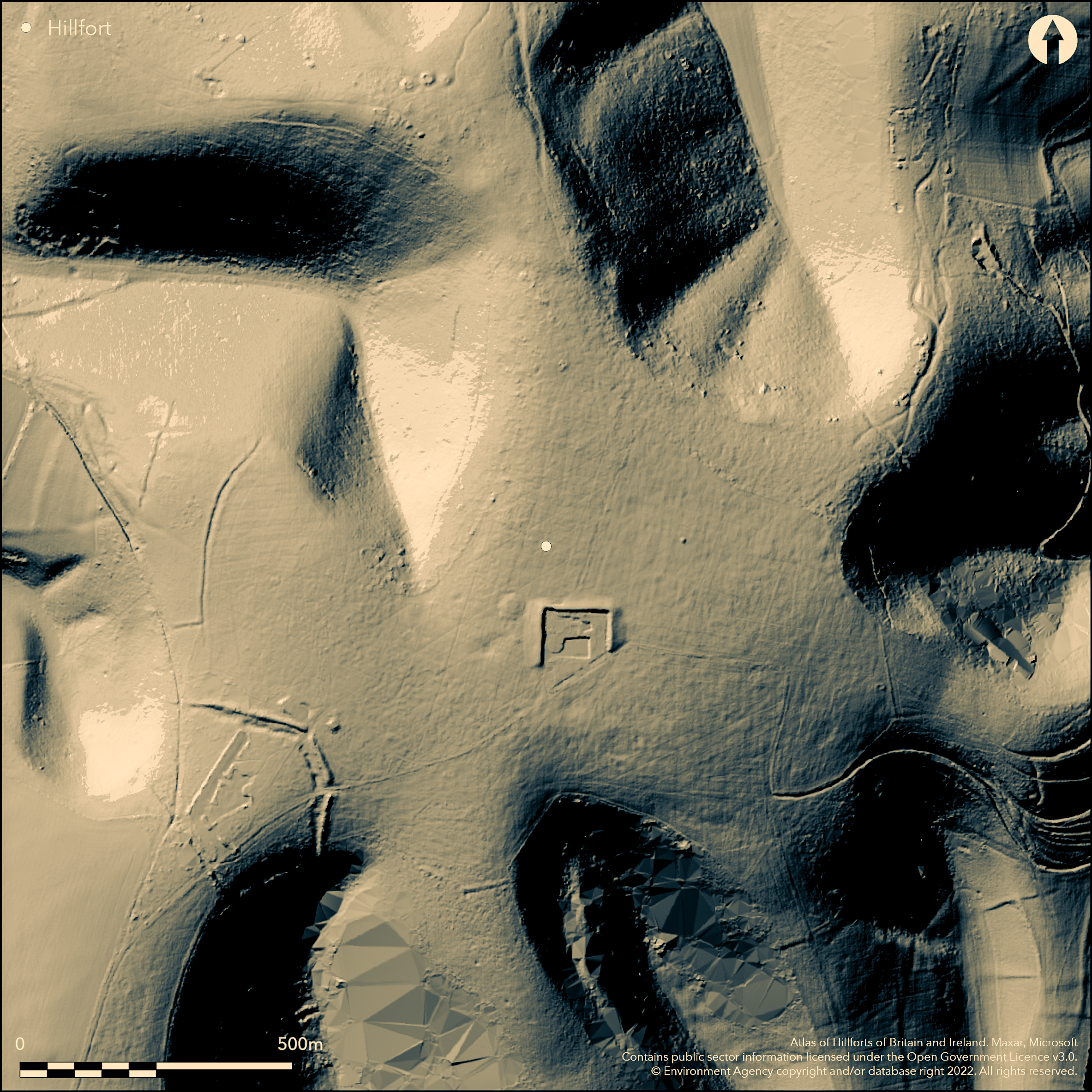
LiDAR 1m DTM Hillshade
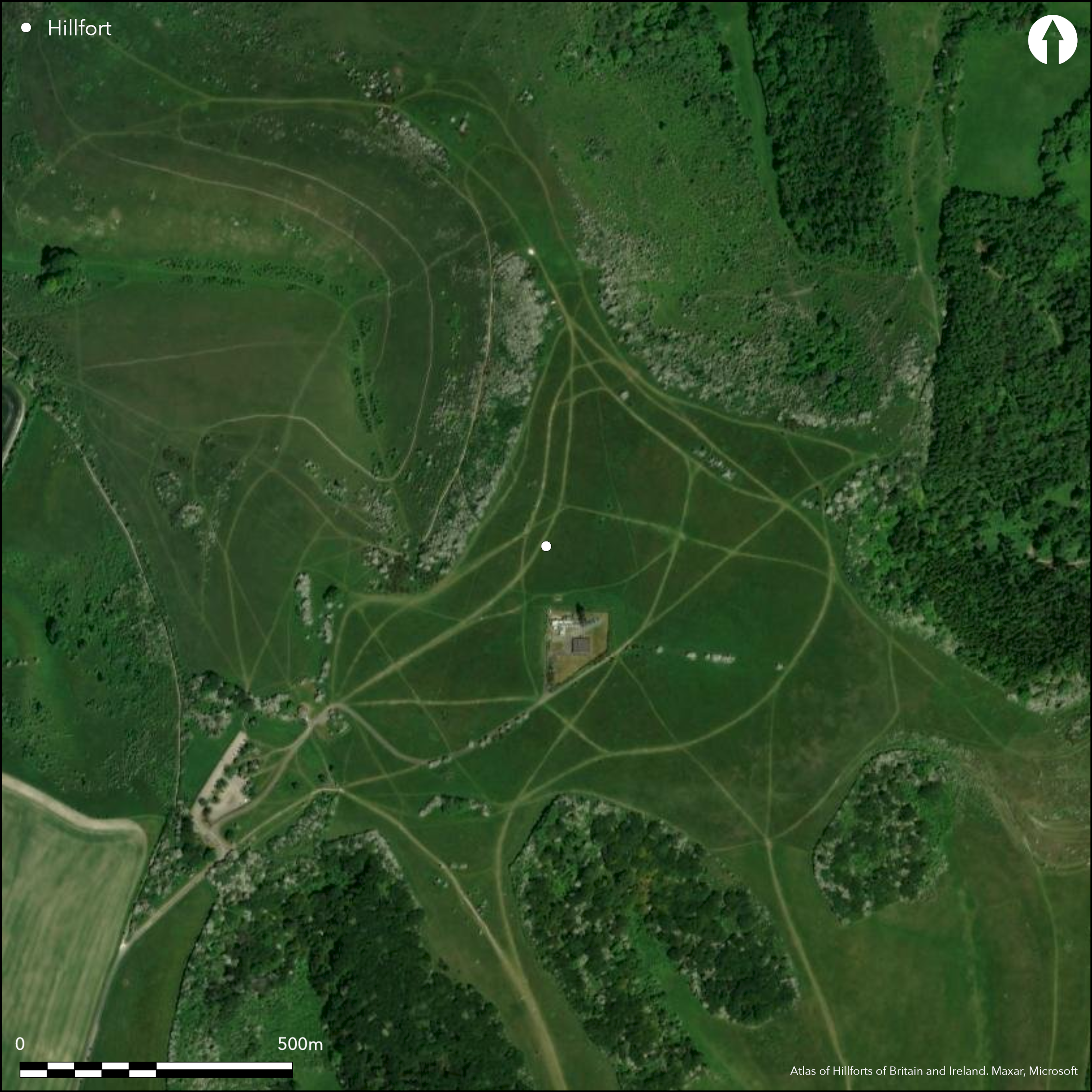
Satellite Imagery
LiDAR 1m DTM Hillshade
Satellite Imagery
Scroll left/right to view further images.
HER: Hampshire 18558; 18563; 18570; 18575; 24820 (None)
NMR: SU 7 2 SW 11 (243117)
SM: 24319
NGR: SU71651914
X: 471527 Y: 120313 (OSGB36)
Located on Butser Hill, SW of Petersfield, a series of banks and ditches which appear to cut off the spurs of the hill top. These may be cross-dykes or possibly some form of enclosure/hillfort. Steep natural slopes to the N, W and E, gentle to S where attached to Hillhampton Down. Approximately 30ha of the hilltop partly enclosed by cross dykes built across the ridge between Butser and Hilhampton Down and on three of the hill's six spurs. The cross dykes, which vary in length between 320m and c.75m, consist usually of a ditch and single low bank, although the two earthworks on the Hilhampton ridge, the easiest access to the hilltop, are more substantial. Here, the outer cross dyke is 90m long and comprises a ditch up to 8m wide and 1m deep, flanked on either side by banks up to 6m wide. Some 90m to the NE, the second, inner, earthwork consists of a 320m long bank and ditch set in a segmented, SW facing arc. The 13m wide bank lies on the uphill side of a ditch up to 11m wide. Both earthworks terminate above steep coombes. Two cross dykes on the W flank of the NW spur are 265m and 128m long respectively, the longer one 80m up slope of the shorter. The higher earthwork has a short right-angled offset section at its S end. Both features consist of a ditch and single bank on the downslope side, both ditches being up to 4m wide. The bank of the longer earthwork is up to 7.5m wide; the bank of the shorter cross dyke is 6m wide. Both features stop at a steep coombe to the N; to the S, they cease on less steep ground north of Limekiln Lane. The cross dyke on the S spur of the hill has an overall length of c.100m, but is in two interrupted sections, 25m (western) and 50m (eastern) long respectively. The feature comprises an irregular low bank up to 6m wide on the up slope side of a 5m wide shallow ditch. The cross dyke on the NE spur of the hill is 98m long and consists of a 3m wide bank on the down slope side of a 4m wide ditch. The earthwork cuts across one hollow way and is cut by another. It has been suggested that some of these represent Neolithic earthworks re-used in the Iron Age and/or the Iron Age enclosure is unfinished. Three Bronze Age barrows on the hilltop, two ploughed out, possibly associated lynchets and field systems on the lower slopes of the hill. On OS 1st Ed map as 'Roman Camp' (1885-1900). Inconclusive small scale excavation R. Bradley 1974. Undated.
Citizen Science: ✗
Reliability of Data: Confirmed
Reliability of Interpretation: Unconfirmed
X: -109375 Y: 6617356 (EPSG: 3857)
Longitude: -0.9825339401086296 Latitude: 50.977732036780715 (EPSG:4326)
Country: England; None
Current County or Unitary Authority: Hampshire
Historic County: Sussex
Current Parish/Community/Council/Townland: Buriton; Langrish
None
| Extant | ✓ |
| Cropmark | ✗ |
| Likely Destroyed | ✗ |
None
| Woodland | ✗ |
| Commercial Forestry Plantation | ✗ |
| Parkland | ✗ |
| Pasture (Grazing) | ✓ |
| Arable | ✗ |
| Scrub/Bracken | ✗ |
| Bare Outcrop | ✗ |
| Heather/Moorland | ✗ |
| Heath | ✗ |
| Built-up | ✗ |
| Coastal Grassland | ✗ |
| Other | ✗ |
Possible partial contour fort on hilltop with spurs or cross-dykes.
| Contour Fort | ✗ |
| Partial Contour Fort | ✓ |
| Promontory Fort | ✗ |
| Hillslope Fort | ✗ |
| Level Terrain Fort | ✗ |
| Marsh Fort | ✗ |
| Multiple Enclosure Fort | ✗ |
| Hilltop | ✓ |
| Coastal Promontory | ✗ |
| Inland Promontory | ✗ |
| Valley Bottom | ✗ |
| Knoll/Hillock/Outcrop | ✗ |
| Ridge | ✗ |
| Cliff/Plateau-edge/Scarp | ✗ |
| Hillslope | ✗ |
| Lowland | ✗ |
| Spur | ✗ |
Dominant Topographic Feature: Hilltop
| North | ✗ |
| Northeast | ✗ |
| East | ✗ |
| Southeast | ✗ |
| South | ✗ |
| Southwest | ✗ |
| West | ✗ |
| Northwest | ✗ |
| Level | ✓ |
Altitude: 265.0m
Boundary Type: Parish/Townland
Undated. Bronze Age round barrows.
Reliability: D - None
| Pre 1200BC | ✗ |
| 1200BC - 800BC | ✗ |
| 800BC - 400BC | ✗ |
| 400BC - AD50 | ✗ |
| AD50 - AD400 | ✗ |
| AD400 - AD 800 | ✗ |
| Post AD800 | ✗ |
| Unknown | ✓ |
| Pre Hillfort: | None |
| Post Hillfort: | None |
In Aubrey's Monumenta Britannica (1665-1693). On OS 1st Ed map as 'Roman Camp' (1885-1900). Small scale excavation R. Bradley 1974.
| Other (1971): | Visited by Hillfort Study Group |
| Excavation (1974): | R. Bradley. |
| 1st Identified Written Reference (None): | In Aubrey's Monumenta Britannica. |
| 1st Identified Map Depiction (None): | OS map. |
No evidence.
None
| None | ✓ |
| Spring | ✗ |
| Stream | ✗ |
| Pool | ✗ |
| Flush | ✗ |
| Well | ✗ |
| Other | ✗ |
None
| No Known Features | ✓ |
| Round Stone Structures | ✗ |
| Rectangular Stone Structures | ✗ |
| Curvilinear Platforms | ✗ |
| Other Roundhouse Evidence | ✗ |
| Pits | ✗ |
| Quarry Hollows | ✗ |
| Other | ✗ |
None
| No Known Excavation | ✓ |
| Pits | ✗ |
| Postholes | ✗ |
| Roundhouses | ✗ |
| Rectangular Structures | ✗ |
| Roads/Tracks | ✗ |
| Quarry Hollows | ✗ |
| Other | ✗ |
| Nothing Found | ✗ |
None
| No Known Geophysics | ✓ |
| Pits | ✗ |
| Roundhouses | ✗ |
| Rectangular Structures | ✗ |
| Roads/Tracks | ✗ |
| Quarry Hollows | ✗ |
| Other | ✗ |
| Nothing Found | ✗ |
None
| No Known Finds | ✓ |
| Pottery | ✗ |
| Metal | ✗ |
| Metalworking | ✗ |
| Human Bones | ✗ |
| Animal Bones | ✗ |
| Lithics | ✗ |
| Environmental | ✗ |
| Other | ✗ |
NO APPARENT FEATURES
| APs Not Checked | ✓ |
| None | ✗ |
| Roundhouses | ✗ |
| Rectangular Structures | ✗ |
| Pits | ✗ |
| Postholes | ✗ |
| Roads/Tracks | ✗ |
| Other | ✗ |
No clear original entrance
| 0: | None |
| 2: | None |
Guard Chambers: ✗
Chevaux de Frise: ✗
Double bank and ditch to Se across neck with Hillhampton Down, single across three other spurs.
| Area 1: | 30.0ha. |
| Total: | 30.0ha. |
Total Footprint Area: Noneha.
None
| ✗ | None |
| ✗ | None |
| NE Quadrant: | None |
| SE Quadrant: | 2 |
| SW Quadrant: | 1 |
| NW Quadrant: | 1 |
| Total: | 2 |
| Partial Univallate | ✓ |
| Univallate | ✗ |
| Partial Bivallate | ✓ |
| Bivallate | ✗ |
| Partial Multivallate | ✗ |
| Multivallate | ✗ |
| Unknown | ✗ |
| Partial Univallate | ✗ |
| Univallate | ✗ |
| Partial Bivallate | ✗ |
| Bivallate | ✗ |
| Partial Multivallate | ✗ |
| Multivallate | ✗ |
None
| None | ✗ |
| Earthen Bank | ✓ |
| Stone Wall | ✗ |
| Rubble | ✗ |
| Wall-walk | ✗ |
| Evidence of Timber | ✗ |
| Vitrification | ✗ |
| Other Burning | ✗ |
| Palisade | ✗ |
| Counter Scarp Bank | ✗ |
| Berm | ✗ |
| Unfinished | ✓ |
| Other | ✗ |
None
| None | ✗ |
| Earthen Bank | ✓ |
| Stone Wall | ✗ |
| Murus Duplex | ✗ |
| Timber-framed | ✗ |
| Timber-laced | ✗ |
| Vitrification | ✗ |
| Other Burning | ✗ |
| Palisade | ✗ |
| Counter Scarp Bank | ✗ |
| Berm | ✗ |
| Unfinished | ✗ |
| No Known Excavation | ✗ |
| Other | ✗ |
| ✗ | None |
| ✓ | None |
Number of Ditches: 1
| ✗ | None |
Bradley, R, 1974. The trial excavation of two earthworks on Butser Hill, Hampshire Fld Club Archaeol Soc Sec Newsl., 83-84
Cavendish, R. 1983. Prehistoric England, London: Guild Publishing,131-132.
Piggott, S, 1930. Butser Hill, Antiquity, 4, 187-200.
RCHME. Industry and Enclosure in the Neolithic: Butser Hill Survey
Atlas of Hillforts:
Wikidata:
This work is licensed under CC BY-SA 4.0

 and should be cited as:
Lock, Gary and Ralston, Ian. 2024. Atlas of Hillforts of Britain and Ireland. Available at: https://hillforts.arch.ox.ac.uk
Document Version 1.1