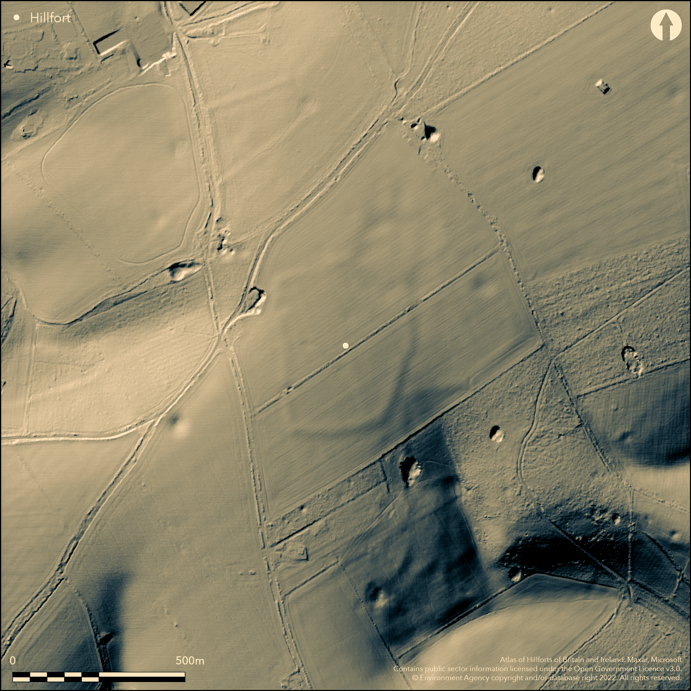
LiDAR 1m DTM Hillshade
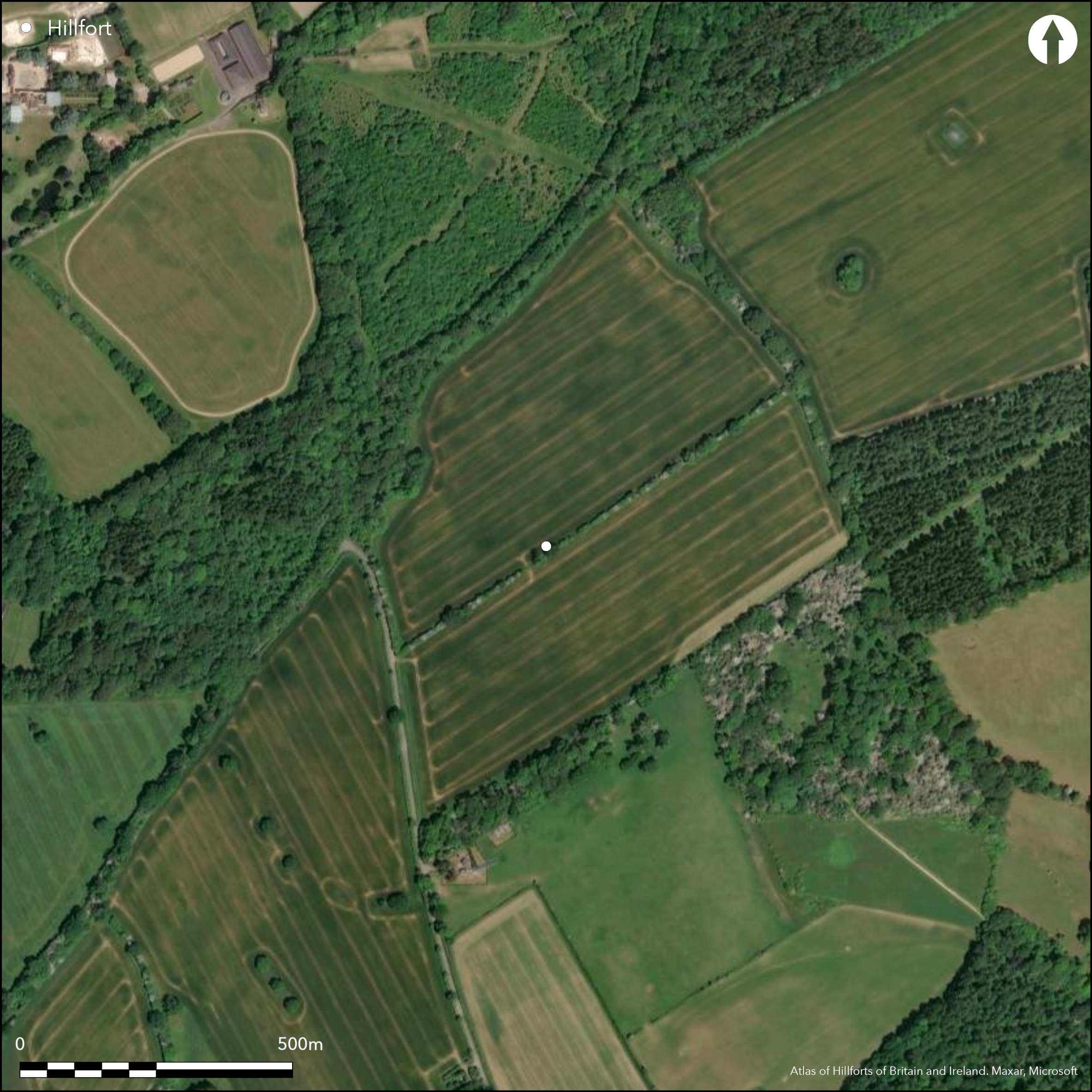
Satellite Imagery
LiDAR 1m DTM Hillshade
Satellite Imagery
Scroll left/right to view further images.
HER: Hampshire 17442 (None)
NMR: SU 74 SW (244030)
SM: None
NGR: SU72324345
X: 472320 Y: 143450 (OSGB36)
Ploughed-out, commanding, univallate contour hillfort located on prominent summit of NE-SW ridge above River Wey on SE, with views in all directions. Steep or moderate to steep surrounding slopes. D-shaped with internal area c. 5.2ha. Single bank and ditch now fragmentary and a faint spread 22m wide and to 0.3m high in places, but mostly much less. Outer ditch now buried feature. Excavation by Alton Archaeological Committee produced no positive dating evidence, but ditch possibly recut at end of Iron Age (Millett 1981). Possible inturned entrance on W side. Circular ditches present within the hillfort possibly round houses, but general evidence for activity is sparse (Pringle 2011). Magnetometer survey 2000 found boundary ditch clearer on N side. Cultivated.
Citizen Science: ✓
Reliability of Data: Confirmed
Reliability of Interpretation: Confirmed
X: -107603 Y: 6654200 (EPSG: 3857)
Longitude: -0.9666156046278078 Latitude: 51.18565415310676 (EPSG:4326)
Country: England; None
Current County or Unitary Authority: Hampshire
Historic County: Hampshire and Isle of Wight
Current Parish/Community/Council/Townland: Froyle; South Warnborough
Ploughed-out; now faint traces only.
| Extant | ✗ |
| Cropmark | ✓ |
| Likely Destroyed | ✗ |
Cultivated.
| Woodland | ✗ |
| Commercial Forestry Plantation | ✗ |
| Parkland | ✗ |
| Pasture (Grazing) | ✗ |
| Arable | ✓ |
| Scrub/Bracken | ✗ |
| Bare Outcrop | ✗ |
| Heather/Moorland | ✗ |
| Heath | ✗ |
| Built-up | ✗ |
| Coastal Grassland | ✗ |
| Other | ✗ |
Ploughed-out, commanding, univallate contour hillfort located on prominent summit of NE-SW ridge above River Wey on SE, with views in all directions. Steep or moderate to steep surrounding slopes.
| Contour Fort | ✓ |
| Partial Contour Fort | ✗ |
| Promontory Fort | ✗ |
| Hillslope Fort | ✗ |
| Level Terrain Fort | ✗ |
| Marsh Fort | ✗ |
| Multiple Enclosure Fort | ✗ |
| Hilltop | ✗ |
| Coastal Promontory | ✗ |
| Inland Promontory | ✗ |
| Valley Bottom | ✗ |
| Knoll/Hillock/Outcrop | ✗ |
| Ridge | ✓ |
| Cliff/Plateau-edge/Scarp | ✗ |
| Hillslope | ✗ |
| Lowland | ✗ |
| Spur | ✗ |
Dominant Topographic Feature: Ridge
| North | ✗ |
| Northeast | ✗ |
| East | ✗ |
| Southeast | ✗ |
| South | ✗ |
| Southwest | ✗ |
| West | ✗ |
| Northwest | ✗ |
| Level | ✓ |
Altitude: 219.0m
Boundary Type: Parish/Townland
Excavation by Alton Archaeological Committee produced no positive dating evidence, but ditch possibly recut at end of Iron Age.
Reliability: B - Medium
| Pre 1200BC | ✗ |
| 1200BC - 800BC | ✗ |
| 800BC - 400BC | ✗ |
| 400BC - AD50 | ✓ |
| AD50 - AD400 | ✗ |
| AD400 - AD 800 | ✗ |
| Post AD800 | ✗ |
| Unknown | ✗ |
| Pre Hillfort: | None |
| Post Hillfort: | None |
| Morphology/Earthwork/Typology: | Ditch possibly recut at end of Iron Age. |
Cable trench inspection 1964-5. Excavation M. Millett Alton Archaeological Committee 1978. Geophysical survey PADMAC 2000. Desk based assessment G. Pringle University of Winchester 2011.
| Excavation (1978): | M. Millett Alton Archaeological Committee. |
| Geophysical Survey (2000): | Magnetometer survey PADMAC. |
| Other (2011): | Desk based assessment G. Pringle University of Winchester. |
| Other (None): | Cable trench inpection. |
Circular ditches present within the hillfort possibly round houses, but general evidence for activity is sparse (Pringle 2011).
None
| None | ✓ |
| Spring | ✗ |
| Stream | ✗ |
| Pool | ✗ |
| Flush | ✗ |
| Well | ✗ |
| Other | ✗ |
Circular ditches present within the hillfort possibly round houses, but general evidence for activity is sparse (Pringle 2011).
| No Known Features | ✓ |
| Round Stone Structures | ✗ |
| Rectangular Stone Structures | ✗ |
| Curvilinear Platforms | ✗ |
| Other Roundhouse Evidence | ✗ |
| Pits | ✗ |
| Quarry Hollows | ✗ |
| Other | ✗ |
None
| No Known Excavation | ✗ |
| Pits | ✗ |
| Postholes | ✗ |
| Roundhouses | ✗ |
| Rectangular Structures | ✗ |
| Roads/Tracks | ✗ |
| Quarry Hollows | ✗ |
| Other | ✗ |
| Nothing Found | ✓ |
None
| No Known Geophysics | ✗ |
| Pits | ✗ |
| Roundhouses | ✗ |
| Rectangular Structures | ✗ |
| Roads/Tracks | ✗ |
| Quarry Hollows | ✗ |
| Other | ✗ |
| Nothing Found | ✓ |
None
| No Known Finds | ✓ |
| Pottery | ✗ |
| Metal | ✗ |
| Metalworking | ✗ |
| Human Bones | ✗ |
| Animal Bones | ✗ |
| Lithics | ✗ |
| Environmental | ✗ |
| Other | ✗ |
None
| APs Not Checked | ✓ |
| None | ✗ |
| Roundhouses | ✗ |
| Rectangular Structures | ✗ |
| Pits | ✗ |
| Postholes | ✗ |
| Roads/Tracks | ✗ |
| Other | ✗ |
Possible inturned entrance on W side
| 1: | None |
| 2: | None |
Guard Chambers: ✗
Chevaux de Frise: ✗
| 1. In-turned (West): | Possible. |
Single bank and ditch now fragmentery and a faint spread 22m wide and to 0.3m high in places, but mostly much less. Outer ditch now buried feature.
| Area 1: | 5.2ha. |
| Total: | 5.2ha. |
Total Footprint Area: Noneha.
None
| ✗ | None |
| ✓ | Ploughed out and original ramparts estimated. |
| NE Quadrant: | 1 |
| SE Quadrant: | 1 |
| SW Quadrant: | 1 |
| NW Quadrant: | 1 |
| Total: | 1 |
| Partial Univallate | ✗ |
| Univallate | ✓ |
| Partial Bivallate | ✗ |
| Bivallate | ✗ |
| Partial Multivallate | ✗ |
| Multivallate | ✗ |
| Unknown | ✗ |
| Partial Univallate | ✗ |
| Univallate | ✗ |
| Partial Bivallate | ✗ |
| Bivallate | ✗ |
| Partial Multivallate | ✗ |
| Multivallate | ✗ |
None
| None | ✗ |
| Earthen Bank | ✓ |
| Stone Wall | ✗ |
| Rubble | ✗ |
| Wall-walk | ✗ |
| Evidence of Timber | ✗ |
| Vitrification | ✗ |
| Other Burning | ✗ |
| Palisade | ✗ |
| Counter Scarp Bank | ✗ |
| Berm | ✗ |
| Unfinished | ✗ |
| Other | ✗ |
Ditch possibly recut at end of Iron Age.
| None | ✗ |
| Earthen Bank | ✗ |
| Stone Wall | ✗ |
| Murus Duplex | ✗ |
| Timber-framed | ✗ |
| Timber-laced | ✗ |
| Vitrification | ✗ |
| Other Burning | ✗ |
| Palisade | ✗ |
| Counter Scarp Bank | ✗ |
| Berm | ✗ |
| Unfinished | ✗ |
| No Known Excavation | ✗ |
| Other | ✓ |
| ✗ | None |
| ✓ | Magnetometer survey 2000 found boundary ditch clearer on N side. |
Number of Ditches: 1
| ✗ | None |
Millett, M. 1981. Iron Age hillfort on Holybourne Down, Proc Hampshire Fld Club Archaeol Soc, 37, 49-53.
Pringle, P. 2011. Exploring the Iron Age on Holybourne Down. A Hampshire hillfort reconsidered, Undergraduate thesis, University of Winchester.
Atlas of Hillforts:
Wikidata:
This work is licensed under CC BY-SA 4.0

 and should be cited as:
Lock, Gary and Ralston, Ian. 2024. Atlas of Hillforts of Britain and Ireland. Available at: https://hillforts.arch.ox.ac.uk
Document Version 1.1