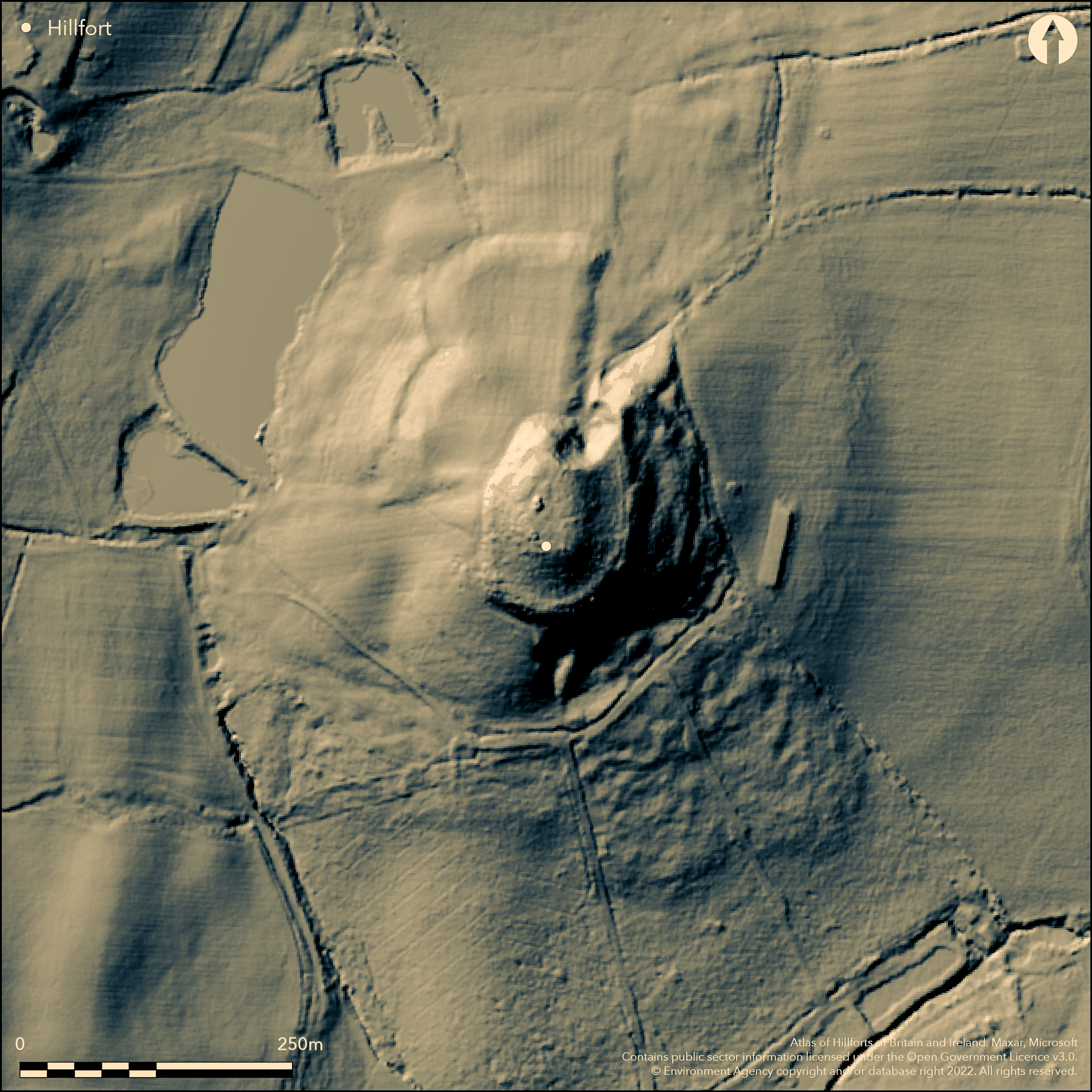
LiDAR 1m DTM Hillshade
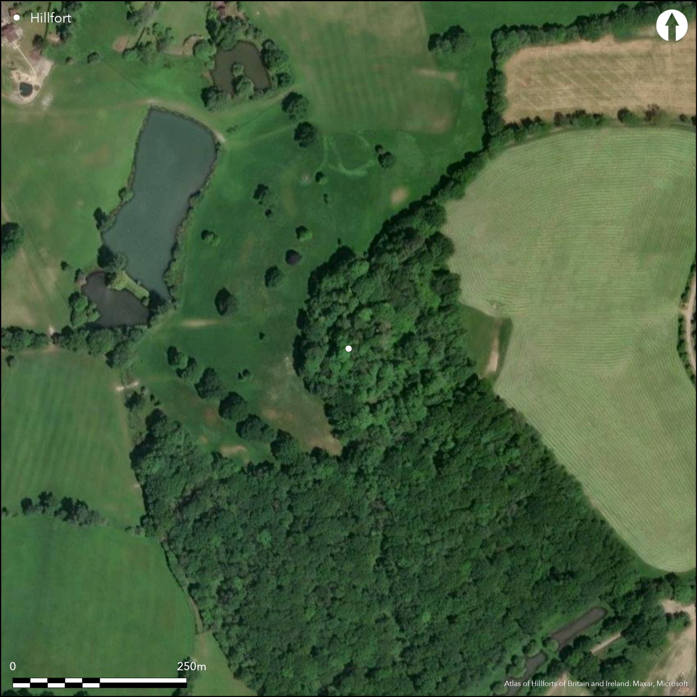
Satellite Imagery
LiDAR 1m DTM Hillshade
Satellite Imagery
Scroll left/right to view further images.
HER: Hampshire 17217 (None)
NMR: SD U7 3NE 4 (243207)
SM: 10204314
NGR: SU75583772
X: 475566 Y: 137692 (OSGB36)
Possible multivallate, contour hillfort located on flat summit and SE crest of Greensand St John's Hill above surrounding streams. Steep surrounding slopes, slightly less on E. Roughly oval N-S when complete, with interior c. 0.8ha. Quarrying for malm stone removed N ramparts but elsewhere defined by two concentric scarps separated by broad ledge, except on NE where access to the interior gained by steep spur cut at base by slight transverse ditch which extends into later boundary feature curving around E base of hill, enclosing series of irregular, possibly natural terraces on fort's lower flank. Partial excavation 1939 found two infilled storage pits used as rubbish tips, one producing ring-headed pin, scatter of flint chips and pottery c. 100 BC (Williams-Freeman 1940). Also pottery and building remains of 13th and 14th centuries of possible hunting lodge supposedly built on hill by King John. Further evidence of post medieval occupation, including oven and building materials. Futher investigation 1947-50 suggested three sequences of activity (Maitland Muller 1950): I. Iron Age farm before or after 100 BC, with storage pits. II. 13th/14th century activity, with re-used diagonally-tooled ashlar blocks. III. Tudor period to 18th century, with walls and rammed malm floors and oven. Wooded on NE-SW, pasture with scattered trees elsewhere. On 1st Ed. OS map (1871-4).
Citizen Science: ✗
Reliability of Data: Confirmed
Reliability of Interpretation: Unconfirmed
X: -102568 Y: 6644937 (EPSG: 3857)
Longitude: -0.9213871180068027 Latitude: 51.133467015128 (EPSG:4326)
Country: England
Current County or Unitary Authority: Hampshire
Historic County: Hampshire and Isle of Wight
Current Parish/Community/Council/Townland: Worldham
Summit of hill dug for malm stone which has erased N earthwork.
| Extant | ✓ |
| Cropmark | ✗ |
| Likely Destroyed | ✓ |
Wooded on NE-SW, pasture with scattered trees elsewhere. Medieval structures/features.
| Woodland | ✓ |
| Commercial Forestry Plantation | ✗ |
| Parkland | ✗ |
| Pasture (Grazing) | ✓ |
| Arable | ✗ |
| Scrub/Bracken | ✗ |
| Bare Outcrop | ✗ |
| Heather/Moorland | ✗ |
| Heath | ✗ |
| Built-up | ✗ |
| Coastal Grassland | ✗ |
| Other | ✓ |
Possible multivallate, contour hillfort located on summit and SE crest of St John's Hill above surrounding streams. Steep surrounding slopes, slightly less on E.
| Contour Fort | ✓ |
| Partial Contour Fort | ✗ |
| Promontory Fort | ✗ |
| Hillslope Fort | ✗ |
| Level Terrain Fort | ✗ |
| Marsh Fort | ✗ |
| Multiple Enclosure Fort | ✗ |
| Hilltop | ✓ |
| Coastal Promontory | ✗ |
| Inland Promontory | ✗ |
| Valley Bottom | ✗ |
| Knoll/Hillock/Outcrop | ✗ |
| Ridge | ✗ |
| Cliff/Plateau-edge/Scarp | ✗ |
| Hillslope | ✗ |
| Lowland | ✗ |
| Spur | ✗ |
Dominant Topographic Feature: Hill top
| North | ✗ |
| Northeast | ✗ |
| East | ✗ |
| Southeast | ✗ |
| South | ✗ |
| Southwest | ✗ |
| West | ✗ |
| Northwest | ✗ |
| Level | ✓ |
Altitude: 183.0m
N/A
Lower Iron Age pottery and ring-headed pin. Investigation 1947 suggested three sequences of activity: I. Iron Age farm before or after 100 BC, with storage pits. II. 13th / 14th century activity, with re-used diagonally-tooled ashlar blocks. III. Tudor period to 18th century, with walls and rammed malm floors and oven.
Reliability: B - Medium
| Pre 1200BC | ✗ |
| 1200BC - 800BC | ✗ |
| 800BC - 400BC | ✗ |
| 400BC - AD50 | ✓ |
| AD50 - AD400 | ✗ |
| AD400 - AD 800 | ✗ |
| Post AD800 | ✗ |
| Unknown | ✗ |
| Pre Hillfort: | None |
| Post Hillfort: | None |
| Artefactual: | Lower Iron Age pottery and ring-headed pin. |
On 1st Ed. Os map (1871-4). Excavation Major J.Ferguson 1939. Excavation M.R. Maitland-Muller 1947-50.
| Excavation (1939): | Major J.Ferguson. |
| 1st Identified Map Depiction (None): | OS map. |
| Excavation (None): | M.R. Maitland-Muller. |
Excavation produced two infilled rubbish tips, one producing ring-headed pin, scatter of flint chips and pottery c. 100 BC.
None
| None | ✓ |
| Spring | ✗ |
| Stream | ✗ |
| Pool | ✗ |
| Flush | ✗ |
| Well | ✗ |
| Other | ✗ |
None
| No Known Features | ✓ |
| Round Stone Structures | ✗ |
| Rectangular Stone Structures | ✗ |
| Curvilinear Platforms | ✗ |
| Other Roundhouse Evidence | ✗ |
| Pits | ✗ |
| Quarry Hollows | ✗ |
| Other | ✗ |
Two infilled rubbish pits. Iron Age farm before or after 100 BC, with storage pits.
| No Known Excavation | ✗ |
| Pits | ✓ |
| Postholes | ✗ |
| Roundhouses | ✗ |
| Rectangular Structures | ✗ |
| Roads/Tracks | ✗ |
| Quarry Hollows | ✗ |
| Other | ✗ |
| Nothing Found | ✗ |
None
| No Known Geophysics | ✓ |
| Pits | ✗ |
| Roundhouses | ✗ |
| Rectangular Structures | ✗ |
| Roads/Tracks | ✗ |
| Quarry Hollows | ✗ |
| Other | ✗ |
| Nothing Found | ✗ |
Rubbish tip produced ring-headed pin, scatter of flint chips and pottery c. 100 BC.
| No Known Finds | ✗ |
| Pottery | ✓ |
| Metal | ✓ |
| Metalworking | ✗ |
| Human Bones | ✗ |
| Animal Bones | ✗ |
| Lithics | ✓ |
| Environmental | ✗ |
| Other | ✗ |
None
| APs Not Checked | ✓ |
| None | ✗ |
| Roundhouses | ✗ |
| Rectangular Structures | ✗ |
| Pits | ✗ |
| Postholes | ✗ |
| Roads/Tracks | ✗ |
| Other | ✗ |
None defined. Possibly on NE along spur, but conjecture.
| 0: | None |
| 2: | None defined. Possibly on NE along spur, but conjecture. |
Guard Chambers: ✗
Chevaux de Frise: ✗
| 1. Simple Gap (North east): | None defined. Possibly on NE along spur, but conjecture. |
Quarrying for malm stone removed N defences, but elsewhere defined by two concentric scarps separated by broad ledge, except on NE where access to the interior gained by steep spur cut at base by slight transverse ditch which extends into later boundary feature curving around E base of hill, enclosing series of irregular, possibly natural terraces on fort's lower flank.
| Area 1: | 0.8ha. |
| Total: | 0.8ha. |
Total Footprint Area: Noneha.
None
| ✗ | None |
| ✗ | N quarried away. |
| NE Quadrant: | 0 |
| SE Quadrant: | 2 |
| SW Quadrant: | 2 |
| NW Quadrant: | 0 |
| Total: | 2 |
| Partial Univallate | ✗ |
| Univallate | ✗ |
| Partial Bivallate | ✓ |
| Bivallate | ✗ |
| Partial Multivallate | ✗ |
| Multivallate | ✗ |
| Unknown | ✗ |
| Partial Univallate | ✗ |
| Univallate | ✗ |
| Partial Bivallate | ✗ |
| Bivallate | ✗ |
| Partial Multivallate | ✗ |
| Multivallate | ✗ |
None
| None | ✗ |
| Earthen Bank | ✓ |
| Stone Wall | ✗ |
| Rubble | ✗ |
| Wall-walk | ✗ |
| Evidence of Timber | ✗ |
| Vitrification | ✗ |
| Other Burning | ✗ |
| Palisade | ✗ |
| Counter Scarp Bank | ✗ |
| Berm | ✗ |
| Unfinished | ✗ |
| Other | ✗ |
None
| None | ✓ |
| Earthen Bank | ✗ |
| Stone Wall | ✗ |
| Murus Duplex | ✗ |
| Timber-framed | ✗ |
| Timber-laced | ✗ |
| Vitrification | ✗ |
| Other Burning | ✗ |
| Palisade | ✗ |
| Counter Scarp Bank | ✗ |
| Berm | ✗ |
| Unfinished | ✗ |
| No Known Excavation | ✗ |
| Other | ✗ |
| ✗ | None |
| ✗ | None visible; probably buried feaure. |
Number of Ditches: 0
| ✗ | None |
Maitland Muller, M. 1950. Alton Museum Report, Alton Museum Report, 17, 5.
Williams-Freeman, J. 1940. King John's Hill, East Worldham, Proc Hampshire Fld Club Archaeol Soc,, 14, 398-99.
Atlas of Hillforts:
Wikidata:
This work is licensed under CC BY-SA 4.0

 and should be cited as:
Lock, Gary and Ralston, Ian. 2024. Atlas of Hillforts of Britain and Ireland. Available at: https://hillforts.arch.ox.ac.uk
Document Version 1.1