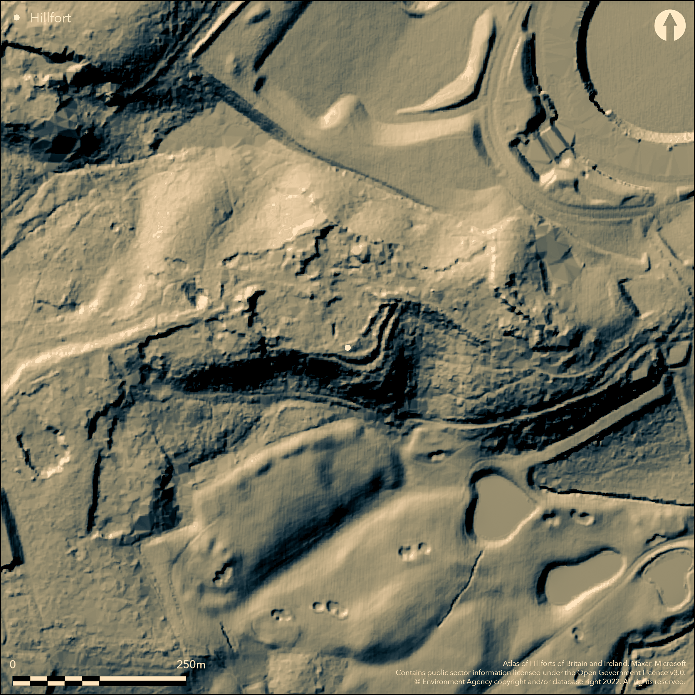
LiDAR 1m DTM Hillshade
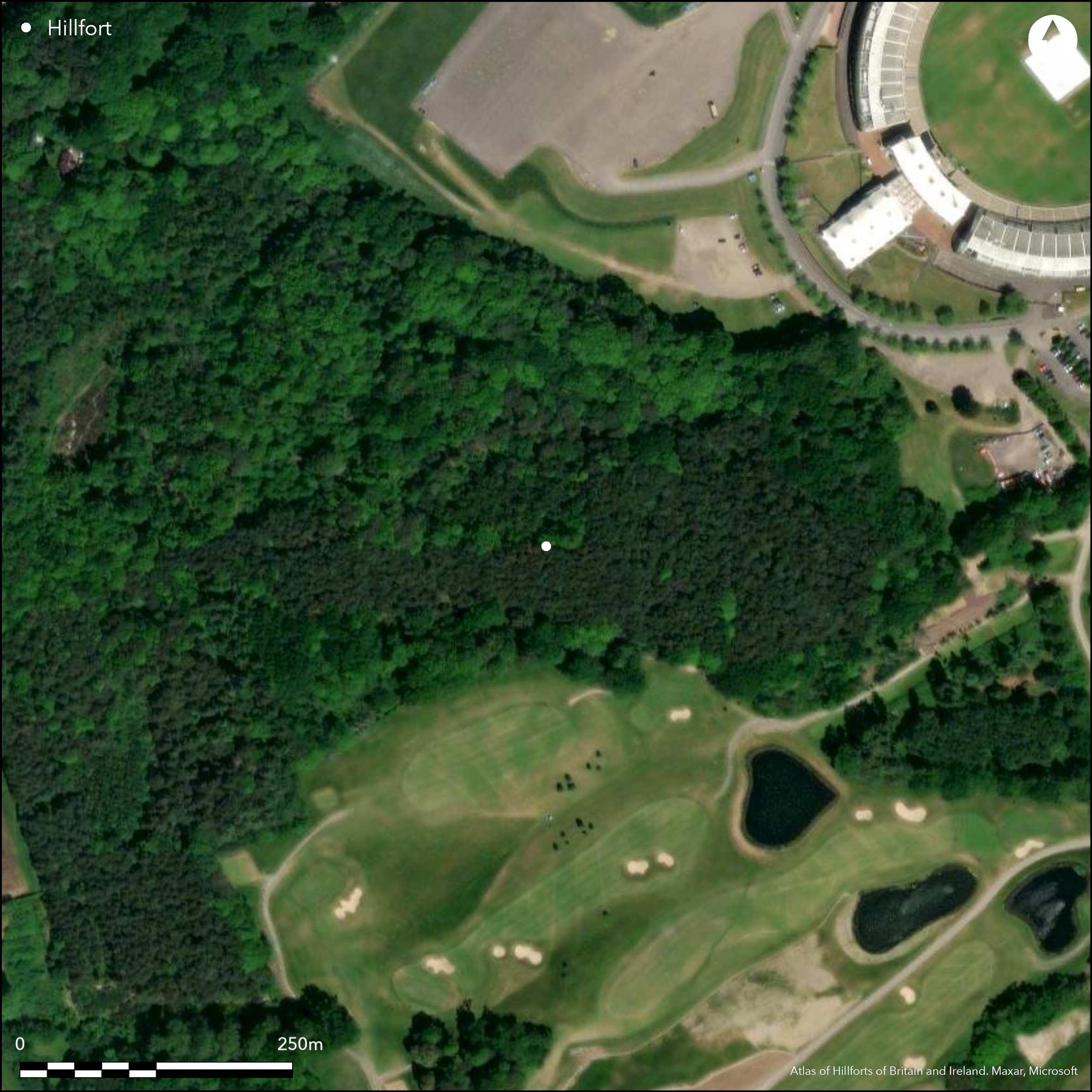
Satellite Imagery
LiDAR 1m DTM Hillshade
Satellite Imagery
Scroll left/right to view further images.
HER: Hampshire 25965 (None)
NMR: SU 47 13NW (230213)
SM: 1017888
NGR: SU47451380
X: 447450 Y: 113800 (OSGB36)
Univallate hillfort, largely destroyed by gravel digging located on the S side of hill W of Hickley Farm. Occupied good position on gravel-capped spur projecting E from a gravel plateau, with steep surrounding slopes, less along spur on E and W. Formerly, possibly roughly rectangular or oval in shape, with width across spur c. 130m, but length unknown but estimated at c. 190m, and internal area area c. 1ha-2ha+. Section of ramparts remain on SE and S sides, where vestiges of bank, c. 2-3m high, with infilled ditch and 1m high counterscarp. Bank taken as boundary of gravel pit, so mostly gone, but ditch and counterscarp intact. Very little of interior survives, only as irregular strip immediately within rampart and some mounds within quarry floor. Possible outer infilled ditch or trackway survives at SE corner and traces of possible quarry ditch within rampart. Rest of site more or less destroyed, but discontinuous sections of truncated rampart or steepened scarp survive on heavily disturbed ground along N and NW sides, whilst traces of infilled ditch and area of high ground and mature vegetation indicate likely position of ramparts on SW side. Possible original entrance from E now buried beneath gravel track which crosses the site. Staggered entrance with outworks indicated by apparent E projection of rampart N of the track. Later banks and ditches, enclosing medieval woodland and areas of common and heath, skirt site to N and SE and extend onto ramparts at E and W. Remains commercial afforested and scrub. Few investigations. Undated.
Citizen Science: ✗
Reliability of Data: Confirmed
Reliability of Interpretation: Confirmed
X: -147644 Y: 6607446 (EPSG: 3857)
Longitude: -1.3263116516961242 Latitude: 50.92165156972794 (EPSG:4326)
Country: England
Current County or Unitary Authority: Hampshire
Historic County: Hampshire and Isle of Wight
Current Parish/Community/Council/Townland: West End
Largely destroyed by gravel extraction, now ceased. Gravel track crosses site.
| Extant | ✓ |
| Cropmark | ✗ |
| Likely Destroyed | ✓ |
Afforested and scrub.
| Woodland | ✗ |
| Commercial Forestry Plantation | ✓ |
| Parkland | ✗ |
| Pasture (Grazing) | ✗ |
| Arable | ✗ |
| Scrub/Bracken | ✓ |
| Bare Outcrop | ✗ |
| Heather/Moorland | ✗ |
| Heath | ✗ |
| Built-up | ✗ |
| Coastal Grassland | ✗ |
| Other | ✗ |
Partial contour fort occuping good position on gravel-capped spur projecting E from a gravel plateau, with steep surrounding slopes, less along spur on E and W.
| Contour Fort | ✗ |
| Partial Contour Fort | ✓ |
| Promontory Fort | ✗ |
| Hillslope Fort | ✗ |
| Level Terrain Fort | ✗ |
| Marsh Fort | ✗ |
| Multiple Enclosure Fort | ✗ |
| Hilltop | ✗ |
| Coastal Promontory | ✗ |
| Inland Promontory | ✗ |
| Valley Bottom | ✗ |
| Knoll/Hillock/Outcrop | ✗ |
| Ridge | ✗ |
| Cliff/Plateau-edge/Scarp | ✗ |
| Hillslope | ✗ |
| Lowland | ✗ |
| Spur | ✓ |
Dominant Topographic Feature: Spur
| North | ✗ |
| Northeast | ✗ |
| East | ✗ |
| Southeast | ✗ |
| South | ✗ |
| Southwest | ✗ |
| West | ✗ |
| Northwest | ✗ |
| Level | ✓ |
Altitude: 75.0m
N/A
None.
Reliability: D - None
| Pre 1200BC | ✗ |
| 1200BC - 800BC | ✗ |
| 800BC - 400BC | ✗ |
| 400BC - AD50 | ✗ |
| AD50 - AD400 | ✗ |
| AD400 - AD 800 | ✗ |
| Post AD800 | ✗ |
| Unknown | ✓ |
| Pre Hillfort: | None |
| Post Hillfort: | Possibly. Later banks and ditches, enclosing medieval woodland and areas of common and heath, skirt site to N and SE and extend onto ramparts at E and W. |
South Stoneham Tithe Awards and Map 1844. Field investigator comments 1955, 1969.
| 1st Identified Map Depiction (1844): | South Stoneham Tithe Awards and Map. |
| Other (None): | Field investigator comments - no details. |
Traces of quarry ditch within rampart.
Shallow dewpond in interior.
| None | ✗ |
| Spring | ✗ |
| Stream | ✗ |
| Pool | ✗ |
| Flush | ✗ |
| Well | ✗ |
| Other | ✓ |
Traces of quarry ditch within rampart.
| No Known Features | ✗ |
| Round Stone Structures | ✗ |
| Rectangular Stone Structures | ✗ |
| Curvilinear Platforms | ✗ |
| Other Roundhouse Evidence | ✗ |
| Pits | ✗ |
| Quarry Hollows | ✓ |
| Other | ✗ |
None
| No Known Excavation | ✓ |
| Pits | ✗ |
| Postholes | ✗ |
| Roundhouses | ✗ |
| Rectangular Structures | ✗ |
| Roads/Tracks | ✗ |
| Quarry Hollows | ✗ |
| Other | ✗ |
| Nothing Found | ✗ |
None
| No Known Geophysics | ✓ |
| Pits | ✗ |
| Roundhouses | ✗ |
| Rectangular Structures | ✗ |
| Roads/Tracks | ✗ |
| Quarry Hollows | ✗ |
| Other | ✗ |
| Nothing Found | ✗ |
None
| No Known Finds | ✓ |
| Pottery | ✗ |
| Metal | ✗ |
| Metalworking | ✗ |
| Human Bones | ✗ |
| Animal Bones | ✗ |
| Lithics | ✗ |
| Environmental | ✗ |
| Other | ✗ |
None
| APs Not Checked | ✓ |
| None | ✗ |
| Roundhouses | ✗ |
| Rectangular Structures | ✗ |
| Pits | ✗ |
| Postholes | ✗ |
| Roads/Tracks | ✗ |
| Other | ✗ |
Possible original entrance from E now buried beneath gravel track which crosses the site. Staggered entrance with outworks indicated by apparent E projection of rampart N of the track.
| None: | None |
| 2: | None |
Guard Chambers: ✗
Chevaux de Frise: ✗
| 1. Simple Gap (East): | Type only conjecture. Now buried beneath gravel track which crosses the site. |
| 2. Outworks (North): | Possible staggered entrance. Position estimated. |
| 2. Over-lapping (North): | Staggered. |
Section of defences remain on SE and S sides, where vestiges of bank, c. 2-3m high, with infilled ditch and 1m high counterscarp. Bank taken as boundary of gravel pit, so mostly gone, but ditch and counterscarp intact. Discontinuous sections of truncated rampart or steepened scarp survive on heavily disturbed ground along N and NW sides, whilst traces of infilled ditch and area of high ground and mature vegetation indicate likely position of ramparts on SW side. Possible outer infilled ditch or trackway survives at SE corner.
| Area 1: | 2.0ha. |
| Total: | 2.0ha. |
Total Footprint Area: Noneha.
None
| ✗ | Area unknown and estimated. |
| ✗ | Most of site destroyed. |
| NE Quadrant: | 0 |
| SE Quadrant: | 1 |
| SW Quadrant: | 0 |
| NW Quadrant: | 0 |
| Total: | 1 |
| Partial Univallate | ✓ |
| Univallate | ✗ |
| Partial Bivallate | ✗ |
| Bivallate | ✗ |
| Partial Multivallate | ✗ |
| Multivallate | ✗ |
| Unknown | ✗ |
| Partial Univallate | ✗ |
| Univallate | ✗ |
| Partial Bivallate | ✗ |
| Bivallate | ✗ |
| Partial Multivallate | ✗ |
| Multivallate | ✗ |
Counterscarp intact on SE and S.
| None | ✗ |
| Earthen Bank | ✓ |
| Stone Wall | ✗ |
| Rubble | ✗ |
| Wall-walk | ✗ |
| Evidence of Timber | ✗ |
| Vitrification | ✗ |
| Other Burning | ✗ |
| Palisade | ✗ |
| Counter Scarp Bank | ✓ |
| Berm | ✗ |
| Unfinished | ✗ |
| Other | ✗ |
None
| None | ✗ |
| Earthen Bank | ✗ |
| Stone Wall | ✗ |
| Murus Duplex | ✗ |
| Timber-framed | ✗ |
| Timber-laced | ✗ |
| Vitrification | ✗ |
| Other Burning | ✗ |
| Palisade | ✗ |
| Counter Scarp Bank | ✗ |
| Berm | ✗ |
| Unfinished | ✗ |
| No Known Excavation | ✓ |
| Other | ✗ |
| ✗ | None |
| ✓ | Infilled ditch where survives. |
Number of Ditches: 1
| ✗ | None |
Farwell, D.1997. Hampshire County Cricket Club New Grounds, Arch Field Evaluation. No details.
Kaye, E. 1976. So'ton Rec. Series', in The Cartulary of God's House, Southampton, Vol. XIX, 158-165.
South Stoneham Tithe Awards and Map Source Date: 1844 Author: Publisher: Surveyor:
Atlas of Hillforts:
Wikidata:
This work is licensed under CC BY-SA 4.0

 and should be cited as:
Lock, Gary and Ralston, Ian. 2024. Atlas of Hillforts of Britain and Ireland. Available at: https://hillforts.arch.ox.ac.uk
Document Version 1.1