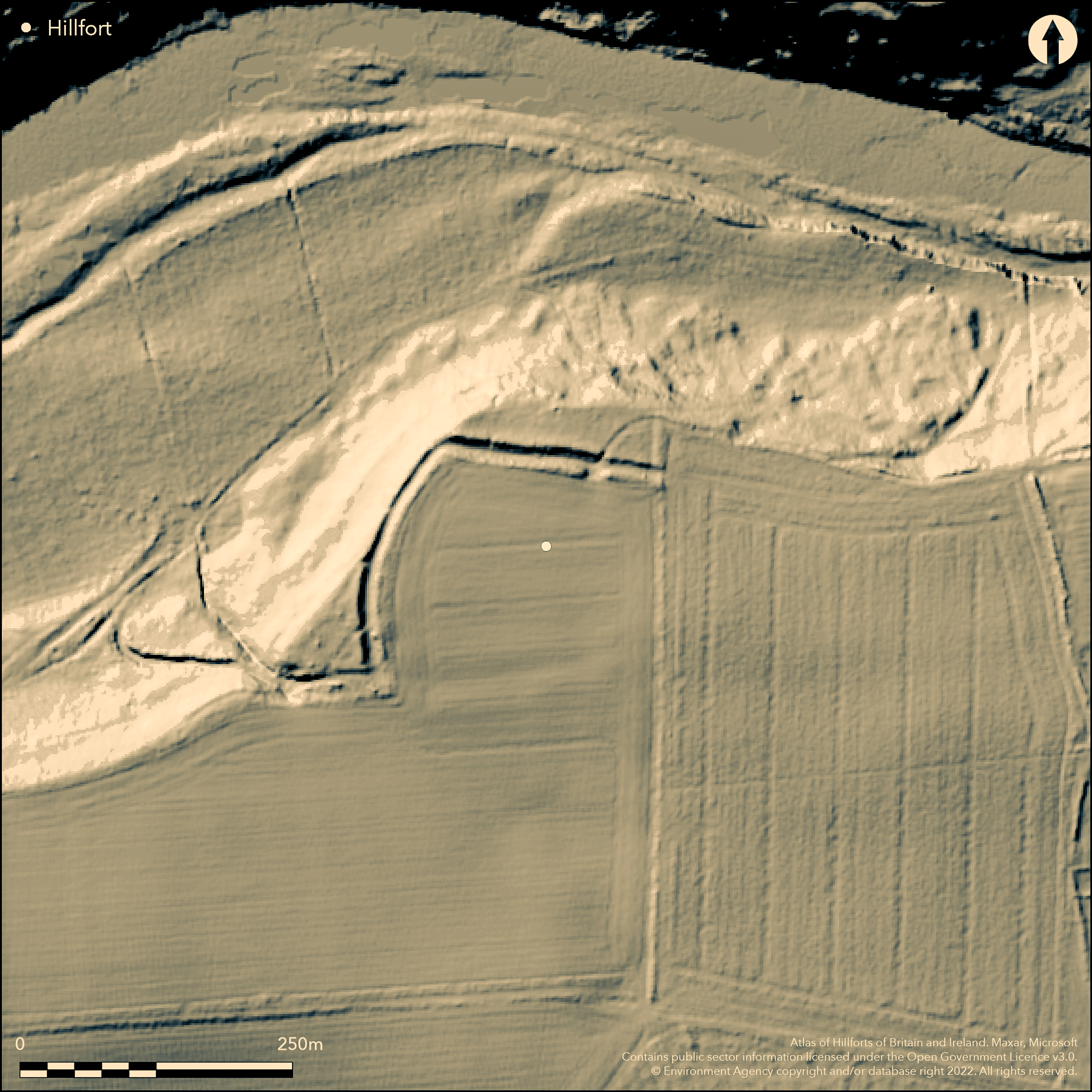
LiDAR 1m DTM Hillshade
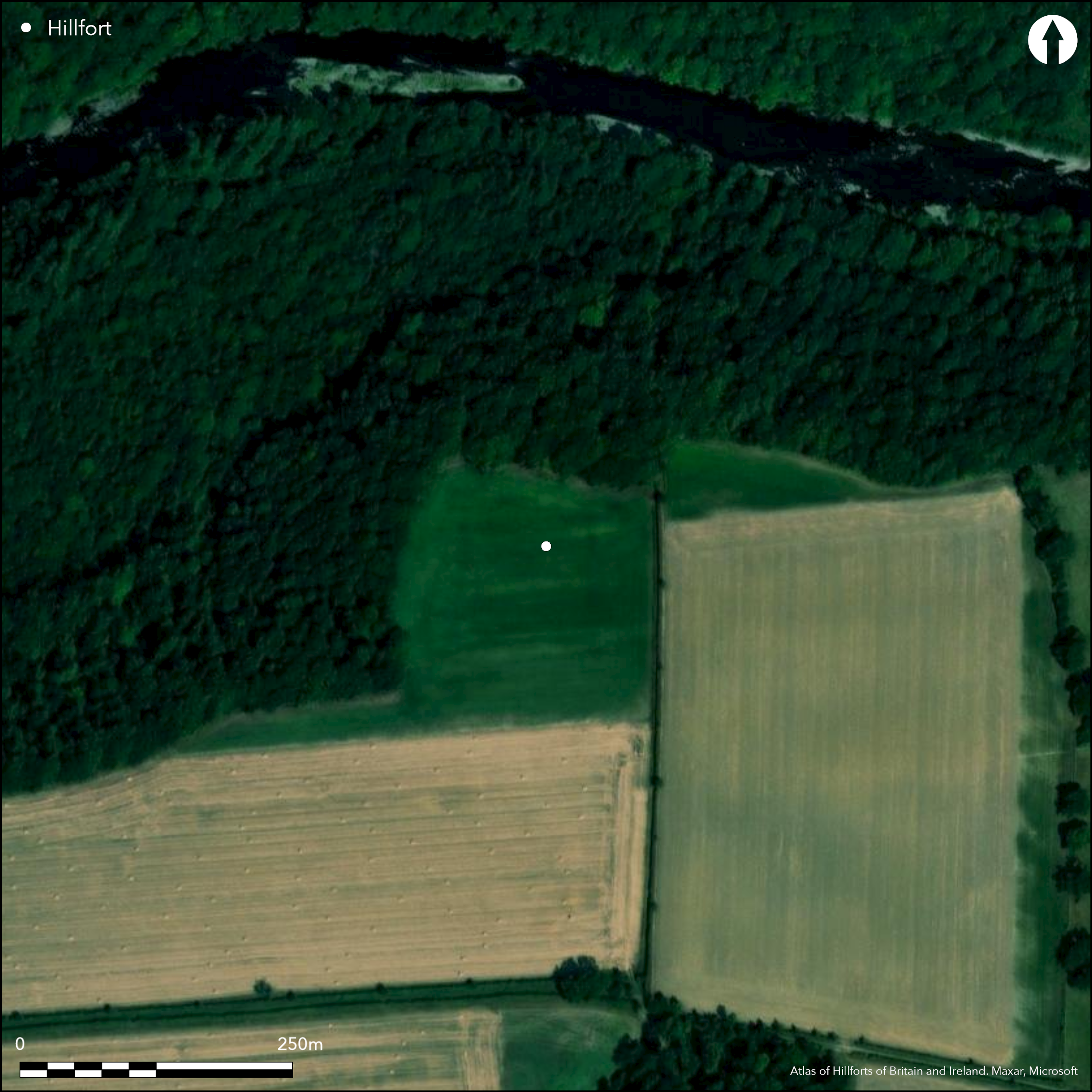
Satellite Imagery
LiDAR 1m DTM Hillshade
Satellite Imagery
Scroll left/right to view further images.
HER: County Durham 2394375; 2303103 (None)
NMR: NZ 11 SW 3 (21906)
SM: None
NGR: NZ 1250 1460
X: 412500 Y: 514600 (OSGB36)
Lying approximately 360m to the W of Ovington, on a cliff above the River Tees and commanding views along the river, a former hillfort of 1.2ha. Once comprising a rampart with a medial ditch and a counterscarp, it survives as tree-covered banks in the N and W on the border of Wycliffe Wood, with the inner rampart ploughed out. It is reduced in the S and levelled in the E. Where measured the ditch was 12m wide and 2-2.2m deep, the combined width of the bank and ditch 16m. The point of a sword was discovered by a farm worker when the bank was levelled in the SW corner (MacLauchlan 1849, 341). A 10m wide entrance lay in the N with an opposing entrance in the S. Both have been destroyed. A holloway 8m wide and 2m deep runs downslope from the SW corner but crosses the counterscarp bank suggesting it is a later feature. A plan was drawn by MacLauchlan (1849, 340) which shows that the banks in the E and S had been destroyed by that time. Recorded on 1857 1:10,560 OS mapping. Minimal investigations, undated.
Citizen Science: ✗
Reliability of Data: Confirmed
Reliability of Interpretation: Confirmed
X: -201307 Y: 7270515 (EPSG: 3857)
Longitude: -1.8083718131071649 Latitude: 54.52654593910797 (EPSG:4326)
Country: England; None
Current County or Unitary Authority: County Durham
Historic County: County Durham
Current Parish/Community/Council/Townland: Wyclifffe with Thorpe; Winston; Ovington
Shown as ploughed down in the E and S on a plan by MacLauchlan (1849)
| Extant | ✓ |
| Cropmark | ✗ |
| Likely Destroyed | ✓ |
None
| Woodland | ✓ |
| Commercial Forestry Plantation | ✗ |
| Parkland | ✗ |
| Pasture (Grazing) | ✗ |
| Arable | ✓ |
| Scrub/Bracken | ✗ |
| Bare Outcrop | ✗ |
| Heather/Moorland | ✗ |
| Heath | ✗ |
| Built-up | ✗ |
| Coastal Grassland | ✗ |
| Other | ✗ |
A partial contour fort lying on land sloping towards a cliff edge overlooking the River Tees at 130m OD
| Contour Fort | ✗ |
| Partial Contour Fort | ✓ |
| Promontory Fort | ✗ |
| Hillslope Fort | ✓ |
| Level Terrain Fort | ✗ |
| Marsh Fort | ✗ |
| Multiple Enclosure Fort | ✗ |
| Hilltop | ✗ |
| Coastal Promontory | ✗ |
| Inland Promontory | ✗ |
| Valley Bottom | ✗ |
| Knoll/Hillock/Outcrop | ✗ |
| Ridge | ✗ |
| Cliff/Plateau-edge/Scarp | ✓ |
| Hillslope | ✓ |
| Lowland | ✗ |
| Spur | ✗ |
Dominant Topographic Feature: Cliff Edge
| North | ✓ |
| Northeast | ✗ |
| East | ✗ |
| Southeast | ✗ |
| South | ✗ |
| Southwest | ✗ |
| West | ✗ |
| Northwest | ✗ |
| Level | ✗ |
Altitude: 130.0m
The parish boundary between Wyclifffe with Thorpe and Winston runs along the Tees Valley to the N. The parish boundary between Wyclifffe with Thorpe and Ovington lies 200m to the E
Boundary Type: Parish/Townland
The site is undated
Reliability: D - None
| Pre 1200BC | ✗ |
| 1200BC - 800BC | ✗ |
| 800BC - 400BC | ✗ |
| 400BC - AD50 | ✗ |
| AD50 - AD400 | ✗ |
| AD400 - AD 800 | ✗ |
| Post AD800 | ✗ |
| Unknown | ✓ |
| Pre Hillfort: | None |
| Post Hillfort: | None |
Described in MacLauchlan (1849) with Plan; Recorded on 1857 1:10,560 OS mapping
| Earthwork Survey (1849): | MacLauchlan (1841) |
| 1st Identified Written Reference (1849): | MacLauchlan (1841) |
| 1st Identified Map Depiction (1857): | None |
| Other (1954): | Field investigation |
| Other (1973): | Field investigation |
| Other (1981): | Field investigation |
No internal features are recorded
River Tees to the N and W, Peg Beck to the S
| None | ✓ |
| Spring | ✗ |
| Stream | ✗ |
| Pool | ✗ |
| Flush | ✗ |
| Well | ✗ |
| Other | ✗ |
None
| No Known Features | ✓ |
| Round Stone Structures | ✗ |
| Rectangular Stone Structures | ✗ |
| Curvilinear Platforms | ✗ |
| Other Roundhouse Evidence | ✗ |
| Pits | ✗ |
| Quarry Hollows | ✗ |
| Other | ✗ |
None
| No Known Excavation | ✓ |
| Pits | ✗ |
| Postholes | ✗ |
| Roundhouses | ✗ |
| Rectangular Structures | ✗ |
| Roads/Tracks | ✗ |
| Quarry Hollows | ✗ |
| Other | ✗ |
| Nothing Found | ✗ |
None
| No Known Geophysics | ✓ |
| Pits | ✗ |
| Roundhouses | ✗ |
| Rectangular Structures | ✗ |
| Roads/Tracks | ✗ |
| Quarry Hollows | ✗ |
| Other | ✗ |
| Nothing Found | ✗ |
Point of a sword
| No Known Finds | ✗ |
| Pottery | ✗ |
| Metal | ✓ |
| Metalworking | ✗ |
| Human Bones | ✗ |
| Animal Bones | ✗ |
| Lithics | ✗ |
| Environmental | ✗ |
| Other | ✗ |
None
| APs Not Checked | ✗ |
| None | ✓ |
| Roundhouses | ✗ |
| Rectangular Structures | ✗ |
| Pits | ✗ |
| Postholes | ✗ |
| Roads/Tracks | ✗ |
| Other | ✗ |
A 10m wide entrance lay in the N with an opposing entrance in the S. Both now destroyed
| 3: | None |
| 2: | None |
Guard Chambers: ✗
Chevaux de Frise: ✗
| 1. Simple Gap (North): | None |
| 2. Simple Gap (South): | None |
Once comprising a rampart with a medial ditch and a counterscarp enclosing 1.2ha, it now survives as banks in the N and W with the inner rampart ploughed out. It is reduced in the S and levelled in the E. Where measured the ditch was 12m wide and 2-2.2m deep, the combined width of the bank and ditch 16m
| Area 1: | 1.2ha. |
| Total: | 1.2ha. |
Total Footprint Area: Noneha.
None
| ✗ | None |
| ✓ | Now destroyed |
| NE Quadrant: | 1 |
| SE Quadrant: | 1 |
| SW Quadrant: | 1 |
| NW Quadrant: | 1 |
| Total: | 1 |
| Partial Univallate | ✗ |
| Univallate | ✓ |
| Partial Bivallate | ✗ |
| Bivallate | ✗ |
| Partial Multivallate | ✗ |
| Multivallate | ✗ |
| Unknown | ✗ |
| Partial Univallate | ✗ |
| Univallate | ✗ |
| Partial Bivallate | ✗ |
| Bivallate | ✗ |
| Partial Multivallate | ✗ |
| Multivallate | ✗ |
None
| None | ✗ |
| Earthen Bank | ✓ |
| Stone Wall | ✗ |
| Rubble | ✗ |
| Wall-walk | ✗ |
| Evidence of Timber | ✗ |
| Vitrification | ✗ |
| Other Burning | ✗ |
| Palisade | ✗ |
| Counter Scarp Bank | ✓ |
| Berm | ✗ |
| Unfinished | ✗ |
| Other | ✗ |
None
| None | ✗ |
| Earthen Bank | ✗ |
| Stone Wall | ✗ |
| Murus Duplex | ✗ |
| Timber-framed | ✗ |
| Timber-laced | ✗ |
| Vitrification | ✗ |
| Other Burning | ✗ |
| Palisade | ✗ |
| Counter Scarp Bank | ✗ |
| Berm | ✗ |
| Unfinished | ✗ |
| No Known Excavation | ✓ |
| Other | ✗ |
| ✗ | None |
| ✓ | None |
Number of Ditches: 1
| ✗ | None |
Hogg, A.H.A. 1979. British Hill-Forts. An Index. British Archaeological Reports, British Series 62. 142
MacLauchlan, H. 1849. On the Roman Roads, Camps, and Other Earthworks, between the Tees and the Swale, in the North Riding of the County of York. Archaeol J. 6, 340-1
Atlas of Hillforts:
Wikidata:
This work is licensed under CC BY-SA 4.0

 and should be cited as:
Lock, Gary and Ralston, Ian. 2024. Atlas of Hillforts of Britain and Ireland. Available at: https://hillforts.arch.ox.ac.uk
Document Version 1.1