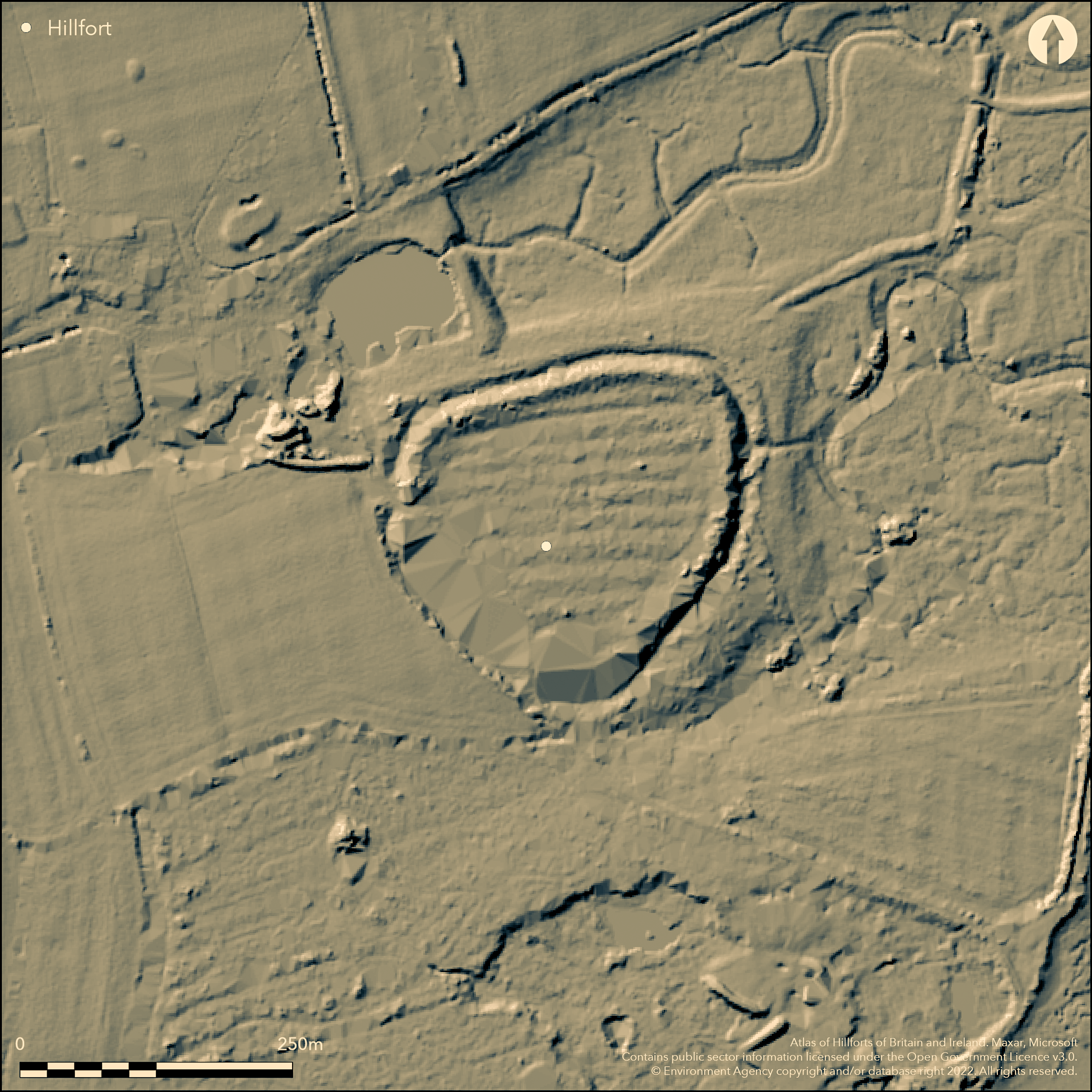
LiDAR 1m DTM Hillshade
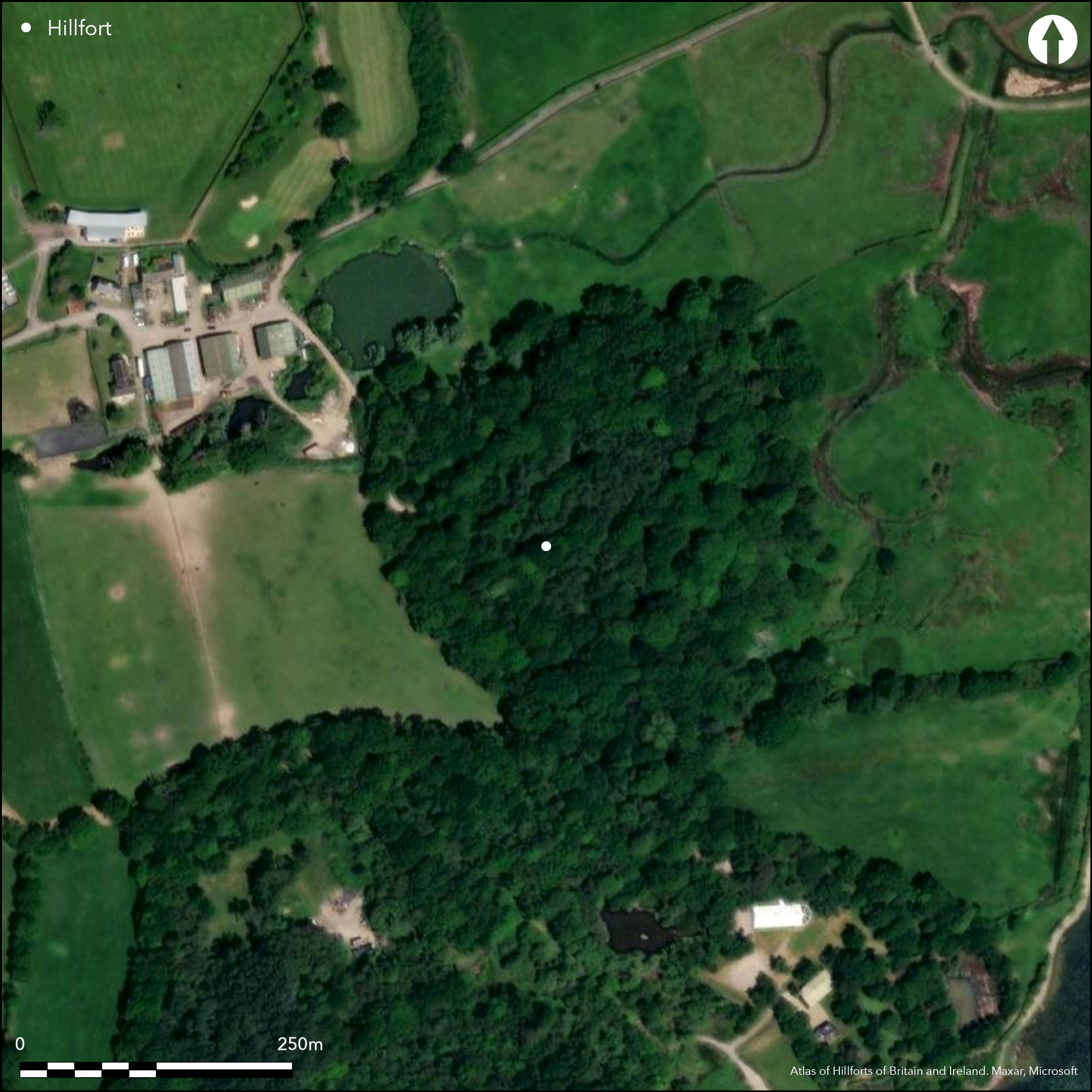
Satellite Imagery
LiDAR 1m DTM Hillshade
Satellite Imagery
Scroll left/right to view further images.
HER: Hampshire 23329 (None)
NMR: SZ 79 NW 1 (462185)
SM: 1001945
NGR: SZ73159986
X: 473150 Y: 99860 (OSGB36)
Univallate level terrain fort located only c. 91m from Solent shore, Hayling Island. Marshy ground to N and S, probably tidal before construction of sea-wall. Surrounds generally flattish. Circular, measuring c. 219m by 183m and enclosing c. 3.4ha. Defined by bank and wet or marshy ditch with counterscarp, former c. 1.2m high and 3m above ditch. Trench through rampart by J.R. Boyden 1959 found possible Iron Age pottery from the old ground surface which was sealed by the rampart. Medieval pottery from the outer edge of the rampart. Excavations by R. Bradley in 1971 (Bradley and Fulford 1975) produced further Iron Age pottery. Roman pottery has also been recovered. Possible evidence of burning below bank. Track passes through site - possible entrance, but conjecture. First documented 1518 as land called 'Tornors' (Tor Shore or land of William de Tornore). Wooded. On 1st Ed. OS map (1867-81).
Citizen Science: ✗
Reliability of Data: Confirmed
Reliability of Interpretation: Confirmed
X: -107257 Y: 6584871 (EPSG: 3857)
Longitude: -0.9635082422285088 Latitude: 50.79363300471806 (EPSG:4326)
Country: England
Current County or Unitary Authority: Hampshire
Historic County: Hampshire and Isle of Wight
Current Parish/Community/Council/Townland: Havant
Track on W side.
| Extant | ✓ |
| Cropmark | ✗ |
| Likely Destroyed | ✗ |
Woodland.
| Woodland | ✓ |
| Commercial Forestry Plantation | ✗ |
| Parkland | ✗ |
| Pasture (Grazing) | ✗ |
| Arable | ✗ |
| Scrub/Bracken | ✗ |
| Bare Outcrop | ✗ |
| Heather/Moorland | ✗ |
| Heath | ✗ |
| Built-up | ✗ |
| Coastal Grassland | ✗ |
| Other | ✗ |
Univallate level terrain fort located only c. 91m from Solent shore, Hayling Island. Marshy ground to N and S, probably tidal before construction of sea-wall. Surrounds generally flattish.
| Contour Fort | ✗ |
| Partial Contour Fort | ✗ |
| Promontory Fort | ✗ |
| Hillslope Fort | ✗ |
| Level Terrain Fort | ✓ |
| Marsh Fort | ✗ |
| Multiple Enclosure Fort | ✗ |
| Hilltop | ✗ |
| Coastal Promontory | ✓ |
| Inland Promontory | ✗ |
| Valley Bottom | ✗ |
| Knoll/Hillock/Outcrop | ✗ |
| Ridge | ✗ |
| Cliff/Plateau-edge/Scarp | ✗ |
| Hillslope | ✗ |
| Lowland | ✓ |
| Spur | ✗ |
Dominant Topographic Feature: Low lying coastal part promontory position.
| North | ✗ |
| Northeast | ✗ |
| East | ✗ |
| Southeast | ✗ |
| South | ✗ |
| Southwest | ✗ |
| West | ✗ |
| Northwest | ✗ |
| Level | ✓ |
Altitude: 10.0m
N/A
Excavations 1959 found possible Iron Age pottery from the old ground surface which was sealed by the rampart. medieval pottery from the outer edge of the rampart. Excavations in 1968 produced further Iron Age pottery. Roman pottery has also been recovered.
Reliability: B - Medium
| Pre 1200BC | ✗ |
| 1200BC - 800BC | ✗ |
| 800BC - 400BC | ✗ |
| 400BC - AD50 | ✓ |
| AD50 - AD400 | ✗ |
| AD400 - AD 800 | ✗ |
| Post AD800 | ✗ |
| Unknown | ✗ |
| Pre Hillfort: | None |
| Post Hillfort: | None |
| Artefactual: | Iron Age, Roman and medieval pottery. |
First documented 1518 as land called 'Tornors' (Tor Shore or land of William de Tornore). On 1st Ed. OS map (1867-81). Field investigator comments 1955, 1969. Excavations J.R. Boyden 1959 and R. Bradley 1971.
| 1st Identified Written Reference (1518): | First documentation. |
| Excavation (1959): | J.R. Boyden. |
| Excavation (1971): | R. Bradley. |
| 1st Identified Map Depiction (None): | OS map. |
| Other (None): | Field investigator comments - no details. |
Excavations 1959 found possible Iron Age pottery from the old ground surface which was sealed by the rampart. Medieval pottery from the outer edge of the rampart. Excavations in 1968 produced further Iron Age pottery. Roman pottery has also been recovered. Possible evidence of burning below bank.
None
| None | ✓ |
| Spring | ✗ |
| Stream | ✗ |
| Pool | ✗ |
| Flush | ✗ |
| Well | ✗ |
| Other | ✗ |
None
| No Known Features | ✓ |
| Round Stone Structures | ✗ |
| Rectangular Stone Structures | ✗ |
| Curvilinear Platforms | ✗ |
| Other Roundhouse Evidence | ✗ |
| Pits | ✗ |
| Quarry Hollows | ✗ |
| Other | ✗ |
None
| No Known Excavation | ✗ |
| Pits | ✗ |
| Postholes | ✗ |
| Roundhouses | ✗ |
| Rectangular Structures | ✗ |
| Roads/Tracks | ✗ |
| Quarry Hollows | ✗ |
| Other | ✗ |
| Nothing Found | ✓ |
None
| No Known Geophysics | ✓ |
| Pits | ✗ |
| Roundhouses | ✗ |
| Rectangular Structures | ✗ |
| Roads/Tracks | ✗ |
| Quarry Hollows | ✗ |
| Other | ✗ |
| Nothing Found | ✗ |
None
| No Known Finds | ✗ |
| Pottery | ✓ |
| Metal | ✗ |
| Metalworking | ✗ |
| Human Bones | ✗ |
| Animal Bones | ✗ |
| Lithics | ✗ |
| Environmental | ✓ |
| Other | ✗ |
None
| APs Not Checked | ✓ |
| None | ✗ |
| Roundhouses | ✗ |
| Rectangular Structures | ✗ |
| Pits | ✗ |
| Postholes | ✗ |
| Roads/Tracks | ✗ |
| Other | ✗ |
Not defined. Track passes through site - possible entrance, but conjecture.
| 0: | None |
| 2: | None |
Guard Chambers: ✗
Chevaux de Frise: ✗
Single bank and wet or marshy ditch with counterscarp, former c. 1.2m high and 3m above ditch.Possible evidence of burning below bank by excavation.
| Area 1: | 3.4ha. |
| Total: | 3.4ha. |
Total Footprint Area: Noneha.
None
| ✗ | None |
| ✓ | None |
| NE Quadrant: | 1 |
| SE Quadrant: | 1 |
| SW Quadrant: | 1 |
| NW Quadrant: | 1 |
| Total: | 1 |
| Partial Univallate | ✗ |
| Univallate | ✓ |
| Partial Bivallate | ✗ |
| Bivallate | ✗ |
| Partial Multivallate | ✗ |
| Multivallate | ✗ |
| Unknown | ✗ |
| Partial Univallate | ✗ |
| Univallate | ✗ |
| Partial Bivallate | ✗ |
| Bivallate | ✗ |
| Partial Multivallate | ✗ |
| Multivallate | ✗ |
Slight counterscarp.
| None | ✗ |
| Earthen Bank | ✓ |
| Stone Wall | ✗ |
| Rubble | ✗ |
| Wall-walk | ✗ |
| Evidence of Timber | ✗ |
| Vitrification | ✗ |
| Other Burning | ✗ |
| Palisade | ✗ |
| Counter Scarp Bank | ✓ |
| Berm | ✗ |
| Unfinished | ✗ |
| Other | ✗ |
Possible evidence of burning below bank.
| None | ✗ |
| Earthen Bank | ✓ |
| Stone Wall | ✗ |
| Murus Duplex | ✗ |
| Timber-framed | ✗ |
| Timber-laced | ✗ |
| Vitrification | ✗ |
| Other Burning | ✓ |
| Palisade | ✗ |
| Counter Scarp Bank | ✓ |
| Berm | ✗ |
| Unfinished | ✗ |
| No Known Excavation | ✗ |
| Other | ✗ |
| ✗ | None |
| ✓ | None |
Number of Ditches: 1
| ✗ | None |
Bradley R. and Fulford, M. 1975. Excavations at Tournerbury, Hayling Island, 1959 and 1971, Proc Hampshire Fld Club Archaeol Soc, 32, 63-69.
Page, W. 1908. The Victoria history of Hampshire and the Isle of Wight, Vol 3, The Victoria history of the counties of England, 129.
Williams-Freeman, J.P. 1915. An introduction to field archaeology as illustrated by Hampshire, London: Macmillan and Co Ltd.
Atlas of Hillforts:
Wikidata:
This work is licensed under CC BY-SA 4.0

 and should be cited as:
Lock, Gary and Ralston, Ian. 2024. Atlas of Hillforts of Britain and Ireland. Available at: https://hillforts.arch.ox.ac.uk
Document Version 1.1