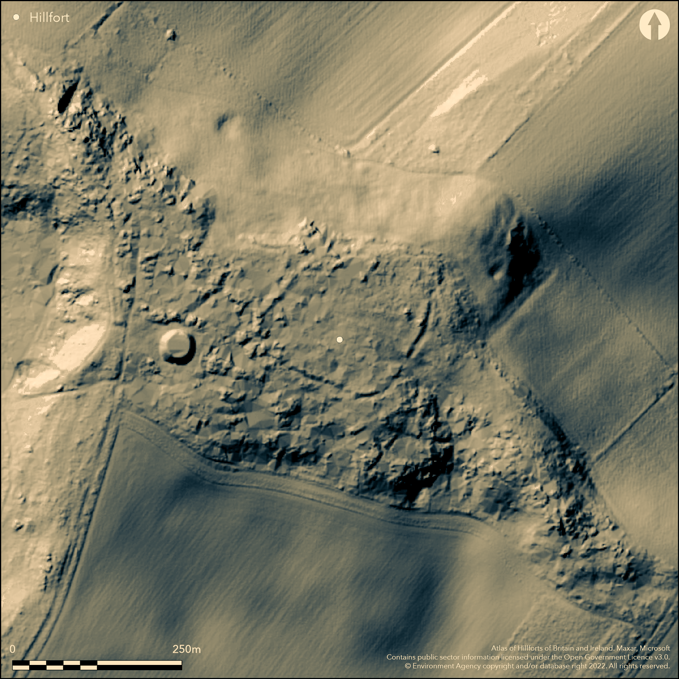
LiDAR 1m DTM Hillshade
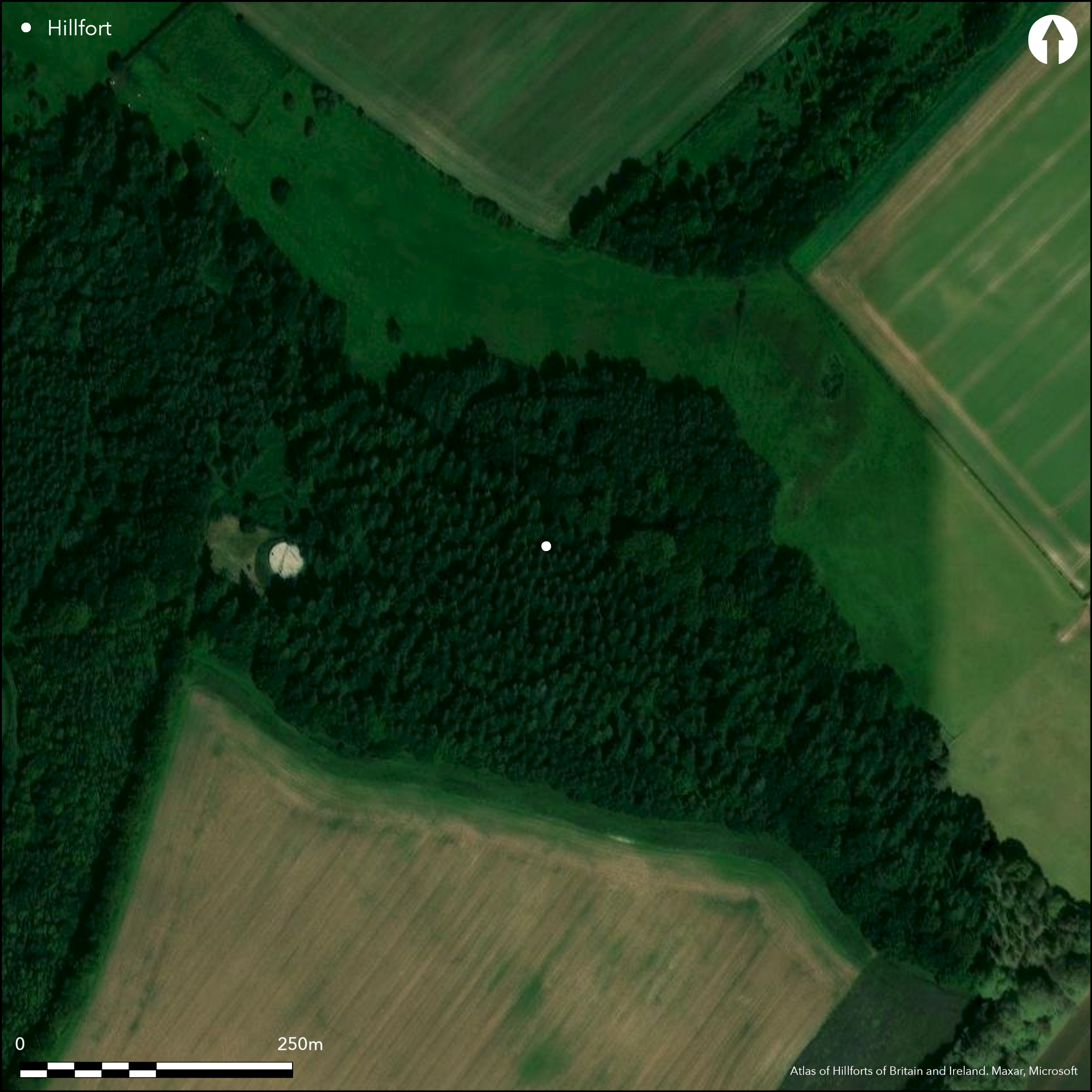
Satellite Imagery
LiDAR 1m DTM Hillshade
Satellite Imagery
Scroll left/right to view further images.
HER: Hampshire 16159 (None)
NMR: SU 01 NE 26 (213415)
SM: 1010764
NGR: SU09911853
X: 409910 Y: 118530 (OSGB36)
Univallate, contour hillfort located slightly SE of highest point of ridge to NE of Damerham Knoll, above Allen River 1.25km to SW, New Forest. Steep surrounding slopes. Circular in shape, with maximum internal dimensions c. 170m NE-SW by 136m, with internal area c. 1.6ha. Defined by single bank and external ditch with slight counterscarp. Best on W with overall width of 16m and bank to 1.2m above base of 9m wide ditch and c .0.8m above general level of interior. Slight bank and ditch, c. 20m long and 6m wide, lie alongside ditch on W side of hillfort. Grim's Ditch 38m to NW of hillfort comprises angled ditch and single bank at its NW, lies across ridge. Linear earthwork runs along ridge from SE-NW in three overlapping strands, one of which skirts closely around N side of hillfort before fading to E. Probable original entrance, c. 10m wide with slight inturn, near SE corner, with another, possible entrance, now much mutilated by sand digging on NW. Possibly medieval hollow ways converge on hillfort from SE, most leaving it at NW corner to pass between cross dyke and linear earthwork. Possible depressions may be pits or hut circles, but uncertain, and could be result of sand digging. Badly mutilated by sand digging in places. Commercial forestry on SW side. Generally overgrown. On OS 1:25,000 map (1961). Few investigations. Undated.
Citizen Science: ✓
Reliability of Data: Confirmed
Reliability of Interpretation: Confirmed
X: -207084 Y: 6615290 (EPSG: 3857)
Longitude: -1.8602677332091544 Latitude: 50.966045929862034 (EPSG:4326)
Country: England; None
Current County or Unitary Authority: Hampshire
Historic County: Hampshire and Isle of Wight
Current Parish/Community/Council/Townland: Damerham; Rockbourne
Bank and external ditch disturbed on N by the linear earthwork and by small-scale quarrying, and occasionally interrupted elsewhere by hollow ways. Possible NW entrance also badly mutilated. Interior also disturbed by sand digging. Site divided in half by estate boundary fence. Public (some erosion) has access to NE half of site owned by Hampshire County Council, cleared within last 5 years but now heavily overgrown with bramble and scrub. Other half on Longford Estate is inaccessible and thickly planted with conifers; heavy bramble undergrowth.
| Extant | ✓ |
| Cropmark | ✗ |
| Likely Destroyed | ✗ |
Plantation on SW side. Downland on NE. Generally overgrown. Quarrying.
| Woodland | ✗ |
| Commercial Forestry Plantation | ✓ |
| Parkland | ✗ |
| Pasture (Grazing) | ✓ |
| Arable | ✗ |
| Scrub/Bracken | ✓ |
| Bare Outcrop | ✗ |
| Heather/Moorland | ✗ |
| Heath | ✗ |
| Built-up | ✗ |
| Coastal Grassland | ✗ |
| Other | ✓ |
Univallate, contour hillfort located slightly SE of highest point of ridge to NE of Damerham Knoll, above Allen River 1.25km to SW. Steep surrounding slopes.
| Contour Fort | ✓ |
| Partial Contour Fort | ✗ |
| Promontory Fort | ✗ |
| Hillslope Fort | ✗ |
| Level Terrain Fort | ✗ |
| Marsh Fort | ✗ |
| Multiple Enclosure Fort | ✗ |
| Hilltop | ✗ |
| Coastal Promontory | ✗ |
| Inland Promontory | ✗ |
| Valley Bottom | ✗ |
| Knoll/Hillock/Outcrop | ✗ |
| Ridge | ✓ |
| Cliff/Plateau-edge/Scarp | ✗ |
| Hillslope | ✗ |
| Lowland | ✗ |
| Spur | ✗ |
Dominant Topographic Feature: Ridge
| North | ✗ |
| Northeast | ✗ |
| East | ✗ |
| Southeast | ✗ |
| South | ✗ |
| Southwest | ✗ |
| West | ✗ |
| Northwest | ✗ |
| Level | ✓ |
Altitude: 122.0m
Boundary Type: Parish/Townland
None.
Reliability: D - None
| Pre 1200BC | ✗ |
| 1200BC - 800BC | ✗ |
| 800BC - 400BC | ✗ |
| 400BC - AD50 | ✗ |
| AD50 - AD400 | ✗ |
| AD400 - AD 800 | ✗ |
| Post AD800 | ✗ |
| Unknown | ✓ |
| Pre Hillfort: | None |
| Post Hillfort: | Possibly medieval hollow ways converge on hillfort from SE. |
On OS 1:25,000 map (1961). New Forest NPA LiDar survey (Citizen Science)..
| 1st Identified Map Depiction (1961): | OS map. |
| LiDAR Survey (2015): | New Forest NPA. |
Possible depressions may be pits or hut circles, but uncertain, and possible sand digging.
None
| None | ✓ |
| Spring | ✗ |
| Stream | ✗ |
| Pool | ✗ |
| Flush | ✗ |
| Well | ✗ |
| Other | ✗ |
Possible depressions may be pits or hut circles, but uncertain.
| No Known Features | ✗ |
| Round Stone Structures | ✗ |
| Rectangular Stone Structures | ✗ |
| Curvilinear Platforms | ✓ |
| Other Roundhouse Evidence | ✗ |
| Pits | ✓ |
| Quarry Hollows | ✗ |
| Other | ✗ |
None
| No Known Excavation | ✓ |
| Pits | ✗ |
| Postholes | ✗ |
| Roundhouses | ✗ |
| Rectangular Structures | ✗ |
| Roads/Tracks | ✗ |
| Quarry Hollows | ✗ |
| Other | ✗ |
| Nothing Found | ✗ |
None
| No Known Geophysics | ✓ |
| Pits | ✗ |
| Roundhouses | ✗ |
| Rectangular Structures | ✗ |
| Roads/Tracks | ✗ |
| Quarry Hollows | ✗ |
| Other | ✗ |
| Nothing Found | ✗ |
None
| No Known Finds | ✓ |
| Pottery | ✗ |
| Metal | ✗ |
| Metalworking | ✗ |
| Human Bones | ✗ |
| Animal Bones | ✗ |
| Lithics | ✗ |
| Environmental | ✗ |
| Other | ✗ |
None
| APs Not Checked | ✓ |
| None | ✗ |
| Roundhouses | ✗ |
| Rectangular Structures | ✗ |
| Pits | ✗ |
| Postholes | ✗ |
| Roads/Tracks | ✗ |
| Other | ✗ |
Entrances on SE and NW. Hollow ways converge on hillfort from SE.
| 2: | None |
| 2: | None |
Guard Chambers: ✗
Chevaux de Frise: ✗
| 1. In-turned (South east): | Slightly inturned. |
| 2. Simple Gap (North west): | Badly mutilated by sand digging. |
Defined by single bank and external ditch with slight counterscarp. Best on W with overall width of 16m and bank to 1.2m above base of 9m wide ditch and c .0.8m above general level of interior. Slight bank and ditch, c. 20m long and 6m wide, lie alongside ditch on W side of hillfort.
| Area 1: | 1.6ha. |
| Total: | 1.6ha. |
Total Footprint Area: Noneha.
None
| ✗ | None |
| ✓ | None |
| NE Quadrant: | 1 |
| SE Quadrant: | 1 |
| SW Quadrant: | 1 |
| NW Quadrant: | 1 |
| Total: | 1 |
| Partial Univallate | ✗ |
| Univallate | ✓ |
| Partial Bivallate | ✗ |
| Bivallate | ✗ |
| Partial Multivallate | ✗ |
| Multivallate | ✗ |
| Unknown | ✗ |
| Partial Univallate | ✗ |
| Univallate | ✗ |
| Partial Bivallate | ✗ |
| Bivallate | ✗ |
| Partial Multivallate | ✗ |
| Multivallate | ✗ |
Slight counterscarp.
| None | ✗ |
| Earthen Bank | ✓ |
| Stone Wall | ✗ |
| Rubble | ✗ |
| Wall-walk | ✗ |
| Evidence of Timber | ✗ |
| Vitrification | ✗ |
| Other Burning | ✗ |
| Palisade | ✗ |
| Counter Scarp Bank | ✓ |
| Berm | ✗ |
| Unfinished | ✗ |
| Other | ✗ |
None
| None | ✗ |
| Earthen Bank | ✗ |
| Stone Wall | ✗ |
| Murus Duplex | ✗ |
| Timber-framed | ✗ |
| Timber-laced | ✗ |
| Vitrification | ✗ |
| Other Burning | ✗ |
| Palisade | ✗ |
| Counter Scarp Bank | ✗ |
| Berm | ✗ |
| Unfinished | ✗ |
| No Known Excavation | ✓ |
| Other | ✗ |
| ✗ | None |
| ✓ | None |
Number of Ditches: 1
| ✗ | None |
Williams-Freeman, J.P. 1915. An introduction to field archaeology as illustrated by Hampshire, London: Macmillan and Co Ltd.
Atlas of Hillforts:
Wikidata:
This work is licensed under CC BY-SA 4.0

 and should be cited as:
Lock, Gary and Ralston, Ian. 2024. Atlas of Hillforts of Britain and Ireland. Available at: https://hillforts.arch.ox.ac.uk
Document Version 1.1