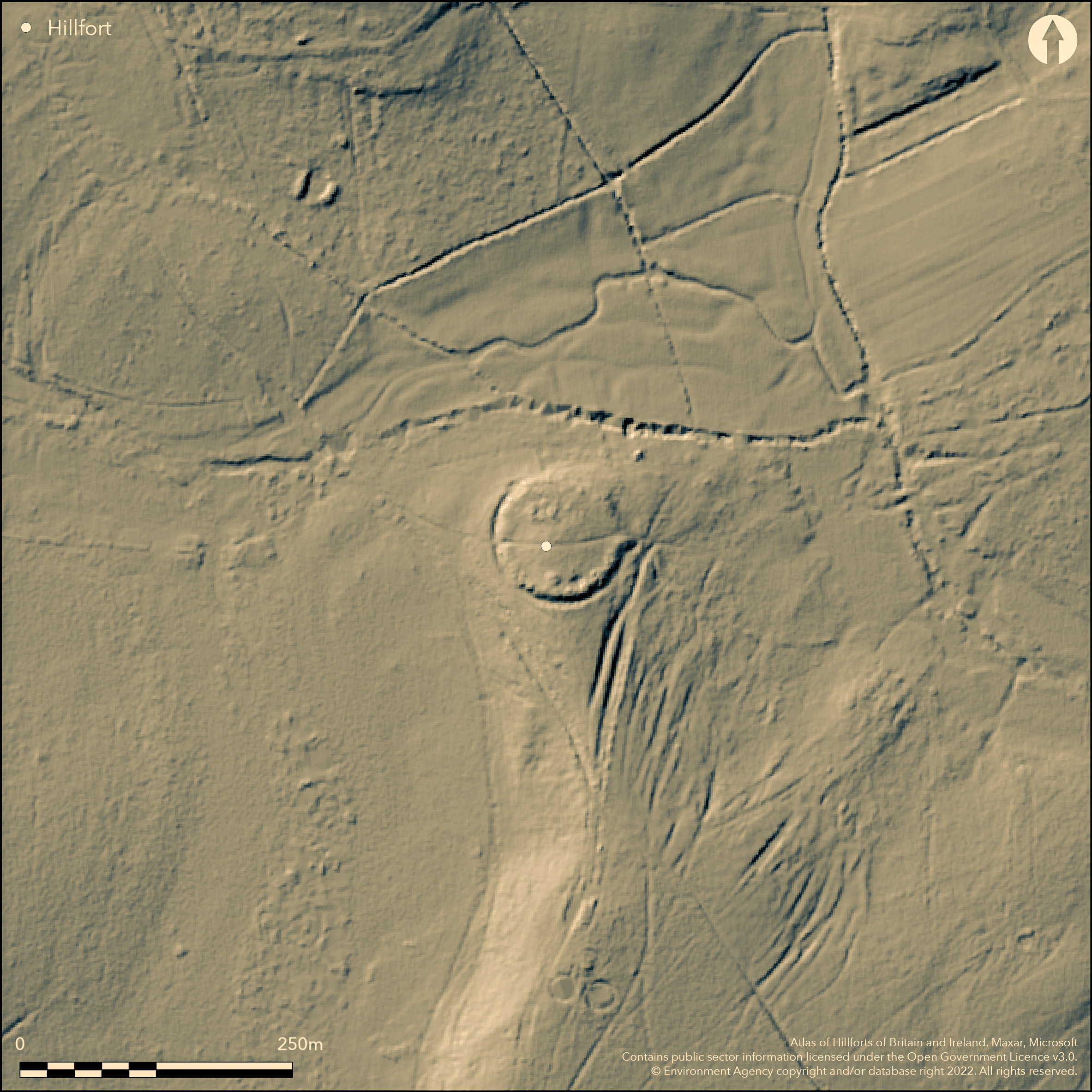
LiDAR 1m DTM Hillshade
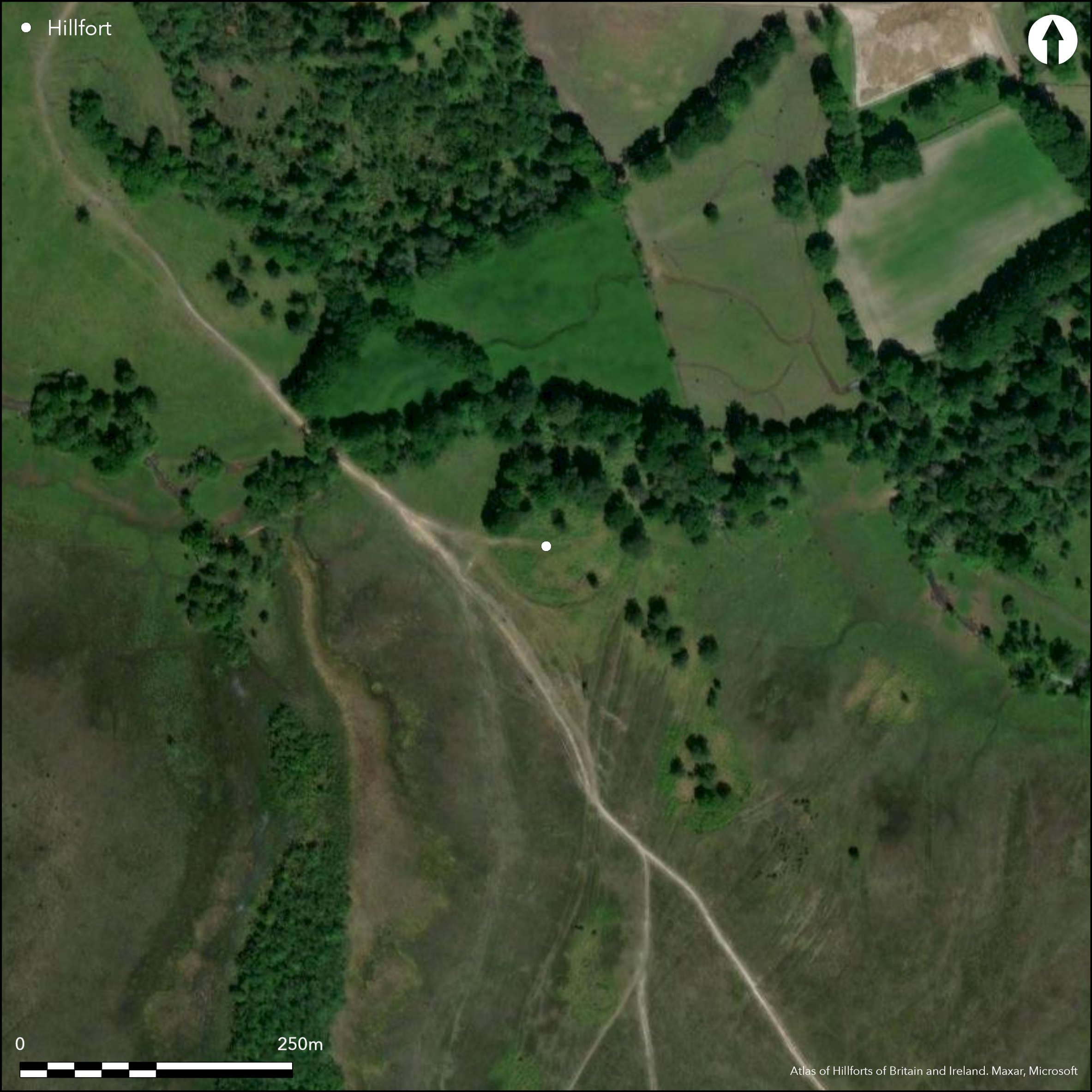
Satellite Imagery
LiDAR 1m DTM Hillshade
Satellite Imagery
Scroll left/right to view further images.
HER: Hampshire 19964 (None)
NMR: SU 30 NW 11 (226181)
SM: 1017019
NGR: SU33580853
X: 433580 Y: 108530 (OSGB36)
Small, possible contour hillfort located at N end of N-S ridge on sandy knoll immediately S of a stream flowing into Beaulieu on SE to River Test and Solent on E, within New Forest, 400m S of Home Farm, Denny Lodge. Moderate surrounding slopes. Sub-circular in plan, c. 80m diameter, enclosing area c. 0.3ha. Bank 1m high and 3m wide, with external ditch to 3m wide and maximum 0.8m deep with slight counterscarp visible around the E, S and W, but like the bank, badly denuded on N. Ditch truncated on NW side by 4m wide hollow and similarly, on E side, by a large hollow or quarry. To N rampart utilizes natural scarp with no external ditch, although depression 7m long, 0.2m wide and 0.3m deep projects N from base of the scarp. RCHME survey 1995 found break of slope on outer face of bank on S side possible episode of recutting. Two gaps in circuit on E and W hillfort with trackway bisecting site damaging any possible entrance. Suggested by RCHME as possibly not original as there no modification to bank. Gap on E, 7m wide, and 4m wide has causeway over ditch and LiDAR shows possibble out-turn on S side. Interior uneven and water-filled pond against S inner bank. Mound, possibly a bowl barrow or spoil from digging of pond; latter favoured. N part of site wooded, remainder grass and scrub. On 1st Ed. OS map (1869). Undated.
Citizen Science: ✓
Reliability of Data: Confirmed
Reliability of Interpretation: Unconfirmed
X: -169664 Y: 6599254 (EPSG: 3857)
Longitude: -1.5241171513717688 Latitude: 50.87523402880143 (EPSG:4326)
Country: England
Current County or Unitary Authority: Hampshire
Historic County: Hampshire and Isle of Wight
Current Parish/Community/Council/Townland: Denny Lodge
Fair condition. Track passes through site E-W with some damage. On Heritage at Risk Register (2015) as result of extensive animal burrowing damage.
| Extant | ✓ |
| Cropmark | ✗ |
| Likely Destroyed | ✗ |
N part of site wooded, remainder grass and scrub.
| Woodland | ✓ |
| Commercial Forestry Plantation | ✗ |
| Parkland | ✗ |
| Pasture (Grazing) | ✓ |
| Arable | ✗ |
| Scrub/Bracken | ✗ |
| Bare Outcrop | ✗ |
| Heather/Moorland | ✗ |
| Heath | ✗ |
| Built-up | ✗ |
| Coastal Grassland | ✗ |
| Other | ✗ |
Small, possible contour hillfort located at N end of N-S ridge on sandy knoll immediately S of a stream flowing into Beaulieu on SE to River Test and Solent on E, within New Forest, 400m S of Home Farm, Denny Lodge. Moderate surrounding slopes.
| Contour Fort | ✓ |
| Partial Contour Fort | ✗ |
| Promontory Fort | ✗ |
| Hillslope Fort | ✗ |
| Level Terrain Fort | ✗ |
| Marsh Fort | ✗ |
| Multiple Enclosure Fort | ✗ |
| Hilltop | ✗ |
| Coastal Promontory | ✗ |
| Inland Promontory | ✗ |
| Valley Bottom | ✗ |
| Knoll/Hillock/Outcrop | ✓ |
| Ridge | ✗ |
| Cliff/Plateau-edge/Scarp | ✗ |
| Hillslope | ✗ |
| Lowland | ✗ |
| Spur | ✗ |
Dominant Topographic Feature: Sandy knoll
| North | ✗ |
| Northeast | ✗ |
| East | ✗ |
| Southeast | ✗ |
| South | ✗ |
| Southwest | ✗ |
| West | ✗ |
| Northwest | ✗ |
| Level | ✓ |
Altitude: 50.0m
N/A
None.
Reliability: D - None
| Pre 1200BC | ✗ |
| 1200BC - 800BC | ✗ |
| 800BC - 400BC | ✗ |
| 400BC - AD50 | ✗ |
| AD50 - AD400 | ✗ |
| AD400 - AD 800 | ✗ |
| Post AD800 | ✗ |
| Unknown | ✓ |
| Pre Hillfort: | Possibly. Mound in interior, possibly a bowl barrow or spoil from digging of pond; latter favoured. Barrows also close outside. |
| Post Hillfort: | None |
On 1st Ed. OS map (1869). Measured survey RCHME 1995. New Forest (Lawrence Shaw) LiDAR.
| 1st Identified Map Depiction (1869): | OS map. |
| Other (1995): | Measured survey RCHME. |
| LiDAR Survey (2016): | None |
Mound, possibly a bowl barrow or spoil from digging of pond; latter favoured.
Water-filled pond against S inner bank.
| None | ✗ |
| Spring | ✗ |
| Stream | ✗ |
| Pool | ✓ |
| Flush | ✗ |
| Well | ✗ |
| Other | ✗ |
Mound, possibly a bowl barrow or spoil from digging of pond; latter favoured.
| No Known Features | ✗ |
| Round Stone Structures | ✗ |
| Rectangular Stone Structures | ✗ |
| Curvilinear Platforms | ✗ |
| Other Roundhouse Evidence | ✗ |
| Pits | ✗ |
| Quarry Hollows | ✗ |
| Other | ✓ |
None
| No Known Excavation | ✓ |
| Pits | ✗ |
| Postholes | ✗ |
| Roundhouses | ✗ |
| Rectangular Structures | ✗ |
| Roads/Tracks | ✗ |
| Quarry Hollows | ✗ |
| Other | ✗ |
| Nothing Found | ✗ |
None
| No Known Geophysics | ✓ |
| Pits | ✗ |
| Roundhouses | ✗ |
| Rectangular Structures | ✗ |
| Roads/Tracks | ✗ |
| Quarry Hollows | ✗ |
| Other | ✗ |
| Nothing Found | ✗ |
None
| No Known Finds | ✓ |
| Pottery | ✗ |
| Metal | ✗ |
| Metalworking | ✗ |
| Human Bones | ✗ |
| Animal Bones | ✗ |
| Lithics | ✗ |
| Environmental | ✗ |
| Other | ✗ |
None
| APs Not Checked | ✓ |
| None | ✗ |
| Roundhouses | ✗ |
| Rectangular Structures | ✗ |
| Pits | ✗ |
| Postholes | ✗ |
| Roads/Tracks | ✗ |
| Other | ✗ |
Two gaps in circuit on E and W hillfort with trackway through bisecting site damaging any possible entrance. Suggested by RCHME as possibly not original, as there no modification to bank, but possible. Gap on E, 7m wide, and 4m wide causeway over ditch, LiDAR shows possible out-turn.
| 2: | Trackway passes through site E-W through gaps. |
| 2: | Possible. |
Guard Chambers: ✗
Chevaux de Frise: ✗
| 1. Out-turned (East): | Possible entrance only. Causewayed. |
| 2. Simple Gap (West): | Possible entrance only. |
Bank 1m high and 3m wide, with external ditch to 3m wide and maximum 0.8m deep with slight counterscarp visible around the E, S and W, but like the bank, badly denuded on N. Ditch truncated on NW side by 4m wide hollow and similarly, on E side, by a large hollow or quarry. To N rampart utilizes natural scarp with no external ditch, although depression 7m long, 0.2m wide and 0.3m deep projects N from base of the scarp. RCHME survey 1995 found break of slope on outer face of bank on S side possible episode of recutting.
| Area 1: | 0.3ha. |
| Total: | 0.3ha. |
Total Footprint Area: Noneha.
None
| ✗ | None |
| ✓ | None |
| NE Quadrant: | 1 |
| SE Quadrant: | 1 |
| SW Quadrant: | 1 |
| NW Quadrant: | 1 |
| Total: | 1 |
| Partial Univallate | ✗ |
| Univallate | ✓ |
| Partial Bivallate | ✗ |
| Bivallate | ✗ |
| Partial Multivallate | ✗ |
| Multivallate | ✗ |
| Unknown | ✗ |
| Partial Univallate | ✗ |
| Univallate | ✗ |
| Partial Bivallate | ✗ |
| Bivallate | ✗ |
| Partial Multivallate | ✗ |
| Multivallate | ✗ |
Slight counterscarp visible around the E, S and W, but like the bank, badly denuded on N.
| None | ✗ |
| Earthen Bank | ✓ |
| Stone Wall | ✗ |
| Rubble | ✗ |
| Wall-walk | ✗ |
| Evidence of Timber | ✗ |
| Vitrification | ✗ |
| Other Burning | ✗ |
| Palisade | ✗ |
| Counter Scarp Bank | ✓ |
| Berm | ✗ |
| Unfinished | ✗ |
| Other | ✗ |
None
| None | ✗ |
| Earthen Bank | ✗ |
| Stone Wall | ✗ |
| Murus Duplex | ✗ |
| Timber-framed | ✗ |
| Timber-laced | ✗ |
| Vitrification | ✗ |
| Other Burning | ✗ |
| Palisade | ✗ |
| Counter Scarp Bank | ✗ |
| Berm | ✗ |
| Unfinished | ✗ |
| No Known Excavation | ✓ |
| Other | ✗ |
| ✗ | None |
| ✓ | None |
Number of Ditches: 1
| ✗ | None |
Read, C. 2016. New Forest hillforts and smaller Iron Age enclosures, New Forest History and Archaeology Group, Report No 8, 28-39.
Sumner, H. 1917. Ancient Earthworks of the New Forest, Chiswick Press, 60.
Williams-Freeman, J.P. 1915. An introduction to field archaeology as illustrated by Hampshire, London: Macmillan and Co Ltd.
Atlas of Hillforts:
Wikidata:
This work is licensed under CC BY-SA 4.0

 and should be cited as:
Lock, Gary and Ralston, Ian. 2024. Atlas of Hillforts of Britain and Ireland. Available at: https://hillforts.arch.ox.ac.uk
Document Version 1.1