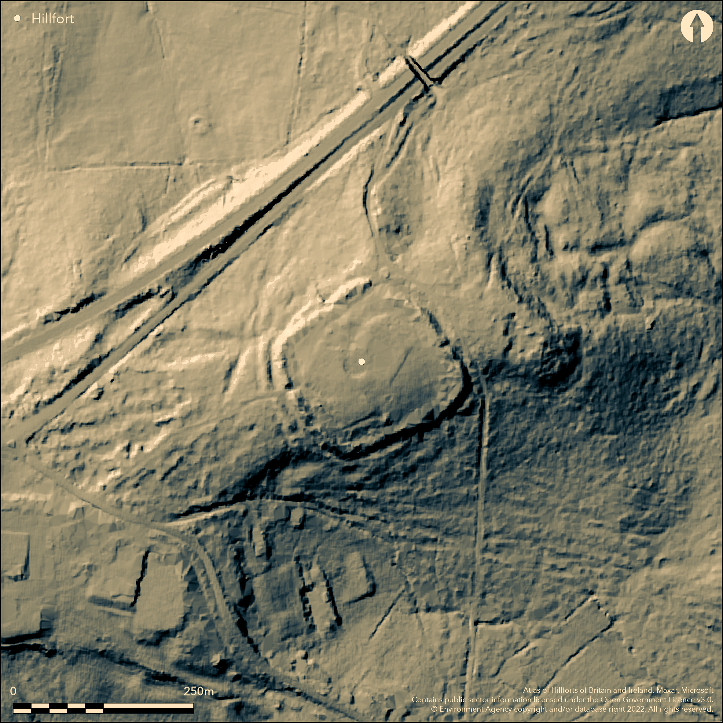
LiDAR 1m DTM Hillshade
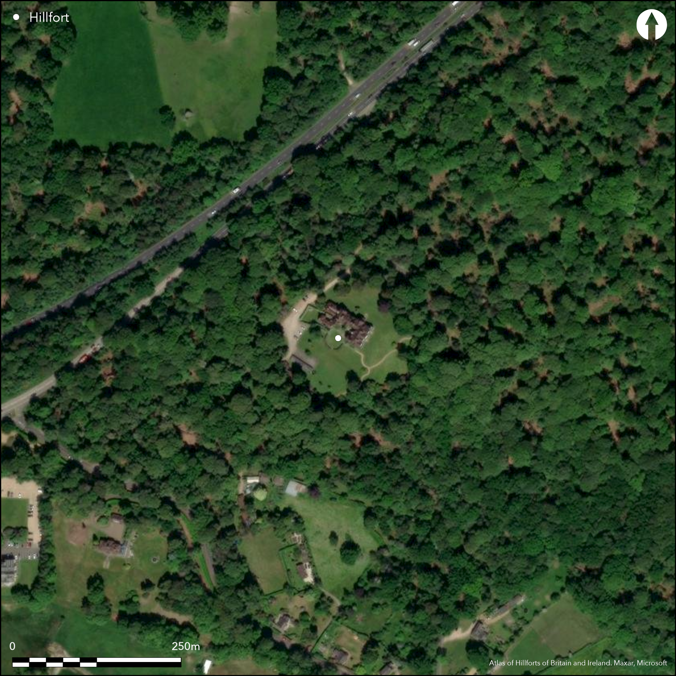
Satellite Imagery
LiDAR 1m DTM Hillshade
Satellite Imagery
Scroll left/right to view further images.
HER: Hampshire No record found (None)
NMR: SU 21 SE 8 (222766)
SM: 1016493
NGR: SU27721214
X: 427720 Y: 112140 (OSGB36)
Multivallate contour hillfort prominently situated at NE end of the Stoney Cross ridge, a flat-topped plateau gravel ridge running NE-SW alongside A31, within Castle Malwood Walk. River Test to E. Ridge former route of Roman road, past NW corner of hillfort, and possible siting of an Armada beacon within the hillfort. Roughly square site with internal area 1.5ha. Ramparts best on SW where across neck of ridge. Here two substantial parallel banks to 12m wide and 2m high, with shallow medial ditch and flanked by second outer ditch to 9m wide and to 1m deep. Possible original entrance on this side widened and badly damaged modern road into site. Also three other breaches of modern tracks and paths. Elsewhere defences smaller scale. To NE and SE springs occur with steep and boggy sides to the ridge enclosed by single rampart to 3.5m above shallow, and now infilled, outer ditch, forming narrow terrace. Part excavation during sewage works 1972 found bank on NW revetted with timber posts along front (Betts 1973). On NE and E at the ridge-end an additional low, parallel outer bank, now partly levelled by modern road. Site disturbed by use as site of substantial country house, Minstead Court, with landscaping and associated features, parkland interior and wooded surrounds. On 1st Ed OS map (1869-71). Undated.
Citizen Science: ✓
Reliability of Data: Confirmed
Reliability of Interpretation: Confirmed
X: -178905 Y: 6605037 (EPSG: 3857)
Longitude: -1.607130101162935 Latitude: 50.90800634492881 (EPSG:4326)
Country: England
Current County or Unitary Authority: Hampshire
Historic County: Hampshire and Isle of Wight
Current Parish/Community/Council/Townland: Minstead
Disturbed. Later use as site of modern country house, Minstead Court, constructed 1884 and Listed Grade II, with landscaping features associated with the house on SE and S, including partial brick revetting of rampart, brick-framed vista to SE and garden path through rampart at S corner. Also construction of septic tank on NW side.
| Extant | ✓ |
| Cropmark | ✗ |
| Likely Destroyed | ✓ |
Site of 19th century country house. Parkland interior and wooded surrounds.
| Woodland | ✓ |
| Commercial Forestry Plantation | ✗ |
| Parkland | ✓ |
| Pasture (Grazing) | ✗ |
| Arable | ✗ |
| Scrub/Bracken | ✗ |
| Bare Outcrop | ✗ |
| Heather/Moorland | ✗ |
| Heath | ✗ |
| Built-up | ✓ |
| Coastal Grassland | ✗ |
| Other | ✗ |
Multivallate contour hillfort prominently situated at NE end of the Stoney Cross ridge, a flat-topped plateau gravel ridge running NE-SW alongside A31, within Castle Malwood Walk. River Test to E.
| Contour Fort | ✓ |
| Partial Contour Fort | ✗ |
| Promontory Fort | ✗ |
| Hillslope Fort | ✗ |
| Level Terrain Fort | ✗ |
| Marsh Fort | ✗ |
| Multiple Enclosure Fort | ✗ |
| Hilltop | ✗ |
| Coastal Promontory | ✗ |
| Inland Promontory | ✗ |
| Valley Bottom | ✗ |
| Knoll/Hillock/Outcrop | ✗ |
| Ridge | ✓ |
| Cliff/Plateau-edge/Scarp | ✗ |
| Hillslope | ✗ |
| Lowland | ✗ |
| Spur | ✗ |
Dominant Topographic Feature: Ridge
| North | ✗ |
| Northeast | ✗ |
| East | ✗ |
| Southeast | ✗ |
| South | ✗ |
| Southwest | ✗ |
| West | ✗ |
| Northwest | ✗ |
| Level | ✓ |
Altitude: 91.0m
N/A
None.
Reliability: D - None
| Pre 1200BC | ✗ |
| 1200BC - 800BC | ✗ |
| 800BC - 400BC | ✗ |
| 400BC - AD50 | ✗ |
| AD50 - AD400 | ✗ |
| AD400 - AD 800 | ✗ |
| Post AD800 | ✗ |
| Unknown | ✓ |
| Pre Hillfort: | None |
| Post Hillfort: | Ridge route of Roman road on W side of fort, and possible siting of an Armada beacon within, as recorded in John Norden's Map of Hampshire of 1595. 19th century parkland. |
Armada beacon within hillfort, recorded in John Norden's Map of Hampshire 1595. On 1st Ed OS map (1869-71). Various Field investigator comments 1954-82. Excavation U.V.G. Betts, Hampshire Field Club Forest Section 1972.
| 1st Identified Map Depiction (1595): | John Norden's Map of Hampshire. |
| Excavation (1972): | U.V.G. Betts, Hampshire Field Club Forest Section. |
| Other (None): | OS map. |
| Other (None): | Various Field investigator comments. |
None.
To NE and SE springs occur with steep and boggy sides to the ridge.
| None | ✗ |
| Spring | ✓ |
| Stream | ✗ |
| Pool | ✗ |
| Flush | ✗ |
| Well | ✗ |
| Other | ✗ |
None
| No Known Features | ✓ |
| Round Stone Structures | ✗ |
| Rectangular Stone Structures | ✗ |
| Curvilinear Platforms | ✗ |
| Other Roundhouse Evidence | ✗ |
| Pits | ✗ |
| Quarry Hollows | ✗ |
| Other | ✗ |
None
| No Known Excavation | ✓ |
| Pits | ✗ |
| Postholes | ✗ |
| Roundhouses | ✗ |
| Rectangular Structures | ✗ |
| Roads/Tracks | ✗ |
| Quarry Hollows | ✗ |
| Other | ✗ |
| Nothing Found | ✗ |
None
| No Known Geophysics | ✓ |
| Pits | ✗ |
| Roundhouses | ✗ |
| Rectangular Structures | ✗ |
| Roads/Tracks | ✗ |
| Quarry Hollows | ✗ |
| Other | ✗ |
| Nothing Found | ✗ |
None
| No Known Finds | ✓ |
| Pottery | ✗ |
| Metal | ✗ |
| Metalworking | ✗ |
| Human Bones | ✗ |
| Animal Bones | ✗ |
| Lithics | ✗ |
| Environmental | ✗ |
| Other | ✗ |
None
| APs Not Checked | ✓ |
| None | ✗ |
| Roundhouses | ✗ |
| Rectangular Structures | ✗ |
| Pits | ✗ |
| Postholes | ✗ |
| Roads/Tracks | ✗ |
| Other | ✗ |
Possible original entrance on SW widened and badly damaged modern road into site.
| 1: | None |
| 2: | Damaged by access road. |
Guard Chambers: ✗
Chevaux de Frise: ✗
| 1. Simple Gap (South west): | Damaged and widened. |
Defences best on SW where across neck of ridge. Here two substantial parallel banks to 12m wide and 2m high, with shallow medial ditch and flanked by second outer ditch to 9m wide and to 1m deep. Elsewhere defences smaller scale. To NE and SE springs occur with steep and boggy sides to the ridge enclosed by single rampart to 3.5m above shallow, and now infilled, outer ditch. Part excavation during sewage works 1972 found bank on NW revetted with timber posts along front. On NE and E defences at the ridge-end have additional low, parallel outer bank, now partly levelled by modern road.
| Area 1: | 1.5ha. |
| Total: | 1.5ha. |
Total Footprint Area: Noneha.
None
| ✗ | None |
| ✓ | None |
| NE Quadrant: | 2 |
| SE Quadrant: | 1 |
| SW Quadrant: | 2 |
| NW Quadrant: | 2 |
| Total: | 2 |
| Partial Univallate | ✓ |
| Univallate | ✗ |
| Partial Bivallate | ✓ |
| Bivallate | ✗ |
| Partial Multivallate | ✗ |
| Multivallate | ✗ |
| Unknown | ✗ |
| Partial Univallate | ✗ |
| Univallate | ✗ |
| Partial Bivallate | ✗ |
| Bivallate | ✗ |
| Partial Multivallate | ✗ |
| Multivallate | ✗ |
None
| None | ✗ |
| Earthen Bank | ✓ |
| Stone Wall | ✗ |
| Rubble | ✗ |
| Wall-walk | ✗ |
| Evidence of Timber | ✗ |
| Vitrification | ✗ |
| Other Burning | ✗ |
| Palisade | ✗ |
| Counter Scarp Bank | ✗ |
| Berm | ✗ |
| Unfinished | ✗ |
| Other | ✗ |
Part excavation during sewage works 1972 found bank on NW revetted with timber posts along front.
| None | ✗ |
| Earthen Bank | ✓ |
| Stone Wall | ✗ |
| Murus Duplex | ✗ |
| Timber-framed | ✓ |
| Timber-laced | ✗ |
| Vitrification | ✗ |
| Other Burning | ✗ |
| Palisade | ✗ |
| Counter Scarp Bank | ✗ |
| Berm | ✗ |
| Unfinished | ✗ |
| No Known Excavation | ✗ |
| Other | ✗ |
| ✗ | None |
| ✓ | None |
Number of Ditches: 2
| ✗ | None |
Betts, U.V.G. 1973. Hampshire Field Club New Forest Section Report, Hampshire Field Club New Forest Section Report, 13, 9-10.
Read, C. 2016. New Forest hillforts and smaller Iron Age enclosures, New Forest History and Archaeology Group, Report No 8, 28-39.
Sumner, H. 1887. The ancient earthworks of the New Forest, 26-9
White, H. T. 1930. The Beacon System in Hampshire, Proc Hampshire Fld Club Archaeol Soc, 10, 252-278.
Atlas of Hillforts:
Wikidata:
This work is licensed under CC BY-SA 4.0

 and should be cited as:
Lock, Gary and Ralston, Ian. 2024. Atlas of Hillforts of Britain and Ireland. Available at: https://hillforts.arch.ox.ac.uk
Document Version 1.1