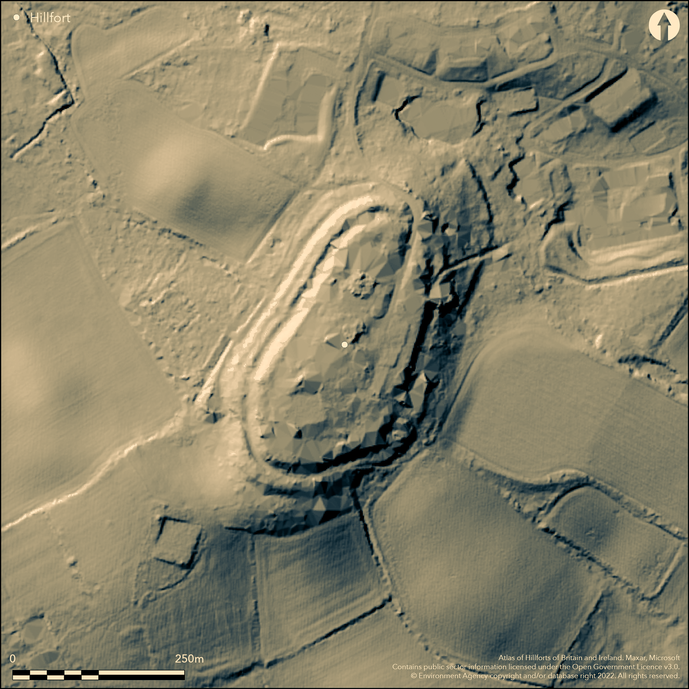
LiDAR 1m DTM Hillshade
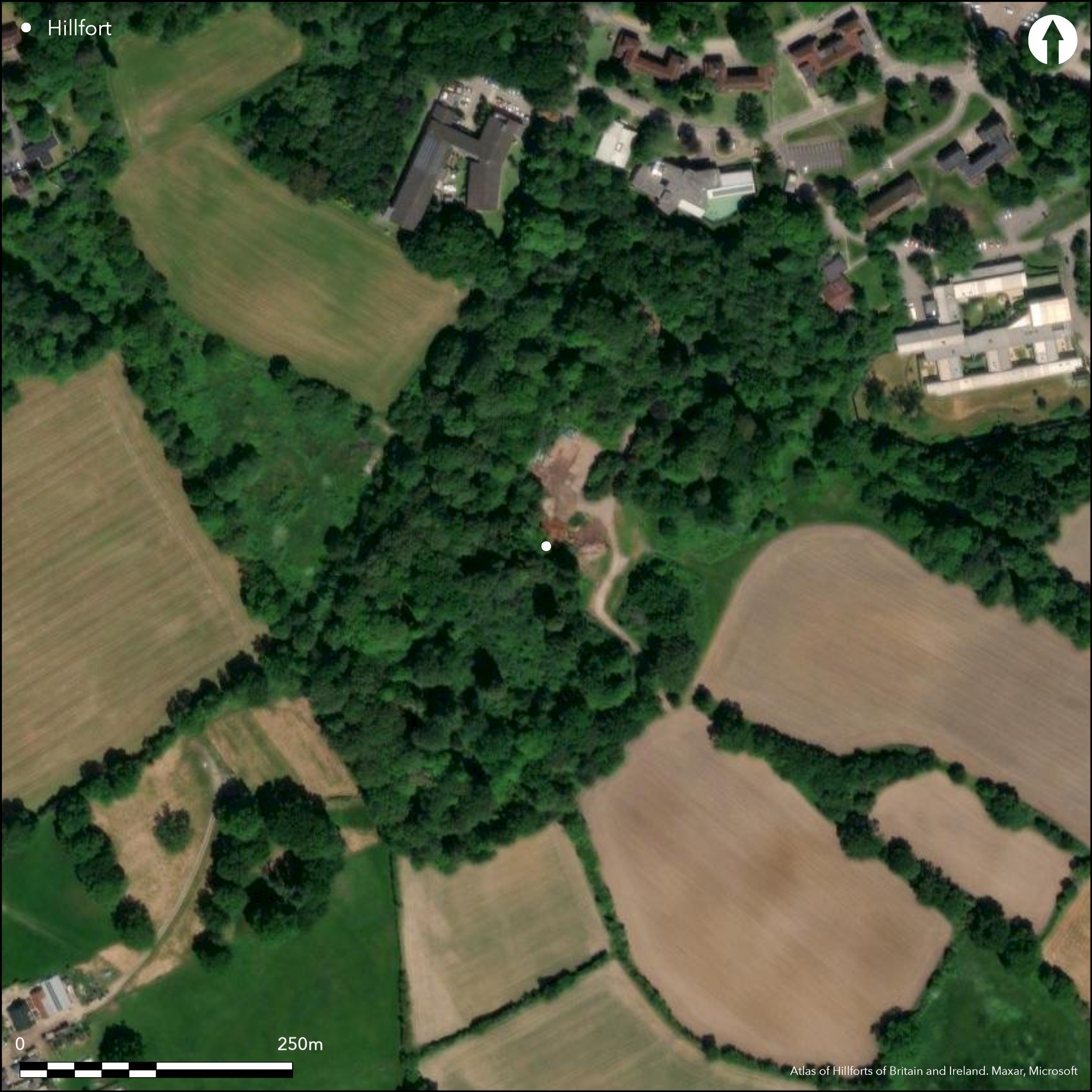
Satellite Imagery
LiDAR 1m DTM Hillshade
Satellite Imagery
Scroll left/right to view further images.
HER: Hampshire 22077 (None)
NMR: SU 31 SW 1 (226838)
SM: 1019193
NGR: SU33011449
X: 433010 Y: 114490 (OSGB36)
Remains of multivallate, contour hillfort located on Tatchbury Mount, a prominent clay hill on NE edge of New Forest. River Test to E and its estuary to SE, Cadnam River and River Blackwater confluence to N. Moderate surrounding slopes. Now adapted as part of an ornamental garden for late 18th century house built inside the ramparts, extensively landscaped in 18th and 19th centuries, and now within grounds of Tatchbury Mount Hospital. Oval earthwork, NNE to SSW, encloses c. 1.8ha-2ha. Two banks between 3.5 - 4m high separated by terrace c. 6.0m wide, except along the W side, where smaller, and originally continuous bank between main banks. Terrace possibly site of infilled ditch. Two trenches excavated in advance of proposed development (Ingram 2005) recorded ditches/gullies. Access to house from N possibly follows line of original entrance. Chance find of Iron Age comb. On 1st Ed. OS map (1869). Undated.
Citizen Science: ✓
Reliability of Data: Confirmed
Reliability of Interpretation: Confirmed
X: -170506 Y: 6608720 (EPSG: 3857)
Longitude: -1.531680943606161 Latitude: 50.928860729124395 (EPSG:4326)
Country: England; None
Current County or Unitary Authority: Hampshire
Historic County: Hampshire and Isle of Wight
Current Parish/Community/Council/Townland: Netley Marsh; Copythorne
Site extensively landscaped and planted with trees as part of formal gardens 18th and 19th centuries. Landscaping involved partial levelling and terracing of E defences, cutting of several footpaths through banks and construction of drainage ditch on NE side.
| Extant | ✓ |
| Cropmark | ✗ |
| Likely Destroyed | ✓ |
Parkland and landscaped gardens.
| Woodland | ✗ |
| Commercial Forestry Plantation | ✗ |
| Parkland | ✓ |
| Pasture (Grazing) | ✗ |
| Arable | ✗ |
| Scrub/Bracken | ✗ |
| Bare Outcrop | ✗ |
| Heather/Moorland | ✗ |
| Heath | ✗ |
| Built-up | ✓ |
| Coastal Grassland | ✗ |
| Other | ✗ |
Remains of multivallate, contour hillfort located on Tatchbury Mount, a prominent clay hill on NE edge of New Forest. River Test to E and its estuary to SE, Cadnam River and River Blackwater confluence to N. Moderate surrounding slopes.
| Contour Fort | ✓ |
| Partial Contour Fort | ✗ |
| Promontory Fort | ✗ |
| Hillslope Fort | ✗ |
| Level Terrain Fort | ✗ |
| Marsh Fort | ✗ |
| Multiple Enclosure Fort | ✗ |
| Hilltop | ✓ |
| Coastal Promontory | ✗ |
| Inland Promontory | ✗ |
| Valley Bottom | ✗ |
| Knoll/Hillock/Outcrop | ✗ |
| Ridge | ✗ |
| Cliff/Plateau-edge/Scarp | ✗ |
| Hillslope | ✗ |
| Lowland | ✗ |
| Spur | ✗ |
Dominant Topographic Feature: Hill top
| North | ✗ |
| Northeast | ✗ |
| East | ✗ |
| Southeast | ✗ |
| South | ✗ |
| Southwest | ✗ |
| West | ✗ |
| Northwest | ✗ |
| Level | ✓ |
Altitude: 61.0m
Boundary Type: Parish/Townland
None.
Reliability: D - None
| Pre 1200BC | ✗ |
| 1200BC - 800BC | ✗ |
| 800BC - 400BC | ✗ |
| 400BC - AD50 | ✗ |
| AD50 - AD400 | ✗ |
| AD400 - AD 800 | ✗ |
| Post AD800 | ✗ |
| Unknown | ✓ |
| Pre Hillfort: | None |
| Post Hillfort: | None |
On Tithe Map, Parish of Eling, Southampton 1842. On 1st Ed. OS map (1869). Field investigator comments 1951, 1960, 1969. Evaluation trenches in advance of proposed deveopment Tatchbury Mount Hospital, Calmore M. Ingram 2005.
| 1st Identified Map Depiction (1842): | On Tithe Map, Parish of Eling, Southampton. |
| Other (1869): | OS map. |
| Excavation (2005): | Evaluation trenches in advance of proposed deveopment Tatchbury Mount Hospital, Calmore M. Ingram, Museum of London Archaeology Service. |
| Other (None): | Field investigator comments. |
Two trenches excavated in advance of proposed development 2005 recorded ditches/gullies. Chance 19th century find of Iron Age comb.
None
| None | ✓ |
| Spring | ✗ |
| Stream | ✗ |
| Pool | ✗ |
| Flush | ✗ |
| Well | ✗ |
| Other | ✗ |
None
| No Known Features | ✓ |
| Round Stone Structures | ✗ |
| Rectangular Stone Structures | ✗ |
| Curvilinear Platforms | ✗ |
| Other Roundhouse Evidence | ✗ |
| Pits | ✗ |
| Quarry Hollows | ✗ |
| Other | ✗ |
Two trenches excavated in advance of proposed development 2005 recorded ditches/gullies.
| No Known Excavation | ✗ |
| Pits | ✗ |
| Postholes | ✗ |
| Roundhouses | ✗ |
| Rectangular Structures | ✗ |
| Roads/Tracks | ✗ |
| Quarry Hollows | ✗ |
| Other | ✓ |
| Nothing Found | ✗ |
None
| No Known Geophysics | ✓ |
| Pits | ✗ |
| Roundhouses | ✗ |
| Rectangular Structures | ✗ |
| Roads/Tracks | ✗ |
| Quarry Hollows | ✗ |
| Other | ✗ |
| Nothing Found | ✗ |
Chance 19th century find of Iron Age comb.
| No Known Finds | ✗ |
| Pottery | ✗ |
| Metal | ✗ |
| Metalworking | ✗ |
| Human Bones | ✗ |
| Animal Bones | ✗ |
| Lithics | ✗ |
| Environmental | ✗ |
| Other | ✓ |
None
| APs Not Checked | ✓ |
| None | ✗ |
| Roundhouses | ✗ |
| Rectangular Structures | ✗ |
| Pits | ✗ |
| Postholes | ✗ |
| Roads/Tracks | ✗ |
| Other | ✗ |
Access to house from N possibly follows line of original entrance.
| 1: | None |
| 2: | None |
Guard Chambers: ✗
Chevaux de Frise: ✗
| 1. Simple Gap (North): | Access road through to house. |
Two trenches excavated in advance of proposed development 2005 recorded ditches/gullies.
| Area 1: | 1.8ha. |
| Total: | 1.8ha. |
Total Footprint Area: Noneha.
None
| ✗ | None |
| ✓ | None |
| NE Quadrant: | 2 |
| SE Quadrant: | 2 |
| SW Quadrant: | 3 |
| NW Quadrant: | 3 |
| Total: | 3 |
| Partial Univallate | ✗ |
| Univallate | ✗ |
| Partial Bivallate | ✓ |
| Bivallate | ✗ |
| Partial Multivallate | ✓ |
| Multivallate | ✗ |
| Unknown | ✗ |
| Partial Univallate | ✗ |
| Univallate | ✗ |
| Partial Bivallate | ✗ |
| Bivallate | ✗ |
| Partial Multivallate | ✗ |
| Multivallate | ✗ |
None
| None | ✗ |
| Earthen Bank | ✓ |
| Stone Wall | ✗ |
| Rubble | ✗ |
| Wall-walk | ✗ |
| Evidence of Timber | ✗ |
| Vitrification | ✗ |
| Other Burning | ✗ |
| Palisade | ✗ |
| Counter Scarp Bank | ✗ |
| Berm | ✗ |
| Unfinished | ✗ |
| Other | ✗ |
Two trenches excavated in advance of proposed development 2005 recorded ditches/gullies.
| None | ✗ |
| Earthen Bank | ✗ |
| Stone Wall | ✗ |
| Murus Duplex | ✗ |
| Timber-framed | ✗ |
| Timber-laced | ✗ |
| Vitrification | ✗ |
| Other Burning | ✗ |
| Palisade | ✗ |
| Counter Scarp Bank | ✗ |
| Berm | ✗ |
| Unfinished | ✗ |
| No Known Excavation | ✗ |
| Other | ✓ |
| ✗ | None |
| ✗ | None defined, but possibly buried features. |
Number of Ditches: None
| ✗ | None |
Ingram M. 2005. Tatchbury Mount, Calmore, Hampshire: an archaeological evaluation report, London: Museum of London Archaeology Service.
Read, C. 2016. New Forest hillforts and smaller Iron Age enclosures, New Forest History and Archaeology Group, Report No 8, 28-39.
Atlas of Hillforts:
Wikidata:
This work is licensed under CC BY-SA 4.0

 and should be cited as:
Lock, Gary and Ralston, Ian. 2024. Atlas of Hillforts of Britain and Ireland. Available at: https://hillforts.arch.ox.ac.uk
Document Version 1.1