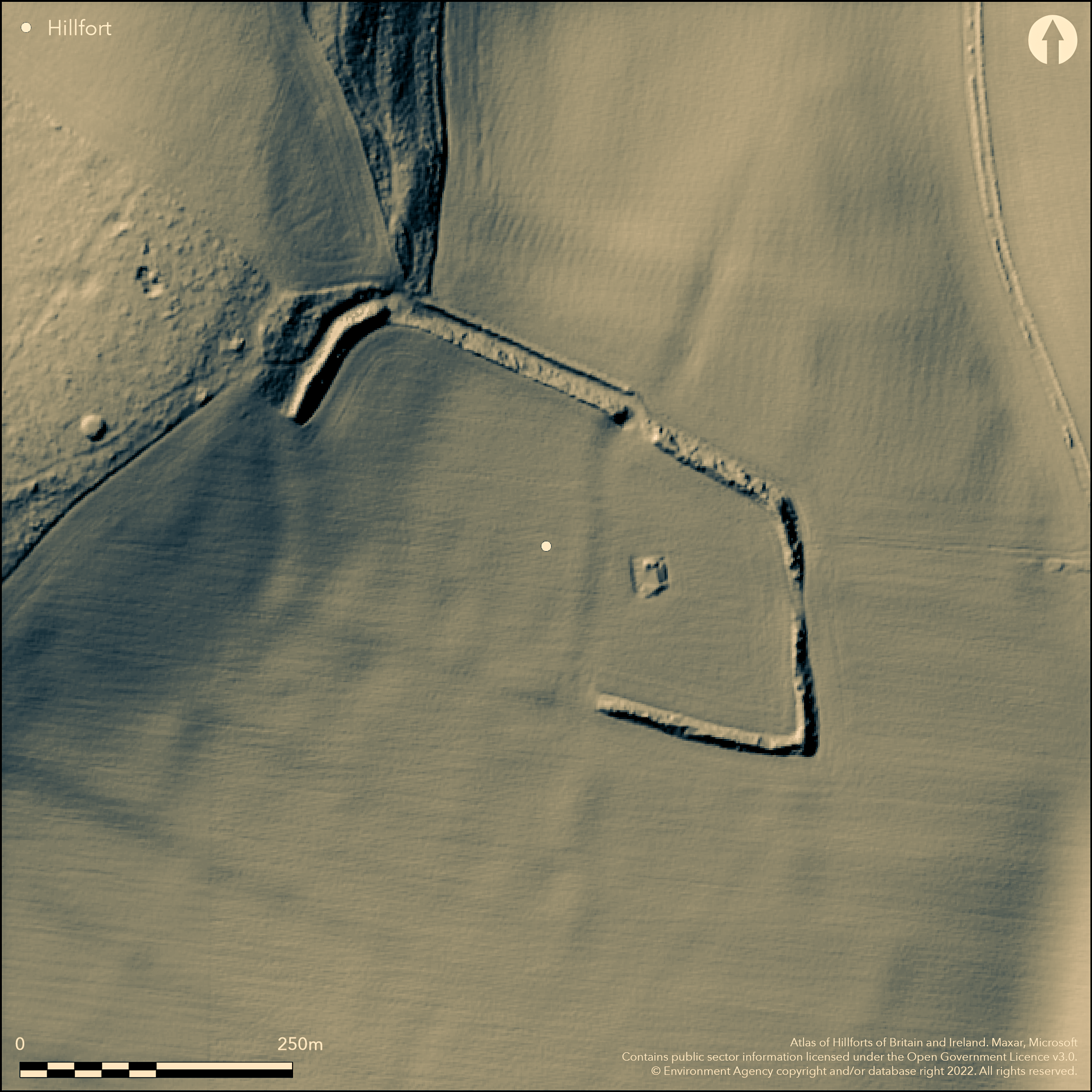
LiDAR 1m DTM Hillshade
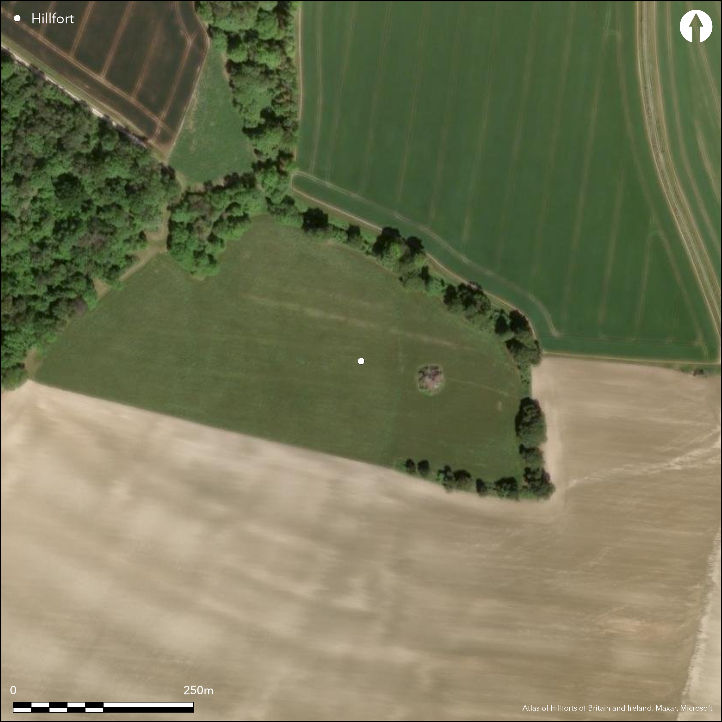
Satellite Imagery
LiDAR 1m DTM Hillshade
Satellite Imagery
Scroll left/right to view further images.
HER: Hampshire 25194 (None)
NMR: SU 33 SE 20 (227656)
SM: 1014815
NGR: SU39403012
X: 439400 Y: 130120 (OSGB36)
Univallate, hillslope fort located on SE-facing slopes of downland summit of Ashley Down to S of Ashley Wood. Mostly moderate to strong surrounding slopes, less on S. Oblong shape measuring internally c. 320m E-W by 183m, with internal area c. 4.5ha. Defined by substantial bank and outer ditch, generally fairly preserved where best and, although S half of W side and W half of S side ploughed-out, and visible only as undulations in a field, ditch visible as a depression and circuit can be seen. Generally ditch variable and now buried feature in places. On parts of E and extreme S bank visible but no trace of ditch. Circuit best then on N and NW sides, with bank to 9m wide and to 2m high and ditch to 8m wide and to 1m deep. Profiles vary according to hillslope and affects of cultivation. Excavations by F. M. Hicks 1931 (Williams-Freeman 1933) on line of N side ditch found it to be 2.7m deep and sharply V-profiled with narrow base only 0.3m wide. Late Iron Age pottery recovered from the ditch provides dating evidence for the construction of the hillfort as does coin of Eppaticus dateable to AD 20-43. Well marked gaps on each side of defences although uncertain which original entrances, but possibly those on E, through which farm track, and on W. Possibly reoccupied in the Roman period with finds of pottery and other objects both from higher levels of ditch where excavated and spread widely over interior of the hillfort. Possible Roman-British bath found in SW corner in 1860's, but uncertain. Traces of field systems of unspecified date lying on all sides visible from aerial photographs. Generally fairly preserved where best, but much affected by ploughing and S half of W side and W half of S side ploughed-out. E occupied by farm buildings and pasture. On 1st Ed OS map (1867-82) as 'Roman Camp'. .
Citizen Science: ✗
Reliability of Data: Confirmed
Reliability of Interpretation: Confirmed
X: -160196 Y: 6633509 (EPSG: 3857)
Longitude: -1.439067620220202 Latitude: 51.0690055759005 (EPSG:4326)
Country: England
Current County or Unitary Authority: Hampshire
Historic County: Hampshire and Isle of Wight
Current Parish/Community/Council/Townland: Ashley
Generally fairly preserved where best, but much affected by ploughing and S half of W side and W half of S side ploughed-out. Ditch variable and now buried feature in places. E occupied by farm buildings and pasture. On Heritage at Risk Register (2015).
| Extant | ✓ |
| Cropmark | ✓ |
| Likely Destroyed | ✗ |
Improved pasture and farm buildings.
| Woodland | ✗ |
| Commercial Forestry Plantation | ✗ |
| Parkland | ✗ |
| Pasture (Grazing) | ✓ |
| Arable | ✗ |
| Scrub/Bracken | ✗ |
| Bare Outcrop | ✗ |
| Heather/Moorland | ✗ |
| Heath | ✗ |
| Built-up | ✓ |
| Coastal Grassland | ✗ |
| Other | ✗ |
Univallate, hillslope fort located on SE-facing slopes of downland summit of Ashley Down to S of Ashley Wood. Mostly moderate to strong surrounding slopes, less on S.
| Contour Fort | ✗ |
| Partial Contour Fort | ✗ |
| Promontory Fort | ✗ |
| Hillslope Fort | ✓ |
| Level Terrain Fort | ✗ |
| Marsh Fort | ✗ |
| Multiple Enclosure Fort | ✗ |
| Hilltop | ✗ |
| Coastal Promontory | ✗ |
| Inland Promontory | ✗ |
| Valley Bottom | ✗ |
| Knoll/Hillock/Outcrop | ✗ |
| Ridge | ✗ |
| Cliff/Plateau-edge/Scarp | ✗ |
| Hillslope | ✓ |
| Lowland | ✗ |
| Spur | ✗ |
Dominant Topographic Feature: Hillslope
| North | ✗ |
| Northeast | ✗ |
| East | ✗ |
| Southeast | ✓ |
| South | ✗ |
| Southwest | ✗ |
| West | ✗ |
| Northwest | ✗ |
| Level | ✗ |
Altitude: 107.0m
N/A
Late Iron Age pottery recovered from the ditch on 1931 excavations.Possibly reoccupied in the Roman period with finds of pottery and other objects both from higher levels of ditch where excavated and spread widely over interior of the hillfort. Coin of Eppaticus of AD 20-43.
Reliability: B - Medium
| Pre 1200BC | ✗ |
| 1200BC - 800BC | ✗ |
| 800BC - 400BC | ✗ |
| 400BC - AD50 | ✓ |
| AD50 - AD400 | ✓ |
| AD400 - AD 800 | ✗ |
| Post AD800 | ✗ |
| Unknown | ✗ |
| Pre Hillfort: | None |
| Post Hillfort: | None |
| Artefactual: | Late Iron Age pottery recovered from the ditch on 1931 excavations. Coin of Eppaticus. |
On 1st Ed OS map (1867-82) as 'Roman Camp'. Minor excavation by F.M. Hicks of Winchester College 1931, digging out ditch E of the entrance on N. side. Ordnance Survey field investigator comments 1956, 1961.
| Excavation (1931): | Minor excavation by F.M. Hicks of Winchester College, digging out ditch E of the entrance on N. side. |
| 1st Identified Map Depiction (None): | OS map. |
| Other (None): | OS field investigator comments. |
Late Iron Age pottery. Possibly reoccupied in the Roman period with finds of pottery and other objects both from higher levels of ditch where excavated and spread widely over interior of the hillfort.
None
| None | ✓ |
| Spring | ✗ |
| Stream | ✗ |
| Pool | ✗ |
| Flush | ✗ |
| Well | ✗ |
| Other | ✗ |
None
| No Known Features | ✓ |
| Round Stone Structures | ✗ |
| Rectangular Stone Structures | ✗ |
| Curvilinear Platforms | ✗ |
| Other Roundhouse Evidence | ✗ |
| Pits | ✗ |
| Quarry Hollows | ✗ |
| Other | ✗ |
None
| No Known Excavation | ✗ |
| Pits | ✗ |
| Postholes | ✗ |
| Roundhouses | ✗ |
| Rectangular Structures | ✗ |
| Roads/Tracks | ✗ |
| Quarry Hollows | ✗ |
| Other | ✗ |
| Nothing Found | ✓ |
None
| No Known Geophysics | ✓ |
| Pits | ✗ |
| Roundhouses | ✗ |
| Rectangular Structures | ✗ |
| Roads/Tracks | ✗ |
| Quarry Hollows | ✗ |
| Other | ✗ |
| Nothing Found | ✗ |
Late Iron Age pottery. Layer of oyster shells, pre-Roman and early Roman pottery sherds and Roman entrenching tool. Elizabethan coins and silver coin of Epaticcus datable to AD 20-43. Possible medieval? tiles.
| No Known Finds | ✗ |
| Pottery | ✓ |
| Metal | ✓ |
| Metalworking | ✗ |
| Human Bones | ✗ |
| Animal Bones | ✗ |
| Lithics | ✗ |
| Environmental | ✓ |
| Other | ✓ |
None
| APs Not Checked | ✓ |
| None | ✗ |
| Roundhouses | ✗ |
| Rectangular Structures | ✗ |
| Pits | ✗ |
| Postholes | ✗ |
| Roads/Tracks | ✗ |
| Other | ✗ |
Well marked gaps on each side of defences on E, W and two on S, although uncertain which original entrances, but possibly those on E, through which farm track, and on W.
| 4: | On E, W and two on S. |
| 2: | Uncertain which of four gaps original, but possibly those on E, through which farm track, and on W. |
Guard Chambers: ✗
Chevaux de Frise: ✗
| 1. Simple Gap (East): | Possible only. |
| 2. Simple Gap (West): | Possible only. |
Defined by substantial bank and outer ditch, generally fairly preserved where best and, although S half of W side and W half of S side ploughed-out, and visible only as undulations in a field, ditch visible as a depression and circuit can be seen. On parts of E and extreme S bank visible but no trace of ditch. Circuit best then on N and NW sides, with bank to 9m wide and to 2m high and ditch to 8m wide and to 1m deep. Profiles vary according to hillslope and affects of cultivation. Excavations by F. M. Hicks 1931 on line of N side ditch found it to be 2.7m deep and sharply V-profiled with narrow base only 0.3m) wide.
| Area 1: | 4.5ha. |
| Total: | 4.5ha. |
Total Footprint Area: Noneha.
None
| ✗ | None |
| ✓ | None |
| NE Quadrant: | 1 |
| SE Quadrant: | 1 |
| SW Quadrant: | 1 |
| NW Quadrant: | 1 |
| Total: | 1 |
| Partial Univallate | ✗ |
| Univallate | ✓ |
| Partial Bivallate | ✗ |
| Bivallate | ✗ |
| Partial Multivallate | ✗ |
| Multivallate | ✗ |
| Unknown | ✗ |
| Partial Univallate | ✗ |
| Univallate | ✗ |
| Partial Bivallate | ✗ |
| Bivallate | ✗ |
| Partial Multivallate | ✗ |
| Multivallate | ✗ |
None
| None | ✗ |
| Earthen Bank | ✓ |
| Stone Wall | ✗ |
| Rubble | ✗ |
| Wall-walk | ✗ |
| Evidence of Timber | ✗ |
| Vitrification | ✗ |
| Other Burning | ✗ |
| Palisade | ✗ |
| Counter Scarp Bank | ✗ |
| Berm | ✗ |
| Unfinished | ✗ |
| Other | ✗ |
Excavations by F. M. Hicks 1931 on line of N side ditch found it to be 2.7m deep and sharply V-profiled with narrow base only 0.3m) wide.
| None | ✗ |
| Earthen Bank | ✓ |
| Stone Wall | ✗ |
| Murus Duplex | ✗ |
| Timber-framed | ✗ |
| Timber-laced | ✗ |
| Vitrification | ✗ |
| Other Burning | ✗ |
| Palisade | ✗ |
| Counter Scarp Bank | ✗ |
| Berm | ✗ |
| Unfinished | ✗ |
| No Known Excavation | ✗ |
| Other | ✓ |
| ✗ | None |
| ✓ | Ditch variable and now buried feature in places. Excavations by F. M. Hicks 1931 on line of N side ditch found it to be 2.7m deep and sharply V-profiled with narrow base only 0.3m) wide. |
Number of Ditches: 1
| ✗ | None |
Williams-Freeman, J.P. 1915. An introduction to field archaeology as illustrated by Hampshire, London: Macmillan and Co Ltd, 229-33.
Williams-Freeman, J.P. 1933. Ashley Roman Camp, Proc Hampshire Fld Club Archaeol Soc, 12, 109-110.
Second OS Archaeology Field Investigator WCW 24-FEB-56
(12) General reference Coin of Epaticus in Ashmolean Museum (Mack 263) Bagendon 1961 143 (EH Clifford)
(13) Field Investigators Comments Third OS Archaeology Field Investigator GHP 11.07.61
(14) General reference Place Names of Roman Britain 1979 277-8 (A L F Rivet & C Smith)
(15) General reference Bagendon 1961 143 (E M Clifford)
(16) General reference
Atlas of Hillforts:
Wikidata:
This work is licensed under CC BY-SA 4.0

 and should be cited as:
Lock, Gary and Ralston, Ian. 2024. Atlas of Hillforts of Britain and Ireland. Available at: https://hillforts.arch.ox.ac.uk
Document Version 1.1