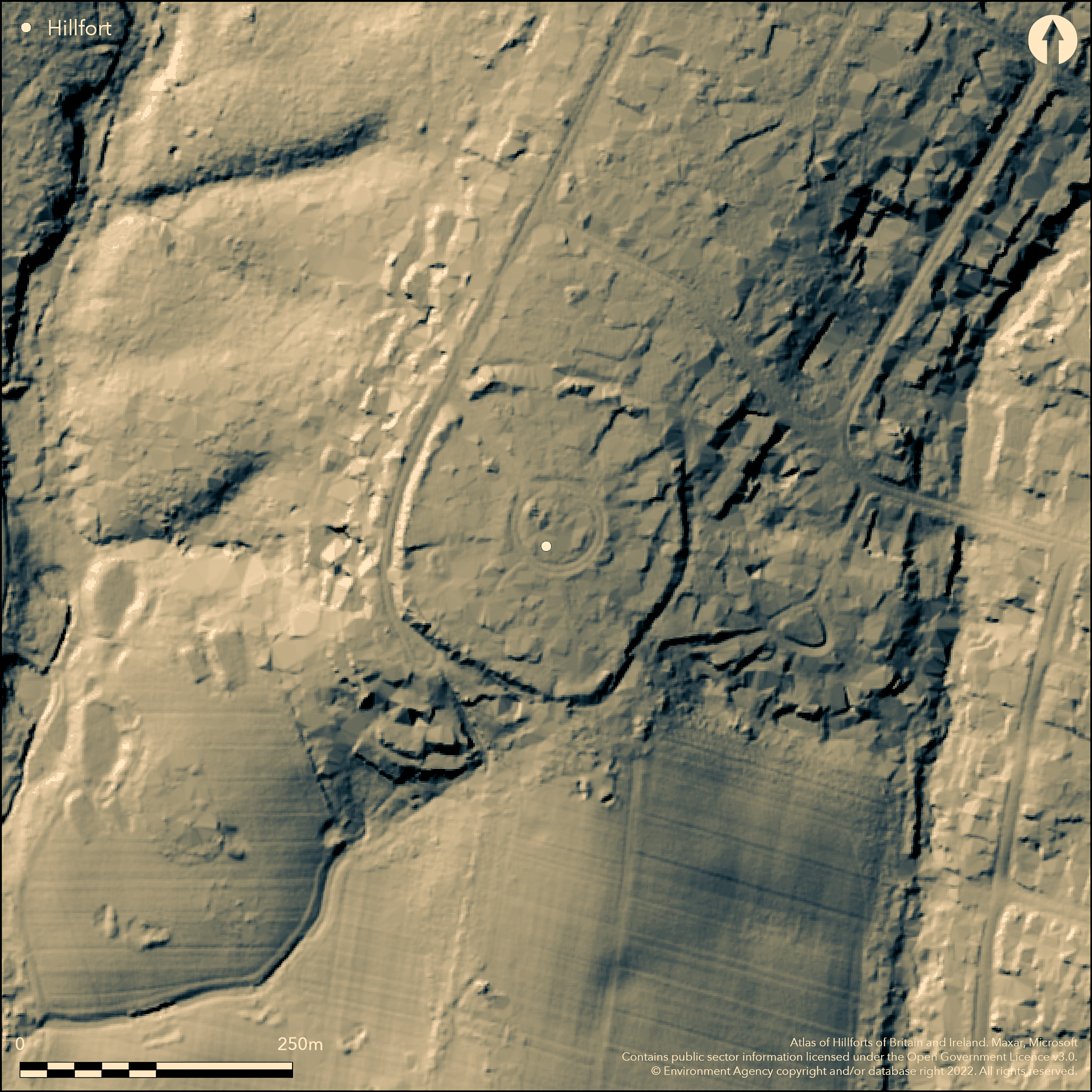
LiDAR 1m DTM Hillshade
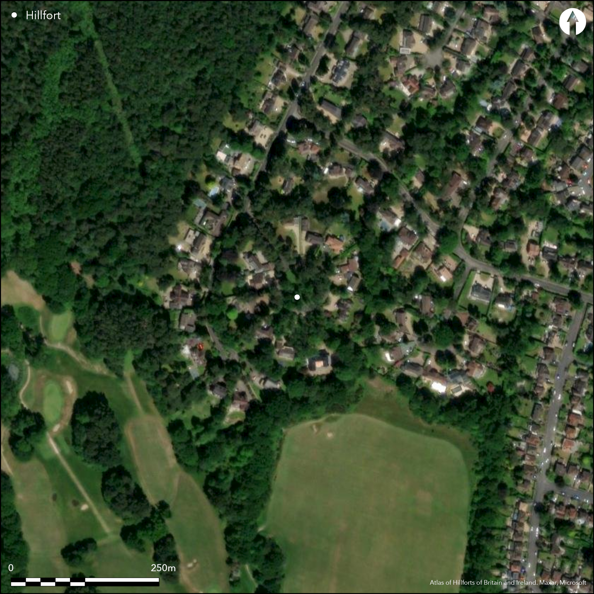
Satellite Imagery
LiDAR 1m DTM Hillshade
Satellite Imagery
Scroll left/right to view further images.
HER: Hampshire 25828 (None)
NMR: SU 41 NW 17 (230144)
SM: 1001941
NGR: SU41351700
X: 441350 Y: 117000 (OSGB36)
Univallate, contour hillfort located at S end of N-S downland ridge above Southampton and Solent to S. Moderate to strong surrounding slopes. Circular in plan following contours with internal area c. 2ha. Defined by uniform bank and ditch around circuit in domestic gardens, but ditch levelled on N side. Possible original entrances were along line of ridge just to W of NE and SE corners, latter destroyed. Excavation through bank and ditch on N by Miss D Liddell 1928 produced few finds of flint and chert, four other cuttings producing nothing (no full report). Fair condition, but affected by housing development within, and mutilated by gardens accordingly, and site surrounded by housing except on SE. On later OS map (1896). Undated.
Citizen Science: ✗
Reliability of Data: Confirmed
Reliability of Interpretation: Confirmed
X: -157264 Y: 6612612 (EPSG: 3857)
Longitude: -1.4127299260831772 Latitude: 50.95089455686615 (EPSG:4326)
Country: England; None
Current County or Unitary Authority: Hampshire
Historic County: Hampshire and Isle of Wight
Current Parish/Community/Council/Townland: Chilworth; Southampton
Fair condition in backs of domestic gardens, but affected by housing development within and mutilated by gardens accordingly, and ditch levelled on N side.
| Extant | ✓ |
| Cropmark | ✗ |
| Likely Destroyed | ✓ |
Tree covered. Housing development within and surrounded by housing except on SE.
| Woodland | ✓ |
| Commercial Forestry Plantation | ✗ |
| Parkland | ✗ |
| Pasture (Grazing) | ✗ |
| Arable | ✗ |
| Scrub/Bracken | ✗ |
| Bare Outcrop | ✗ |
| Heather/Moorland | ✗ |
| Heath | ✗ |
| Built-up | ✓ |
| Coastal Grassland | ✗ |
| Other | ✗ |
Possible, univallate, contour hillfort located at S end of N-S downland ridge above Southampton and Solent to S. Moderate to strong surrounding slopes.
| Contour Fort | ✓ |
| Partial Contour Fort | ✗ |
| Promontory Fort | ✗ |
| Hillslope Fort | ✗ |
| Level Terrain Fort | ✗ |
| Marsh Fort | ✗ |
| Multiple Enclosure Fort | ✗ |
| Hilltop | ✗ |
| Coastal Promontory | ✗ |
| Inland Promontory | ✗ |
| Valley Bottom | ✗ |
| Knoll/Hillock/Outcrop | ✗ |
| Ridge | ✓ |
| Cliff/Plateau-edge/Scarp | ✗ |
| Hillslope | ✗ |
| Lowland | ✗ |
| Spur | ✗ |
Dominant Topographic Feature: Ridge
| North | ✗ |
| Northeast | ✗ |
| East | ✗ |
| Southeast | ✗ |
| South | ✗ |
| Southwest | ✗ |
| West | ✗ |
| Northwest | ✗ |
| Level | ✓ |
Altitude: 76.0m
Boundary Type: Parish/Townland
None.
Reliability: D - None
| Pre 1200BC | ✗ |
| 1200BC - 800BC | ✗ |
| 800BC - 400BC | ✗ |
| 400BC - AD50 | ✗ |
| AD50 - AD400 | ✗ |
| AD400 - AD 800 | ✗ |
| Post AD800 | ✗ |
| Unknown | ✓ |
| Pre Hillfort: | None |
| Post Hillfort: | None |
On later OS map (1896). Excavation D. Liddell 1928 - no full report. Watching Briefs R. Smith 1992 and A. Crockett 1993. Field investigator comments 1953, 1969, 1983.
| 1st Identified Map Depiction (1896): | OS map. |
| Excavation (1928): | D. Liddell |
| Other (1992): | Watching Brief R. Smith. |
| Other (1993): | Watching Brief |
| Other (None): | Field investigator comments - no details. |
Excavation through bank and ditch on N by Miss D Liddle 1928 produced few finds of flint and chert, four other cuttings producing nothing.
None
| None | ✓ |
| Spring | ✗ |
| Stream | ✗ |
| Pool | ✗ |
| Flush | ✗ |
| Well | ✗ |
| Other | ✗ |
None
| No Known Features | ✓ |
| Round Stone Structures | ✗ |
| Rectangular Stone Structures | ✗ |
| Curvilinear Platforms | ✗ |
| Other Roundhouse Evidence | ✗ |
| Pits | ✗ |
| Quarry Hollows | ✗ |
| Other | ✗ |
None
| No Known Excavation | ✗ |
| Pits | ✗ |
| Postholes | ✗ |
| Roundhouses | ✗ |
| Rectangular Structures | ✗ |
| Roads/Tracks | ✗ |
| Quarry Hollows | ✗ |
| Other | ✗ |
| Nothing Found | ✓ |
None
| No Known Geophysics | ✓ |
| Pits | ✗ |
| Roundhouses | ✗ |
| Rectangular Structures | ✗ |
| Roads/Tracks | ✗ |
| Quarry Hollows | ✗ |
| Other | ✗ |
| Nothing Found | ✗ |
Excavation through bank and ditch on N by Miss D Liddle 1928 produced few finds of flint and chert, four other cuttings producing nothing.
| No Known Finds | ✓ |
| Pottery | ✗ |
| Metal | ✗ |
| Metalworking | ✗ |
| Human Bones | ✗ |
| Animal Bones | ✗ |
| Lithics | ✗ |
| Environmental | ✗ |
| Other | ✗ |
None
| APs Not Checked | ✓ |
| None | ✗ |
| Roundhouses | ✗ |
| Rectangular Structures | ✗ |
| Pits | ✗ |
| Postholes | ✗ |
| Roads/Tracks | ✗ |
| Other | ✗ |
Possible entrances were along line of ridge just to W of NE and SE corners, latter destroyed. Gap to E of modern road crossing bank possibly modern.
| 3: | Gap to E of modern road. crossing bank possibly modern. |
| 2: | Possible entrances only. |
Guard Chambers: ✗
Chevaux de Frise: ✗
| 1. Simple Gap (North east): | None |
| 2. Simple Gap (South east): | None |
Defined by uniform bank and ditch around circuit, but ditch levelled on N side.
| Area 1: | 2.0ha. |
| Total: | 2.0ha. |
Total Footprint Area: Noneha.
None
| ✗ | None |
| ✓ | None |
| NE Quadrant: | 1 |
| SE Quadrant: | 1 |
| SW Quadrant: | 1 |
| NW Quadrant: | 1 |
| Total: | 1 |
| Partial Univallate | ✗ |
| Univallate | ✓ |
| Partial Bivallate | ✗ |
| Bivallate | ✗ |
| Partial Multivallate | ✗ |
| Multivallate | ✗ |
| Unknown | ✗ |
| Partial Univallate | ✗ |
| Univallate | ✗ |
| Partial Bivallate | ✗ |
| Bivallate | ✗ |
| Partial Multivallate | ✗ |
| Multivallate | ✗ |
None
| None | ✗ |
| Earthen Bank | ✓ |
| Stone Wall | ✗ |
| Rubble | ✗ |
| Wall-walk | ✗ |
| Evidence of Timber | ✗ |
| Vitrification | ✗ |
| Other Burning | ✗ |
| Palisade | ✗ |
| Counter Scarp Bank | ✗ |
| Berm | ✗ |
| Unfinished | ✗ |
| Other | ✗ |
None
| None | ✗ |
| Earthen Bank | ✓ |
| Stone Wall | ✗ |
| Murus Duplex | ✗ |
| Timber-framed | ✗ |
| Timber-laced | ✗ |
| Vitrification | ✗ |
| Other Burning | ✗ |
| Palisade | ✗ |
| Counter Scarp Bank | ✗ |
| Berm | ✗ |
| Unfinished | ✗ |
| No Known Excavation | ✗ |
| Other | ✗ |
| ✗ | None |
| ✓ | Ditch levelled on N side. |
Number of Ditches: 1
| ✗ | None |
Anon. 1926-30. Note, Proc Hampshire Fld Club Archaeol Soc, 10, 290
Anon. 1930. Note, Proc Hampshire Fld Club Archaeol Soc, 11, 4-5
Crockett A. 1993. "Loutches", Chilworth Ring, Chilworth, Southampton, Hampshire: Archaeological Watching Brief, Wessex Archaeology.
Smith, R. 1992. "Greenridge", Chilworth Ring, Chilworth, Southampton, Hampshire Archaeological Watching Brief, Wessex Archaeology.
Williams-Freeman, J.P. 1915. An introduction to field archaeology as illustrated by Hampshire, London: Macmillan and Co Ltd, 368.
Atlas of Hillforts:
Wikidata:
This work is licensed under CC BY-SA 4.0

 and should be cited as:
Lock, Gary and Ralston, Ian. 2024. Atlas of Hillforts of Britain and Ireland. Available at: https://hillforts.arch.ox.ac.uk
Document Version 1.1