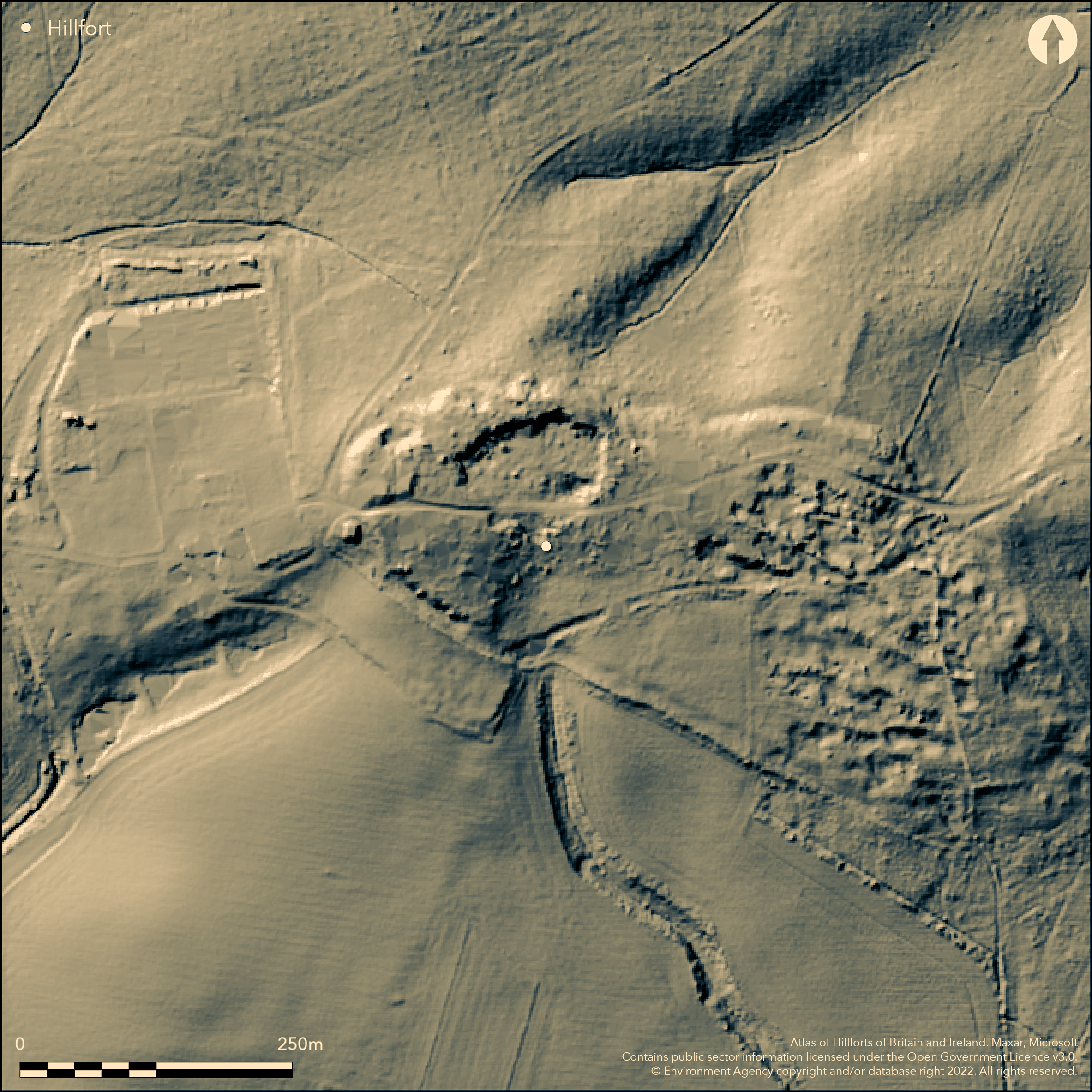
LiDAR 1m DTM Hillshade
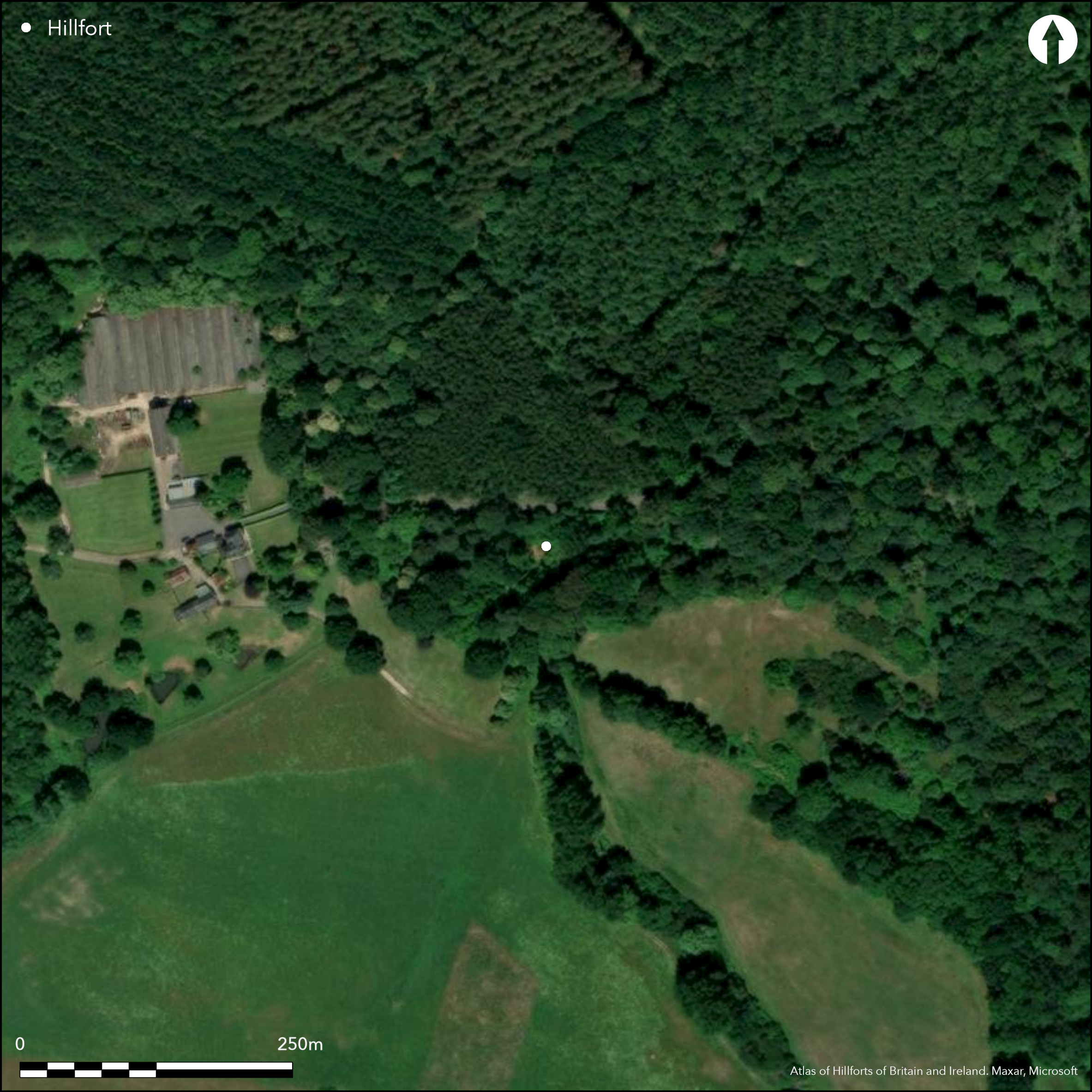
Satellite Imagery
LiDAR 1m DTM Hillshade
Satellite Imagery
Scroll left/right to view further images.
HER: Hampshire 22151 (None)
NMR: SU 22 NE 22 (223028)
SM: 1001948
NGR: SU28532741
X: 428500 Y: 127400 (OSGB36)
Situated to the NW of Lockerley, a possible contour fort on a sharply contoured hilltop in Holbury Wood. The site is now greatly disturbed by sand quarrying and by a sunken trackway running E-W through the middle of it to Holbury Farm. It could have originally been an irregular oval in plan as shown by J. Williams-Freeman (1915), enclosing c. 3.6ha. Evidence for a rampart is sparse although LiDAR shows a possible rampart and outer ditch following the contour along the N, W and SW sides of the hill (P. Reilly, provided as Citizen Science). On the ground the rampart, which is reduced to a scarp in places, is between 1m and 4m high, the only surface evidence for the ditch is to the SW. This interpretation has been disputed and explained as the result of quarrying and the sunken way although this was before the LiDAR survey. There is no evidence for an original entrance but could have been on the E side where sand-pits and cuttings would have completely destroyed it. The name 'Holbury' may be significant, as may early claims that it was a camp; but the even more significant name 'Cadbury' survives, without any associated earthwork, at Cadbury Farm some two miles to the east, and the combination of a 'bury' name with the find of quantities of Roman pottery and coins in c. 1870 at its NE corner (NMR 223014) may have influenced antiquarians. On the 1st Ed OS map (1871). Few investigations. Undated.
Citizen Science: ✓
Reliability of Data: Unconfirmed
Reliability of Interpretation: Unconfirmed
X: -177537 Y: 6629291 (EPSG: 3857)
Longitude: -1.5948441403643783 Latitude: 51.0451899910593 (EPSG:4326)
Country: England; None
Current County or Unitary Authority: Hampshire
Historic County: Hampshire and Isle of Wight
Current Parish/Community/Council/Townland: East Tytherley; East Dean
None
| Extant | ✓ |
| Cropmark | ✗ |
| Likely Destroyed | ✓ |
None
| Woodland | ✓ |
| Commercial Forestry Plantation | ✗ |
| Parkland | ✗ |
| Pasture (Grazing) | ✗ |
| Arable | ✗ |
| Scrub/Bracken | ✗ |
| Bare Outcrop | ✗ |
| Heather/Moorland | ✗ |
| Heath | ✗ |
| Built-up | ✗ |
| Coastal Grassland | ✗ |
| Other | ✗ |
Contour fort on a hilltop
| Contour Fort | ✓ |
| Partial Contour Fort | ✗ |
| Promontory Fort | ✗ |
| Hillslope Fort | ✗ |
| Level Terrain Fort | ✗ |
| Marsh Fort | ✗ |
| Multiple Enclosure Fort | ✗ |
| Hilltop | ✓ |
| Coastal Promontory | ✗ |
| Inland Promontory | ✗ |
| Valley Bottom | ✗ |
| Knoll/Hillock/Outcrop | ✗ |
| Ridge | ✗ |
| Cliff/Plateau-edge/Scarp | ✗ |
| Hillslope | ✗ |
| Lowland | ✗ |
| Spur | ✗ |
Dominant Topographic Feature: hilltop
| North | ✗ |
| Northeast | ✗ |
| East | ✗ |
| Southeast | ✗ |
| South | ✗ |
| Southwest | ✗ |
| West | ✗ |
| Northwest | ✗ |
| Level | ✓ |
Altitude: 61.0m
Boundary Type: Parish/Townland
Unknown
Reliability: D - None
| Pre 1200BC | ✗ |
| 1200BC - 800BC | ✗ |
| 800BC - 400BC | ✗ |
| 400BC - AD50 | ✗ |
| AD50 - AD400 | ✗ |
| AD400 - AD 800 | ✗ |
| Post AD800 | ✗ |
| Unknown | ✓ |
| Pre Hillfort: | None |
| Post Hillfort: | None |
On 1st Ed. OS map (1871). Plan by J. Williams-Freeman 1915. Field investigator comments 1965, 1968. Described by LiDAR analysis 2014 (P. Reilly, unpublished).
| 1st Identified Map Depiction (1871): | OS map. |
| 1st Identified Written Reference (1915): | J. Williams-Freeman. |
| LiDAR Survey (2014): | P. Reilly, unpublished, provided as Citizen Science. |
| Other (None): | Field investigator comments - no details. |
None
None
| None | ✓ |
| Spring | ✗ |
| Stream | ✗ |
| Pool | ✗ |
| Flush | ✗ |
| Well | ✗ |
| Other | ✗ |
None
| No Known Features | ✓ |
| Round Stone Structures | ✗ |
| Rectangular Stone Structures | ✗ |
| Curvilinear Platforms | ✗ |
| Other Roundhouse Evidence | ✗ |
| Pits | ✗ |
| Quarry Hollows | ✗ |
| Other | ✗ |
None
| No Known Excavation | ✓ |
| Pits | ✗ |
| Postholes | ✗ |
| Roundhouses | ✗ |
| Rectangular Structures | ✗ |
| Roads/Tracks | ✗ |
| Quarry Hollows | ✗ |
| Other | ✗ |
| Nothing Found | ✗ |
None
| No Known Geophysics | ✓ |
| Pits | ✗ |
| Roundhouses | ✗ |
| Rectangular Structures | ✗ |
| Roads/Tracks | ✗ |
| Quarry Hollows | ✗ |
| Other | ✗ |
| Nothing Found | ✗ |
None
| No Known Finds | ✓ |
| Pottery | ✗ |
| Metal | ✗ |
| Metalworking | ✗ |
| Human Bones | ✗ |
| Animal Bones | ✗ |
| Lithics | ✗ |
| Environmental | ✗ |
| Other | ✗ |
NO APPARENT FEATURES
| APs Not Checked | ✓ |
| None | ✗ |
| Roundhouses | ✗ |
| Rectangular Structures | ✗ |
| Pits | ✗ |
| Postholes | ✗ |
| Roads/Tracks | ✗ |
| Other | ✗ |
No evidence
| 0: | None |
| 2: | None |
Guard Chambers: ✗
Chevaux de Frise: ✗
Single bank and ditch in places, reduced to a scarp in other areas
| Area 1: | 3.6ha. |
| Total: | 3.6ha. |
Total Footprint Area: Noneha.
None
| ✗ | None |
| ✗ | None |
| NE Quadrant: | None |
| SE Quadrant: | None |
| SW Quadrant: | 1 |
| NW Quadrant: | 1 |
| Total: | 1 |
| Partial Univallate | ✓ |
| Univallate | ✗ |
| Partial Bivallate | ✗ |
| Bivallate | ✗ |
| Partial Multivallate | ✗ |
| Multivallate | ✗ |
| Unknown | ✗ |
| Partial Univallate | ✗ |
| Univallate | ✗ |
| Partial Bivallate | ✗ |
| Bivallate | ✗ |
| Partial Multivallate | ✗ |
| Multivallate | ✗ |
None
| None | ✗ |
| Earthen Bank | ✓ |
| Stone Wall | ✗ |
| Rubble | ✗ |
| Wall-walk | ✗ |
| Evidence of Timber | ✗ |
| Vitrification | ✗ |
| Other Burning | ✗ |
| Palisade | ✗ |
| Counter Scarp Bank | ✗ |
| Berm | ✗ |
| Unfinished | ✗ |
| Other | ✗ |
None
| None | ✗ |
| Earthen Bank | ✗ |
| Stone Wall | ✗ |
| Murus Duplex | ✗ |
| Timber-framed | ✗ |
| Timber-laced | ✗ |
| Vitrification | ✗ |
| Other Burning | ✗ |
| Palisade | ✗ |
| Counter Scarp Bank | ✗ |
| Berm | ✗ |
| Unfinished | ✗ |
| No Known Excavation | ✓ |
| Other | ✗ |
| ✗ | None |
| ✓ | None |
Number of Ditches: 1
| ✗ | None |
Hogg, A.H.A. 1979. British Hill-forts: an index. Oxford: British Archaeological Reports, British Series 62, 209.
Williams-Freeman, J. 1915. An introduction to field archaeology as illustrated by Hampshire. London: Macmillan, 161, 378 plan.
Atlas of Hillforts:
Wikidata:
This work is licensed under CC BY-SA 4.0

 and should be cited as:
Lock, Gary and Ralston, Ian. 2024. Atlas of Hillforts of Britain and Ireland. Available at: https://hillforts.arch.ox.ac.uk
Document Version 1.1