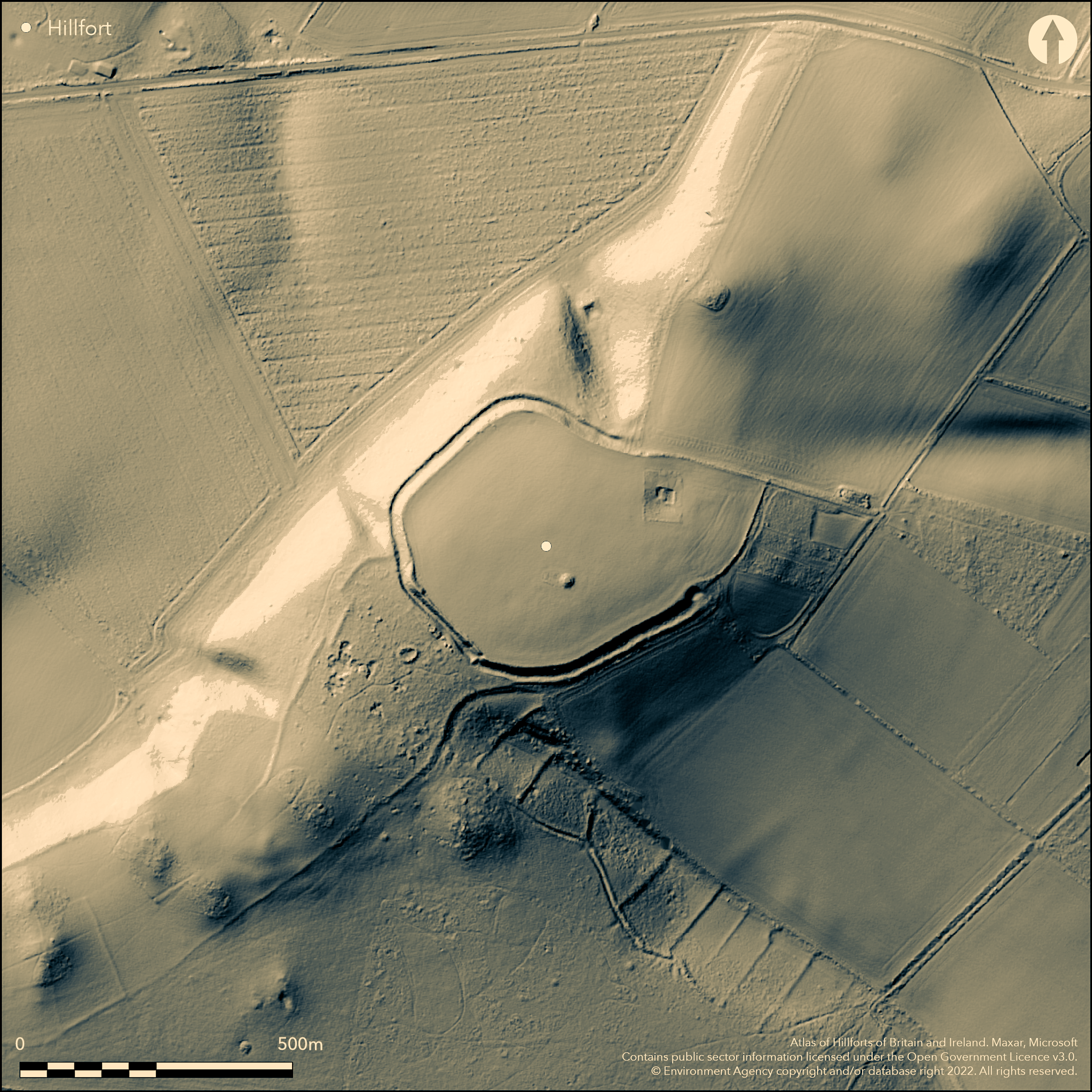
LiDAR 1m DTM Hillshade
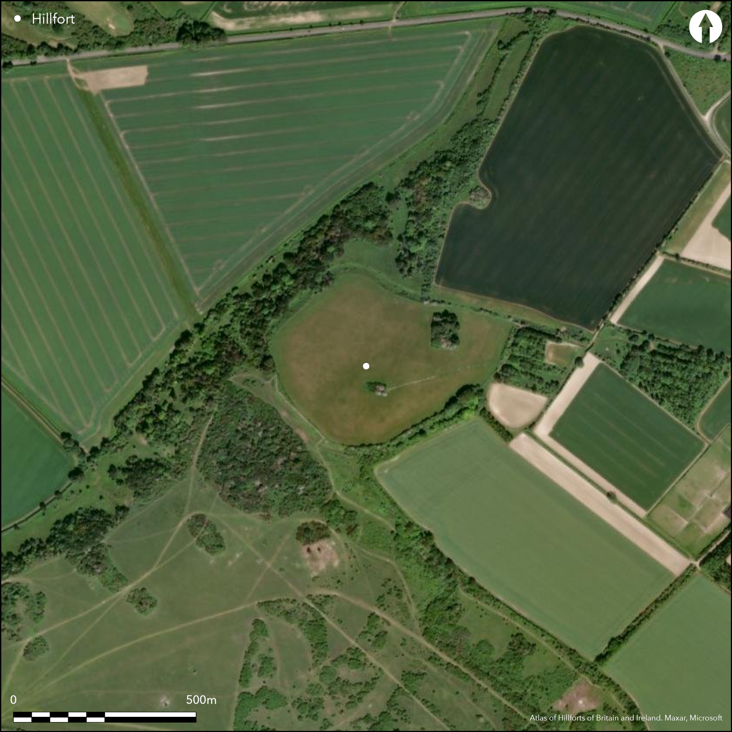
Satellite Imagery
LiDAR 1m DTM Hillshade
Satellite Imagery
Scroll left/right to view further images.
HER: Hampshire 24910 (None)
NMR: SU 33 NE 19 (None)
SM: 1003531
NGR: SU381353
X: 438120 Y: 135320 (OSGB36)
Large, univallate, contour hillfort located on prominent chalk ridge of Stockridge Down above River Test on W. Generally modertate to strong surrounding slopes, but very steep to river from N to W. Site developed at junction of existing linear ditches associated with extensive field system. Roughly pear-shaped, with internal area c. 7ha. Defined by rampart and ditch and intermittent counterscarp, ploughed-out on NE and E sides where course found by geophysics and excavation and where present fence probably delineates line. Where best on W and NW bank to maximum 2.7m and to 4.9m above ditch, to 1m-1.5m deep. To N and S bank ploughed-out but ditch well-defined with the counterscarp bank on S side and E half of N side. Levelled ditch excavated by (Cunliffe and Poole 2000), finds dating site construction to early Iron Age c. 550 BC. Late Iron Age to Roman settlement/farmstead found to have occupied interior on E. Causeway across ditch and breach in bank on SW side appears to be original entrance. possible entrance on ploughed-out E. Chalk pit on NE. Adjacent plough-levelled field system. Hill figure of horse, first mentioned in 1859, of rough flints laid on turf of outer face of S rampart of site. Local legends suggest 18th century origin. Horse was restored and whitewashed 1929. Site is privately owned. Formerly obliterated by shrubs and trees and by soil erosion, now cleared. Hillfort fair condition where best. W ditch owned by National Trust, boundary on top of bank. Rest private ownership and heavily ploughed. Improved pasture with some scrub. Mixed wood at N end. On 1st Ed. OS map (1871-77). This site is included in the Re-dating Danebury Project which is underway at this time of writing (2015). This will provide an independent chronology for Danebury and related Danebury Environs sites which may change the dating recorded here (Haselgrove et. al. forthcoming).
Citizen Science: ✗
Reliability of Data: Confirmed
Reliability of Interpretation: Confirmed
X: -162169 Y: 6641812 (EPSG: 3857)
Longitude: -1.456787738107383 Latitude: 51.11584955702474 (EPSG:4326)
Country: England; None
Current County or Unitary Authority: Hampshire
Historic County: Hampshire and Isle of Wight
Current Parish/Community/Council/Townland: Little Somborne; Leckford; Stockridge.
Fair condition where best. Ploughed-out on NE and E. W ditch owned by National Trust, boundary on top of bank. Rest private ownership and heavily ploughed.
| Extant | ✓ |
| Cropmark | ✗ |
| Likely Destroyed | ✗ |
Improved pasture with some scrub invasion. Part heavily ploughed. Mixed wood at N end.
| Woodland | ✓ |
| Commercial Forestry Plantation | ✗ |
| Parkland | ✗ |
| Pasture (Grazing) | ✓ |
| Arable | ✗ |
| Scrub/Bracken | ✓ |
| Bare Outcrop | ✗ |
| Heather/Moorland | ✗ |
| Heath | ✗ |
| Built-up | ✗ |
| Coastal Grassland | ✗ |
| Other | ✗ |
Large, univallate, contour hillfort located on prominent chalk ridge of Stockridge Down above River Test on W. Generally moderate to strong surrounding slopes, but very steep to river from N to W.
| Contour Fort | ✓ |
| Partial Contour Fort | ✗ |
| Promontory Fort | ✗ |
| Hillslope Fort | ✗ |
| Level Terrain Fort | ✗ |
| Marsh Fort | ✗ |
| Multiple Enclosure Fort | ✗ |
| Hilltop | ✗ |
| Coastal Promontory | ✗ |
| Inland Promontory | ✗ |
| Valley Bottom | ✗ |
| Knoll/Hillock/Outcrop | ✗ |
| Ridge | ✓ |
| Cliff/Plateau-edge/Scarp | ✗ |
| Hillslope | ✗ |
| Lowland | ✗ |
| Spur | ✗ |
Dominant Topographic Feature: Downland ridge.
| North | ✗ |
| Northeast | ✗ |
| East | ✗ |
| Southeast | ✗ |
| South | ✗ |
| Southwest | ✗ |
| West | ✗ |
| Northwest | ✗ |
| Level | ✓ |
Altitude: 159.0m
Boundary Type: Parish/Townland
Levelled defensive ditch on E side excavated in 1989 (Cunliffe 1989 5), finds dating construction to early Iron Age c. 550 BC. Date of pits suggested by excavation as early to middle Iron Age. Reoccupation of E part of site in late Iron Age to Roman period. Six C14 dates 500 BC to 400 BC start to 300 BC to 200 BC end. This site is included in the Re-dating Danebury Project which is underway at this time of writing (2015). This will provide an independent chronology for Danebury and related Danebury Environs sites which may change the dating recorded here (Haselgrove et. al. forthcoming).
Reliability: A - High
| Pre 1200BC | ✗ |
| 1200BC - 800BC | ✗ |
| 800BC - 400BC | ✓ |
| 400BC - AD50 | ✓ |
| AD50 - AD400 | ✓ |
| AD400 - AD 800 | ✗ |
| Post AD800 | ✗ |
| Unknown | ✗ |
| Pre Hillfort: | None |
| Post Hillfort: | None |
| Artefactual: | Finds dating construction to early Iron Age c. 550 BC. |
| C14: | Six C14 dates. |
First documented AD 947 as Benitham Welnabyrig (Camp of the Springs). In Aubrey's Monumenta Britannica (1665-1693). On 1st Ed. OS map (1871-77). Measured survey RCHME 1970-79, ref. no. 885724. Excavation B. Cunliffe, Danebury Environs Project 1989. Geophysical survey AML 1989. Geophysical survey AML 1990. Geophysical survey part of Wessex Hillforts Project 1997.
| Excavation (1989): | B. Cunliffe, Danebury Environs Project. |
| Geophysical Survey (1989): | AML. |
| Geophysical Survey (1990): | AML. |
| Geophysical Survey (1997): | Wessex Hillforts Project. |
| Other (None): | In Aubrey's Monumenta Britannica. |
| 1st Identified Map Depiction (None): | OS map. |
| Earthwork Survey (None): | Measured survey RCHME. |
| 1st Identified Written Reference (None): | First documented as Benitham Welnabyrig (Camp of the Springs). |
Date of isolated pits suggested by excavation as early to middle Iron Age. Interior divided by small ditches into enclosures. Finds dating construction to early Iron Age c. 550 BC.
None
| None | ✓ |
| Spring | ✗ |
| Stream | ✗ |
| Pool | ✗ |
| Flush | ✗ |
| Well | ✗ |
| Other | ✗ |
None
| No Known Features | ✓ |
| Round Stone Structures | ✗ |
| Rectangular Stone Structures | ✗ |
| Curvilinear Platforms | ✗ |
| Other Roundhouse Evidence | ✗ |
| Pits | ✗ |
| Quarry Hollows | ✗ |
| Other | ✗ |
Date of pits suggested by excavation as early to middle Iron Age. Interior divided by small ditches into enclosures.
| No Known Excavation | ✗ |
| Pits | ✓ |
| Postholes | ✗ |
| Roundhouses | ✗ |
| Rectangular Structures | ✗ |
| Roads/Tracks | ✗ |
| Quarry Hollows | ✗ |
| Other | ✓ |
| Nothing Found | ✗ |
Isolated pits, especially in E.
| No Known Geophysics | ✗ |
| Pits | ✓ |
| Roundhouses | ✗ |
| Rectangular Structures | ✗ |
| Roads/Tracks | ✗ |
| Quarry Hollows | ✗ |
| Other | ✗ |
| Nothing Found | ✗ |
Finds dating construction to early Iron Age c. 550 BC.
| No Known Finds | ✗ |
| Pottery | ✓ |
| Metal | ✗ |
| Metalworking | ✗ |
| Human Bones | ✗ |
| Animal Bones | ✗ |
| Lithics | ✗ |
| Environmental | ✗ |
| Other | ✗ |
None
| APs Not Checked | ✓ |
| None | ✗ |
| Roundhouses | ✗ |
| Rectangular Structures | ✗ |
| Pits | ✗ |
| Postholes | ✗ |
| Roads/Tracks | ✗ |
| Other | ✗ |
Causeway across ditch and breach in bank on W side appears to be original entrance. Second entrance possibly on ploughed-out E side.
| 1: | None |
| 2: | None |
Guard Chambers: ✗
Chevaux de Frise: ✗
| 1. Simple Gap (South west): | Causeway across ditch. |
| 2. Simple Gap (East): | Second entrance possibly on ploughed-out E side. |
Defined by rampart and ditch and intermittent counterscarp, ploughed-out on E side where present fence probably delineates line. Where best on W and NW bank to maximum 2.7m and to 4.9m above ditch, to 1m-1.5m deep. To N and S bank ploughed-out but ditch well-defined with the counterscarp bank on S side and E half of N side. Levelled ditch excavated by Sir Barry Cunliffe 1989, finds dating site construction to early Iron Age c. 550 BC. Course of ploughed-out rampart found by excavation 1989.
| Area 1: | 7.0ha. |
| Total: | 7.0ha. |
Total Footprint Area: Noneha.
None
| ✗ | None |
| ✓ | Ploughed-out on NE and E, but remnants in NE and SE quadrants. |
| NE Quadrant: | 1 |
| SE Quadrant: | 1 |
| SW Quadrant: | 1 |
| NW Quadrant: | 1 |
| Total: | 1 |
| Partial Univallate | ✗ |
| Univallate | ✓ |
| Partial Bivallate | ✗ |
| Bivallate | ✗ |
| Partial Multivallate | ✗ |
| Multivallate | ✗ |
| Unknown | ✗ |
| Partial Univallate | ✗ |
| Univallate | ✗ |
| Partial Bivallate | ✗ |
| Bivallate | ✗ |
| Partial Multivallate | ✗ |
| Multivallate | ✗ |
Dump construction. To N and S bank ploughed-out, but ditch well-defined with the counterscarp bank on S side and E half of N side.
| None | ✗ |
| Earthen Bank | ✓ |
| Stone Wall | ✗ |
| Rubble | ✗ |
| Wall-walk | ✗ |
| Evidence of Timber | ✗ |
| Vitrification | ✗ |
| Other Burning | ✗ |
| Palisade | ✗ |
| Counter Scarp Bank | ✓ |
| Berm | ✗ |
| Unfinished | ✗ |
| Other | ✗ |
Course of ploughed-out rampart found by excavation 1989.
| None | ✓ |
| Earthen Bank | ✗ |
| Stone Wall | ✗ |
| Murus Duplex | ✗ |
| Timber-framed | ✗ |
| Timber-laced | ✗ |
| Vitrification | ✗ |
| Other Burning | ✗ |
| Palisade | ✗ |
| Counter Scarp Bank | ✗ |
| Berm | ✗ |
| Unfinished | ✗ |
| No Known Excavation | ✗ |
| Other | ✗ |
| ✗ | None |
| ✓ | Ditch ploughed-out on E. To N and S bank ploughed-out, but ditch well-defined. Levelled ditch excavated 1989. |
Number of Ditches: 1
| ✗ | None |
Anon 1990. Archaeology in Hampshire, annual report Hampshire County Council, 16-17.
Cunliffe, B.W. and Poole, C. 2000. The Danebury Environs Programme - the prehistory of a Wessex landscape, Vol 2, Part 1 - Woolbury, Stockridge, Hants 1989. Oxford: English Heritage/ Oxford U Committee Archaeol Monograph 49 (Part 1).
Haselgrove, C., Gosden, C., Hamilton, D., Brown, L. and Poole, C. Forthcoming. Iron Age settlement and society in central southern Britain: a new chronological perspective. Oxford: School of Archaeology Monograph.
Payne, A, Corney, M. and Cunliffe, B. 2006. The Wessex hillforts project, Extensive survey of hillfort interiors in central southern England. London: English Heritage, 76-80.
Williams-Freeman, J.P. 1915. An introduction to field archaeology as illustrated by Hampshire, London: Macmillan and Co Ltd, 234-5, 421.
Atlas of Hillforts:
Wikidata:
This work is licensed under CC BY-SA 4.0

 and should be cited as:
Lock, Gary and Ralston, Ian. 2024. Atlas of Hillforts of Britain and Ireland. Available at: https://hillforts.arch.ox.ac.uk
Document Version 1.1