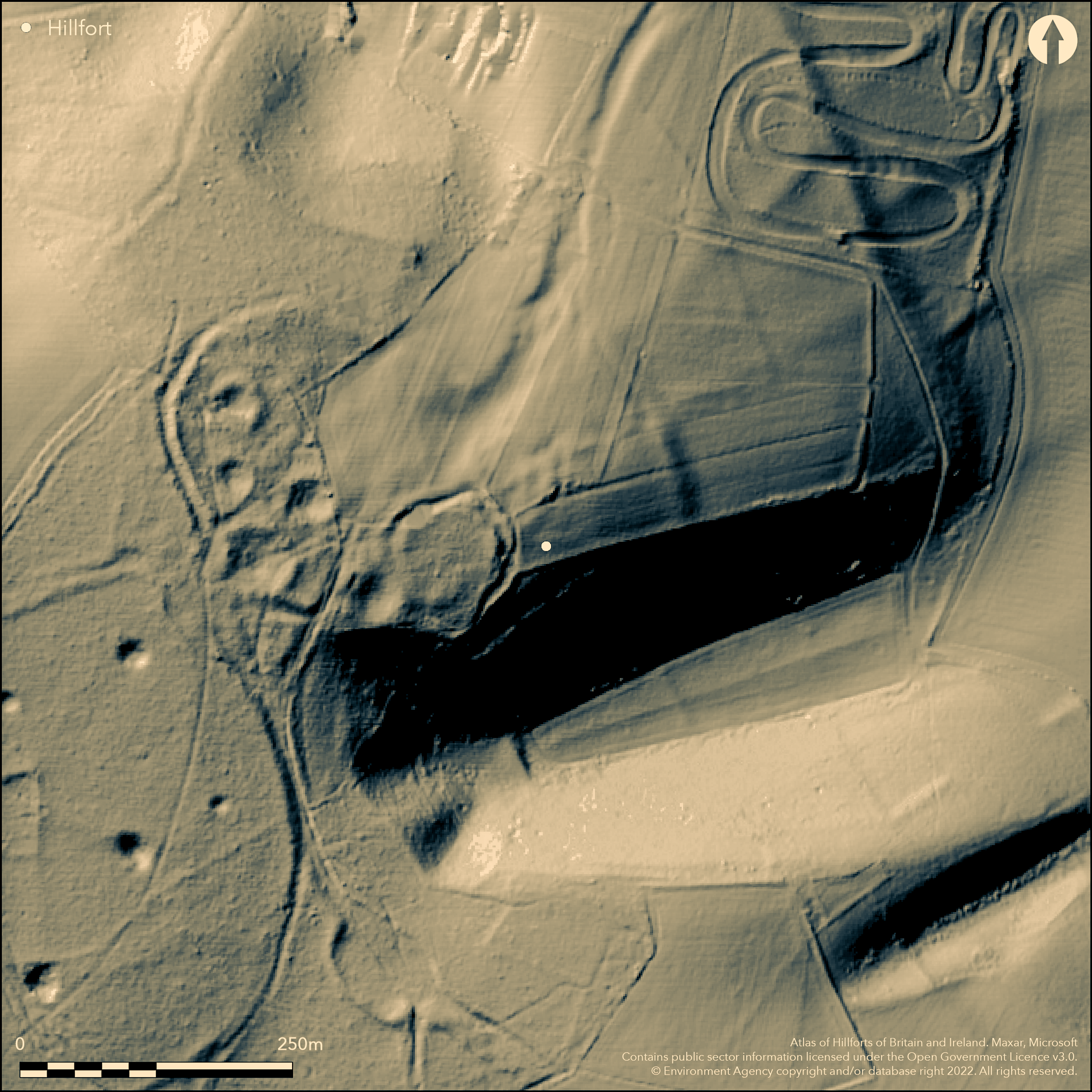
LiDAR 1m DTM Hillshade
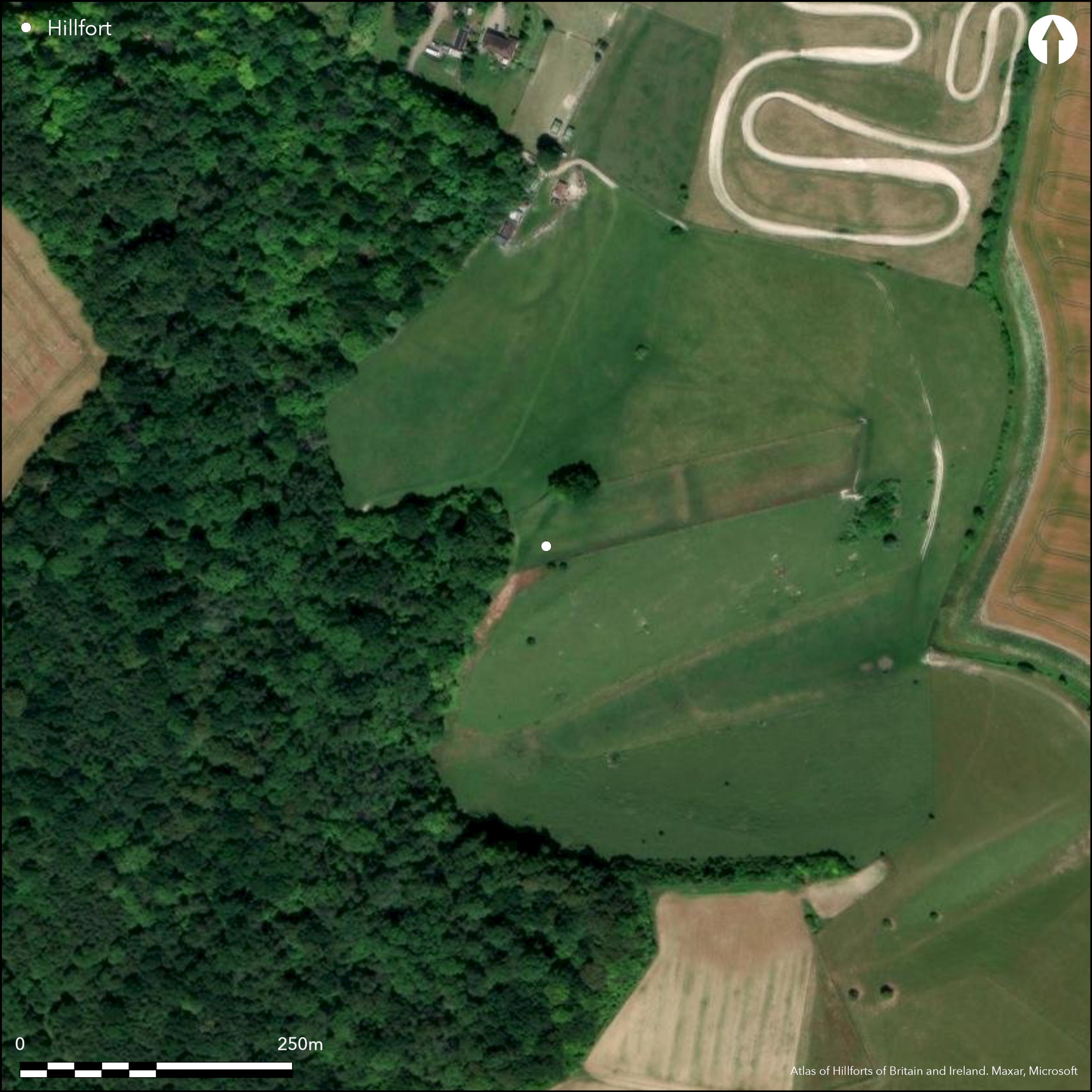
Satellite Imagery
LiDAR 1m DTM Hillshade
Satellite Imagery
Scroll left/right to view further images.
HER: Hampshire 22372 (None); Wiltshire and Swindon MWI17466
NMR: SU 23 SE 2 (223403)
SM: 1001796
NGR: SU26083483
X: 426080 Y: 134830 (OSGB36)
Little known, univallate hillslope hillfort located in Ashley's Copse above NE-facing scarp slope on SE half of end of spur of Upper Chalk jutting out to NW from steep range of hills S of Wallop stream. Local deposits of Tertiary gravels cover the chalk over NW part of site, and their subsequent quarrying caused extensive damage to over half of interior. Immediately to SE very steep-sided, dry coombe cuts into scarp slope, giving extensive views over the central Hampshire chalklands, with views of Quarley Hill (Atlas No 3831) and Danebury (Atlas No 3828). Moderate slope along spur ridge to SW, precipitous slopes to the S, steep elsewhere. Oval shape enclosing c. 2.6ha. Defined by rampart and ditch and low counterscarp, best on SW where overall width to 18m and height to c. 1.75m and ditch to 2m deep. To SE another bank and ditch seems superimposed, obscuring detail. Two original entrances, on NE marked by inturning rampart, second S-facing, with outwork on its W flank. Site badly reduced by ploughing on NE, and over half of interior affected by later gravel extraction. Field investigation by RCHME 1992 found much pottery and some struck flint in the interior. Earliest diagnostic sherds haematite coated 'scratched cordoned bowls' of later 6th and 5th centuries BC. Others indicate activity during the 1st century BC through to later Roman period. Flintwork concentrated in area to S of NE entrance suggests activity during Neolithic and Bronze Age. On 1st Ed OS map (1871-76). Part of site in Wiltshire.
Citizen Science: ✗
Reliability of Data: Confirmed
Reliability of Interpretation: Confirmed
X: -181321 Y: 6641150 (EPSG: 3857)
Longitude: -1.62883032708732 Latitude: 51.11211595071974 (EPSG:4326)
Country: England; None
Current County or Unitary Authority: Hampshire; Wiltshire
Historic County: Hampshire and Isle of Wight; Wiltshire
Current Parish/Community/Council/Townland: Winterslow; Nether Wallop
Mutilated and fragmentary. Local deposits of Tertiary gravels cover the chalk over NW part of site, and their subsequent quarrying caused extensive damage over 50% of interior. Much plough damage on NE.
| Extant | ✓ |
| Cropmark | ✗ |
| Likely Destroyed | ✓ |
S and W in Ashley's Copse, with pasture on NE. Quarrying.
| Woodland | ✓ |
| Commercial Forestry Plantation | ✗ |
| Parkland | ✗ |
| Pasture (Grazing) | ✓ |
| Arable | ✗ |
| Scrub/Bracken | ✗ |
| Bare Outcrop | ✗ |
| Heather/Moorland | ✗ |
| Heath | ✗ |
| Built-up | ✗ |
| Coastal Grassland | ✗ |
| Other | ✓ |
Univallate hillslope hillfort located in Ashley's Copse above NE-facing scarp slope on SE half of end of spur of Upper Chalk jutting out to NW from steep range of hills S of Wallop stream. Local deposits of Tertiary gravels cover the chalk over NW part of site, and their subsequent quarrying caused extensive damage to over half of interior. Immediately to SE very steep-sided, dry combe cuts into scarp slope. Moderate slope along spur ridge to SW.
| Contour Fort | ✗ |
| Partial Contour Fort | ✗ |
| Promontory Fort | ✗ |
| Hillslope Fort | ✓ |
| Level Terrain Fort | ✗ |
| Marsh Fort | ✗ |
| Multiple Enclosure Fort | ✗ |
| Hilltop | ✗ |
| Coastal Promontory | ✗ |
| Inland Promontory | ✗ |
| Valley Bottom | ✗ |
| Knoll/Hillock/Outcrop | ✗ |
| Ridge | ✗ |
| Cliff/Plateau-edge/Scarp | ✗ |
| Hillslope | ✓ |
| Lowland | ✗ |
| Spur | ✓ |
Dominant Topographic Feature: Chalk spur
| North | ✗ |
| Northeast | ✗ |
| East | ✗ |
| Southeast | ✗ |
| South | ✗ |
| Southwest | ✗ |
| West | ✗ |
| Northwest | ✗ |
| Level | ✓ |
Altitude: 152.0m
Boundary Type: County
Field investigation by RCHME 1992 found much pottery and some struck flint in the interior. Earliest diagnostic sherds haematite coated 'scratched cordoned bowls' of later 6th and 5th centuries BC. Others indicate activity during the 1st century BC through to later Roman period, but whether this is continued use or reoccupation unclear.
Reliability: C - Low
| Pre 1200BC | ✗ |
| 1200BC - 800BC | ✗ |
| 800BC - 400BC | ✓ |
| 400BC - AD50 | ✓ |
| AD50 - AD400 | ✓ |
| AD400 - AD 800 | ✗ |
| Post AD800 | ✗ |
| Unknown | ✗ |
| Pre Hillfort: | None |
| Post Hillfort: | None |
| Artefactual: | Earliest diagnostic sherds haematite coated 'scratched cordoned bowls' of later 6th and 5th centuries BC. Others indicate activity during the 1st century BC through to later Roman period. |
On 1st Ed OS map (1871-76). Field investigator comments 1956, 1965, 1969. Field investigation by RCHME South Wiltshire Project 1992.
| Other (1992): | RCHME survey. |
| 1st Identified Map Depiction (None): | OS map. |
| Other (None): | Field investigator comments - no details. |
No interior details as result of disturbance. Field investigation by RCHME 1992 found much pottery and some struck flint in the interior. Earliest diagnostic sherds haematite coated 'scratched cordoned bowls' of later 6th and 5th centuries BC. Others indicate activity during the 1st century BC through to later Roman period. Also some struck flint. Animal bone reported from E end.
None
| None | ✓ |
| Spring | ✗ |
| Stream | ✗ |
| Pool | ✗ |
| Flush | ✗ |
| Well | ✗ |
| Other | ✗ |
Interior much disturbed. Ploughing affected NE, as result no internal detail visible on the ground. Pits associated with gravel extraction.
| No Known Features | ✓ |
| Round Stone Structures | ✗ |
| Rectangular Stone Structures | ✗ |
| Curvilinear Platforms | ✗ |
| Other Roundhouse Evidence | ✗ |
| Pits | ✗ |
| Quarry Hollows | ✗ |
| Other | ✗ |
None
| No Known Excavation | ✓ |
| Pits | ✗ |
| Postholes | ✗ |
| Roundhouses | ✗ |
| Rectangular Structures | ✗ |
| Roads/Tracks | ✗ |
| Quarry Hollows | ✗ |
| Other | ✗ |
| Nothing Found | ✗ |
None
| No Known Geophysics | ✓ |
| Pits | ✗ |
| Roundhouses | ✗ |
| Rectangular Structures | ✗ |
| Roads/Tracks | ✗ |
| Quarry Hollows | ✗ |
| Other | ✗ |
| Nothing Found | ✗ |
Field investigation by RCHME 1992 found much pottery and some struck flint in the interior. Earliest diagnostic sherds haematite coated 'scratched cordoned bowls' of later 6th and 5th centuries BC. Others indicate activity during the 1st century BC through to later Roman period. Also some struck flint. Animal bone reported from E end.
| No Known Finds | ✗ |
| Pottery | ✓ |
| Metal | ✗ |
| Metalworking | ✗ |
| Human Bones | ✗ |
| Animal Bones | ✓ |
| Lithics | ✓ |
| Environmental | ✗ |
| Other | ✗ |
None
| APs Not Checked | ✓ |
| None | ✗ |
| Roundhouses | ✗ |
| Rectangular Structures | ✗ |
| Pits | ✗ |
| Postholes | ✗ |
| Roads/Tracks | ✗ |
| Other | ✗ |
Two original entrances, on NE marked by inturning rampart, second S-facing, with outwork on its W flank. Additional modern gaps on NE.
| 4: | Four or five gaps through rampart on NE. |
| 2: | None |
Guard Chambers: ✗
Chevaux de Frise: ✗
| 1. In-turned (North east): | None |
| 2. Outworks (South): | Outwork on W flank. |
Defined by rampart and ditch and low counterscarp, best on SW where overall width to 18m and height to c. 1.75m and ditch to 2m deep. To SE another bank and ditch seems superimposed, obscuring detail. Bank and ditch with low counterscarp surround site except on SE quadrant, where an overlying enclosure obscures detail. Defences are best preserved on SW, where overall width 18m plus. Here, rampart c. 1.75m high and ditch to 2m deep.
| Area 1: | 2.6ha. |
| Total: | 2.6ha. |
Total Footprint Area: Noneha.
None
| ✗ | None |
| ✓ | Detail obscured on SE. |
| NE Quadrant: | 1 |
| SE Quadrant: | 1 |
| SW Quadrant: | 1 |
| NW Quadrant: | 1 |
| Total: | 1 |
| Partial Univallate | ✗ |
| Univallate | ✓ |
| Partial Bivallate | ✗ |
| Bivallate | ✗ |
| Partial Multivallate | ✗ |
| Multivallate | ✗ |
| Unknown | ✗ |
| Partial Univallate | ✗ |
| Univallate | ✗ |
| Partial Bivallate | ✗ |
| Bivallate | ✗ |
| Partial Multivallate | ✗ |
| Multivallate | ✗ |
Low counterscarp surrounds site except on SE quadrant, where an overlying enclosure obscures detail.
| None | ✗ |
| Earthen Bank | ✓ |
| Stone Wall | ✗ |
| Rubble | ✗ |
| Wall-walk | ✗ |
| Evidence of Timber | ✗ |
| Vitrification | ✗ |
| Other Burning | ✗ |
| Palisade | ✗ |
| Counter Scarp Bank | ✓ |
| Berm | ✗ |
| Unfinished | ✗ |
| Other | ✗ |
None
| None | ✗ |
| Earthen Bank | ✗ |
| Stone Wall | ✗ |
| Murus Duplex | ✗ |
| Timber-framed | ✗ |
| Timber-laced | ✗ |
| Vitrification | ✗ |
| Other Burning | ✗ |
| Palisade | ✗ |
| Counter Scarp Bank | ✗ |
| Berm | ✗ |
| Unfinished | ✗ |
| No Known Excavation | ✓ |
| Other | ✗ |
| ✗ | None |
| ✓ | Best seen on SW. |
Number of Ditches: 1
| ✗ | None |
Payne, A, Corney, M. and Cunliffe, B. 2006. The Wessex hillforts project, Extensive survey of hillfort interiors in central southern England. London: English Heritage, 142.
Williams-Freeman, J.P. 1915. An introduction to field archaeology as illustrated by Hampshire, London: Macmillan and Co Ltd, 136-7, 348.
Williams-Freeman, J.P 1931. Note, Proc Hampshire Field Club Archaeol Soc, 12, 120.
Atlas of Hillforts:
Wikidata:
This work is licensed under CC BY-SA 4.0

 and should be cited as:
Lock, Gary and Ralston, Ian. 2024. Atlas of Hillforts of Britain and Ireland. Available at: https://hillforts.arch.ox.ac.uk
Document Version 1.1