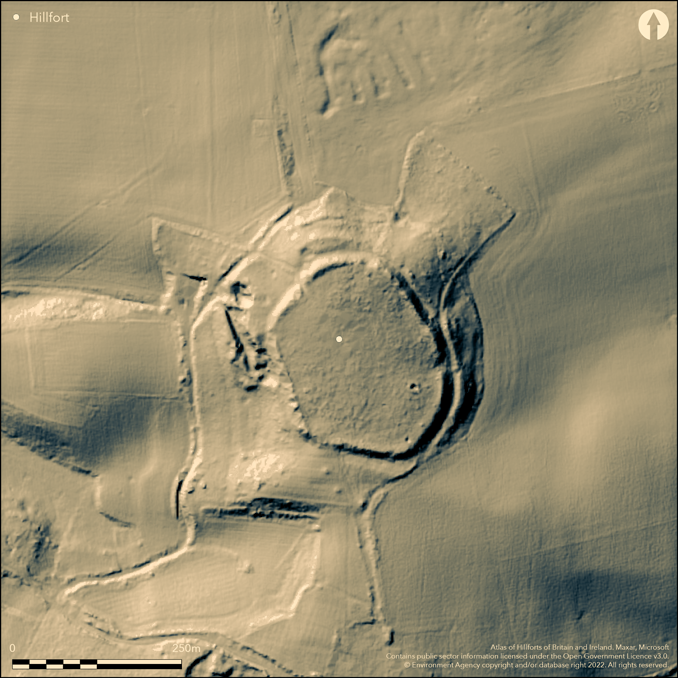
LiDAR 1m DTM Hillshade
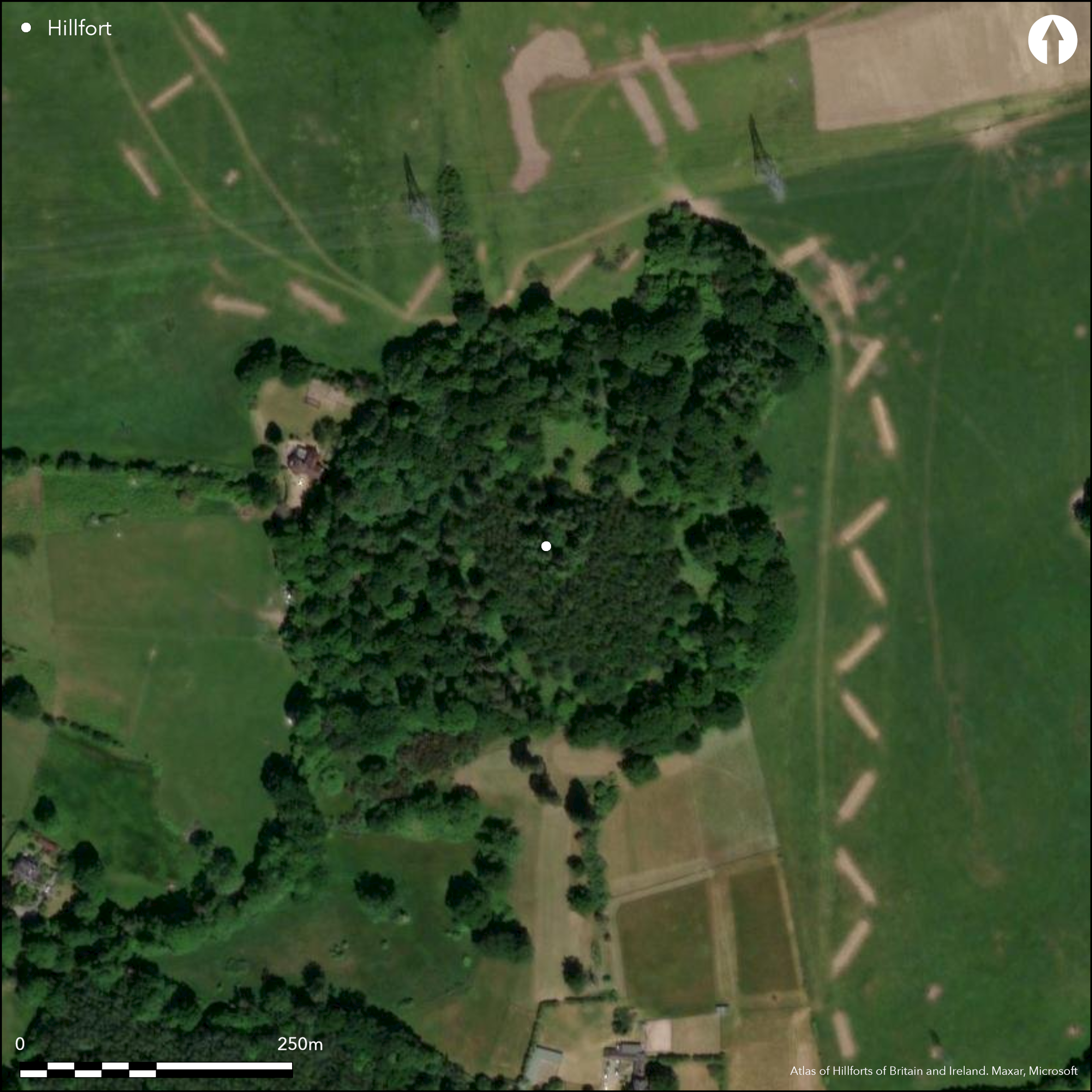
Satellite Imagery
LiDAR 1m DTM Hillshade
Satellite Imagery
Scroll left/right to view further images.
HER: Hampshire 25293 (None)
NMR: SU 31 NE 25 (226719)
SM: 1001947
NGR: SU38151865
X: 438150 Y: 118650 (OSGB36)
Prominent, univallate, contour hillfort located at N end of NNW-facing spur of Toot Hill above River Test on W. Steep surrounding slopes on N to SW sides, less on NE and E, moderate along ridge on SSE. Sub-oval shaped with internal area c. 1.8ha. Defined by single rampart, c. 1m above interior, with ditch c. 5m wide and 1.5m deep and traces of counterscarp to 0.5m high. Additional outwork on N side, c. 70m long and c. 2m high. Four gaps in ramparts - on N, E and S, but original not defined, although those on E and to the ridge on S possibly most likely. Measured Survey of 9ha of ROMSEY GOLF CLUB, in part of NIGHTINGALE WOOD in advance of proposed extension of golf course recorded lynchets and terraces thought to be associated with hillfort (Anon. 1999). On 1st Ed. OS map (1867).
Citizen Science: ✗
Reliability of Data: Confirmed
Reliability of Interpretation: Confirmed
X: -162316 Y: 6615273 (EPSG: 3857)
Longitude: -1.4581106097712184 Latitude: 50.965951667009016 (EPSG:4326)
Country: England
Current County or Unitary Authority: Hampshire
Historic County: Hampshire and Isle of Wight
Current Parish/Community/Council/Townland: Nursling and Rownhams
Fair condition. Encroached by sand extraction on W.
| Extant | ✓ |
| Cropmark | ✗ |
| Likely Destroyed | ✗ |
Wooded site.
| Woodland | ✓ |
| Commercial Forestry Plantation | ✗ |
| Parkland | ✗ |
| Pasture (Grazing) | ✗ |
| Arable | ✗ |
| Scrub/Bracken | ✓ |
| Bare Outcrop | ✗ |
| Heather/Moorland | ✗ |
| Heath | ✗ |
| Built-up | ✗ |
| Coastal Grassland | ✗ |
| Other | ✗ |
Prominentm, univallate, contour hillfort located at N end of NNW-facing spur of Toot Hill above River Test on W. Steep surrounding slopes on N to SW sides, less on NE and E, moderate along ridge on SSE.
| Contour Fort | ✓ |
| Partial Contour Fort | ✗ |
| Promontory Fort | ✗ |
| Hillslope Fort | ✗ |
| Level Terrain Fort | ✗ |
| Marsh Fort | ✗ |
| Multiple Enclosure Fort | ✗ |
| Hilltop | ✓ |
| Coastal Promontory | ✗ |
| Inland Promontory | ✗ |
| Valley Bottom | ✗ |
| Knoll/Hillock/Outcrop | ✗ |
| Ridge | ✗ |
| Cliff/Plateau-edge/Scarp | ✗ |
| Hillslope | ✗ |
| Lowland | ✗ |
| Spur | ✓ |
Dominant Topographic Feature: Spur
| North | ✗ |
| Northeast | ✗ |
| East | ✗ |
| Southeast | ✗ |
| South | ✗ |
| Southwest | ✗ |
| West | ✗ |
| Northwest | ✗ |
| Level | ✓ |
Altitude: 76.0m
N/A
None.
Reliability: D - None
| Pre 1200BC | ✗ |
| 1200BC - 800BC | ✗ |
| 800BC - 400BC | ✗ |
| 400BC - AD50 | ✗ |
| AD50 - AD400 | ✗ |
| AD400 - AD 800 | ✗ |
| Post AD800 | ✗ |
| Unknown | ✓ |
| Pre Hillfort: | Bronze Age spearhead(s) recovered; formerly in Broadlands, now lost. |
| Post Hillfort: | In 1607 trees were being cut for making and repairing Totehill Beacon. Marked as 'Telegraph' on old maps - post-medieval beacon or signal station. Now no trace, but site also called 'Telegraph Wood'. |
On 1st Ed. OS map (1867). Field investigator comments 1959, 1969. Measured survey Romsey Golf Club, Berkshire Archaeological Services 1999, found lynchets and terraces possibly associated with hillfort.
| 1st Identified Map Depiction (1867): | OS map. |
| Other (1999): | Measured survey Romsey Golf Club, Berkshire Archaeological Services.. |
| Other (None): | Field investigator comments. |
None.
None
| None | ✓ |
| Spring | ✗ |
| Stream | ✗ |
| Pool | ✗ |
| Flush | ✗ |
| Well | ✗ |
| Other | ✗ |
None
| No Known Features | ✓ |
| Round Stone Structures | ✗ |
| Rectangular Stone Structures | ✗ |
| Curvilinear Platforms | ✗ |
| Other Roundhouse Evidence | ✗ |
| Pits | ✗ |
| Quarry Hollows | ✗ |
| Other | ✗ |
None
| No Known Excavation | ✓ |
| Pits | ✗ |
| Postholes | ✗ |
| Roundhouses | ✗ |
| Rectangular Structures | ✗ |
| Roads/Tracks | ✗ |
| Quarry Hollows | ✗ |
| Other | ✗ |
| Nothing Found | ✗ |
None
| No Known Geophysics | ✓ |
| Pits | ✗ |
| Roundhouses | ✗ |
| Rectangular Structures | ✗ |
| Roads/Tracks | ✗ |
| Quarry Hollows | ✗ |
| Other | ✗ |
| Nothing Found | ✗ |
None
| No Known Finds | ✓ |
| Pottery | ✗ |
| Metal | ✗ |
| Metalworking | ✗ |
| Human Bones | ✗ |
| Animal Bones | ✗ |
| Lithics | ✗ |
| Environmental | ✗ |
| Other | ✗ |
None
| APs Not Checked | ✓ |
| None | ✗ |
| Roundhouses | ✗ |
| Rectangular Structures | ✗ |
| Pits | ✗ |
| Postholes | ✗ |
| Roads/Tracks | ✗ |
| Other | ✗ |
Four gaps in ramparts - on N, E and S, but original not defined, although those on E and to the ridge on S possibly most likely.
| 4: | None |
| 2: | Original not defined, although those on E and to the ridge on S possibly most likely and S appears favoured. |
Guard Chambers: ✗
Chevaux de Frise: ✗
| 1. Simple Gap (South): | Possible only. |
Defined by single rampart, c. 1m above interior, with ditch c. 5m wide and 1.5m deep and traces of counterscarp to 0.5m high. Additional outwork on N side, c. 70m long and c. 2m high.
| Area 1: | 1.8ha. |
| Total: | 1.8ha. |
Total Footprint Area: Noneha.
None
| ✗ | None |
| ✓ | None |
| NE Quadrant: | 1 |
| SE Quadrant: | 1 |
| SW Quadrant: | 1 |
| NW Quadrant: | 1 |
| Total: | 1 |
| Partial Univallate | ✗ |
| Univallate | ✓ |
| Partial Bivallate | ✗ |
| Bivallate | ✗ |
| Partial Multivallate | ✗ |
| Multivallate | ✗ |
| Unknown | ✗ |
| Partial Univallate | ✗ |
| Univallate | ✗ |
| Partial Bivallate | ✗ |
| Bivallate | ✗ |
| Partial Multivallate | ✗ |
| Multivallate | ✗ |
Counterscarp around c. two-thirds of circuit.
| None | ✗ |
| Earthen Bank | ✓ |
| Stone Wall | ✗ |
| Rubble | ✗ |
| Wall-walk | ✗ |
| Evidence of Timber | ✗ |
| Vitrification | ✗ |
| Other Burning | ✗ |
| Palisade | ✗ |
| Counter Scarp Bank | ✓ |
| Berm | ✗ |
| Unfinished | ✗ |
| Other | ✗ |
None
| None | ✗ |
| Earthen Bank | ✗ |
| Stone Wall | ✗ |
| Murus Duplex | ✗ |
| Timber-framed | ✗ |
| Timber-laced | ✗ |
| Vitrification | ✗ |
| Other Burning | ✗ |
| Palisade | ✗ |
| Counter Scarp Bank | ✗ |
| Berm | ✗ |
| Unfinished | ✗ |
| No Known Excavation | ✓ |
| Other | ✗ |
| ✗ | None |
| ✓ | None |
Number of Ditches: 1
| ✗ | None |
Anon 1999. An archaeological earthwork recording survey in Nightingale Wood, near North Baddesley, Hampshire, Report, Berkshire Archaeological Services.
Williams-Freeman, J.P. 1915. An introduction to field archaeology as illustrated by Hampshire, London: Macmillan and Co Ltd, 413.
Atlas of Hillforts:
Wikidata:
This work is licensed under CC BY-SA 4.0

 and should be cited as:
Lock, Gary and Ralston, Ian. 2024. Atlas of Hillforts of Britain and Ireland. Available at: https://hillforts.arch.ox.ac.uk
Document Version 1.1