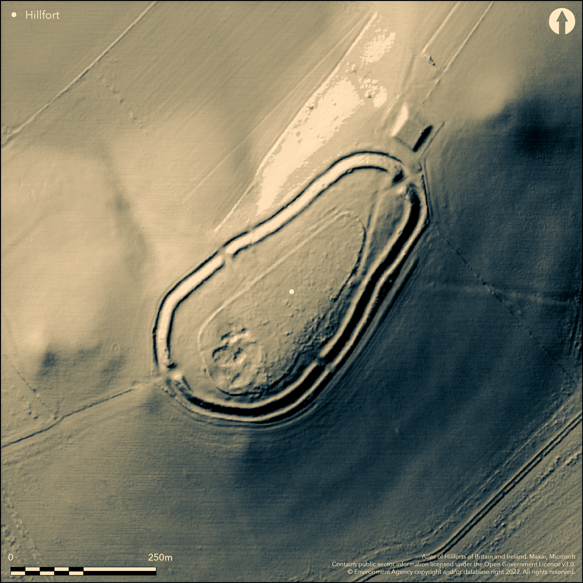
LiDAR 1m DTM Hillshade
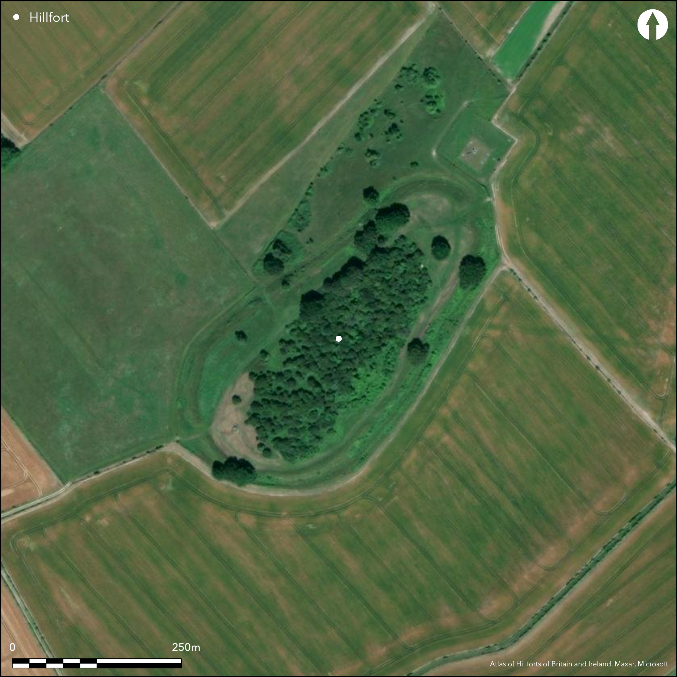
Satellite Imagery
LiDAR 1m DTM Hillshade
Satellite Imagery
Scroll left/right to view further images.
HER: Hampshire 22133 (None)
NMR: SU 24 SE 3 (223925)
SM: 1001952
NGR: SU26254236
X: 426250 Y: 142350 (OSGB36)
Univallate and prominent contour hillfort located on downland of Quarley Hill above River Bourne on W. Steep surrounding slopes. Oblong shape aligned NE-SW with internal area c. 3.6ha. Suggested by C.F.C. Hawkes in his 1938 excavation to have replaced an earlier Iron Age palisaded enclosure, overlying late Bronze Age system of linear ditches radiating from the hill. Site established in early Iron Age, with no evidence to suggest in use later than fourth century BC (Payne et al 2006, 13). Defined by substantial glacis style dump rampart, with ditch and counterscarp. Bank to 4.8m above the silted ditch. Evidence that ramparts enhanced on more than one occasion (Payne et al 2006, 159). Hawkes cut sections through ramparts and entrances and relationship of hillfort to linear ditches investigated. Found ramparts dump construction and revetted around the gates. Main ditch c. 6.1m deep and 9.1m wide at top. NE entrance produced evidence of massive wooden 'barbican', later replaced by lesser timber structure. Gaps in the earthworks to NW and SE possibly post-medieval as rampart ditch crossed gap in bank in both cases. Palisade trench found in the causeway of NE and SW entrance, but as not seen elsewhere, unclear whether represented earlier enclosure of hill top or laying out ditch for main rampart. Only occupation evidence found at junction of two linear ditches inside the hillfort, where spread of occupation debris excavated, producing finds. Hawkes suggested ramparts never completed and site short lived. The hillfort post-dates all the linear ditches, though it is possible that one contemporary with the palisade ditch. Environmental samples indicated site constructed in open grassland environment. Two well-defined inturned original entrances on NE and SW, with track passing through and cutting through site. Two probably modern gaps on SE and NW. Oblong wood follows alignment of site NE-SW in interior surrounded by rough grass to rampart circuit. On 1st Ed. OS map (1874).
Citizen Science: ✗
Reliability of Data: Confirmed
Reliability of Interpretation: Confirmed
X: -180989 Y: 6653147 (EPSG: 3857)
Longitude: -1.6258555542273105 Latitude: 51.17972809716842 (EPSG:4326)
Country: England; None
Current County or Unitary Authority: Hampshire
Historic County: Hampshire and Isle of Wight
Current Parish/Community/Council/Townland: Quarley; Grately
Good condition.
| Extant | ✓ |
| Cropmark | ✗ |
| Likely Destroyed | ✗ |
Oblong wood follows alignment of site NE-SW in interior surrounded by rough grass to rampart circuit.Ramparts mostly pasture. SSSI.
| Woodland | ✓ |
| Commercial Forestry Plantation | ✗ |
| Parkland | ✗ |
| Pasture (Grazing) | ✓ |
| Arable | ✗ |
| Scrub/Bracken | ✗ |
| Bare Outcrop | ✗ |
| Heather/Moorland | ✗ |
| Heath | ✗ |
| Built-up | ✗ |
| Coastal Grassland | ✗ |
| Other | ✗ |
Univallate and prominent contour hillfort located on downland of Quarley Hill above River Bourne on W. Steep surrounding slopes.
| Contour Fort | ✓ |
| Partial Contour Fort | ✗ |
| Promontory Fort | ✗ |
| Hillslope Fort | ✗ |
| Level Terrain Fort | ✗ |
| Marsh Fort | ✗ |
| Multiple Enclosure Fort | ✗ |
| Hilltop | ✓ |
| Coastal Promontory | ✗ |
| Inland Promontory | ✗ |
| Valley Bottom | ✗ |
| Knoll/Hillock/Outcrop | ✗ |
| Ridge | ✗ |
| Cliff/Plateau-edge/Scarp | ✗ |
| Hillslope | ✗ |
| Lowland | ✗ |
| Spur | ✗ |
Dominant Topographic Feature: Hill top
| North | ✗ |
| Northeast | ✗ |
| East | ✗ |
| Southeast | ✗ |
| South | ✗ |
| Southwest | ✗ |
| West | ✗ |
| Northwest | ✗ |
| Level | ✓ |
Altitude: 171.0m
Boundary Type: Parish/Townland
Suggested by Hawkes in his 1938 excavation to have replaced an earlier Iron Age palisaded enclosure, overlying late Bronze Age system of linear ditches radiating from the hill. Site established in early Iron Age, with no evidence to suggest in use later than fourth century BC (Payne 2006, 13). Pottery of fifth and fourth century BC.
Reliability: B - Medium
| Pre 1200BC | ✗ |
| 1200BC - 800BC | ✗ |
| 800BC - 400BC | ✓ |
| 400BC - AD50 | ✗ |
| AD50 - AD400 | ✗ |
| AD400 - AD 800 | ✗ |
| Post AD800 | ✗ |
| Unknown | ✗ |
| Pre Hillfort: | None |
| Post Hillfort: | None |
| Artefactual: | Pottery of fifth and fourth century BC. |
In Aubrey's Monumenta Britannica (1665-1693). On 1st Ed. OS map (1874). Excavation C.F.C. Hawkes 1938. Field investigator comments 1967.
| 1st Identified Map Depiction (1874): | OS map. |
| Excavation (1938): | C.F.C. Hawkes. |
| Other (1967): | Field investigator comments - no details. |
| Other (1971): | Visited by Hillfort Study Group |
| 1st Identified Written Reference (None): | In Aubrey's Monumenta Britannica (1665-1693). |
Only occupation evidence found at junction of two linear ditches inside the hillfort, where spread of occupation debris excavated, producing finds. Iron Age pottery, stone quern, animal and human bone.
None
| None | ✓ |
| Spring | ✗ |
| Stream | ✗ |
| Pool | ✗ |
| Flush | ✗ |
| Well | ✗ |
| Other | ✗ |
None
| No Known Features | ✓ |
| Round Stone Structures | ✗ |
| Rectangular Stone Structures | ✗ |
| Curvilinear Platforms | ✗ |
| Other Roundhouse Evidence | ✗ |
| Pits | ✗ |
| Quarry Hollows | ✗ |
| Other | ✗ |
None
| No Known Excavation | ✗ |
| Pits | ✗ |
| Postholes | ✗ |
| Roundhouses | ✗ |
| Rectangular Structures | ✗ |
| Roads/Tracks | ✗ |
| Quarry Hollows | ✗ |
| Other | ✓ |
| Nothing Found | ✗ |
None
| No Known Geophysics | ✓ |
| Pits | ✗ |
| Roundhouses | ✗ |
| Rectangular Structures | ✗ |
| Roads/Tracks | ✗ |
| Quarry Hollows | ✗ |
| Other | ✗ |
| Nothing Found | ✗ |
Only occupation evidence found at junction of two ranch boundaries inside the hillfort, where spread of occupation debris excavated, producing finds. Iron Age pottery, stone quern, animal and human bone.
| No Known Finds | ✗ |
| Pottery | ✓ |
| Metal | ✗ |
| Metalworking | ✗ |
| Human Bones | ✓ |
| Animal Bones | ✓ |
| Lithics | ✓ |
| Environmental | ✗ |
| Other | ✗ |
None
| APs Not Checked | ✓ |
| None | ✗ |
| Roundhouses | ✗ |
| Rectangular Structures | ✗ |
| Pits | ✗ |
| Postholes | ✗ |
| Roads/Tracks | ✗ |
| Other | ✗ |
Two inturned original entrances on NE and SW, with track passing through and cutting through site. Two modern gaps on SE and NW with field boundary cutting through.
| 4: | Modern gaps on SE and NW. |
| 2: | None |
Guard Chambers: ✗
Chevaux de Frise: ✗
| 1. In-turned (North east): | None |
| 2. In-turned (South west): | None |
Defined by substantial glacis style rampart, with ditch and counterscarp. Evidence that ramparts enhanced on more than one occasion (Payne 2000, 159). Hawkes cut sections through ramparts and entrances and relationship of hillfort to linear ditches investigated. Found ramparts dump construction and revetted around the gates. Main ditch c. 6.1m deep and 9.1m wide at top.
| Area 1: | 3.6ha. |
| Total: | 3.6ha. |
Total Footprint Area: Noneha.
None
| ✗ | None |
| ✓ | None |
| NE Quadrant: | 1 |
| SE Quadrant: | 1 |
| SW Quadrant: | 1 |
| NW Quadrant: | 1 |
| Total: | 1 |
| Partial Univallate | ✗ |
| Univallate | ✓ |
| Partial Bivallate | ✗ |
| Bivallate | ✗ |
| Partial Multivallate | ✗ |
| Multivallate | ✗ |
| Unknown | ✗ |
| Partial Univallate | ✗ |
| Univallate | ✗ |
| Partial Bivallate | ✗ |
| Bivallate | ✗ |
| Partial Multivallate | ✗ |
| Multivallate | ✗ |
Glacis style rampart. Evidence that ramparts enhanced on more than one occasion (Payne 2000, 159).
| None | ✗ |
| Earthen Bank | ✓ |
| Stone Wall | ✗ |
| Rubble | ✗ |
| Wall-walk | ✗ |
| Evidence of Timber | ✗ |
| Vitrification | ✗ |
| Other Burning | ✗ |
| Palisade | ✗ |
| Counter Scarp Bank | ✓ |
| Berm | ✗ |
| Unfinished | ✗ |
| Other | ✗ |
Hawkes cut sections through ramparts and entrances and relationship of hillfort to ranch boundaries investigated. Found ramparts dump construction and revetted around the gates. Main ditch c. 6.1m deep and 9.1m wide at top.
| None | ✗ |
| Earthen Bank | ✓ |
| Stone Wall | ✓ |
| Murus Duplex | ✗ |
| Timber-framed | ✗ |
| Timber-laced | ✗ |
| Vitrification | ✗ |
| Other Burning | ✗ |
| Palisade | ✓ |
| Counter Scarp Bank | ✗ |
| Berm | ✗ |
| Unfinished | ✗ |
| No Known Excavation | ✗ |
| Other | ✗ |
| ✗ | None |
| ✓ | None |
Number of Ditches: 1
| ✗ | None |
Cunliffe, B. and Miles, D. 1984. Aspects of the Iron Age in Central Southern Britain, Oxford: Oxford University Committee for Archaeology Monograph 2, 9, 30-1.
Hawkes, C.F.C. 1938-40. Excavations at Quarley Hill, Proc Hampshire Fld Club Archaeol Soc, 14, 136-94.
Payne, A, Corney, M. and Cunliffe, B. 2006. The Wessex hillforts project, Extensive survey of hillfort interiors in central southern England. London: English Heritage.
Williams-Freeman, J.P. 1915. An introduction to field archaeology as illustrated by Hampshire, London: Macmillan and Co Ltd, 121-4, 397.
Atlas of Hillforts:
Wikidata:
This work is licensed under CC BY-SA 4.0

 and should be cited as:
Lock, Gary and Ralston, Ian. 2024. Atlas of Hillforts of Britain and Ireland. Available at: https://hillforts.arch.ox.ac.uk
Document Version 1.1