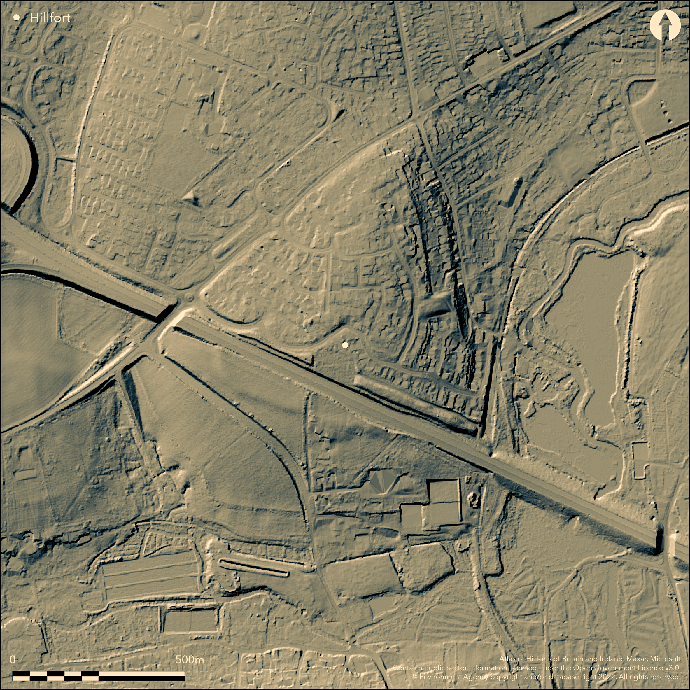
LiDAR 1m DTM Hillshade
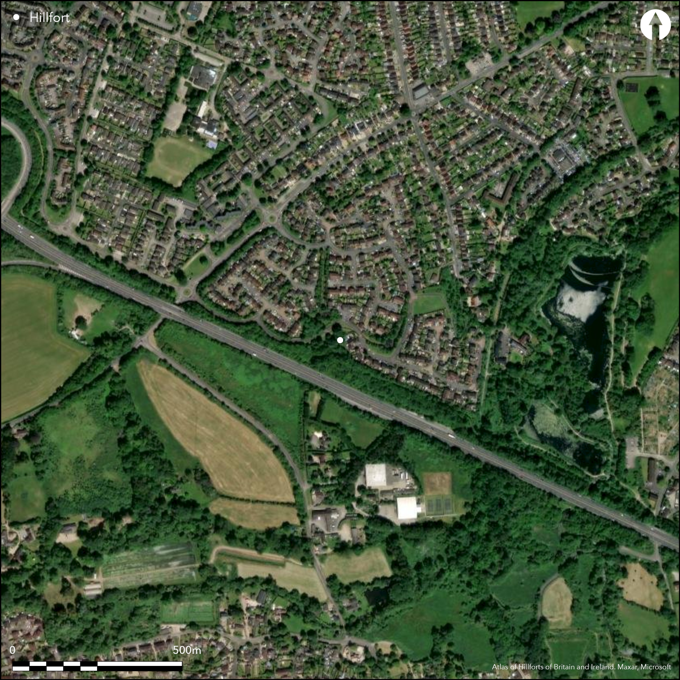
Satellite Imagery
LiDAR 1m DTM Hillshade
Satellite Imagery
Scroll left/right to view further images.
HER: Hampshire 28887 (None)
NMR: SU 34 SE 1 (228154)
SM: 1018562
NGR: SU35154456
X: 435150 Y: 144560 (OSGB36)
Univallate, partial contour hillfort formerly located on small knoll on summit of low downland S-facing Upper Chalk spur at confluence of River Anton and River Anna (Pillhill Brook) to SE in S suburbs of Andover. Site virtually destroyed by housing development on N and modern roads on S, including the A 303 Andover by-pass, and now only SW end survives. Although not topographically commanding, the site occupied a position which dominates the neighbouring river valleys. Roughly triangular in plan aligned NE-SW, dropping across contours to SE, with internal area c. 18ha. Extensive excavation of interior and sections across ramparts undertaken in several phases between early 1973 and late 1990s, with earlier investigations of 1939 and 1967 (Hawkes 1939; Wainwright 1969; Wainwright and Davies 1995). These detailed how site defined by single timber-revetted bank 2m high and 6m wide, with surrounding steep-sided ditch, c. 5m wide and 3m deep. Seven C14 samples of antler, charcoal and human bone and pottery fragment analysis from 1973 and 1981 excavations suggest defences constructed in at least three phases during the late Bronze Age and early Iron Age, with further modification in Romano-British period, and site remained in use until the late Roman period. Single, gated entrance in SE, with causeway across the ditch. Intensive occupation of interior throughout period of use, with remains of huts and other wooden structures, pits, postholes, gullies and hearths of late Iron Age to late Roman date, burials of late Bronze Age and Roman date. Very many finds, among which included pottery, antlers, querns, shale bracelets, metalwork, brooches and pins, glass and animal and human bone. Targeted excavation across parts of interior and exterior of the enclosure 1995-7 confirmed phases of construction and refurbishment, and found deposits unexamined S part of E rampart (Ellis and Rawlings 2001). During groundworks 1996 two disturbed inhumations were recovered from interior (Ellis and Rawlings 1997). On 1st Ed. OS map (1873-4).
Citizen Science: ✗
Reliability of Data: Confirmed
Reliability of Interpretation: Confirmed
X: -166792 Y: 6656592 (EPSG: 3857)
Longitude: -1.4983172076284517 Latitude: 51.199123505201875 (EPSG:4326)
Country: England; None
Current County or Unitary Authority: Hampshire
Historic County: Hampshire and Isle of Wight
Current Parish/Community/Council/Townland: Andover; Upper Clatford
About three-quarters of site destroyed.
| Extant | ✓ |
| Cropmark | ✗ |
| Likely Destroyed | ✓ |
About three-quarters now housing development and roads. Remaining area grassland.
| Woodland | ✗ |
| Commercial Forestry Plantation | ✗ |
| Parkland | ✗ |
| Pasture (Grazing) | ✓ |
| Arable | ✗ |
| Scrub/Bracken | ✗ |
| Bare Outcrop | ✗ |
| Heather/Moorland | ✗ |
| Heath | ✗ |
| Built-up | ✓ |
| Coastal Grassland | ✗ |
| Other | ✗ |
Univallate, partial contour hillfort formerly located on small knoll of low downland S-facing Upper Chalk spur at confluence of River Anton and River Anna (Pillhill Brook) to SE in S suburbs of Andover.
| Contour Fort | ✗ |
| Partial Contour Fort | ✓ |
| Promontory Fort | ✗ |
| Hillslope Fort | ✗ |
| Level Terrain Fort | ✗ |
| Marsh Fort | ✗ |
| Multiple Enclosure Fort | ✗ |
| Hilltop | ✗ |
| Coastal Promontory | ✗ |
| Inland Promontory | ✗ |
| Valley Bottom | ✗ |
| Knoll/Hillock/Outcrop | ✗ |
| Ridge | ✗ |
| Cliff/Plateau-edge/Scarp | ✗ |
| Hillslope | ✗ |
| Lowland | ✗ |
| Spur | ✓ |
Dominant Topographic Feature: Small knoll on low spur.
| North | ✗ |
| Northeast | ✗ |
| East | ✗ |
| Southeast | ✓ |
| South | ✗ |
| Southwest | ✗ |
| West | ✗ |
| Northwest | ✗ |
| Level | ✗ |
Altitude: 91.0m
Boundary Type: Parish/Townland
Seven C14 samples of antler, charcoal and human bone and pottery fragment analysis from 1973 and 1981 excavations suggest defences constructed in at least three phases during the late Bronze Age and early Iron Age, and site remained in use until the late Roman period.
Reliability: A - High
| Pre 1200BC | ✗ |
| 1200BC - 800BC | ✗ |
| 800BC - 400BC | ✓ |
| 400BC - AD50 | ✓ |
| AD50 - AD400 | ✓ |
| AD400 - AD 800 | ✗ |
| Post AD800 | ✗ |
| Unknown | ✗ |
| Pre Hillfort: | None |
| Post Hillfort: | None |
| Artefactual: | Pottery |
| C14: | Seven C14 samples of antler, charcoal and human bone. |
In Aubrey's Monumenta Britannica (1665-1693). On 1st Ed. OS map (1873-4). Part excavation Mrs. J. Hawkes 1939. Excavations G.J. Wainwright 1967, 1973, 1981. Excavation Wessex Archaeology 1995-7.
| Excavation (1967): | G. J. Wainwright. |
| Other (1971): | Visited by Hillfort Study Group |
| Geophysical Survey (1973): | A. Bartlett AML |
| 1st Identified Written Reference (None): | None |
| 1st Identified Map Depiction (None): | OS map. |
| Excavation (None): | G.J. Wainwright and S.M. Davies. |
| Excavation (None): | Wessex Archaeology. |
Intensive occupation of interior throughout period of use, with remains of huts and other wooden structures, pits, postholes, gullies, hearths of early Iron Age to late Roman date and burials of late Bronze Age and Roman date.Very many finds, among which included pottery, antlers, querns, shale bracelets, spindle whorls and loom weights, daub, metalwork, brooches and pins, glass, animal and human bone and environmental. Roman coins. During groundworks 1996 two disturbed inhumations were recovered from interior.
None
| None | ✓ |
| Spring | ✗ |
| Stream | ✗ |
| Pool | ✗ |
| Flush | ✗ |
| Well | ✗ |
| Other | ✗ |
Site virtually destroyed.
| No Known Features | ✓ |
| Round Stone Structures | ✗ |
| Rectangular Stone Structures | ✗ |
| Curvilinear Platforms | ✗ |
| Other Roundhouse Evidence | ✗ |
| Pits | ✗ |
| Quarry Hollows | ✗ |
| Other | ✗ |
None
| No Known Excavation | ✗ |
| Pits | ✓ |
| Postholes | ✓ |
| Roundhouses | ✓ |
| Rectangular Structures | ✗ |
| Roads/Tracks | ✗ |
| Quarry Hollows | ✗ |
| Other | ✓ |
| Nothing Found | ✗ |
Geophysics 1973 in advance of excavation - no details.
| No Known Geophysics | ✗ |
| Pits | ✗ |
| Roundhouses | ✗ |
| Rectangular Structures | ✗ |
| Roads/Tracks | ✗ |
| Quarry Hollows | ✗ |
| Other | ✓ |
| Nothing Found | ✗ |
Very many finds, among which included pottery, antlers, querns, shale braceets, spindle whorls and loom weights, daub, metalwork, brooches and pins, glass, animal and human bone and environmental. Roman coins.
| No Known Finds | ✗ |
| Pottery | ✓ |
| Metal | ✓ |
| Metalworking | ✗ |
| Human Bones | ✓ |
| Animal Bones | ✓ |
| Lithics | ✓ |
| Environmental | ✓ |
| Other | ✓ |
None
| APs Not Checked | ✓ |
| None | ✗ |
| Roundhouses | ✗ |
| Rectangular Structures | ✗ |
| Pits | ✗ |
| Postholes | ✗ |
| Roads/Tracks | ✗ |
| Other | ✗ |
Excavation showed single, gated entrance in SE, with causeway across the ditch
| None: | Not determined. Site virtually destroyed. |
| 2: | None |
Guard Chambers: ✗
Chevaux de Frise: ✗
| 1. Simple Gap (South east): | Causeway across ditch. |
Excavations showed site defined by single timber-revetted bank 2m high and 6m wide, with surrounding steep-sided ditch, c. 5m wide and 3m deep.
| Area 1: | 18.0ha. |
| Total: | 18.0ha. |
Total Footprint Area: Noneha.
None
| ✓ | Phased and modified. |
| ✗ | Present not determined. Site almost destroyed. |
| NE Quadrant: | None |
| SE Quadrant: | None |
| SW Quadrant: | None |
| NW Quadrant: | None |
| Total: | None |
| Partial Univallate | ✗ |
| Univallate | ✗ |
| Partial Bivallate | ✗ |
| Bivallate | ✗ |
| Partial Multivallate | ✗ |
| Multivallate | ✗ |
| Unknown | ✓ |
| Partial Univallate | ✗ |
| Univallate | ✓ |
| Partial Bivallate | ✗ |
| Bivallate | ✗ |
| Partial Multivallate | ✗ |
| Multivallate | ✗ |
Site almost destroyed.
| None | ✗ |
| Earthen Bank | ✓ |
| Stone Wall | ✗ |
| Rubble | ✗ |
| Wall-walk | ✗ |
| Evidence of Timber | ✗ |
| Vitrification | ✗ |
| Other Burning | ✗ |
| Palisade | ✗ |
| Counter Scarp Bank | ✗ |
| Berm | ✗ |
| Unfinished | ✗ |
| Other | ✗ |
Excavations showed site defined by single timber-revetted bank 2m high and 6m wide.
| None | ✗ |
| Earthen Bank | ✓ |
| Stone Wall | ✗ |
| Murus Duplex | ✗ |
| Timber-framed | ✓ |
| Timber-laced | ✗ |
| Vitrification | ✗ |
| Other Burning | ✗ |
| Palisade | ✗ |
| Counter Scarp Bank | ✗ |
| Berm | ✗ |
| Unfinished | ✗ |
| No Known Excavation | ✗ |
| Other | ✗ |
| ✗ | None |
| ✓ | Surrounding steep-sided ditch, c. 5m wide and 3m deep. |
Number of Ditches: 1
| ✗ | None |
Bartlett, A. 1973. Geophysics: Balksbury Camp, Andover, AML Rep No 1606, English Heritage.
Ellis, C.J. and Rawlings, M. 1997. Excavations at Balksbury Camp, Andover 1995-97, Wessex Archaeology Report.
Ellis, C.J. and Rawlings, M. 2001. Excavations at Balksbury Camp 1995-97, Proc Hampshire Fld Club Archaeol Soc, 56, 21-94.
Hawkes, J. 1939. The Excavations at Balksbury, 1939, Proc Hampshire Fld Club Archaeol Soc, 14, 291-337.
Wainwright, G. J, 1969. The Excavation of Balksbury Camp, Andover, Hants, Proc Hampshire Fld Club Archaeol Soc, 26, 21-55.
Wainwright, G.J. and Davies, S.M. 1995. Balksbury Camp Hampshire. Excavations 1973 and 1981, English Heritage Archaeological Report 4, London: English Heritage.
Williams-Freeman, J.P. 1915. An introduction to field archaeology as illustrated by Hampshire, London: Macmillan and Co Ltd, 137-8, 335, 340, 354.
Atlas of Hillforts:
Wikidata:
This work is licensed under CC BY-SA 4.0

 and should be cited as:
Lock, Gary and Ralston, Ian. 2024. Atlas of Hillforts of Britain and Ireland. Available at: https://hillforts.arch.ox.ac.uk
Document Version 1.1