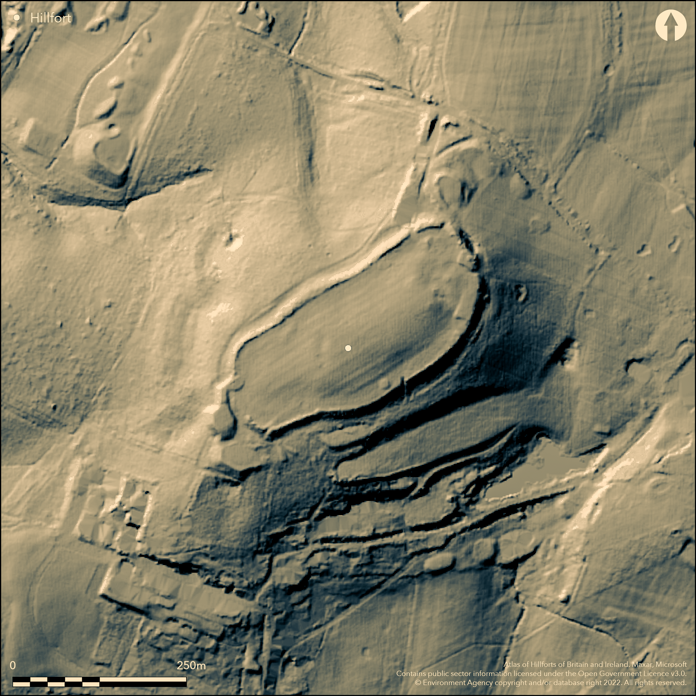
LiDAR 1m DTM Hillshade
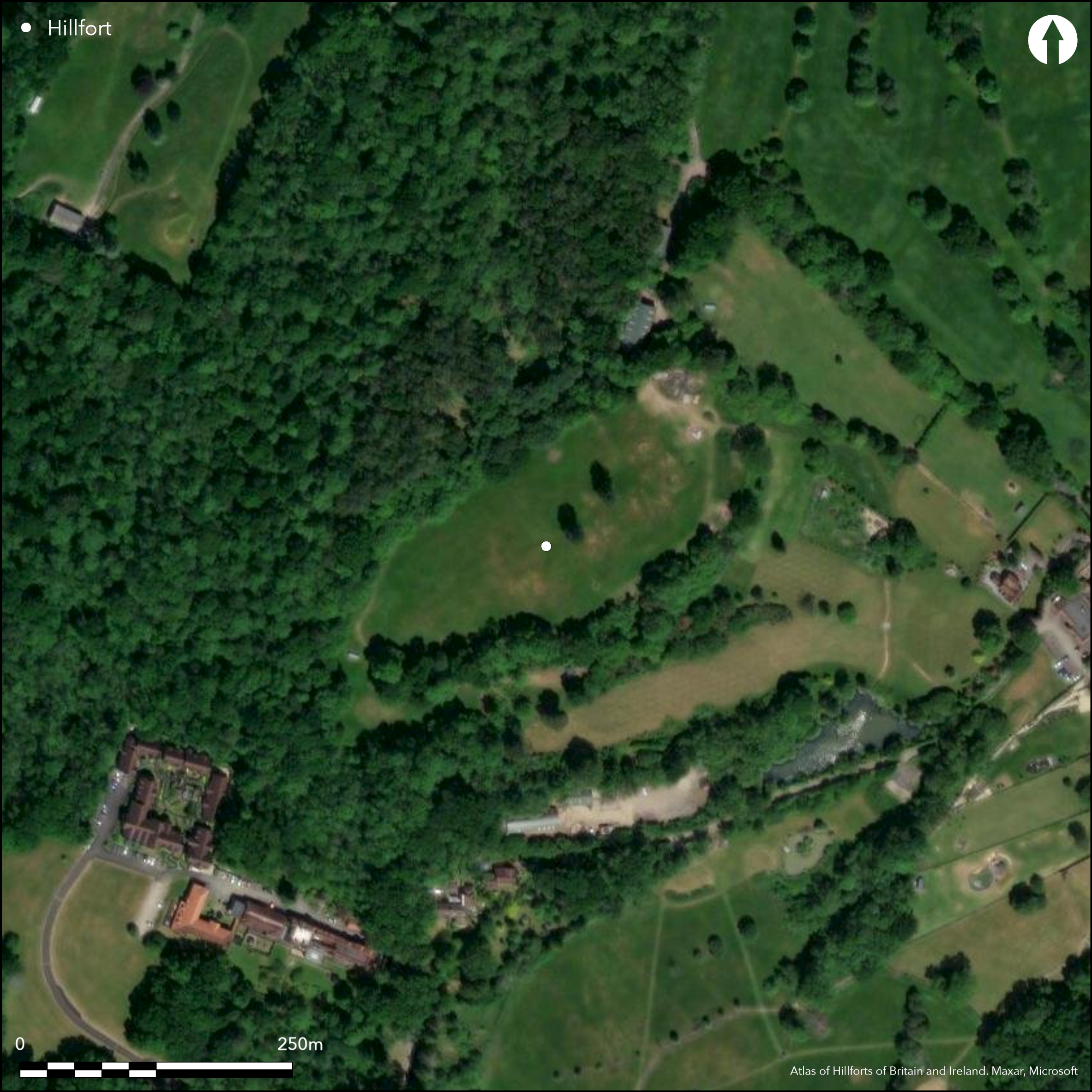
Satellite Imagery
LiDAR 1m DTM Hillshade
Satellite Imagery
Scroll left/right to view further images.
HER: Hampshire 23937 (None)
NMR: SU 32 SW 1 (227161)
SM: 1001946
NGR: SU31302306
X: 431300 Y: 123060 (OSGB36)
Possible, univallate, contour hillfort, or natural feature, located on summit of small sandy hill standing to c. 12m above general ground level. Higher reaches of stream to River Blackwater on W, River Test to E. Steep surrounding slopes, less on NE. Interior is not flat, but rises to ridge roughly following axis of site. It is possible that the site was unfinished, but theory questionable. Ramparts, if exist at all, scarped rather than constructed as a bank, although a slight rise exists in places to nearly 0.1m above interior. No ditch in evidence, but level terrace at foot of scarp possibly caused by any scarping. Slight ditches near N of interior, aligned NW-SW at right angles to alignment of site probably of medieval or later date. No original entrances are visible as such, and the multiple gaps on the site are probably modern. Now golf course and minor earth moving may have have altered any low bank around site on SW and W. On 1st Ed. OS map (1889). Few investigations. Undated.
Citizen Science: ✗
Reliability of Data: Unconfirmed
Reliability of Interpretation: Unconfirmed
X: -173133 Y: 6622358 (EPSG: 3857)
Longitude: -1.5552770881921751 Latitude: 51.006018947889174 (EPSG:4326)
Country: England
Current County or Unitary Authority: Hampshire
Historic County: Hampshire and Isle of Wight
Current Parish/Community/Council/Townland: Sherfield English
Questionable if exists, but if so nearly gone and now part of Dunwood Manor golf course.
| Extant | ✗ |
| Cropmark | ✗ |
| Likely Destroyed | ✓ |
Golf course. Wooded on SW-NE side.
| Woodland | ✗ |
| Commercial Forestry Plantation | ✗ |
| Parkland | ✓ |
| Pasture (Grazing) | ✗ |
| Arable | ✗ |
| Scrub/Bracken | ✗ |
| Bare Outcrop | ✗ |
| Heather/Moorland | ✗ |
| Heath | ✗ |
| Built-up | ✗ |
| Coastal Grassland | ✗ |
| Other | ✓ |
Possible, unfinished, univallate, contour hillfort, or natural feature, located on summit of small sandy hill standing to c. 12m above general ground level. Higher reaches of stream to River Blackwater on W, River Test to E. Steep surrounding slopes, less on NE.
| Contour Fort | ✓ |
| Partial Contour Fort | ✗ |
| Promontory Fort | ✗ |
| Hillslope Fort | ✗ |
| Level Terrain Fort | ✗ |
| Marsh Fort | ✗ |
| Multiple Enclosure Fort | ✗ |
| Hilltop | ✓ |
| Coastal Promontory | ✗ |
| Inland Promontory | ✗ |
| Valley Bottom | ✗ |
| Knoll/Hillock/Outcrop | ✗ |
| Ridge | ✗ |
| Cliff/Plateau-edge/Scarp | ✗ |
| Hillslope | ✗ |
| Lowland | ✗ |
| Spur | ✗ |
Dominant Topographic Feature: Hill top
| North | ✗ |
| Northeast | ✗ |
| East | ✗ |
| Southeast | ✗ |
| South | ✗ |
| Southwest | ✗ |
| West | ✗ |
| Northwest | ✗ |
| Level | ✓ |
Altitude: 76.0m
N/A
None.
Reliability: D - None
| Pre 1200BC | ✗ |
| 1200BC - 800BC | ✗ |
| 800BC - 400BC | ✗ |
| 400BC - AD50 | ✗ |
| AD50 - AD400 | ✗ |
| AD400 - AD 800 | ✗ |
| Post AD800 | ✗ |
| Unknown | ✓ |
| Pre Hillfort: | None |
| Post Hillfort: | Possibly. Slight ditches near N of interior, aligned NW-SW at right angles to alignment of site probably of medieval or later date. |
On 1st Ed. OS map (1889). Field investigator comments 1953, 1959, 1969. Mentioned by Forde-Johnson as a fort in his Group I hilltop situation 1976.
| 1st Identified Map Depiction (1889): | OS map. |
| Other (1976): | Mentioned by Forde-Johnson as a fort in his Group I hill-top situation. |
| Other (None): | Field investigator comments - no details. |
None.
None
| None | ✓ |
| Spring | ✗ |
| Stream | ✗ |
| Pool | ✗ |
| Flush | ✗ |
| Well | ✗ |
| Other | ✗ |
None
| No Known Features | ✓ |
| Round Stone Structures | ✗ |
| Rectangular Stone Structures | ✗ |
| Curvilinear Platforms | ✗ |
| Other Roundhouse Evidence | ✗ |
| Pits | ✗ |
| Quarry Hollows | ✗ |
| Other | ✗ |
None
| No Known Excavation | ✓ |
| Pits | ✗ |
| Postholes | ✗ |
| Roundhouses | ✗ |
| Rectangular Structures | ✗ |
| Roads/Tracks | ✗ |
| Quarry Hollows | ✗ |
| Other | ✗ |
| Nothing Found | ✗ |
None
| No Known Geophysics | ✓ |
| Pits | ✗ |
| Roundhouses | ✗ |
| Rectangular Structures | ✗ |
| Roads/Tracks | ✗ |
| Quarry Hollows | ✗ |
| Other | ✗ |
| Nothing Found | ✗ |
None
| No Known Finds | ✓ |
| Pottery | ✗ |
| Metal | ✗ |
| Metalworking | ✗ |
| Human Bones | ✗ |
| Animal Bones | ✗ |
| Lithics | ✗ |
| Environmental | ✗ |
| Other | ✗ |
None
| APs Not Checked | ✓ |
| None | ✗ |
| Roundhouses | ✗ |
| Rectangular Structures | ✗ |
| Pits | ✗ |
| Postholes | ✗ |
| Roads/Tracks | ✗ |
| Other | ✗ |
No original entrances are visible as such, and the multiple gaps on the site are probably modern.
| 0: | Multiple modern gaps. |
| 2: | None |
Guard Chambers: ✗
Chevaux de Frise: ✗
Ramparts, if exist at all, scarped rather than constructed as a bank, although a slight rise exists in places to nearly 0.1m above interior.
| Area 1: | 1.8ha. |
| Total: | 1.8ha. |
Total Footprint Area: Noneha.
None
| ✗ | None |
| ✗ | If existed would have been single bank surrounding circuit. |
| NE Quadrant: | None |
| SE Quadrant: | None |
| SW Quadrant: | None |
| NW Quadrant: | None |
| Total: | None |
| Partial Univallate | ✗ |
| Univallate | ✗ |
| Partial Bivallate | ✗ |
| Bivallate | ✗ |
| Partial Multivallate | ✗ |
| Multivallate | ✗ |
| Unknown | ✓ |
| Partial Univallate | ✗ |
| Univallate | ✗ |
| Partial Bivallate | ✗ |
| Bivallate | ✗ |
| Partial Multivallate | ✗ |
| Multivallate | ✗ |
It is possible that the site was unfinished, but theory questionable.
| None | ✓ |
| Earthen Bank | ✗ |
| Stone Wall | ✗ |
| Rubble | ✗ |
| Wall-walk | ✗ |
| Evidence of Timber | ✗ |
| Vitrification | ✗ |
| Other Burning | ✗ |
| Palisade | ✗ |
| Counter Scarp Bank | ✗ |
| Berm | ✗ |
| Unfinished | ✓ |
| Other | ✗ |
None
| None | ✗ |
| Earthen Bank | ✗ |
| Stone Wall | ✗ |
| Murus Duplex | ✗ |
| Timber-framed | ✗ |
| Timber-laced | ✗ |
| Vitrification | ✗ |
| Other Burning | ✗ |
| Palisade | ✗ |
| Counter Scarp Bank | ✗ |
| Berm | ✗ |
| Unfinished | ✗ |
| No Known Excavation | ✓ |
| Other | ✗ |
| ✗ | None |
| ✗ | None visible. |
Number of Ditches: 0
| ✗ | None |
Forde-Johnston, J. 1976. Hillforts of the Iron Age in England and Wales, Liverpool: LIverpool University Press, 59.
Williams-Freeman, J.P. 1915. An introduction to field archaeology as illustrated by Hampshire, London: Macmillan and Co Ltd, 371.
Atlas of Hillforts:
Wikidata:
This work is licensed under CC BY-SA 4.0

 and should be cited as:
Lock, Gary and Ralston, Ian. 2024. Atlas of Hillforts of Britain and Ireland. Available at: https://hillforts.arch.ox.ac.uk
Document Version 1.1