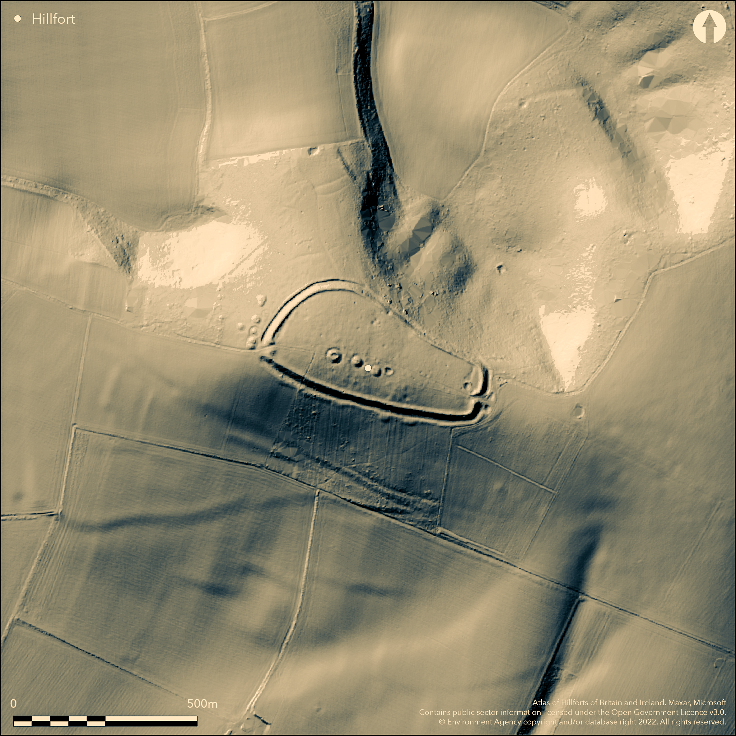
LiDAR 1m DTM Hillshade
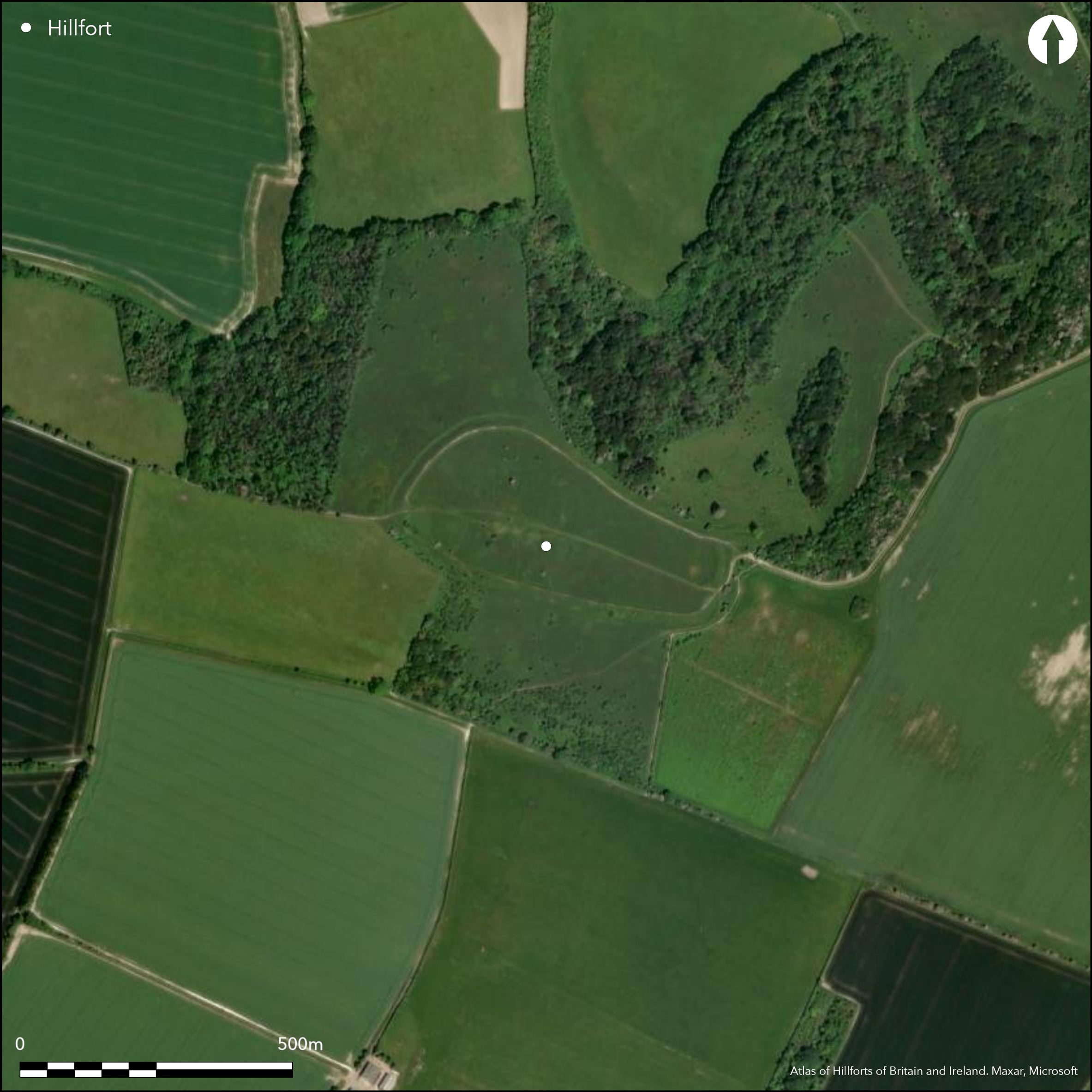
Satellite Imagery
LiDAR 1m DTM Hillshade
Satellite Imagery
Scroll left/right to view further images.
HER: Hampshire 24565 (None)
NMR: SU 62 SW 25 (239439)
SM: 1017899
NGR: SU64102055
X: 464100 Y: 120550 (OSGB36)
Prominent and commanding contour hillfort located on chalk downland spur above River Meon valley to W, closely following line of hill and rising to centre of site. Very steep surrounding slopes to N, steep on S and W, less along ridge to E. Elongated E-W sub-trapezoidal shape, entirely enclosing c. 5.67ha of the spur. Defined by substantial single bank, generally rising to 1.52m above interior and to 7m ditch, but greater near two substantial inturned entrances on SE and W ends of the fort, where bank rises to c. 3m above interior and c. 10m above ditch. A counterscarp bank 3m-16m wide with external height c. 2m. Ditch is shallow flat-bottomed 2m-8m wide and to 1.8m deep and visible on all sides except NE where 7m-12m wide terrace or ledge. About 70 slight surface depressions and associated pits may represent hut platforms. Possible earlier earthwork enclosure suggested by infilled ditch across interior at E end. Remains of 'Celtic' field system to W as slight regular scarps enclosing small rectangular fields. Further remains of 'Celtic' fields and associated trackways outside ramparts to S. At least two lynchets, as slight banks, run parallel to ramparts. Four bowl barrows within fort and others just outside entrances at E and W ends. Three mounds incorporated in the rampart and cut by ditch on S may be remains of bowl barrows. Survey by RCHME 1994 found complex sequence of development. Earliest component a field system, with extensive and dispersed arrangement of barrow monuments placed on top of this and this in turn overlaid by boundary and associated settlement features of the Iron Age hillfort. Survey also revealed slight traces of ridge and furrow ploughing and other vestiges of medieval or post medieval field system including linear field boundaries. Good downland site well-preserved. National Nature Reserve. On 1st Ed. OS map (1884). Undated.
Citizen Science: ✗
Reliability of Data: Confirmed
Reliability of Interpretation: Confirmed
X: -121146 Y: 6617887 (EPSG: 3857)
Longitude: -1.0882702106944915 Latitude: 50.980736456232975 (EPSG:4326)
Country: England; None
Current County or Unitary Authority: Hampshire
Historic County: Hampshire and Isle of Wight
Current Parish/Community/Council/Townland: Corhampton and Meonstoke; Exton
Fine well-preserved hillfort. National Nature Reserve.
| Extant | ✓ |
| Cropmark | ✗ |
| Likely Destroyed | ✗ |
Downland grass with some scrub on banks in places. SSSI.
| Woodland | ✗ |
| Commercial Forestry Plantation | ✗ |
| Parkland | ✗ |
| Pasture (Grazing) | ✓ |
| Arable | ✗ |
| Scrub/Bracken | ✓ |
| Bare Outcrop | ✗ |
| Heather/Moorland | ✗ |
| Heath | ✗ |
| Built-up | ✗ |
| Coastal Grassland | ✗ |
| Other | ✗ |
Prominent and commanding contour hillfort located on chalk downland spur above River Meon valley to W, closely following line of hill and rising to centre of site. Very steep surrounding slopes to N, steep on S and W, less along ridge to E.
| Contour Fort | ✓ |
| Partial Contour Fort | ✗ |
| Promontory Fort | ✗ |
| Hillslope Fort | ✗ |
| Level Terrain Fort | ✗ |
| Marsh Fort | ✗ |
| Multiple Enclosure Fort | ✗ |
| Hilltop | ✓ |
| Coastal Promontory | ✗ |
| Inland Promontory | ✗ |
| Valley Bottom | ✗ |
| Knoll/Hillock/Outcrop | ✗ |
| Ridge | ✗ |
| Cliff/Plateau-edge/Scarp | ✗ |
| Hillslope | ✗ |
| Lowland | ✗ |
| Spur | ✗ |
Dominant Topographic Feature: Hill top
| North | ✗ |
| Northeast | ✗ |
| East | ✗ |
| Southeast | ✗ |
| South | ✗ |
| Southwest | ✗ |
| West | ✗ |
| Northwest | ✗ |
| Level | ✓ |
Altitude: 199.0m
Boundary Type: Parish/Townland
None.
Reliability: D - None
| Pre 1200BC | ✗ |
| 1200BC - 800BC | ✗ |
| 800BC - 400BC | ✗ |
| 400BC - AD50 | ✗ |
| AD50 - AD400 | ✗ |
| AD400 - AD 800 | ✗ |
| Post AD800 | ✗ |
| Unknown | ✓ |
| Pre Hillfort: | Possible earlier earthwork enclosure suggested by infilled ditch across interior at E end. Four barrows within fort and others just outside entrances at E and W ends. Three mounds incorporated in the rampart and cut by ditch on S may be remains of bowl barrows. |
| Post Hillfort: | RCHME survey revealed slight traces of ridge and furrow ploughing and other vestiges of medieval or post medieval field system including linear field boundaries . |
First documented in reign of Edward IV (1461-83) as PASTURA VOCATA OLDE WINCHESTER (Gate of the Earth Fort). Field investigator comments 1968, 1983. On 1st Ed. OS map (1884). Measured survey field observation RCHME 1994, ref. no. 930692. Geophysical survey AML 1995. RCHME medieval settlement project 1996.
| 1st Identified Map Depiction (1884): | OS map. |
| Other (1971): | Visited by Hillfort Study Group |
| Earthwork Survey (1994): | RCHME measured survey field observation. |
| Geophysical Survey (1995): | Magnetometer survey AML. |
| Other (1996): | RCHME medieval settlement project. |
| 1st Identified Written Reference (None): | First documented in reign of Edward IV (1461-83) as PASTURA VOCATA OLDE WINCHESTER (Gate of the Earth Fort). |
| Other (None): | Field investigator comments - no details. |
About 70 slight surface depressions and associated pits may represent hut platforms.
None
| None | ✓ |
| Spring | ✗ |
| Stream | ✗ |
| Pool | ✗ |
| Flush | ✗ |
| Well | ✗ |
| Other | ✗ |
About 70 slight surface depressions and associated pits may represent hut platforms.
| No Known Features | ✗ |
| Round Stone Structures | ✗ |
| Rectangular Stone Structures | ✗ |
| Curvilinear Platforms | ✓ |
| Other Roundhouse Evidence | ✗ |
| Pits | ✓ |
| Quarry Hollows | ✗ |
| Other | ✗ |
None
| No Known Excavation | ✓ |
| Pits | ✗ |
| Postholes | ✗ |
| Roundhouses | ✗ |
| Rectangular Structures | ✗ |
| Roads/Tracks | ✗ |
| Quarry Hollows | ✗ |
| Other | ✗ |
| Nothing Found | ✗ |
None
| No Known Geophysics | ✗ |
| Pits | ✗ |
| Roundhouses | ✗ |
| Rectangular Structures | ✗ |
| Roads/Tracks | ✗ |
| Quarry Hollows | ✗ |
| Other | ✓ |
| Nothing Found | ✗ |
None
| No Known Finds | ✓ |
| Pottery | ✗ |
| Metal | ✗ |
| Metalworking | ✗ |
| Human Bones | ✗ |
| Animal Bones | ✗ |
| Lithics | ✗ |
| Environmental | ✗ |
| Other | ✗ |
None
| APs Not Checked | ✓ |
| None | ✗ |
| Roundhouses | ✗ |
| Rectangular Structures | ✗ |
| Pits | ✗ |
| Postholes | ✗ |
| Roads/Tracks | ✗ |
| Other | ✗ |
Two substantial inturned entrances on SE and W ends of the fort, where bank rises to c. 3m above interior and c. 10m above ditch and fronted by bowl barrows.
| 2: | None |
| 2: | None |
Guard Chambers: ✗
Chevaux de Frise: ✗
| 1. In-turned (South east): | Substantial. |
| 2. In-turned (West): | Substantial. |
Defined by substantial single bank, generally rising to 1.52m above interior and to 7m ditch, but greater near two substantial inturned entrances on SE and W ends of the fort, where bank rises to c. 3m above interior and c. 10m above ditch. A counterscarp bank 3m-16m wide with external height c. 2m. Ditch is shallow flat-bottomed 2m-8m wide and to 1.8m deep and visible on all sides except NE where 7m-12m wide terrace or ledge.
| Area 1: | 5.67ha. |
| Total: | 5.67ha. |
Total Footprint Area: Noneha.
None
| ✗ | None |
| ✓ | None |
| NE Quadrant: | 1 |
| SE Quadrant: | 1 |
| SW Quadrant: | 1 |
| NW Quadrant: | 1 |
| Total: | 1 |
| Partial Univallate | ✗ |
| Univallate | ✓ |
| Partial Bivallate | ✗ |
| Bivallate | ✗ |
| Partial Multivallate | ✗ |
| Multivallate | ✗ |
| Unknown | ✗ |
| Partial Univallate | ✗ |
| Univallate | ✗ |
| Partial Bivallate | ✗ |
| Bivallate | ✗ |
| Partial Multivallate | ✗ |
| Multivallate | ✗ |
Counterscarp bank 3m-16m wide with external height c. 2m.
| None | ✗ |
| Earthen Bank | ✓ |
| Stone Wall | ✗ |
| Rubble | ✗ |
| Wall-walk | ✗ |
| Evidence of Timber | ✗ |
| Vitrification | ✗ |
| Other Burning | ✗ |
| Palisade | ✗ |
| Counter Scarp Bank | ✓ |
| Berm | ✗ |
| Unfinished | ✗ |
| Other | ✗ |
None
| None | ✗ |
| Earthen Bank | ✗ |
| Stone Wall | ✗ |
| Murus Duplex | ✗ |
| Timber-framed | ✗ |
| Timber-laced | ✗ |
| Vitrification | ✗ |
| Other Burning | ✗ |
| Palisade | ✗ |
| Counter Scarp Bank | ✗ |
| Berm | ✗ |
| Unfinished | ✗ |
| No Known Excavation | ✓ |
| Other | ✗ |
| ✗ | None |
| ✓ | Ditch is shallow flat-bottomed 2m-8m wide and to 1.8m deep and visible on all sides except NE where 7m-12m wide terrace or ledge. |
Number of Ditches: 1
| ✗ | None |
Payne, A. 1995. Old Winchester Hill, Corhampton ... preliminary report on geophysical survey, Ancient Monuments Laboratory.
Williams-Freeman, J.P. 1915. An introduction to field archaeology as illustrated by Hampshire, London: Macmillan and Co Ltd.
Atlas of Hillforts:
Wikidata:
This work is licensed under CC BY-SA 4.0

 and should be cited as:
Lock, Gary and Ralston, Ian. 2024. Atlas of Hillforts of Britain and Ireland. Available at: https://hillforts.arch.ox.ac.uk
Document Version 1.1