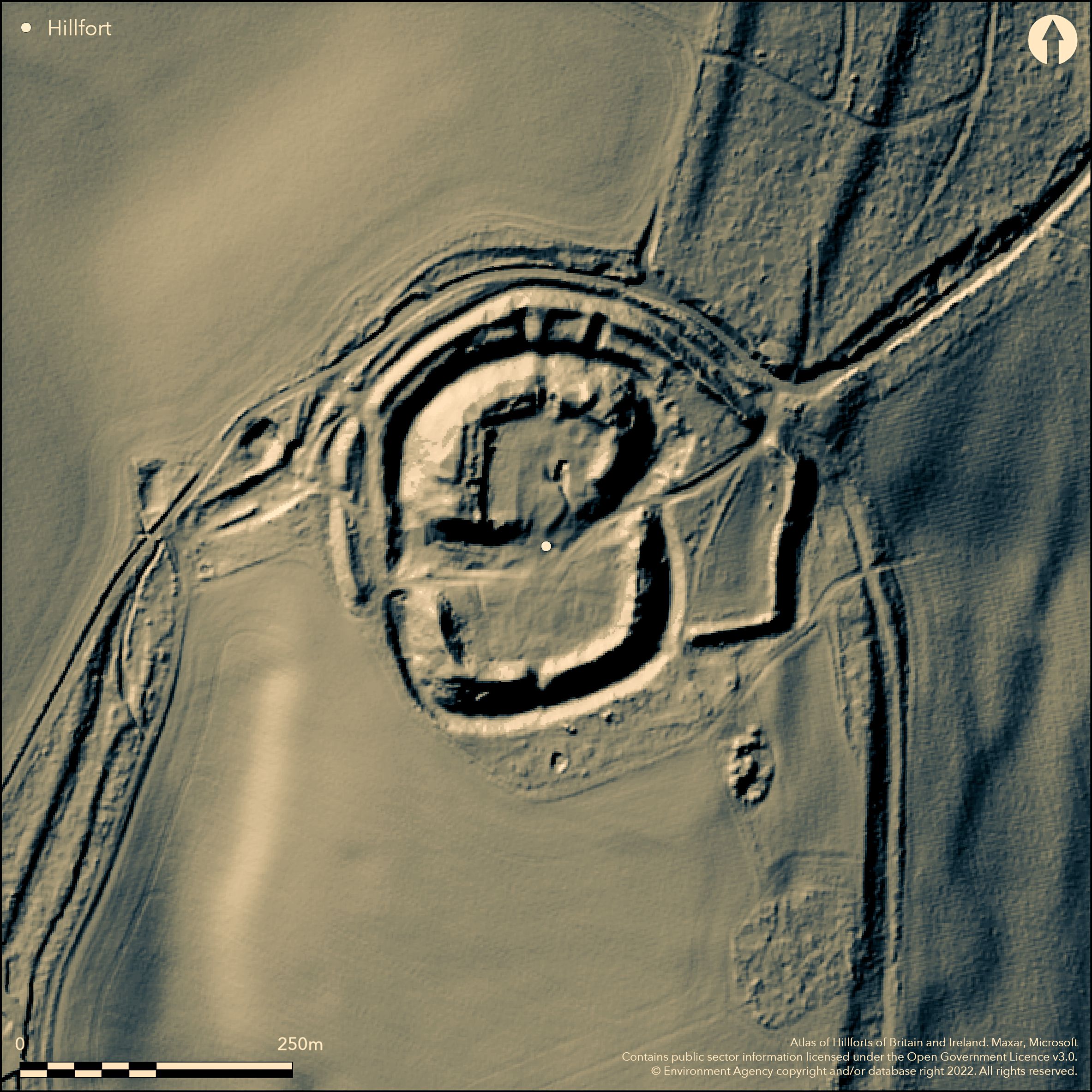
LiDAR 1m DTM Hillshade
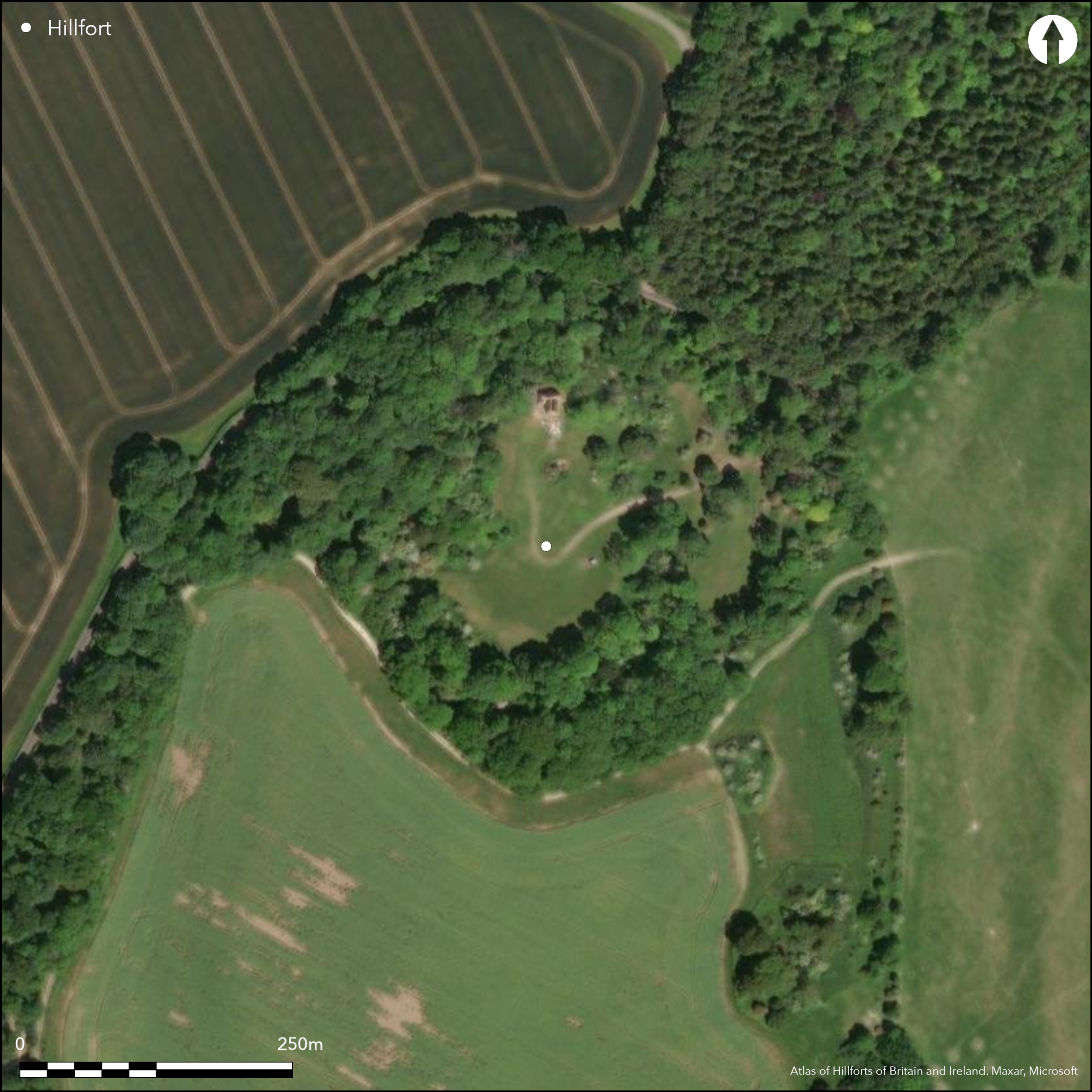
Satellite Imagery
LiDAR 1m DTM Hillshade
Satellite Imagery
Scroll left/right to view further images.
HER: Hampshire 25400 (None)
NMR: SU 42 NW 4 (231087)
SM: 1019123
NGR: SU42082646
X: 442080 Y: 126460 (OSGB36)
Univallate hillfort located on prominent, S-facing chalk spur in downs between River Itchen on E and River Test on W. Steep slopes NE to SE, moderate to strong elsewhere. Substantial motte and bailey castle constructed in interior with massive bank and ditch, which has masked and modified hillfort features. Polygonal enclosure c. 3.7ha. Single rampart and ditch with slight counterscarp across the neck of the spur on N. Best on NE where rampart 2m above interior and 4m above outer ditch. Further disturbed on S by modern ploughing. Possible original entrance on W, No definite evidence but slight out-turning and overlapping of ramparts suggesting possible hornwork. All other gaps modern. Rough grass interior, trees on ramparts and surrounds. On 1st Ed. OS map (1867). Few investigations. Undated.
Citizen Science: ✗
Reliability of Data: Confirmed
Reliability of Interpretation: Confirmed
X: -155986 Y: 6627647 (EPSG: 3857)
Longitude: -1.4012445789001573 Latitude: 51.03590561812663 (EPSG:4326)
Country: England
Current County or Unitary Authority: Hampshire
Historic County: Hampshire and Isle of Wight
Current Parish/Community/Council/Townland: Hursley
Fair condition despite some plough damage. Substantial motte and bailey castle in interior.
| Extant | ✓ |
| Cropmark | ✗ |
| Likely Destroyed | ✗ |
Rough grass interior, trees on ramparts and surrounds. Motte and bailey castle.
| Woodland | ✓ |
| Commercial Forestry Plantation | ✗ |
| Parkland | ✗ |
| Pasture (Grazing) | ✓ |
| Arable | ✗ |
| Scrub/Bracken | ✗ |
| Bare Outcrop | ✗ |
| Heather/Moorland | ✗ |
| Heath | ✗ |
| Built-up | ✗ |
| Coastal Grassland | ✗ |
| Other | ✓ |
Univallate contour hillfort located on prominent, S-facing chalk spur in downs between River Itchen on E and River Test on W. Steep slopes NE to SE, moderate to strong elsewhere.
| Contour Fort | ✓ |
| Partial Contour Fort | ✗ |
| Promontory Fort | ✗ |
| Hillslope Fort | ✗ |
| Level Terrain Fort | ✗ |
| Marsh Fort | ✗ |
| Multiple Enclosure Fort | ✗ |
| Hilltop | ✗ |
| Coastal Promontory | ✗ |
| Inland Promontory | ✗ |
| Valley Bottom | ✗ |
| Knoll/Hillock/Outcrop | ✗ |
| Ridge | ✗ |
| Cliff/Plateau-edge/Scarp | ✗ |
| Hillslope | ✗ |
| Lowland | ✗ |
| Spur | ✓ |
Dominant Topographic Feature: Spur
| North | ✗ |
| Northeast | ✗ |
| East | ✗ |
| Southeast | ✗ |
| South | ✗ |
| Southwest | ✗ |
| West | ✗ |
| Northwest | ✗ |
| Level | ✓ |
Altitude: 111.0m
N/A
None.
Reliability: D - None
| Pre 1200BC | ✗ |
| 1200BC - 800BC | ✗ |
| 800BC - 400BC | ✗ |
| 400BC - AD50 | ✗ |
| AD50 - AD400 | ✗ |
| AD400 - AD 800 | ✗ |
| Post AD800 | ✗ |
| Unknown | ✓ |
| Pre Hillfort: | None |
| Post Hillfort: | Medieval motte and bailey castle on site built by Henry de Blois, Bishop of Winchester 1129-38, destroyed 1156. Possibly site of Saxon defended manorial residence of 8th century. Possible medieval and post-medieval period use as hollow ways and banks to NW shown on map of 1588 as forming part of old road curving around N side of castle. RCHME survey 1993 and 1994 found earthworks and buried foundations suggesting site used as military camp during WWI and WWII. |
On 1st Ed. OS map (1867). Field investigator comments 1961, 1968. Measured survey RCHME 1993. Geophysical survey M. Cole AML 1994.
| 1st Identified Map Depiction (1867): | OS map. |
| Earthwork Survey (1993): | Measured survey RCHME. |
| Geophysical Survey (1994): | M. Cole AML. |
| Other (None): | Field investigator comments - no details. |
Geophysics found castle and later details masking any earlier feature.
None
| None | ✓ |
| Spring | ✗ |
| Stream | ✗ |
| Pool | ✗ |
| Flush | ✗ |
| Well | ✗ |
| Other | ✗ |
Any possible hillfort features masked by later castle.
| No Known Features | ✓ |
| Round Stone Structures | ✗ |
| Rectangular Stone Structures | ✗ |
| Curvilinear Platforms | ✗ |
| Other Roundhouse Evidence | ✗ |
| Pits | ✗ |
| Quarry Hollows | ✗ |
| Other | ✗ |
None
| No Known Excavation | ✓ |
| Pits | ✗ |
| Postholes | ✗ |
| Roundhouses | ✗ |
| Rectangular Structures | ✗ |
| Roads/Tracks | ✗ |
| Quarry Hollows | ✗ |
| Other | ✗ |
| Nothing Found | ✗ |
None
| No Known Geophysics | ✗ |
| Pits | ✗ |
| Roundhouses | ✗ |
| Rectangular Structures | ✗ |
| Roads/Tracks | ✗ |
| Quarry Hollows | ✗ |
| Other | ✗ |
| Nothing Found | ✓ |
None
| No Known Finds | ✓ |
| Pottery | ✗ |
| Metal | ✗ |
| Metalworking | ✗ |
| Human Bones | ✗ |
| Animal Bones | ✗ |
| Lithics | ✗ |
| Environmental | ✗ |
| Other | ✗ |
None
| APs Not Checked | ✓ |
| None | ✗ |
| Roundhouses | ✗ |
| Rectangular Structures | ✗ |
| Pits | ✗ |
| Postholes | ✗ |
| Roads/Tracks | ✗ |
| Other | ✗ |
Possible original entrance on W, No definite evidence but slight out-turning and overlapping of ramparts suggesting possible hornwork. All other gaps modern.
| None: | Total gaps not determined. |
| 2: | None |
Guard Chambers: ✗
Chevaux de Frise: ✗
| 1. Out-turned (West): | Slight out-turning and overlapping of ramparts suggesting possible hornwork. |
| 1. Over-lapping (West): | Slight overlapping of ramparts. |
| 1. Hornwork (West): | Possible hornwork. |
Single rampart and ditch with slight counterscarp across the neck of the spur on N. Best on NE where rampart 2m above interior and 4m above outer ditch. Further disturbed on S by modern ploughing.
| Area 1: | 3.7ha. |
| Total: | 3.7ha. |
Total Footprint Area: Noneha.
None
| ✓ | Possible earlier phase of construction or attached enclosure, as semicircular section of bank extends from SE ramparts. |
| ✓ | None |
| NE Quadrant: | 1 |
| SE Quadrant: | 1 |
| SW Quadrant: | 1 |
| NW Quadrant: | 1 |
| Total: | 1 |
| Partial Univallate | ✗ |
| Univallate | ✓ |
| Partial Bivallate | ✗ |
| Bivallate | ✗ |
| Partial Multivallate | ✗ |
| Multivallate | ✗ |
| Unknown | ✗ |
| Partial Univallate | ✗ |
| Univallate | ✗ |
| Partial Bivallate | ✗ |
| Bivallate | ✗ |
| Partial Multivallate | ✗ |
| Multivallate | ✗ |
Counterscarp on N.
| None | ✗ |
| Earthen Bank | ✓ |
| Stone Wall | ✗ |
| Rubble | ✗ |
| Wall-walk | ✗ |
| Evidence of Timber | ✗ |
| Vitrification | ✗ |
| Other Burning | ✗ |
| Palisade | ✗ |
| Counter Scarp Bank | ✓ |
| Berm | ✗ |
| Unfinished | ✗ |
| Other | ✗ |
None
| None | ✗ |
| Earthen Bank | ✗ |
| Stone Wall | ✗ |
| Murus Duplex | ✗ |
| Timber-framed | ✗ |
| Timber-laced | ✗ |
| Vitrification | ✗ |
| Other Burning | ✗ |
| Palisade | ✗ |
| Counter Scarp Bank | ✗ |
| Berm | ✗ |
| Unfinished | ✗ |
| No Known Excavation | ✓ |
| Other | ✗ |
| ✗ | None |
| ✓ | None |
Number of Ditches: 1
| ✗ | None |
Cole, M.1994. Merdon Castle, Hursley, Hampshire: report on geophysical survey, AML Rep. no. 26/94, AML.
Donachie, J.D.1994. RCHME Field Survey Report: Merdon Castle, Hursley, RCHME.
Roberts, E. 1988. The Bishop of Winchester's deer parks in Hampshire, 1200-1400, Proc Hampshire Fld Club Archaeol Soc , 44, 76.
Williams-Freeman, J.P. 1915. An introduction to field archaeology as illustrated by Hampshire, London: Macmillan and Co Ltd.
Atlas of Hillforts:
Wikidata:
This work is licensed under CC BY-SA 4.0

 and should be cited as:
Lock, Gary and Ralston, Ian. 2024. Atlas of Hillforts of Britain and Ireland. Available at: https://hillforts.arch.ox.ac.uk
Document Version 1.1