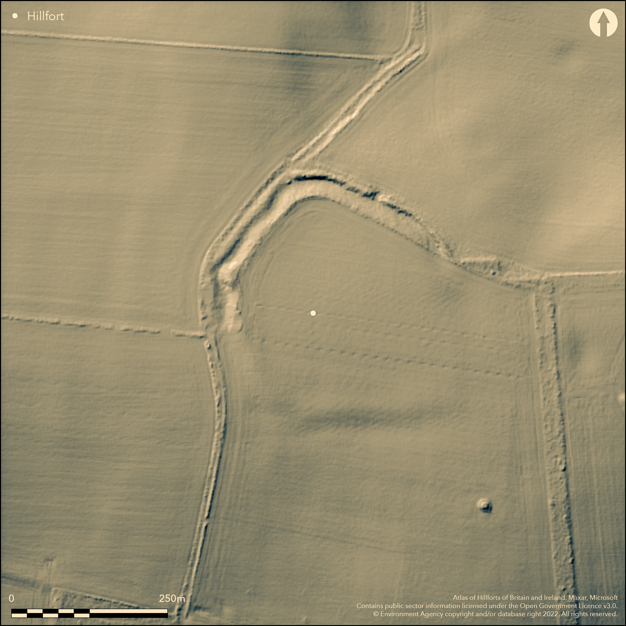
LiDAR 1m DTM Hillshade
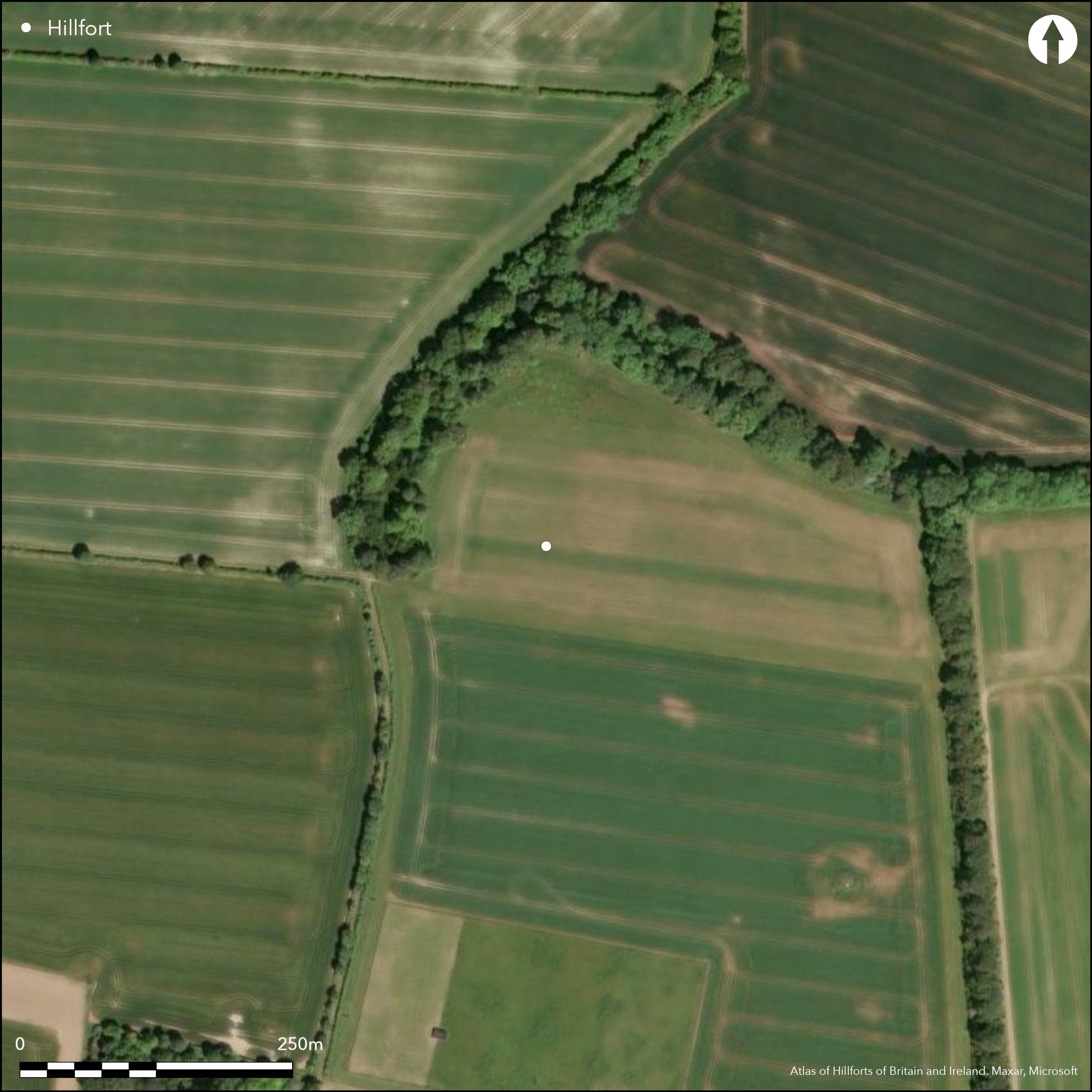
Satellite Imagery
LiDAR 1m DTM Hillshade
Satellite Imagery
Scroll left/right to view further images.
HER: Hampshire 17713 (None)
NMR: SU 44 SE 19 (232256)
SM: 1020317
NGR: SU49004000
X: 449072 Y: 140093 (OSGB36)
Univallate partial contour hillfort located on sloping W crest of E-W aligned chalk ridge flanking the River Dever to S. Roughly trapezoid shaped enclosing c. 4ha of level ground commanding extensive views in all directions except E. Modern tracks and ploughing damaged defences, particularly to the east and south, where they survive only as a low bank or scarp, a ploughed-out ditch and faint traces of a slight outer bank. To N and W inner rampart and shallow ditch with counterscarp better preserved than on E and S where now low bank , ploughed-out ditch and faint traces of the counterscarp. Where best, both banks to 12m wide, and main bank to 2.5m above ditch and to 0.3m above interior. On N side, possible traces of outer ditch, to make site bivallate here, probably later trackway or boundary feature. English Heritage magnetometer survey 1997 found two original entrances in ploughed-down area of the ramparts, with simple gap on SE, and more complex gate on SW consisting of inturned rampart providing corridor (Payne et. al. 2006). Survey also found large number of pits, hearths and ditches in interior, suggesting round houses, granaries, compounds, iron ore smelting hearths and other domestic and industrial activities. Fieldwalking 1979 produced Bronze Age, Iron Age and Roman pottery, suggesting a long perod of use of the site. Later use also indicated by post-medieval (16th-18th century) pottery and building materials and similarly dated earthwork bank, probably boundary feature or lynchet. Cultivated. First documented as NAESAN BYRIG (Old Camp) AD 901. On 1st Ed. OS map (1870).
Citizen Science: ✗
Reliability of Data: Confirmed
Reliability of Interpretation: Confirmed
X: -144680 Y: 6649278 (EPSG: 3857)
Longitude: -1.2996817814112835 Latitude: 51.15793472406413 (EPSG:4326)
Country: England; None
Current County or Unitary Authority: Hampshire
Historic County: Hampshire and Isle of Wight
Current Parish/Community/Council/Townland: Micheldever; Wonston
Ploughing disturbance and defences damaged. On Heritage at Risk Register (2015).
| Extant | ✓ |
| Cropmark | ✗ |
| Likely Destroyed | ✗ |
Cultivated.
| Woodland | ✗ |
| Commercial Forestry Plantation | ✗ |
| Parkland | ✗ |
| Pasture (Grazing) | ✓ |
| Arable | ✓ |
| Scrub/Bracken | ✗ |
| Bare Outcrop | ✗ |
| Heather/Moorland | ✗ |
| Heath | ✗ |
| Built-up | ✗ |
| Coastal Grassland | ✗ |
| Other | ✗ |
Univallate partial contour hillfort located on sloping W crest of E-W aligned chalk ridge flanking the River Dever to S. Commands extensive views in all directions except E.
| Contour Fort | ✗ |
| Partial Contour Fort | ✓ |
| Promontory Fort | ✗ |
| Hillslope Fort | ✗ |
| Level Terrain Fort | ✗ |
| Marsh Fort | ✗ |
| Multiple Enclosure Fort | ✗ |
| Hilltop | ✗ |
| Coastal Promontory | ✗ |
| Inland Promontory | ✗ |
| Valley Bottom | ✗ |
| Knoll/Hillock/Outcrop | ✗ |
| Ridge | ✓ |
| Cliff/Plateau-edge/Scarp | ✗ |
| Hillslope | ✗ |
| Lowland | ✗ |
| Spur | ✗ |
Dominant Topographic Feature: Ridge
| North | ✗ |
| Northeast | ✗ |
| East | ✗ |
| Southeast | ✗ |
| South | ✗ |
| Southwest | ✗ |
| West | ✓ |
| Northwest | ✗ |
| Level | ✗ |
Altitude: 93.0m
Boundary Type: Parish/Townland
Fieldwalking 1979 produced Bronze Age, Iron Age and Roman pottery, suggesting a long perod of use of the site.
Reliability: C - Low
| Pre 1200BC | ✗ |
| 1200BC - 800BC | ✗ |
| 800BC - 400BC | ✓ |
| 400BC - AD50 | ✓ |
| AD50 - AD400 | ✓ |
| AD400 - AD 800 | ✗ |
| Post AD800 | ✗ |
| Unknown | ✗ |
| Pre Hillfort: | None |
| Post Hillfort: | None |
| Artefactual: | Bronze Age, Iron Age and Roman pottery. |
First documented in AD 901 as NAESAN BYRIG (Old Camp). On 1st Ed. OS map (1870). Geophysical survey English Heritage Wessex Hillforts Project AML 1997. Geophysical survey English Heritage Wessex Hillforts Project Bartlett Clark Consultancy 1999.
| 1st Identified Map Depiction (1870): | OS map. |
| Geophysical Survey (1997): | English Heritage Wessex Hillforts Project. AML. |
| Geophysical Survey (1999): | English Heritage Wessex Hillforts Project Bartlett Clark Consultancy. |
| 1st Identified Written Reference (None): | First documented as NAESAN BYRIG (Old Camp). |
English Heritage magnetometer survey also found large number of pits, hearths and ditches in interior, suggesting round houses, granaries, compounds, iron ore smelting hearths and other domestic and industrial activities. Fieldwalking 1979 produced Bronze Age, Iron Age and Roman pottery, suggesting a long perod of use of the site. Later use also indicated by post-medieval (16th-18th century) pottery and building materials and similarly dated earthwork bank, probably boundary feature or lynchet. On 1st Ed. OS map (1870).
None
| None | ✓ |
| Spring | ✗ |
| Stream | ✗ |
| Pool | ✗ |
| Flush | ✗ |
| Well | ✗ |
| Other | ✗ |
None
| No Known Features | ✓ |
| Round Stone Structures | ✗ |
| Rectangular Stone Structures | ✗ |
| Curvilinear Platforms | ✗ |
| Other Roundhouse Evidence | ✗ |
| Pits | ✗ |
| Quarry Hollows | ✗ |
| Other | ✗ |
None
| No Known Excavation | ✓ |
| Pits | ✗ |
| Postholes | ✗ |
| Roundhouses | ✗ |
| Rectangular Structures | ✗ |
| Roads/Tracks | ✗ |
| Quarry Hollows | ✗ |
| Other | ✗ |
| Nothing Found | ✗ |
None
| No Known Geophysics | ✗ |
| Pits | ✓ |
| Roundhouses | ✓ |
| Rectangular Structures | ✗ |
| Roads/Tracks | ✗ |
| Quarry Hollows | ✗ |
| Other | ✓ |
| Nothing Found | ✗ |
Fieldwalking 1979 produced Bronze Age, Iron Age and Roman pottery, suggesting a long perod of use of the site. Later use also indicated by post-medieval (16th-18th century) pottery and building materials.
| No Known Finds | ✗ |
| Pottery | ✓ |
| Metal | ✗ |
| Metalworking | ✗ |
| Human Bones | ✗ |
| Animal Bones | ✗ |
| Lithics | ✗ |
| Environmental | ✗ |
| Other | ✓ |
None
| APs Not Checked | ✓ |
| None | ✗ |
| Roundhouses | ✗ |
| Rectangular Structures | ✗ |
| Pits | ✗ |
| Postholes | ✗ |
| Roads/Tracks | ✗ |
| Other | ✗ |
English Heritage magnetometer survey 1997 found two original entrances in ploughed-down area of the defences, with simple gap on SE, and more complex gate on SW consisting of inturned rampart providing corridor.
| 2: | None |
| 2: | None |
Guard Chambers: ✗
Chevaux de Frise: ✗
| 1. Simple Gap (South east): | None |
| 2. In-turned (South west): | None |
| 2. Passage-way/Corridor (South west): | Corridor. |
Modern tracks and ploughing damaged defences, particularly to the east and south, where they survive only as a low bank or scarp, a ploughed-out ditch and faint traces of a slight outer bank. To N and W inner rampart and shallow ditch with counterscarp better preserved than on E and S where now low bank, ploughed-out ditch and faint traces of the counterscarp. Where best, both banks to 12m wide, and main bank to 2.5m above ditch and to 0.3m above interior. On N side, possible traces of outer ditch, to make site bivallate here, probably later trackway or boundary feature.
| Area 1: | 4.0ha. |
| Total: | 4.0ha. |
Total Footprint Area: Noneha.
None
| ✗ | None |
| ✓ | None |
| NE Quadrant: | 1 |
| SE Quadrant: | 1 |
| SW Quadrant: | 1 |
| NW Quadrant: | 1 |
| Total: | 1 |
| Partial Univallate | ✗ |
| Univallate | ✓ |
| Partial Bivallate | ✗ |
| Bivallate | ✗ |
| Partial Multivallate | ✗ |
| Multivallate | ✗ |
| Unknown | ✗ |
| Partial Univallate | ✗ |
| Univallate | ✗ |
| Partial Bivallate | ✗ |
| Bivallate | ✗ |
| Partial Multivallate | ✗ |
| Multivallate | ✗ |
Good counterscarp to N and W, faint on E and S.
| None | ✗ |
| Earthen Bank | ✓ |
| Stone Wall | ✗ |
| Rubble | ✗ |
| Wall-walk | ✗ |
| Evidence of Timber | ✗ |
| Vitrification | ✗ |
| Other Burning | ✗ |
| Palisade | ✗ |
| Counter Scarp Bank | ✓ |
| Berm | ✗ |
| Unfinished | ✗ |
| Other | ✗ |
None
| None | ✗ |
| Earthen Bank | ✗ |
| Stone Wall | ✗ |
| Murus Duplex | ✗ |
| Timber-framed | ✗ |
| Timber-laced | ✗ |
| Vitrification | ✗ |
| Other Burning | ✗ |
| Palisade | ✗ |
| Counter Scarp Bank | ✗ |
| Berm | ✗ |
| Unfinished | ✗ |
| No Known Excavation | ✓ |
| Other | ✗ |
| ✗ | None |
| ✓ | Ditch ploughed-out on E and S. |
Number of Ditches: 1
| ✗ | None |
Bartlett, A. 1999. Castle Ditches, Wiltshire and Norsebury Ring, Hampshire: magnetic susceptibility surveys for Wessex Hillforts Project. Bartlett Clark Consultancy.
Grinsell, L.V. 1958. The archaeology of Wessex : an account of Wessex antiquities from the earliest times to the end of the pagan-Saxon period, with special reference to existing field monuments, 180.
Payne, A, Corney, M. and Cunliffe, B. 2006. The Wessex hillforts project, Extensive survey of hillfort interiors in central southern England. London: English Heritage, 66-71.
Williams-Freeman, J.P. 1915. An introduction to field archaeology as illustrated by Hampshire, London: Macmillan and Co Ltd.
Atlas of Hillforts:
Wikidata:
This work is licensed under CC BY-SA 4.0

 and should be cited as:
Lock, Gary and Ralston, Ian. 2024. Atlas of Hillforts of Britain and Ireland. Available at: https://hillforts.arch.ox.ac.uk
Document Version 1.1