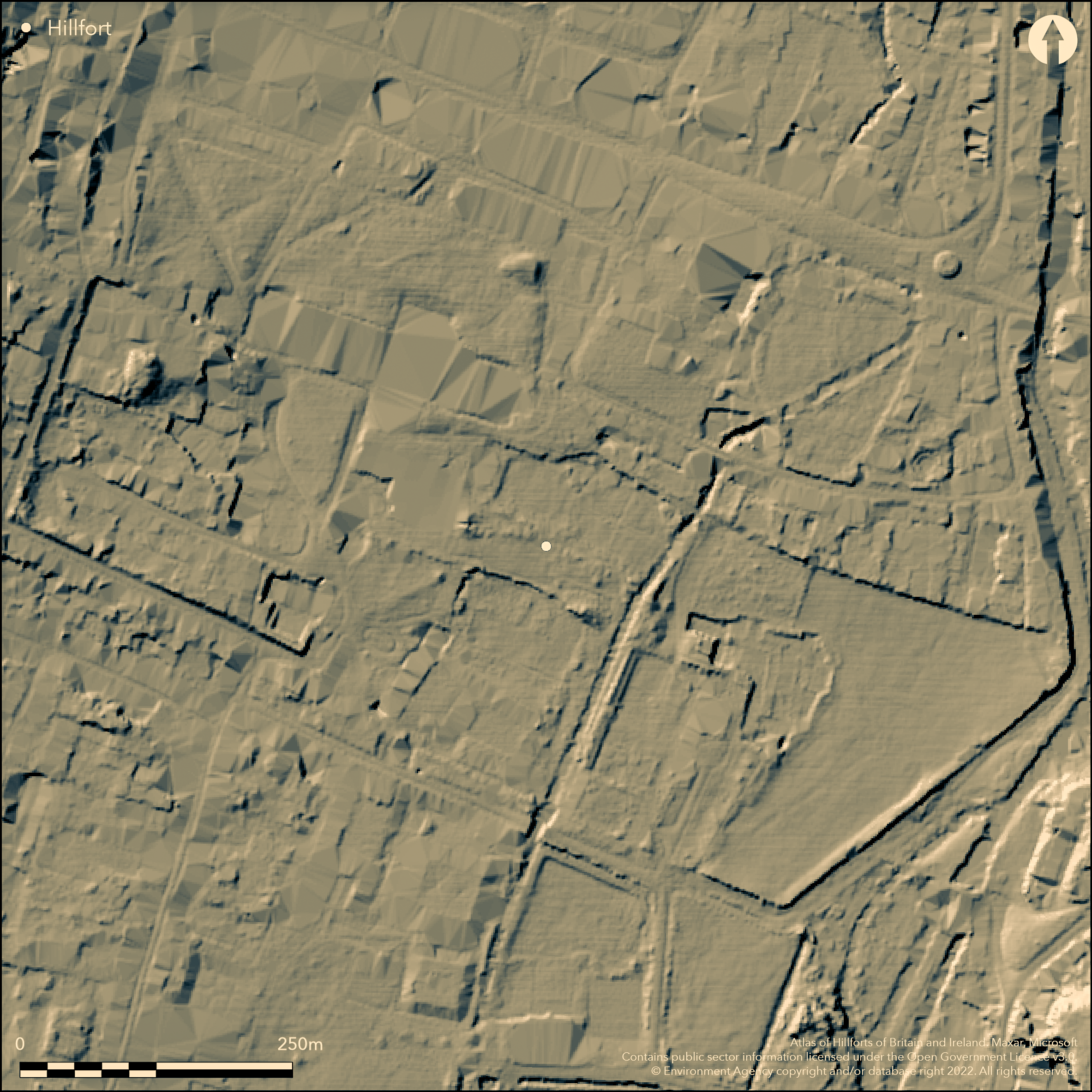
LiDAR 1m DTM Hillshade
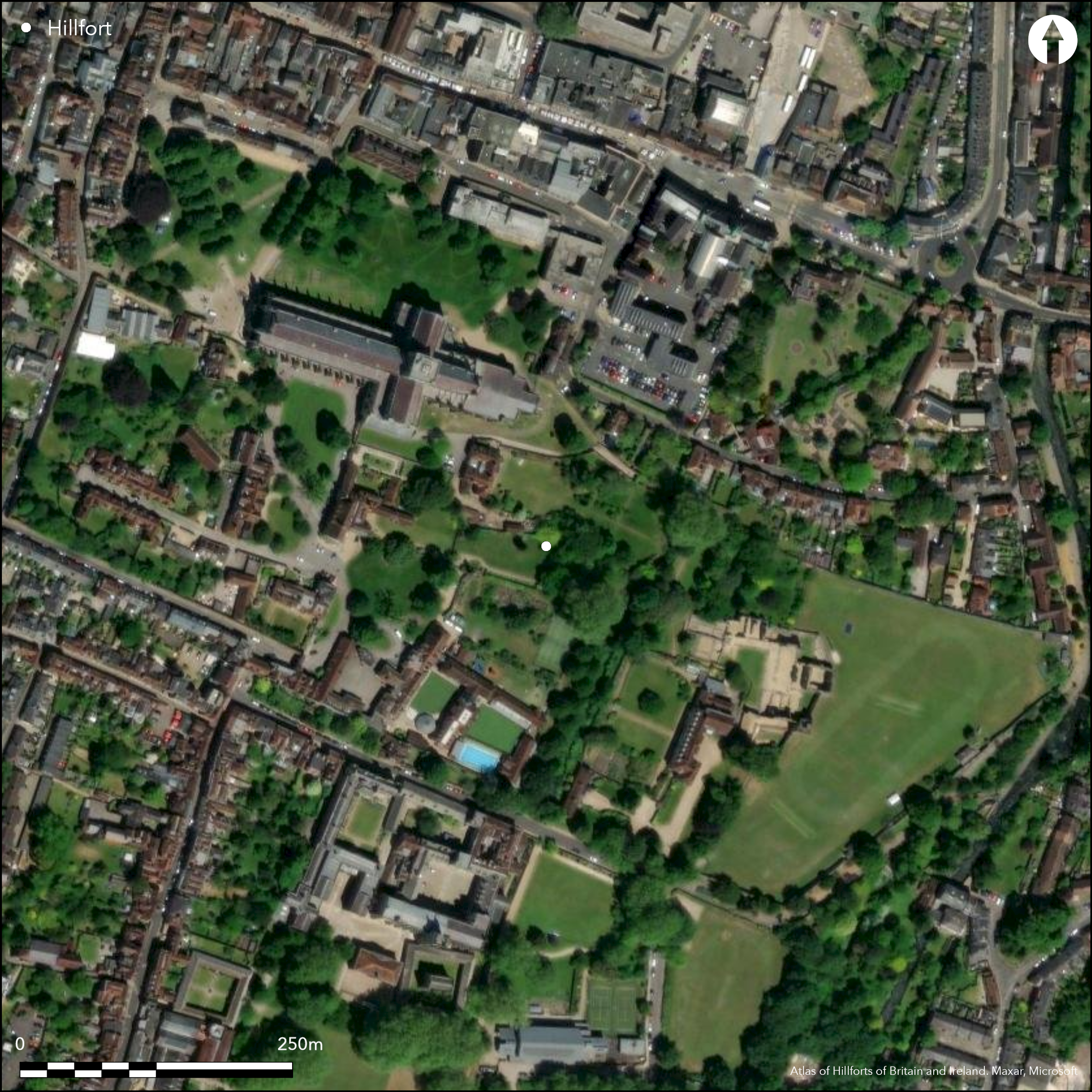
Satellite Imagery
LiDAR 1m DTM Hillshade
Satellite Imagery
Scroll left/right to view further images.
HER: Hampshire 58629 (None)
NMR: SU 4 2 NE 1 (230572)
SM: None
NGR: SU 482 293
X: 448312 Y: 129169 (OSGB36)
Oram’s Arbour in Winchester is an Iron Age hill-slope enclosure that has often been referred to as an oppidum (e.g. Ordnance Survey 1962; Cunliffe 2005:402-3), but as recent work has suggested it lacks the morphological characteristics of an oppidum and is of the wrong date. It is a univallate enclosure of about 20ha defined by the valleys of the Itchen to the east and the now dry stream of the Fulflood to the north; the eastern defences are under the town and have not been located but probably lie at the bottom of the slope along Parchment Street. It seems to have had at least five entrances (Qualmann et al. 2004), though only the one on Oram’s Arbour has been excavated (Biddle 1967), formed by the in-turning of the ditch on the northern side. Nowhere has the rampart survived (pace Cunliffe 2005); the apparent bank on Oram’s Arbour is due to more recent landscaping and in fact masks the ditch which here runs under Clifton Road. The ditch, up to 7-7.5m wide and 4.5m deep, has been sectioned in several places on its southern, western and northern sides (Qualmann et al. 2004). Dating evidence for its construction is limited, but there is pottery of late Middle Iron Age from the primary silting. From the secondary silting on the Trafalgar Street/Castle Yard excavations there are very early Late Iron Age groups of pottery, late 2nd or early 1st centuries BC (Qualmann et al. 2004, Fig. 31; Collis 2014, Fig. 4). Within the enclosure although there is Early Iron Age pottery (Qualmann et al. 2004; Brown 2011a) and possible contemporary round houses (Brown 2011b); these seem to predate the defences. The main period of occupation is latest Middle Iron Age based on pottery with extensive occupation shown by round houses, four and six-post structures and the gulleys of small enclosures mainly excavated on Tower Street (Biddle 1965; Collis 1978), Staple Gardens (Qualmann et al. 2004; Ford and Teague 2011), Jewry Street (Ford and Teague 2011) and St. George’s Street (Collis forthcoming). Except possibly for two round houses on Staple Gardens for which a very early Late Iron Age date has been suggested on the basis of one sherd of pottery (Qualmann et al. 2004:16), there are no finds like the later Late Iron Age material found in the ditch fill which therefore probably derives from activity outside the enclosure. There is evidence of trade with surrounding areas and long distance trade. Industrial activity is limited (Bayley 2004:68). Virtually all the Late Iron Age finds come from the ditch and areas outside the enclosure to the south or to the south east like the fragment of ‘coin-mould’ found on Cathedral Green in a layer with Gallo-Belgic sherds (Morris forthcoming). There is a scatter of Iron Age coins from Winchester but all unstratified or in later contexts, and the relative lack of coins forms a contrast with the plentiful finds from Late Iron Age oppida elsewhere. At the time of the Roman conquest the enclosure itself had been virtually unoccupied for some 150 years, though the location of the entrances had a profound influence on the line of the Roman roads entering the later Roman civitas capital of Venta Belgarum (Qualmann et al. 2004), and from at least Early Roman times the town has controlled this major crossing point across the Itchen valley.
Citizen Science: ✗
Reliability of Data: Confirmed
Reliability of Interpretation: Unconfirmed
X: -146052 Y: 6631874 (EPSG: 3857)
Longitude: -1.3120086389114658 Latitude: 51.05977499817495 (EPSG:4326)
Country: England
Current County or Unitary Authority: Hampshire
Historic County: Hampshire and Isle of Wight
Current Parish/Community/Council/Townland: Winchester
N/A as not a hillfort
| Extant | ✗ |
| Cropmark | ✗ |
| Likely Destroyed | ✗ |
None
| Woodland | ✗ |
| Commercial Forestry Plantation | ✗ |
| Parkland | ✗ |
| Pasture (Grazing) | ✗ |
| Arable | ✗ |
| Scrub/Bracken | ✗ |
| Bare Outcrop | ✗ |
| Heather/Moorland | ✗ |
| Heath | ✗ |
| Built-up | ✗ |
| Coastal Grassland | ✗ |
| Other | ✗ |
N/A as not a hillfort
| Contour Fort | ✗ |
| Partial Contour Fort | ✗ |
| Promontory Fort | ✗ |
| Hillslope Fort | ✗ |
| Level Terrain Fort | ✗ |
| Marsh Fort | ✗ |
| Multiple Enclosure Fort | ✗ |
| Hilltop | ✗ |
| Coastal Promontory | ✗ |
| Inland Promontory | ✗ |
| Valley Bottom | ✗ |
| Knoll/Hillock/Outcrop | ✗ |
| Ridge | ✗ |
| Cliff/Plateau-edge/Scarp | ✗ |
| Hillslope | ✗ |
| Lowland | ✗ |
| Spur | ✗ |
Dominant Topographic Feature: None
| North | ✗ |
| Northeast | ✗ |
| East | ✗ |
| Southeast | ✗ |
| South | ✗ |
| Southwest | ✗ |
| West | ✗ |
| Northwest | ✗ |
| Level | ✗ |
Altitude: Nonem
N/A
N/A as not a hillfort
Reliability: D - None
| Pre 1200BC | ✗ |
| 1200BC - 800BC | ✗ |
| 800BC - 400BC | ✗ |
| 400BC - AD50 | ✗ |
| AD50 - AD400 | ✗ |
| AD400 - AD 800 | ✗ |
| Post AD800 | ✗ |
| Unknown | ✓ |
| Pre Hillfort: | None |
| Post Hillfort: | None |
N/A as not a hillfort
N/A as not a hillfort
None
| None | ✗ |
| Spring | ✗ |
| Stream | ✗ |
| Pool | ✗ |
| Flush | ✗ |
| Well | ✗ |
| Other | ✗ |
None
| No Known Features | ✓ |
| Round Stone Structures | ✗ |
| Rectangular Stone Structures | ✗ |
| Curvilinear Platforms | ✗ |
| Other Roundhouse Evidence | ✗ |
| Pits | ✗ |
| Quarry Hollows | ✗ |
| Other | ✗ |
None
| No Known Excavation | ✓ |
| Pits | ✗ |
| Postholes | ✗ |
| Roundhouses | ✗ |
| Rectangular Structures | ✗ |
| Roads/Tracks | ✗ |
| Quarry Hollows | ✗ |
| Other | ✗ |
| Nothing Found | ✗ |
None
| No Known Geophysics | ✓ |
| Pits | ✗ |
| Roundhouses | ✗ |
| Rectangular Structures | ✗ |
| Roads/Tracks | ✗ |
| Quarry Hollows | ✗ |
| Other | ✗ |
| Nothing Found | ✗ |
None
| No Known Finds | ✓ |
| Pottery | ✗ |
| Metal | ✗ |
| Metalworking | ✗ |
| Human Bones | ✗ |
| Animal Bones | ✗ |
| Lithics | ✗ |
| Environmental | ✗ |
| Other | ✗ |
NO APPARENT FEATURES
| APs Not Checked | ✓ |
| None | ✗ |
| Roundhouses | ✗ |
| Rectangular Structures | ✗ |
| Pits | ✗ |
| Postholes | ✗ |
| Roads/Tracks | ✗ |
| Other | ✗ |
N/A as not a hillfort
| None: | None |
| 2: | None |
Guard Chambers: ✗
Chevaux de Frise: ✗
N/A as not a hillfort
| Area 1: | Noneha. |
| Total: | Noneha. |
Total Footprint Area: Noneha.
None
| ✗ | None |
| ✗ | None |
| NE Quadrant: | None |
| SE Quadrant: | None |
| SW Quadrant: | None |
| NW Quadrant: | None |
| Total: | None |
| Partial Univallate | ✗ |
| Univallate | ✗ |
| Partial Bivallate | ✗ |
| Bivallate | ✗ |
| Partial Multivallate | ✗ |
| Multivallate | ✗ |
| Unknown | ✓ |
| Partial Univallate | ✗ |
| Univallate | ✗ |
| Partial Bivallate | ✗ |
| Bivallate | ✗ |
| Partial Multivallate | ✗ |
| Multivallate | ✗ |
None
| None | ✓ |
| Earthen Bank | ✗ |
| Stone Wall | ✗ |
| Rubble | ✗ |
| Wall-walk | ✗ |
| Evidence of Timber | ✗ |
| Vitrification | ✗ |
| Other Burning | ✗ |
| Palisade | ✗ |
| Counter Scarp Bank | ✗ |
| Berm | ✗ |
| Unfinished | ✗ |
| Other | ✗ |
None
| None | ✓ |
| Earthen Bank | ✗ |
| Stone Wall | ✗ |
| Murus Duplex | ✗ |
| Timber-framed | ✗ |
| Timber-laced | ✗ |
| Vitrification | ✗ |
| Other Burning | ✗ |
| Palisade | ✗ |
| Counter Scarp Bank | ✗ |
| Berm | ✗ |
| Unfinished | ✗ |
| No Known Excavation | ✗ |
| Other | ✗ |
| ✗ | None |
| ✗ | None |
Number of Ditches: None
| ✗ | None |
Bayley, J. 2004. Metalworking residues in Qualmann et al. 2004:68.
Biddle, M. 1965. Excavations at Winchester 1964: third interim report. Antiquaries Journal 45:230–264.
Biddle M. 1967. Excavations at Winchester 1966: fifth interim report. Antiquaries Journal 47:224–250.
Biddle, M. 1975a. Excavations at Winchester 1971: tenth interim report. Antiquaries Journal 55:96–126, 295–337.
Brown, L. 2011a. The prehistoric settlement (Phase 1). In B.M. Ford and S. Teague 2011:37–48.
Brown, L. 2011b. Discussion: the prehistoric settlement. In B.M. Ford and S. Teague 2011:173–179.
Collis, J.R. 1978. Winchester Excavations 1949–1960. Vol. 2: excavations in the suburbs and western parts of the town. Winchester, Winchester City Museum.
Collis, J.R. 2014. Building a new Iron Age chronology. In J. Bullinger, P. Crotti and C. Huegenin (eds.). De l’âge du Fer à l’usage du verre. Mélanges offerts à Gilbert Kaenel, dit «Auguste», à l’occasion de son 66e anniversaire. Cahiers d’archéologie romande 151:133–144.
Collis, J.R. forthcoming. Excavations in Winchester, 1949–1960. Vol. 3: excavations in the High Street and St. George’s Street. Winchester, Winchester City Museum, and J.R. Collis Publications (draft text available in the museum archives).
Cunliffe, B.W. 2005. Iron Age Communities in Britain. Fourth edition. London, Routledge and Kegan Paul.
Ford, B.M. and Teague, S. 2011. Winchester in the Making: excavations between 2002 and 2007 on the sites of Northgate House, Staple Gardens and the former Winchester Library, Jewry Street. Oxford, Oxford Archaeology Monograph no. 12.
Morris, F. forthcoming. The prehistoric pottery. In M. Biddle (ed.) Winchester Studies 3, Pre-Roman and Roman Winchester part 1: Venta Belgarum.
Ordnance Survey 1962. Map of Southern Britain in the Iron Age. Chessington. Ordnance Survey.
Qualmann, K.E., Rees, H., Scobie, G.D. and Whinney, R. 2004. Oram’s Arbour: the Iron Age enclosure at Winchester, Vol. 1: investigations 1950–1999. Winchester, Winchester Museums Service and English Heritage.
Atlas of Hillforts:
Wikidata:
This work is licensed under CC BY-SA 4.0

 and should be cited as:
Lock, Gary and Ralston, Ian. 2024. Atlas of Hillforts of Britain and Ireland. Available at: https://hillforts.arch.ox.ac.uk
Document Version 1.1