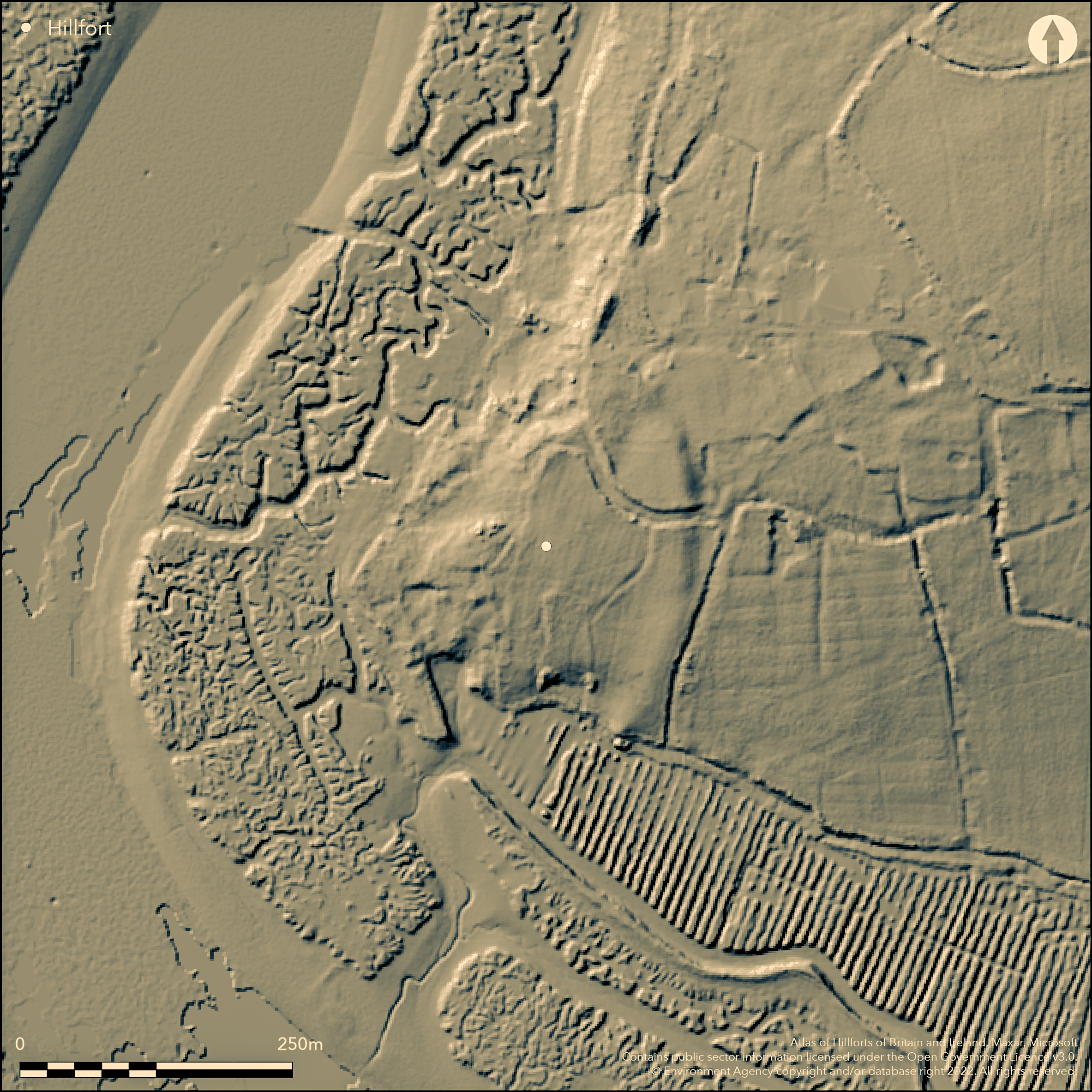
LiDAR 1m DTM Hillshade
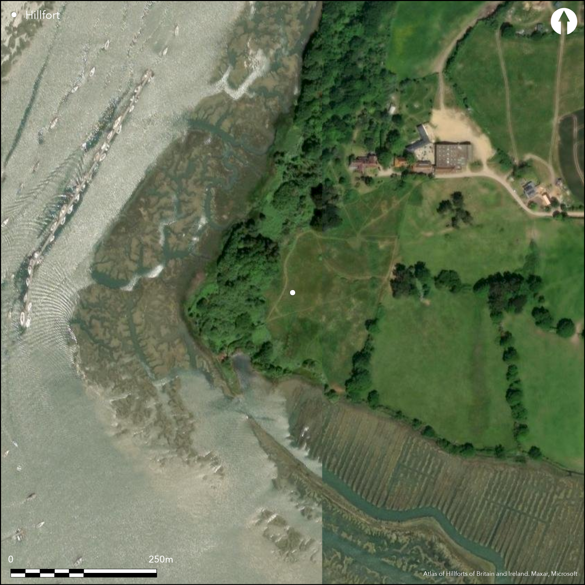
Satellite Imagery
LiDAR 1m DTM Hillshade
Satellite Imagery
Scroll left/right to view further images.
HER: Hampshire 21974 (None)
NMR: SZ 49 NW 3 (460661)
SM: None
NGR: SZ41929872
X: 441920 Y: 98720 (OSGB36)
Inland promontory fort located on SW-facing promontory above River Beaulieu running W to SE, where river meets The Solent to SE. At less than 15m O.D. sub-trangular shape with area not defined. Well-preserved curving rampart cutting off the promontory NE-SE was outlined by Grimes in 1939, but now much denuded. Surveys by University of Southampton 1995 and RCHME (Donachie) 1996. Latter found traces of bank and poorly preserved outer ditch to 7m wide and to 0.2m deep. Possible entrance showing as 7m breach in bank on NE. Traces of ridge and furrow in interior to S of an embanked track. Also remains of post-medieval field boundary nd possible site of two buildings. Affected by field boundaries. On 1759 map and then 1:25,000 OS map (1961). Undated.
Citizen Science: ✓
Reliability of Data: Confirmed
Reliability of Interpretation: Confirmed
X: -156594 Y: 6583611 (EPSG: 3857)
Longitude: -1.4067060582481676 Latitude: 50.786477119117 (EPSG:4326)
Country: England; None
Current County or Unitary Authority: Hampshire
Historic County: Hampshire and Isle of Wight
Current Parish/Community/Council/Townland: Exbury and Lepe; Beaulieu
Well-preserved bank outlined by Grimes in 1939, now much denuded. Affected by field boundaries.
| Extant | ✓ |
| Cropmark | ✗ |
| Likely Destroyed | ✗ |
Pasture interior. Wooded slopes to river on W
| Woodland | ✗ |
| Commercial Forestry Plantation | ✗ |
| Parkland | ✗ |
| Pasture (Grazing) | ✓ |
| Arable | ✗ |
| Scrub/Bracken | ✓ |
| Bare Outcrop | ✗ |
| Heather/Moorland | ✗ |
| Heath | ✗ |
| Built-up | ✗ |
| Coastal Grassland | ✗ |
| Other | ✗ |
Inland promontory fort located on SW-facing promontory above River Beaulieu running W to SE, where river meets The Solent to SE.
| Contour Fort | ✗ |
| Partial Contour Fort | ✗ |
| Promontory Fort | ✓ |
| Hillslope Fort | ✗ |
| Level Terrain Fort | ✗ |
| Marsh Fort | ✗ |
| Multiple Enclosure Fort | ✗ |
| Hilltop | ✗ |
| Coastal Promontory | ✗ |
| Inland Promontory | ✓ |
| Valley Bottom | ✗ |
| Knoll/Hillock/Outcrop | ✗ |
| Ridge | ✗ |
| Cliff/Plateau-edge/Scarp | ✗ |
| Hillslope | ✗ |
| Lowland | ✗ |
| Spur | ✗ |
Dominant Topographic Feature: Promontory.
| North | ✗ |
| Northeast | ✗ |
| East | ✗ |
| Southeast | ✗ |
| South | ✗ |
| Southwest | ✓ |
| West | ✗ |
| Northwest | ✗ |
| Level | ✗ |
Altitude: 5.0m
Boundary Type: Parish/Townland
None.
Reliability: D - None
| Pre 1200BC | ✗ |
| 1200BC - 800BC | ✗ |
| 800BC - 400BC | ✗ |
| 400BC - AD50 | ✗ |
| AD50 - AD400 | ✗ |
| AD400 - AD 800 | ✗ |
| Post AD800 | ✗ |
| Unknown | ✓ |
| Pre Hillfort: | None |
| Post Hillfort: | Traces of ridge and furrow in interior to S of an embanked track. Also remains of post-medieval field boundary and possible site of two buildings. |
On 1759 Taylor map. Geophysical and topographical survey University of Southampton 1995. Measured Survey New Forest Project RCHME 1996. 2011 New Forest National Park Authority lidar image.
| 1st Identified Map Depiction (1798): | None |
| Geophysical Survey (1995): | Resistivity and magnetometer surveys University of Southampton. |
| Earthwork Survey (1995): | University of Southampton. |
| Other (1996): | Measured survey RCHME. |
| LiDAR Survey (2011): | None |
Unspecified undulations in interior.
None
| None | ✗ |
| Spring | ✓ |
| Stream | ✗ |
| Pool | ✗ |
| Flush | ✗ |
| Well | ✗ |
| Other | ✗ |
Unspecified undulations in interior.
| No Known Features | ✗ |
| Round Stone Structures | ✗ |
| Rectangular Stone Structures | ✗ |
| Curvilinear Platforms | ✗ |
| Other Roundhouse Evidence | ✗ |
| Pits | ✗ |
| Quarry Hollows | ✗ |
| Other | ✓ |
None
| No Known Excavation | ✓ |
| Pits | ✗ |
| Postholes | ✗ |
| Roundhouses | ✗ |
| Rectangular Structures | ✗ |
| Roads/Tracks | ✗ |
| Quarry Hollows | ✗ |
| Other | ✗ |
| Nothing Found | ✗ |
None
| No Known Geophysics | ✗ |
| Pits | ✗ |
| Roundhouses | ✗ |
| Rectangular Structures | ✗ |
| Roads/Tracks | ✗ |
| Quarry Hollows | ✗ |
| Other | ✗ |
| Nothing Found | ✓ |
None
| No Known Finds | ✓ |
| Pottery | ✗ |
| Metal | ✗ |
| Metalworking | ✗ |
| Human Bones | ✗ |
| Animal Bones | ✗ |
| Lithics | ✗ |
| Environmental | ✗ |
| Other | ✗ |
None
| APs Not Checked | ✓ |
| None | ✗ |
| Roundhouses | ✗ |
| Rectangular Structures | ✗ |
| Pits | ✗ |
| Postholes | ✗ |
| Roads/Tracks | ✗ |
| Other | ✗ |
Possible entrance showing as 7m breach in bank on NE, two further gaps to N and SE may be entrances but not clear.
| 3: | None |
| 2: | None |
Guard Chambers: ✗
Chevaux de Frise: ✗
| 1. Simple Gap (North east): | Possible. |
Well-preserved curving rampart cutting off the promontory NE-SE was outlined by Grimes in 1939, but now much denuded. Surveys by University of Southampton 1995 and RCHME 1996. Latter found traces of bank and poorly preserved outer ditch to 7m wide and to 0.2m deep.
| Area 1: | 2.2ha. |
| Total: | 2.2ha. |
Total Footprint Area: Noneha.
None
| ✗ | Area not defined. |
| ✗ | None |
| NE Quadrant: | 1 |
| SE Quadrant: | 1 |
| SW Quadrant: | 0 |
| NW Quadrant: | 0 |
| Total: | 1 |
| Partial Univallate | ✓ |
| Univallate | ✗ |
| Partial Bivallate | ✗ |
| Bivallate | ✗ |
| Partial Multivallate | ✗ |
| Multivallate | ✗ |
| Unknown | ✗ |
| Partial Univallate | ✗ |
| Univallate | ✗ |
| Partial Bivallate | ✗ |
| Bivallate | ✗ |
| Partial Multivallate | ✗ |
| Multivallate | ✗ |
None
| None | ✗ |
| Earthen Bank | ✓ |
| Stone Wall | ✗ |
| Rubble | ✗ |
| Wall-walk | ✗ |
| Evidence of Timber | ✗ |
| Vitrification | ✗ |
| Other Burning | ✗ |
| Palisade | ✗ |
| Counter Scarp Bank | ✗ |
| Berm | ✗ |
| Unfinished | ✗ |
| Other | ✗ |
None
| None | ✗ |
| Earthen Bank | ✗ |
| Stone Wall | ✗ |
| Murus Duplex | ✗ |
| Timber-framed | ✗ |
| Timber-laced | ✗ |
| Vitrification | ✗ |
| Other Burning | ✗ |
| Palisade | ✗ |
| Counter Scarp Bank | ✗ |
| Berm | ✗ |
| Unfinished | ✗ |
| No Known Excavation | ✓ |
| Other | ✗ |
| ✗ | None |
| ✓ | Traces of outer ditch. |
Number of Ditches: 1
| ✗ | None |
Donachie, J.D. 1996. RCHME: Lower Exbury Farm Field Report, RCHME.
Hampshire County Council 1995, 1996. Note, Archaeology in Hampshire, annual report Hampshire County Council.
Read, C. 2016. New Forest hillforts and smaller Iron Age enclosures, New Forest History and Archaeology Group, Report No 8, 28-39.
Smith, N. 1999. The earthwork remains of enclosure in the New Forest, Proc Hampshire Fld Club Archaeol Soc, Hampshire Stud, 54, 8.
Sumner, H. 1917. Ancient earthworks in the New Forest, 119.
Atlas of Hillforts:
Wikidata:
This work is licensed under CC BY-SA 4.0

 and should be cited as:
Lock, Gary and Ralston, Ian. 2024. Atlas of Hillforts of Britain and Ireland. Available at: https://hillforts.arch.ox.ac.uk
Document Version 1.1