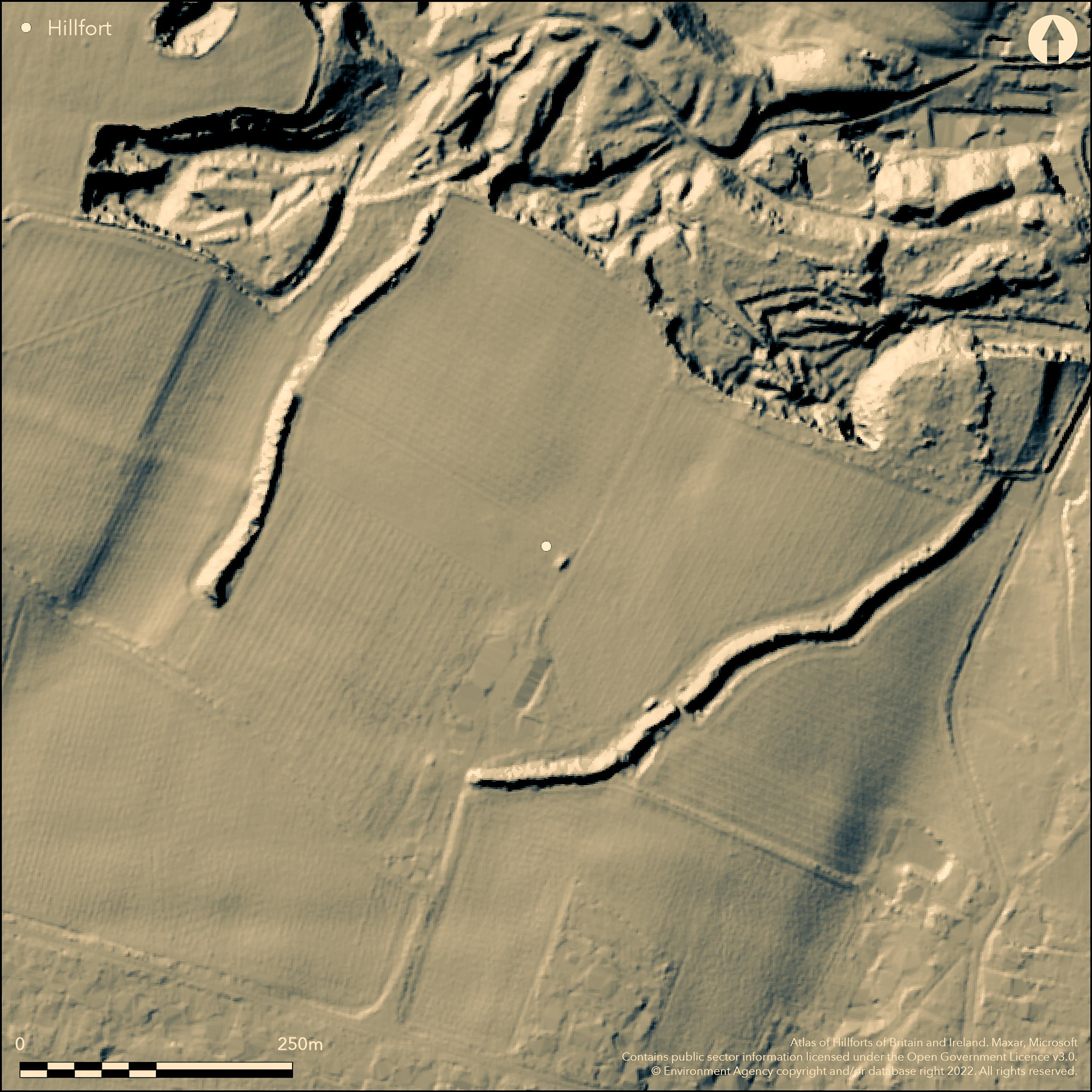
LiDAR 1m DTM Hillshade
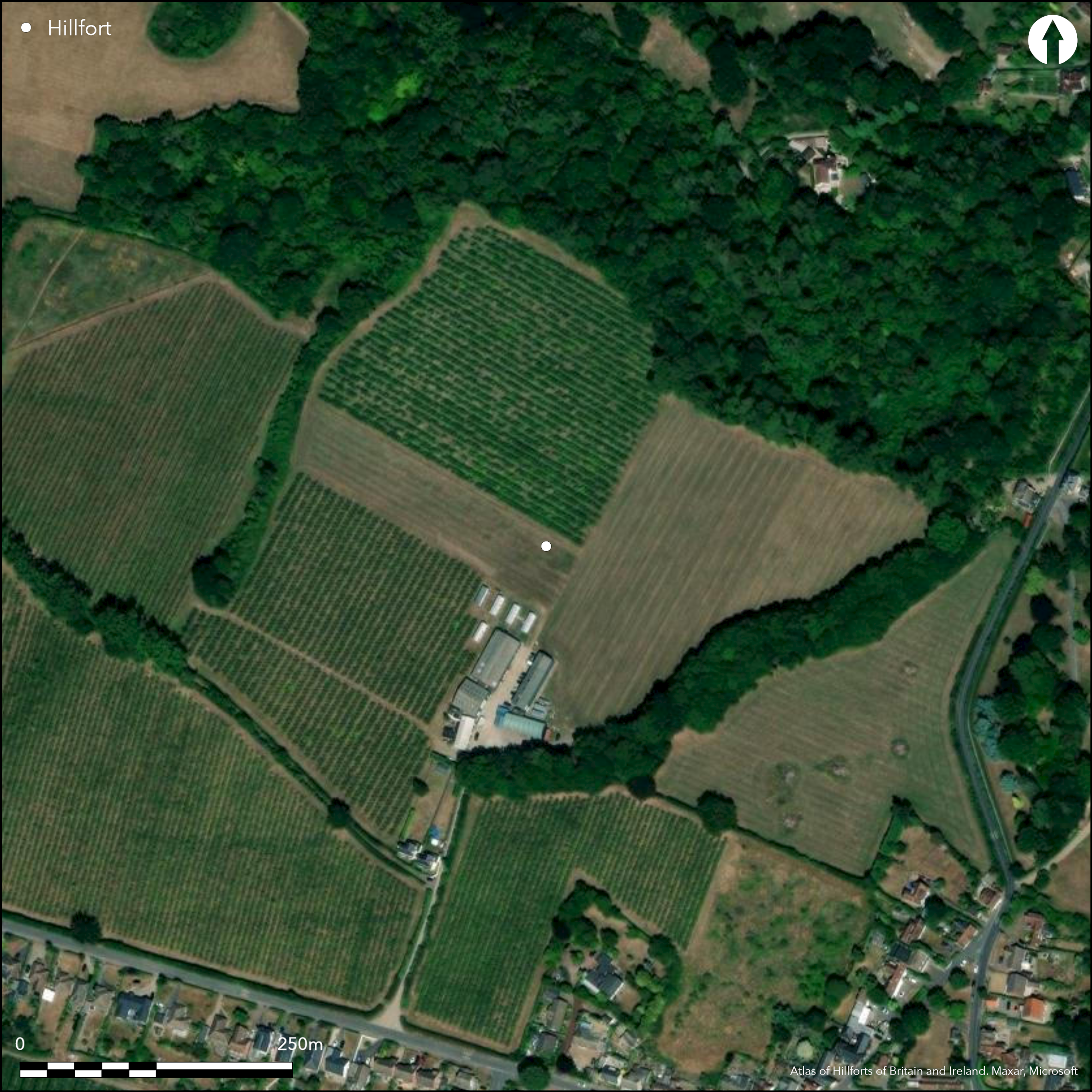
Satellite Imagery
LiDAR 1m DTM Hillshade
Satellite Imagery
Scroll left/right to view further images.
HER: Kent MKE2124 (None)
NMR: TQ 75 SE 4 (415631)
SM: 1005139
NGR: TQ 7656 5158
X: 576560 Y: 151580 (OSGB36)
A possible major Iron Age oppidum (Cunliffe and Rowley 1976) straddling the parishes of Loose and Boughton Monchelsea. Located on a low spur on the S bank of the Loose Valley it is protected by the valley on the western side, enclosing c. 12ha. The site lies within a dense concentration of finds dating to the 1st century BC, including some Roman imports. It is believed to have been constructed around AD 40 shortly before the Roman invasion. First mentioned in a guidebook in 1839, with a plan that showed the earthworks in the S and N had been lost by that time (Kelly 1972). Possibly originally U-shaped in plan and estimated at 12ha, it survives as a 360m length of rampart on the SE, with short sections of outer ditch still extant. The NW rampart is approximately 280m long. The defences in the S were plough-levelled in the 19th century and destroyed by quarrying in the N. A possible entrance lies in the SW corner. Excavated by the Kent Archaeological Society, initially under the direction of Piercy Fox in 1963 and subsequently by Kelly (Kelly 1972). Resistance survey in 1966 located the position of the levelled banks in the S, which were later confirmed by excavation. Excavation showed that In common with Wheathampstead (Atlas No 1831), Prae Wood (Atlas No. 1830), and other oppida, the ditches are wide, at between 7.9m and 11.2m but comparatively shallow at between 2m-2.7m deep. The banks are of single-phase dump construction (Kelly 1972). Extensive linear earthworks in the N, E and S, plotted by the OS, are considered to be part of the same complex. The largest section of bank and ditch lies 0.8km to the S of Quarry Wood Camp running E-W for 4.4km. A short section of massive bank and ditch survives in the E running N-S for approximately 1.6km. Finds from the outer earthworks show they are of the same period as the camp. Recorded on 1885, 1:2,500 OS mapping. Included here as an oppidum.
Citizen Science: ✗
Reliability of Data: Confirmed
Reliability of Interpretation: Unconfirmed
X: 58754 Y: 6663150 (EPSG: 3857)
Longitude: 0.5277957038907973 Latitude: 51.23602289088062 (EPSG:4326)
Country: England
Current County or Unitary Authority: Kent
Historic County: Kent
Current Parish/Community/Council/Townland: Boughton Monchelsea
N/A - not a hillfort
| Extant | ✗ |
| Cropmark | ✗ |
| Likely Destroyed | ✗ |
None
| Woodland | ✗ |
| Commercial Forestry Plantation | ✗ |
| Parkland | ✗ |
| Pasture (Grazing) | ✗ |
| Arable | ✗ |
| Scrub/Bracken | ✗ |
| Bare Outcrop | ✗ |
| Heather/Moorland | ✗ |
| Heath | ✗ |
| Built-up | ✗ |
| Coastal Grassland | ✗ |
| Other | ✗ |
N/A - not a hillfort
| Contour Fort | ✗ |
| Partial Contour Fort | ✗ |
| Promontory Fort | ✗ |
| Hillslope Fort | ✗ |
| Level Terrain Fort | ✗ |
| Marsh Fort | ✗ |
| Multiple Enclosure Fort | ✗ |
| Hilltop | ✗ |
| Coastal Promontory | ✗ |
| Inland Promontory | ✗ |
| Valley Bottom | ✗ |
| Knoll/Hillock/Outcrop | ✗ |
| Ridge | ✗ |
| Cliff/Plateau-edge/Scarp | ✗ |
| Hillslope | ✗ |
| Lowland | ✗ |
| Spur | ✗ |
Dominant Topographic Feature: None
| North | ✗ |
| Northeast | ✗ |
| East | ✗ |
| Southeast | ✗ |
| South | ✗ |
| Southwest | ✗ |
| West | ✗ |
| Northwest | ✗ |
| Level | ✗ |
Altitude: Nonem
N/A
N/A - not a hillfort
Reliability: None
| Pre 1200BC | ✗ |
| 1200BC - 800BC | ✗ |
| 800BC - 400BC | ✗ |
| 400BC - AD50 | ✗ |
| AD50 - AD400 | ✗ |
| AD400 - AD 800 | ✗ |
| Post AD800 | ✗ |
| Unknown | ✓ |
| Pre Hillfort: | None |
| Post Hillfort: | None |
N/A - not a hillfort
N/A - not a hillfort
None
| None | ✗ |
| Spring | ✗ |
| Stream | ✗ |
| Pool | ✗ |
| Flush | ✗ |
| Well | ✗ |
| Other | ✗ |
None
| No Known Features | ✓ |
| Round Stone Structures | ✗ |
| Rectangular Stone Structures | ✗ |
| Curvilinear Platforms | ✗ |
| Other Roundhouse Evidence | ✗ |
| Pits | ✗ |
| Quarry Hollows | ✗ |
| Other | ✗ |
None
| No Known Excavation | ✓ |
| Pits | ✗ |
| Postholes | ✗ |
| Roundhouses | ✗ |
| Rectangular Structures | ✗ |
| Roads/Tracks | ✗ |
| Quarry Hollows | ✗ |
| Other | ✗ |
| Nothing Found | ✗ |
None
| No Known Geophysics | ✓ |
| Pits | ✗ |
| Roundhouses | ✗ |
| Rectangular Structures | ✗ |
| Roads/Tracks | ✗ |
| Quarry Hollows | ✗ |
| Other | ✗ |
| Nothing Found | ✗ |
None
| No Known Finds | ✓ |
| Pottery | ✗ |
| Metal | ✗ |
| Metalworking | ✗ |
| Human Bones | ✗ |
| Animal Bones | ✗ |
| Lithics | ✗ |
| Environmental | ✗ |
| Other | ✗ |
NO APPARENT FEATURES
| APs Not Checked | ✓ |
| None | ✗ |
| Roundhouses | ✗ |
| Rectangular Structures | ✗ |
| Pits | ✗ |
| Postholes | ✗ |
| Roads/Tracks | ✗ |
| Other | ✗ |
N/A - not a hillfort
| None: | None |
| 2: | None |
Guard Chambers: ✗
Chevaux de Frise: ✗
N/A - not a hillfort
| Area 1: | Noneha. |
| Total: | Noneha. |
Total Footprint Area: Noneha.
None
| ✗ | None |
| ✗ | None |
| NE Quadrant: | None |
| SE Quadrant: | None |
| SW Quadrant: | None |
| NW Quadrant: | None |
| Total: | None |
| Partial Univallate | ✗ |
| Univallate | ✗ |
| Partial Bivallate | ✗ |
| Bivallate | ✗ |
| Partial Multivallate | ✗ |
| Multivallate | ✗ |
| Unknown | ✓ |
| Partial Univallate | ✗ |
| Univallate | ✗ |
| Partial Bivallate | ✗ |
| Bivallate | ✗ |
| Partial Multivallate | ✗ |
| Multivallate | ✗ |
None
| None | ✓ |
| Earthen Bank | ✗ |
| Stone Wall | ✗ |
| Rubble | ✗ |
| Wall-walk | ✗ |
| Evidence of Timber | ✗ |
| Vitrification | ✗ |
| Other Burning | ✗ |
| Palisade | ✗ |
| Counter Scarp Bank | ✗ |
| Berm | ✗ |
| Unfinished | ✗ |
| Other | ✗ |
None
| None | ✓ |
| Earthen Bank | ✗ |
| Stone Wall | ✗ |
| Murus Duplex | ✗ |
| Timber-framed | ✗ |
| Timber-laced | ✗ |
| Vitrification | ✗ |
| Other Burning | ✗ |
| Palisade | ✗ |
| Counter Scarp Bank | ✗ |
| Berm | ✗ |
| Unfinished | ✗ |
| No Known Excavation | ✗ |
| Other | ✗ |
| ✗ | None |
| ✗ | None |
Number of Ditches: None
| ✗ | None |
Cunliffe, B. and Rowley, T. (eds.) 1976. Oppida, the Beginnings of Urbanisation in Barbarian Europe: Papers Presented to a Conference at Oxford, October 1975. British Archaeological Reports. Oxford: Archaeopress. 11, 155, 235, 318, 332-4
Kelly, D. B. 1972. Quarry Wood Camp, Loose: a Belgic oppidum. Archaeol Cantiana, 86, 55-84
Atlas of Hillforts:
Wikidata:
This work is licensed under CC BY-SA 4.0

 and should be cited as:
Lock, Gary and Ralston, Ian. 2024. Atlas of Hillforts of Britain and Ireland. Available at: https://hillforts.arch.ox.ac.uk
Document Version 1.1