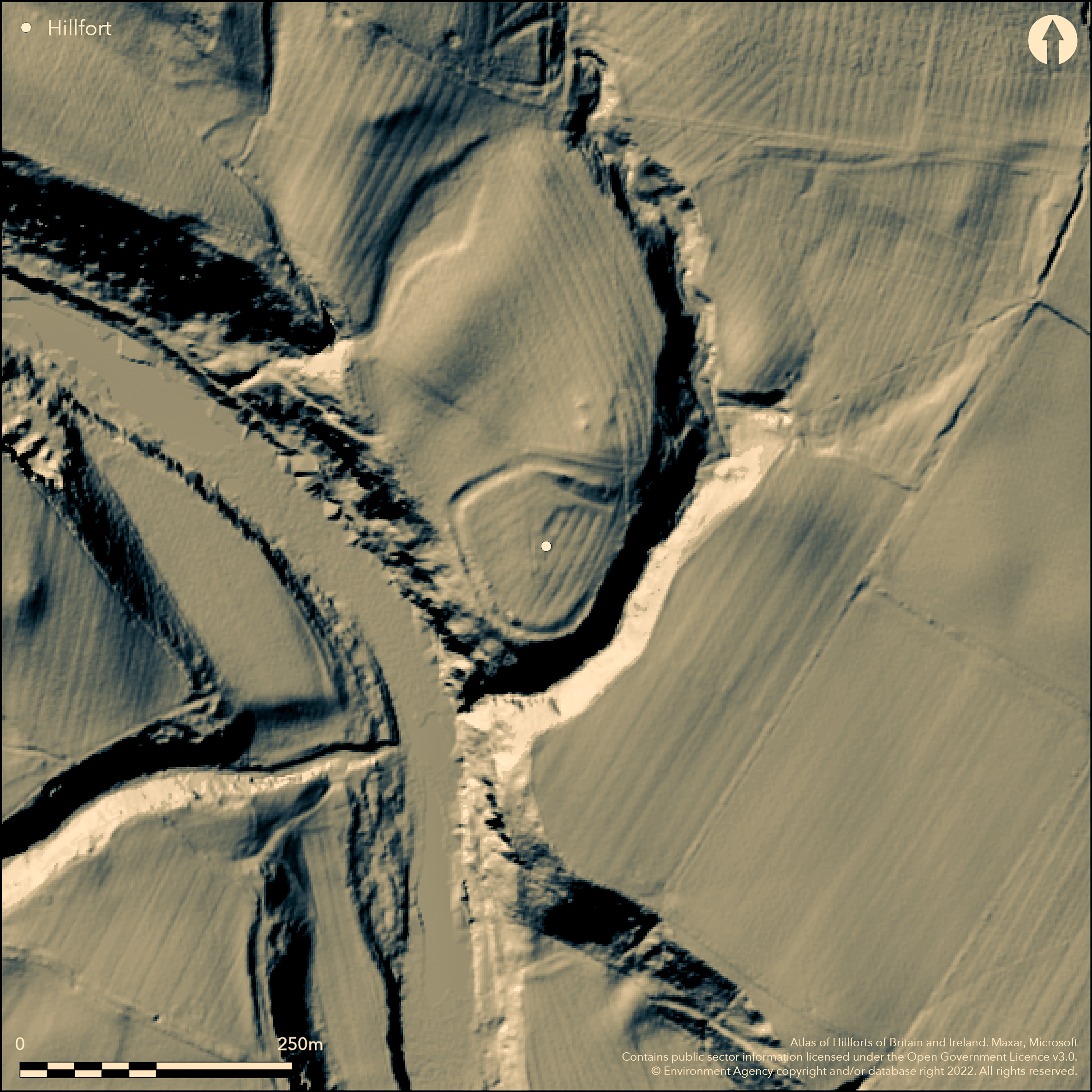
LiDAR 1m DTM Hillshade
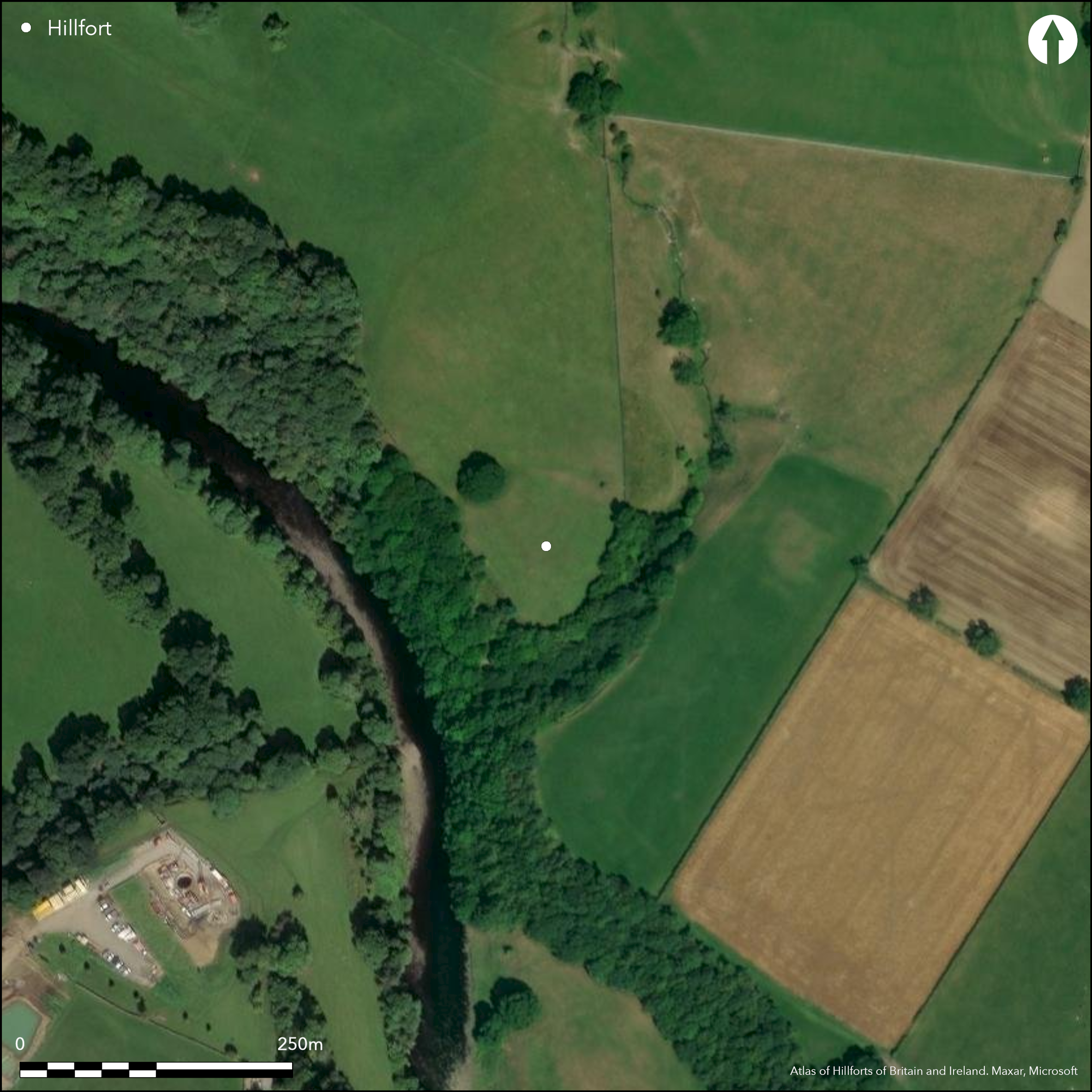
Satellite Imagery
LiDAR 1m DTM Hillshade
Satellite Imagery
Scroll left/right to view further images.
HER: County Durham 2383259, 2302284 (None)
NMR: NZ 01 NW 1 (19872)
SM: 1021113
NGR: NZ 02462 19510
X: 402462 Y: 519510 (OSGB36)
Lying 500m to the NW of West Holme House, a probable hillfort surviving as a partially destroyed earthwork which occupies a steep-sided promontory on the N bank of the river Tees at 178m OD. It comprises two banks up to 7m wide and 0.3m high with a medial ditch, except in the E. The ditch measures 9m wide and 0.8m deep where it cuts across the promontory but narrowing to 5m wide where it follows the edge of the promontory, forming an almost circular enclosure measuring 85m N-S by 80m transversely enclosing approximately 0.8ha. A probable entrance placed centrally in the ditch provides access from the N. Within the enclosure the remains of a rectangular building 16m long and 8m wide, visible as a slight depression, probably represents later occupation of the site. Ridge and furrow ploughing is contained within the interior. The site is scheduled as a prehistoric defended settlement. No further investigation has been carried out. Undated.
Citizen Science: ✗
Reliability of Data: Confirmed
Reliability of Interpretation: Confirmed
X: -218568 Y: 7279012 (EPSG: 3857)
Longitude: -1.9634309260890561 Latitude: 54.57081844514948 (EPSG:4326)
Country: England; None
Current County or Unitary Authority: County Durham
Historic County: County Durham
Current Parish/Community/Council/Townland: Marwood; Cotherstone
Partially destroyed
| Extant | ✓ |
| Cropmark | ✗ |
| Likely Destroyed | ✓ |
None
| Woodland | ✗ |
| Commercial Forestry Plantation | ✗ |
| Parkland | ✗ |
| Pasture (Grazing) | ✓ |
| Arable | ✗ |
| Scrub/Bracken | ✗ |
| Bare Outcrop | ✗ |
| Heather/Moorland | ✗ |
| Heath | ✗ |
| Built-up | ✗ |
| Coastal Grassland | ✗ |
| Other | ✗ |
A promontory fort occupying a steep-sided spur at approximately 179m OD, on the N bank of the Tees
| Contour Fort | ✗ |
| Partial Contour Fort | ✗ |
| Promontory Fort | ✓ |
| Hillslope Fort | ✗ |
| Level Terrain Fort | ✗ |
| Marsh Fort | ✗ |
| Multiple Enclosure Fort | ✗ |
| Hilltop | ✓ |
| Coastal Promontory | ✗ |
| Inland Promontory | ✓ |
| Valley Bottom | ✗ |
| Knoll/Hillock/Outcrop | ✗ |
| Ridge | ✗ |
| Cliff/Plateau-edge/Scarp | ✗ |
| Hillslope | ✗ |
| Lowland | ✗ |
| Spur | ✓ |
Dominant Topographic Feature: Spur
| North | ✗ |
| Northeast | ✗ |
| East | ✗ |
| Southeast | ✗ |
| South | ✓ |
| Southwest | ✗ |
| West | ✓ |
| Northwest | ✗ |
| Level | ✗ |
Altitude: 179.0m
The parish boundary between Marwood and Cotherstone lies to the SW
Boundary Type: None
The site is undated
Reliability: D - None
| Pre 1200BC | ✗ |
| 1200BC - 800BC | ✗ |
| 800BC - 400BC | ✗ |
| 400BC - AD50 | ✗ |
| AD50 - AD400 | ✗ |
| AD400 - AD 800 | ✗ |
| Post AD800 | ✗ |
| Unknown | ✓ |
| Pre Hillfort: | None |
| Post Hillfort: | Remains of a rectangular building, visible as a slight depression, probably later occupation of the site. Ridge and furrow ploughing |
Recorded on an aerial photograph in 1946. Field investigation in 1972. General reference in Challis and Harding (1975). Scheduled
| Other (1946): | Recorded on ap. |
| Other (1972): | Field investigation |
| 1st Identified Written Reference (1975): | None |
| Other (2003): | Scheduled |
No internal features are recorded
The River Tees runs to the SW. Springs are recorded in the W
| None | ✓ |
| Spring | ✗ |
| Stream | ✗ |
| Pool | ✗ |
| Flush | ✗ |
| Well | ✗ |
| Other | ✗ |
Remains of a rectangular building 16m long and 8m wide are visible as a slight depression
| No Known Features | ✗ |
| Round Stone Structures | ✗ |
| Rectangular Stone Structures | ✗ |
| Curvilinear Platforms | ✗ |
| Other Roundhouse Evidence | ✗ |
| Pits | ✗ |
| Quarry Hollows | ✗ |
| Other | ✓ |
None
| No Known Excavation | ✓ |
| Pits | ✗ |
| Postholes | ✗ |
| Roundhouses | ✗ |
| Rectangular Structures | ✗ |
| Roads/Tracks | ✗ |
| Quarry Hollows | ✗ |
| Other | ✗ |
| Nothing Found | ✗ |
None
| No Known Geophysics | ✓ |
| Pits | ✗ |
| Roundhouses | ✗ |
| Rectangular Structures | ✗ |
| Roads/Tracks | ✗ |
| Quarry Hollows | ✗ |
| Other | ✗ |
| Nothing Found | ✗ |
None
| No Known Finds | ✓ |
| Pottery | ✗ |
| Metal | ✗ |
| Metalworking | ✗ |
| Human Bones | ✗ |
| Animal Bones | ✗ |
| Lithics | ✗ |
| Environmental | ✗ |
| Other | ✗ |
None
| APs Not Checked | ✗ |
| None | ✓ |
| Roundhouses | ✗ |
| Rectangular Structures | ✗ |
| Pits | ✗ |
| Postholes | ✗ |
| Roads/Tracks | ✗ |
| Other | ✗ |
A probable entrance, identified as a causeway lying centrally across the ditch, provides access from the N
| 1: | None |
| 2: | None |
Guard Chambers: ✗
Chevaux de Frise: ✗
| 1. Simple Gap (North): | None |
Comprising two banks up to 7m wide and 0.3m high with a medial ditch, except in the E. The ditch measures 9m wide and 0.8m deep where it cuts across the promontory but narrowing to 5m wide where it follows the edge of the promontory, forming an almost circular enclosure measuring 85m N-S by 80m transversely enclosing approximately 0.8ha
| Area 1: | 0.8ha. |
| Total: | 0.8ha. |
Total Footprint Area: Noneha.
None
| ✗ | None |
| ✗ | Second bank possibly a counterscarp |
| NE Quadrant: | None |
| SE Quadrant: | None |
| SW Quadrant: | 2 |
| NW Quadrant: | 2 |
| Total: | 2 |
| Partial Univallate | ✗ |
| Univallate | ✗ |
| Partial Bivallate | ✓ |
| Bivallate | ✗ |
| Partial Multivallate | ✗ |
| Multivallate | ✗ |
| Unknown | ✗ |
| Partial Univallate | ✗ |
| Univallate | ✗ |
| Partial Bivallate | ✗ |
| Bivallate | ✗ |
| Partial Multivallate | ✗ |
| Multivallate | ✗ |
None
| None | ✗ |
| Earthen Bank | ✓ |
| Stone Wall | ✗ |
| Rubble | ✗ |
| Wall-walk | ✗ |
| Evidence of Timber | ✗ |
| Vitrification | ✗ |
| Other Burning | ✗ |
| Palisade | ✗ |
| Counter Scarp Bank | ✗ |
| Berm | ✗ |
| Unfinished | ✗ |
| Other | ✗ |
None
| None | ✗ |
| Earthen Bank | ✗ |
| Stone Wall | ✗ |
| Murus Duplex | ✗ |
| Timber-framed | ✗ |
| Timber-laced | ✗ |
| Vitrification | ✗ |
| Other Burning | ✗ |
| Palisade | ✗ |
| Counter Scarp Bank | ✗ |
| Berm | ✗ |
| Unfinished | ✗ |
| No Known Excavation | ✓ |
| Other | ✗ |
| ✗ | None |
| ✓ | None |
Number of Ditches: 1
| ✗ | None |
Challis, A.J. and Harding, D.W., 1975. Later prehistory from the Trent to the Tyne. BAR British Series 1 (1974) - 20 (i-ii), 51
Clack, P. 1980. Archaeology of the Durham Dales (46), 46
Atlas of Hillforts:
Wikidata:
This work is licensed under CC BY-SA 4.0

 and should be cited as:
Lock, Gary and Ralston, Ian. 2024. Atlas of Hillforts of Britain and Ireland. Available at: https://hillforts.arch.ox.ac.uk
Document Version 1.1