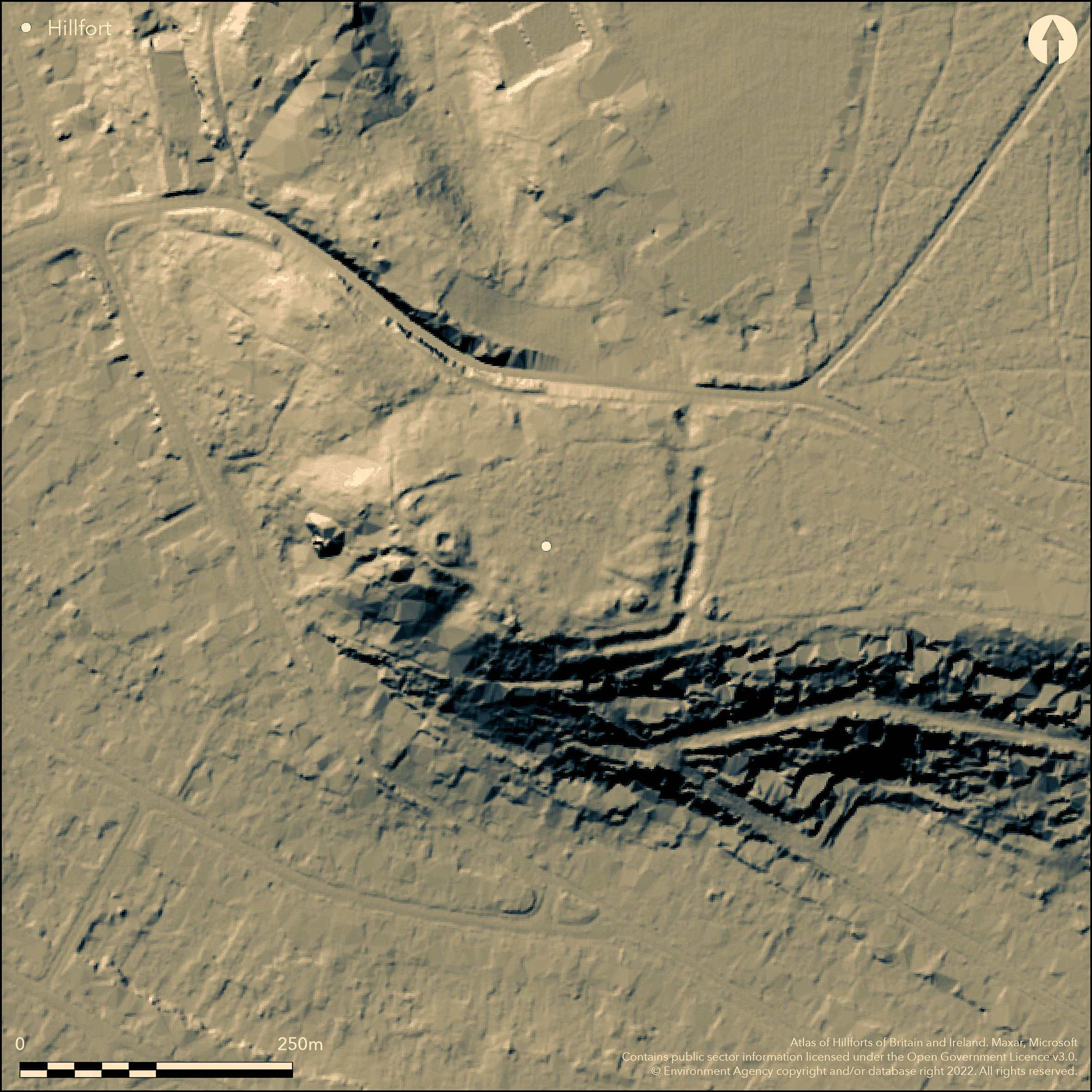
LiDAR 1m DTM Hillshade
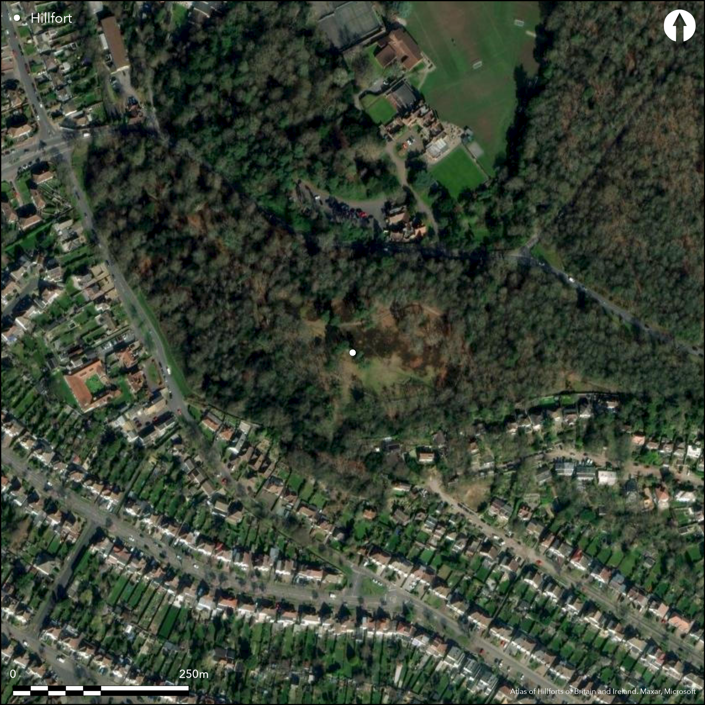
Satellite Imagery
LiDAR 1m DTM Hillshade
Satellite Imagery
Scroll left/right to view further images.
HER: Greater London MLO17289 (None)
NMR: TQ 36 NE 1 (403989)
SM: None
NGR: TQ 3985 6522
X: 539851 Y: 165222 (OSGB36)
On West Wickham Common, Bromley, a possible unfinished univallate hillfort. It lies on a steep sided, wooded promontory at 96m OD. Assumed to have been sub-rectangular in plan, it measures 180m E-W by 130m transversely covering an area of approximately 2ha. It comprises segments of bank and an external ditch in the S and E but it is uncertain if any existed in the N and W. The ditch, V-shaped in section measuring 225m in length (Hogg et al. 1941, 33), cuts into the natural slope and runs along the escarpment, merging with the natural scarp in the W. It is best preserved in the E reaching a maximum depth of 1.8m and 0.8 in the S where it is augmented by the natural scarp. Two causeways, possibly entrances have been identified across the ditch. The site was first mentioned in Camden's Britannia in 1608 where it was considered to have been constructed as a practice earthwork by the landowner Sir Christopher Heydon (Hogg 1981). It was later recorded on a plan by Petrie (1880). Described in VCH (1908) as a possible unfinished Iron Age enclosure or Elizabethan redoubt, it was once again interpreted as a causewayed enclosure (Hogg et al. 1941; Hogg 1981), although a small excavation produced only a few flint flakes and some charcoal. Surveyed by RCHME in 1995, where the interpretation of an unfinished hillfort is favoured, and again in 2010-11 by Wessex Archaeology as part of a Conservation Heritage Plan for West Wickham Common. A mound of unknown purpose, possibly a rabbit warren (HER ref MLO46591), lies on the bank, with a further destroyed mound within. Gravel workings cut into the defences in the S. The site is recorded on 1892-1905 OS mapping.
Citizen Science: ✗
Reliability of Data: Confirmed
Reliability of Interpretation: Unconfirmed
X: 855 Y: 6686789 (EPSG: 3857)
Longitude: 0.007678504401245725 Latitude: 51.368788950974576 (EPSG:4326)
Country: England; None
Current County or Unitary Authority: Greater London Authority
Historic County: Kent
Current Parish/Community/Council/Townland: None
Possibly destroyed or unfinished
| Extant | ✓ |
| Cropmark | ✗ |
| Likely Destroyed | ✓ |
Now a public open space, woodland encroaches on the defences with former wood pasture and parkland within the interior
| Woodland | ✓ |
| Commercial Forestry Plantation | ✗ |
| Parkland | ✗ |
| Pasture (Grazing) | ✗ |
| Arable | ✗ |
| Scrub/Bracken | ✗ |
| Bare Outcrop | ✗ |
| Heather/Moorland | ✗ |
| Heath | ✗ |
| Built-up | ✗ |
| Coastal Grassland | ✗ |
| Other | ✓ |
A univallate enclosure, possibly unfinished, lying on a steep sided, wooded promontory at 96m OD.
| Contour Fort | ✗ |
| Partial Contour Fort | ✓ |
| Promontory Fort | ✗ |
| Hillslope Fort | ✗ |
| Level Terrain Fort | ✗ |
| Marsh Fort | ✗ |
| Multiple Enclosure Fort | ✗ |
| Hilltop | ✓ |
| Coastal Promontory | ✗ |
| Inland Promontory | ✓ |
| Valley Bottom | ✗ |
| Knoll/Hillock/Outcrop | ✗ |
| Ridge | ✗ |
| Cliff/Plateau-edge/Scarp | ✓ |
| Hillslope | ✗ |
| Lowland | ✗ |
| Spur | ✗ |
Dominant Topographic Feature: Level promontory eventually falling away to the NW. The land falls away steeply in the S
| North | ✗ |
| Northeast | ✗ |
| East | ✗ |
| Southeast | ✗ |
| South | ✗ |
| Southwest | ✗ |
| West | ✗ |
| Northwest | ✓ |
| Level | ✗ |
Altitude: 96.0m
A parish boundary is shown in the NE on historic OS mapping
Boundary Type: Parish/Townland
The site is undated
Reliability: D - None
| Pre 1200BC | ✗ |
| 1200BC - 800BC | ✗ |
| 800BC - 400BC | ✗ |
| 400BC - AD50 | ✗ |
| AD50 - AD400 | ✗ |
| AD400 - AD 800 | ✗ |
| Post AD800 | ✗ |
| Unknown | ✓ |
| Pre Hillfort: | Lies in a landscape of barrows, hut circles, field systems and linear ditches |
| Post Hillfort: | Trig point, Public open space |
Described in Holland's translation of Camden's Britannia of 1610. Surveyed by Petrie in 1881; Hogg 1940 and 1981; RCHME 1995; Wessex Archaeology 2010-11. Recorded on 1892-1905 OS mapping
| 1st Identified Written Reference (1610): | None |
| Earthwork Survey (1881): | Petrie |
| Earthwork Survey (1940): | Hogg et al. 1941; |
| Excavation (1941): | None |
| Earthwork Survey (1981): | Hogg 1981 |
| 1st Identified Map Depiction (None): | None |
No internal features are recorded
None
| None | ✓ |
| Spring | ✗ |
| Stream | ✗ |
| Pool | ✗ |
| Flush | ✗ |
| Well | ✗ |
| Other | ✗ |
Possible pillow mound
| No Known Features | ✗ |
| Round Stone Structures | ✗ |
| Rectangular Stone Structures | ✗ |
| Curvilinear Platforms | ✗ |
| Other Roundhouse Evidence | ✗ |
| Pits | ✗ |
| Quarry Hollows | ✗ |
| Other | ✓ |
Ditch only excavated
| No Known Excavation | ✓ |
| Pits | ✗ |
| Postholes | ✗ |
| Roundhouses | ✗ |
| Rectangular Structures | ✗ |
| Roads/Tracks | ✗ |
| Quarry Hollows | ✗ |
| Other | ✗ |
| Nothing Found | ✗ |
None
| No Known Geophysics | ✓ |
| Pits | ✗ |
| Roundhouses | ✗ |
| Rectangular Structures | ✗ |
| Roads/Tracks | ✗ |
| Quarry Hollows | ✗ |
| Other | ✗ |
| Nothing Found | ✗ |
Undated flint flakes and charcoal. Oak charcoal and pollen show the site lay in a region of Oak-Hazel wood with some Holly and with Alder and heather not far away (Hogg et al. 1941, 30)
| No Known Finds | ✗ |
| Pottery | ✗ |
| Metal | ✗ |
| Metalworking | ✗ |
| Human Bones | ✗ |
| Animal Bones | ✗ |
| Lithics | ✓ |
| Environmental | ✓ |
| Other | ✓ |
None
| APs Not Checked | ✓ |
| None | ✗ |
| Roundhouses | ✗ |
| Rectangular Structures | ✗ |
| Pits | ✗ |
| Postholes | ✗ |
| Roads/Tracks | ✗ |
| Other | ✗ |
Two causeways, possibly the location of entrances have been identified across the ditch, no locations.
| 2: | None |
| 2: | None |
Guard Chambers: ✗
Chevaux de Frise: ✗
| 1. Other Forms (None): | Causeway |
| 2. Other Forms (None): | Causeway |
A possible unfinished univallate hillfort. Assumed to have been sub-rectangular in plan, it measures 180m E-W by 130m transversely covering an area of approximately 2ha. It comprises segments of bank and an external ditch in the S and E but it is uncertain if any defences existed in the N and W. The ditch which is V-shaped in section (Hogg et al. 1941, 33), measures 225m in length. It is cut into the natural slope and runs along the escarpment, merging with the natural scarp in the W. It is best preserved in the E reaching a maximum depth of 1.8m and 0.8 in the S where it is augmented by the natural scarp.
| Area 1: | 2.0ha. |
| Total: | 2.0ha. |
Total Footprint Area: Noneha.
None
| ✗ | None |
| ✗ | None |
| NE Quadrant: | None |
| SE Quadrant: | 1 |
| SW Quadrant: | None |
| NW Quadrant: | None |
| Total: | 1 |
| Partial Univallate | ✓ |
| Univallate | ✗ |
| Partial Bivallate | ✗ |
| Bivallate | ✗ |
| Partial Multivallate | ✗ |
| Multivallate | ✗ |
| Unknown | ✗ |
| Partial Univallate | ✗ |
| Univallate | ✗ |
| Partial Bivallate | ✗ |
| Bivallate | ✗ |
| Partial Multivallate | ✗ |
| Multivallate | ✗ |
Possibly unfinished
| None | ✗ |
| Earthen Bank | ✓ |
| Stone Wall | ✗ |
| Rubble | ✗ |
| Wall-walk | ✗ |
| Evidence of Timber | ✗ |
| Vitrification | ✗ |
| Other Burning | ✗ |
| Palisade | ✗ |
| Counter Scarp Bank | ✗ |
| Berm | ✗ |
| Unfinished | ✓ |
| Other | ✗ |
Ditch only excavated
| None | ✗ |
| Earthen Bank | ✗ |
| Stone Wall | ✗ |
| Murus Duplex | ✗ |
| Timber-framed | ✗ |
| Timber-laced | ✗ |
| Vitrification | ✗ |
| Other Burning | ✗ |
| Palisade | ✗ |
| Counter Scarp Bank | ✗ |
| Berm | ✗ |
| Unfinished | ✗ |
| No Known Excavation | ✗ |
| Other | ✓ |
| ✗ | None |
| ✓ | None |
Number of Ditches: 1
| ✗ | None |
Hogg, A.H.A. 1981. The Causewayed Enclosure and the Elizabethan Redoubt on West Wickham Common. Archaeol Cantiana , 97, 71-8
Hogg, A. H. A., O'Neil B. H. St J., and Stevens, C. E. 1941. Earthworks on Hayes and West Wickham Commons, Archaeol Cantiana, 54, 28-34
Oswald, A. 1995. An Enclosure On West Wickham Common, London Borough Of Bromley. RCHME. Unpublished
Page, W. 1908. The Victoria County History of the County of Kent. Vol I, 402-3
Petrie, F. 1880. Notes on Kentish Earthworks. Archaeol Cantiana, 13, 8-17
Wessex Archaeology 2011. West Wickham Common, Coney Hall, Bromley, Heritage Conservation Plan.
Atlas of Hillforts:
Wikidata:
This work is licensed under CC BY-SA 4.0

 and should be cited as:
Lock, Gary and Ralston, Ian. 2024. Atlas of Hillforts of Britain and Ireland. Available at: https://hillforts.arch.ox.ac.uk
Document Version 1.1